Scott City, Missouri

Last updated
Scott City, Missouri
Scott County Missouri Incorporated and Unincorporated areas Scott City Highlighted.svg
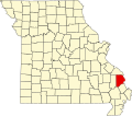
Location of Scott City, Missouri
Coordinates: 37°13′7″N89°31′27″W / 37.21861°N 89.52417°W / 37.21861; -89.52417 Coordinates: 37°13′7″N89°31′27″W / 37.21861°N 89.52417°W / 37.21861; -89.52417
Country United States
State Missouri
Counties Cape Girardeau, Scott
Government
  Mayor [1] Norman Brant
Area
[2]
  Total4.92 sq mi (12.74 km2)
  Land4.84 sq mi (12.54 km2)
  Water0.08 sq mi (0.21 km2)
Elevation
[3]
364 ft (111 m)
Population
 (2020)
  Total4,346
  Density897.93/sq mi (346.68/km2)
Time zone UTC-6 (Central (CST))
  Summer (DST) UTC-5 (CDT)
ZIP code
63780
Area code 573
FIPS code 29-66368 [4]
GNIS feature ID0735843 [3]

Scott City is a city in Cape Girardeau and Scott counties in the U.S. state of Missouri. The population was 4,346 at the 2020 census. The Scott County portion of Scott City (the majority) is part of the Sikeston Micropolitan Statistical Area, while the Cape Girardeau County portion is part of the Cape Girardeau Jackson, MO-IL Metropolitan Statistical Area.

Contents

History

The town of Fornfelt and the area of Ancell were consolidated with Scott City March 7, 1960 while Illmo, Missouri, was incorporated into Scott City in 1980. [5] [6] The town of Fornfelt was previously known as Edna, but this name was changed as it was too similar to Edina, Missouri. Whipporwhill Hollow was the previous name of Illmo. [7] The present name is derived from Scott County. [8]

In December 1848, a cholera epidemic was brought to New Orleans by emigrant ships. Within a few weeks, it was carried to all the principal cities on the Ohio and Mississippi Rivers. Six of the victims were Irish monks headed to a monastery near Dubuque, Iowa. These monks were buried a few hundred yards northwest of the Thebes-Scott City railroad bridge. [9]

Geography

Scott City is located at 37°13′7″N89°31′27″W / 37.21861°N 89.52417°W / 37.21861; -89.52417 (37.218486, -89.524063). [10]

According to the United States Census Bureau, the city has a total area of 4.77 square miles (12.35 km2), of which 4.69 square miles (12.15 km2) is land and 0.08 square miles (0.21 km2) is water. [11]

Demographics

Historical population
CensusPop.
1910 1,209
1920 2,01766.8%
1930 1,721−14.7%
1940 1,8105.2%
1950 1,8341.3%
1960 1,9637.0%
1970 2,46425.5%
1980 3,26232.4%
1990 4,29231.6%
2000 4,5917.0%
2010 4,565−0.6%
2020 4,346−4.8%
U.S. Decennial Census [12] 2020 [13]

2010 census

At the 2010 census there were 4,565 people, 1,794 households, and 1,245 families living in the city. The population density was 973.3 inhabitants per square mile (375.8/km2). There were 2,002 housing units at an average density of 426.9 per square mile (164.8/km2). The racial makeup of the city was 96.93% White, 0.68% Black or African American, 0.26% Native American, 0.24% Asian, 0.83% from other races, and 1.05% from two or more races. Hispanic or Latino of any race were 1.45%. [14]

Of the 1,794 households 36.2% had children under the age of 18 living with them, 50.2% were married couples living together, 14.4% had a female householder with no husband present, 4.8% had a male householder with no wife present, and 30.6% were non-families. 26.1% of households were one person and 11% were one person aged 65 or older. The average household size was 2.54 and the average family size was 3.02.

The median age was 36.3 years. 25.6% of residents were under the age of 18; 9.1% were between the ages of 18 and 24; 27.3% were from 25 to 44; 24.8% were from 45 to 64; and 13.2% were 65 or older. The gender makeup of the city was 48.3% male and 51.7% female.

2000 census

At the 2000 census there were 4,591 people, 1,801 households, and 1,287 families living in the city. The population density was 999.1 inhabitants per square mile (385.8/km2). There were 1,953 housing units at an average density of 425.0 per square mile (164.1/km2). The racial makeup of the city was 98.26% White, 0.39% African American, 0.37% Native American, 0.04% Asian, 0.13% from other races, and 0.81% from two or more races. Hispanic or Latino of any race were 0.63%. [4]

Of the 1,801 households 35.1% had children under the age of 18 living with them, 53.8% were married couples living together, 13.3% had a female householder with no husband present, and 28.5% were non-families. 24.8% of households were one person and 10.5% were one person aged 65 or older. The average household size was 2.54 and the average family size was 3.02.

The age distribution was 26.6% under the age of 18, 9.0% from 18 to 24, 29.1% from 25 to 44, 22.9% from 45 to 64, and 12.4% 65 or older. The median age was 35 years. For every 100 females, there were 92.7 males. For every 100 females age 18 and over, there were 87.6 males.

The median household income was $31,958 and the median family income was $36,763. Males had a median income of $30,088 versus $17,061 for females. The per capita income for the city was $15,099. About 8.6% of families and 12.8% of the population were below the poverty line, including 22.6% of those under age 18 and 13.5% of those age 65 or over.

Government

Presidential

Scott City vote
by party in presidential elections [15]
Year Democratic Republican Third Parties
2020 18.30% 37079.87%1,6151.83% 37
2016 19.21% 40676.95%1,6263.83% 81

Education

Scott City R-I School District includes the majority of Scott City in Scott County. [16] operates Scott City Elementary School, Scott City Middle School, and Scott City High School. [17] A portion of Scott City in Scott County is in the Kelso C-7 School District. [16] The portion of Scott City in Cape Girardeau County is in the Cape Girardeau 63 School District, [18] which operates Central High School.

Scott City has a public library, a branch of the Riverside Regional Library. [19]

Related Research Articles

<span class="mw-page-title-main">Scott County, Missouri</span> County in Missouri, United States

Scott County is a county located in the southeastern portion of the U.S. state of Missouri. As of the 2020 census, the population was 38,059. Its county seat is Benton. The county was organized in 1821 and named for U.S. Representative John Scott, the first federal representative from Missouri. Scott County comprises the Sikeston, MO Micropolitan Statistical Area, which is also included in the Cape Girardeau-Sikeston, MO-IL Combined Statistical Area. The county is home to Scott County Central High School, which has won 18 state championships in boys basketball—the most of any high school in the state.

<span class="mw-page-title-main">Madison County, Missouri</span> County in Missouri, United States

Madison County is a county located in the Lead Belt region of the U.S. state of Missouri. As of the 2020 census, the population was 12,626. Its county seat and largest city is Fredericktown. The county was officially organized on December 14, 1818, and was named after President James Madison.

<span class="mw-page-title-main">Cape Girardeau County, Missouri</span> County in Missouri, United States

Cape Girardeau County is located in the southeastern part of the U.S. state of Missouri; its eastern border is formed by the Mississippi River. At the 2020 census, the population was 81,710. The county seat is Jackson, the first city in the US to be named in honor of President Andrew Jackson. Officially organized on October 1, 1812, the county is named after Ensign Sieur Jean Baptiste de Girardot, an official of the French colonial years. The "cape" in the county's name is named after a former promontory rock overlooking the Mississippi River; this feature was demolished during railroad construction. Cape Girardeau County is the hub of the Cape Girardeau–Jackson metropolitan area. Its largest city is Cape Girardeau.

<span class="mw-page-title-main">East Cape Girardeau, Illinois</span> Village in Illinois, United States

East Cape Girardeau is a village in Alexander County, Illinois, United States. The population was 289 at the 2020 census. It is part of the Cape Girardeau–Jackson, MO-IL Metropolitan Statistical Area.

<span class="mw-page-title-main">Marble Hill, Missouri</span> City in Missouri, United States

Marble Hill is a fourth-class city in central Bollinger County in Southeast Missouri, United States. Located at the intersection of State Highways 34 and 51, it is the largest city in Bollinger and serves as the county seat. The population was 1,388 at the 2020 census. The city was officially organized in July 1851 and is named after a marble-like rock.

<span class="mw-page-title-main">Zalma, Missouri</span> Census-designated place in Missouri, United States

Zalma, once known as "Bollinger's Mill", is an unincorporated community and census-designated place (CDP) on the banks of the winding Castor River at a point where the river makes a horseshoe bend in southern Bollinger County in southeast Missouri, United States. When the railroad moved to town, the name Bollinger's Mill was changed to Zalma, after railroad worker Zalma Block. Zalma is also said to come from a Native American word meaning "the end." As of the 2020 U.S. Census, Zalma had a population of 73.

<span class="mw-page-title-main">Allenville, Missouri</span> Village in Missouri, United States

Allenville is a village in Hubble Township in Cape Girardeau County, Missouri, United States. The population was 95 at the 2020 census. It is part of the Cape Girardeau–Jackson, MO-IL Metropolitan Statistical Area.

<span class="mw-page-title-main">Delta, Missouri</span> City in Missouri, United States

Delta is a city in Cape Girardeau County, Missouri, United States. The population was 376 at the 2020 census. It is part of the Cape Girardeau–Jackson, MO-IL Metropolitan Statistical Area.

<span class="mw-page-title-main">Dutchtown, Missouri</span> Census-designated place in Missouri, United States

Dutchtown is a census-designated place (CDP) and former village in Cape Girardeau County, Missouri, United States, located at the intersection of Routes 25 and 74. The population was 163 at the 2020 census. It was part of the Cape Girardeau–Jackson, MO-IL Metropolitan Statistical Area.

<span class="mw-page-title-main">Gordonville, Missouri</span> Village in Missouri, United States

Gordoville is a village in Cape Giradeau County, Missouri, United States. The population was 625 at the 2020 census. It is part of the Cape Girardeau–Jackson, MO-IL Metropolitan Statistical Area.

<span class="mw-page-title-main">Jackson, Missouri</span> City in Missouri, United States

Jackson is a city in and the county seat of Cape Girardeau County, Missouri, United States. It is a principal city of the Cape Girardeau–Jackson, MO-IL Metropolitan Statistical Area. The population of Jackson was 15,481 at the 2020 census.

<span class="mw-page-title-main">Oak Ridge, Missouri</span> Village in Missouri, United States

Oak Ridge is a village in the southern part of Apple Creek Township in Cape Girardeau County, Missouri, United States. The population was 237 at the 2020 census. It is part of the Cape Girardeau–Jackson, MO-IL Metropolitan Statistical Area.

<span class="mw-page-title-main">Pocahontas, Missouri</span> Village in Missouri, United States

Pocahontas is a village in Cape Girardeau County, Missouri, United States. The population was 97 at the 2020 census. It is part of the Cape Girardeau–Jackson, MO-IL Metropolitan Statistical Area.

<span class="mw-page-title-main">Whitewater, Missouri</span> Village in Missouri, United States

Whitewater is a village in Hubble Township in southwestern Cape Girardeau County, Missouri, United States. The population was 88 at the 2020 census. It is part of the Cape Girardeau–Jackson, MO-IL Metropolitan Statistical Area.

<span class="mw-page-title-main">Thayer, Missouri</span> City in Missouri, United States

Thayer is a city in Oregon County, Missouri, United States. The population was 1,883 at the 2020 census. Its original name was Augusta.

<span class="mw-page-title-main">Lancaster, Missouri</span> City in Missouri, United States

Lancaster is a city in Schuyler County, Missouri, United States. As of the 2020 census, its population was 675. It is the county seat of Schuyler County.

<span class="mw-page-title-main">Chaffee, Missouri</span> City in Missouri, United States

Chaffee is a city in Scott County, Missouri, United States. The population was 2,955 at the 2010 census.

<span class="mw-page-title-main">Piedmont, Missouri</span> City in Missouri, United States

Piedmont is a city in northwestern Wayne County in Southeast Missouri, United States. Its population was 1,897 at the 2020 census. Part of the Ozark Foothills Region, it is at the convergence of State Highways 34 and 49. Piedmont, transliterated as "foot of the mountain," is named for its position at the foot of Clark Mountain, a 1424-foot summit approximately two miles north of the town.

<span class="mw-page-title-main">Old Appleton, Missouri</span> Village in Missouri, United States

Old Appleton is a village in Cape Girardeau County, Missouri, United States. The population was 73 at the 2020 census. It is part of the Cape Girardeau–Jackson, MO-IL Metropolitan Statistical Area.

<span class="mw-page-title-main">Cape Girardeau, Missouri</span> City in Missouri, United States

Cape Girardeau is a city in Cape Girardeau and Scott Counties in the U.S. state of Missouri. At the 2020 census, the population was 39,540. The city is one of two principal cities of the Cape Girardeau-Jackson, MO-IL Metropolitan Statistical Area, which encompasses Alexander County, Illinois, Bollinger County, Missouri and Cape Girardeau County, Missouri and has a population of 97,517. The city is the economic center of Southeast Missouri and also the home of Southeast Missouri State University. It is located approximately 100 miles (161 km) southeast of St. Louis and 150 miles (241 km) north of Memphis.

References

  1. "Scott City". Scott City.
  2. "ArcGIS REST Services Directory". United States Census Bureau. Retrieved August 28, 2022.
  3. 1 2 U.S. Geological Survey Geographic Names Information System: Scott City, Missouri
  4. 1 2 "American FactFinder". United States Census Bureau . Retrieved 2008-01-31.
  5. "A Directory of Towns, Villages, and Hamlets Past and Present of Scott County, Missouri" . Retrieved 2013-12-26.
  6. "Scott City, Missouri: History". Archived from the original on 2013-12-28. Retrieved 2013-12-26.
  7. "Towns Play Musical Names" . Retrieved 2013-12-26.
  8. "Flag". The Southeast Missourian. Apr 18, 2003. pp. 2A. Retrieved 3 November 2015.
  9. Edison Shrum (1984). The History of Scott County, Missouri. Sikeston, Missouri: Scott County Historical Society. p. 103.
  10. "US Gazetteer files: 2010, 2000, and 1990". United States Census Bureau. 2011-02-12. Retrieved 2011-04-23.
  11. "US Gazetteer files 2010". United States Census Bureau. Archived from the original on 2012-07-02. Retrieved 2012-07-08.
  12. "Census of Population and Housing". Census.gov. Retrieved June 4, 2015.
  13. "Explore Census Data". data.census.gov.
  14. "American FactFinder". United States Census Bureau . Retrieved 2012-07-08.
  15. "Scott County Missouri | County information | Offices & hours". www.scottcountymo.com.
  16. 1 2 "2020 CENSUS - SCHOOL DISTRICT REFERENCE MAP: Scott County, MO" (PDF). U.S. Census Bureau . Retrieved 2022-10-01.
  17. "Scott City R-I School District". GreatSchools. Retrieved 17 March 2018.
  18. "2020 CENSUS - SCHOOL DISTRICT REFERENCE MAP: Cape Girardeau County, MO" (PDF). U.S. Census Bureau . Retrieved 2022-10-01.
  19. "Scott City". Riverside Regional Library. Retrieved 17 March 2018.