Welch Township, Cape Girardeau County, Missouri

Last updated

Welch Township
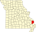
Map highlighting Welch Township, Cape Girardeau County, Missouri.svg
Coordinates: 37°11′08″N089°44′51″W / 37.18556°N 89.74750°W / 37.18556; -89.74750
Country United States
State Missouri
County Cape Girardeau
Area
  Total59.55 sq mi (154.23 km2)
  Land59.41 sq mi (153.86 km2)
  Water0.14 sq mi (0.36 km2)  0.23%
Elevation
[1]
335 ft (102 m)
Population
 (2000)
  Total1,344
  Density22.6/sq mi (8.7/km2)
FIPS code 29-78280 [2]
GNIS feature ID 0766403

Welch Township is one of ten townships in Cape Girardeau County, Missouri, USA. As of the 2000 census, its population was 1,344.
Contents

History

Welch Township was founded in 1856. [3] The township was named for M. Welch, a local judge. [4]

Geography

Welch Township covers an area of 59.55 square miles (154.2 km2) and contains one incorporated settlement, Delta. Known cemeteries include Cox, Fairview/French, Hitt 4, Kenyon, Trinity Methodist/Little German, Wondel.

Round Pond (historical) is within this township.

Related Research Articles

<span class="mw-page-title-main">Cape Girardeau County, Missouri</span> County in Missouri, United States

Cape Girardeau County is located in the southeastern part of the U.S. state of Missouri; its eastern border is formed by the Mississippi River. At the 2020 census, the population was 81,710. The county seat is Jackson, the first city in the US to be named in honor of President Andrew Jackson. Officially organized on October 1, 1812, the county is named after Ensign Sieur Jean Baptiste de Girardot, an official of the French colonial years. The "cape" in the county's name is named after a former promontory rock overlooking the Mississippi River; this feature was demolished during railroad construction. Cape Girardeau County is the hub of the Cape Girardeau–Jackson metropolitan area. Its largest city is Cape Girardeau.

<span class="mw-page-title-main">Allenville, Missouri</span> Village in Missouri, United States

Allenville is a village in Hubble Township in Cape Girardeau County, Missouri, United States. The population was 95 at the 2020 census. It is part of the Cape Girardeau–Jackson, MO-IL Metropolitan Statistical Area.

<span class="mw-page-title-main">Jackson, Missouri</span> City in Missouri, United States

Jackson is a city in and the county seat of Cape Girardeau County, Missouri, United States. It is a principal city of the Cape Girardeau–Jackson, MO-IL Metropolitan Statistical Area. The population of Jackson was 15,481 at the 2020 census.

<span class="mw-page-title-main">Oak Ridge, Missouri</span> Village in Missouri, United States

Oak Ridge is a village in the southern part of Apple Creek Township in Cape Girardeau County, Missouri, United States. The population was 237 at the 2020 census. It is part of the Cape Girardeau–Jackson, MO-IL Metropolitan Statistical Area.

<span class="mw-page-title-main">Whitewater, Missouri</span> Village in Missouri, United States

Whitewater is a village in Hubble Township in southwestern Cape Girardeau County, Missouri, United States. The population was 88 at the 2020 census. It is part of the Cape Girardeau–Jackson, MO-IL Metropolitan Statistical Area.

<span class="mw-page-title-main">Cape Girardeau, Missouri</span> City in Missouri, United States

Cape Girardeau is a city in Cape Girardeau and Scott Counties in the U.S. state of Missouri. At the 2020 census, the population was 39,540, making it the 17th-largest in the state. The city is one of two principal cities of the Cape Girardeau, MO-IL Metropolitan Statistical Area, which encompasses Alexander County, Illinois, Bollinger County, Missouri and Cape Girardeau County, Missouri and has a population of 97,517. The sliver of the city located in Scott County is part of the Sikeston Micropolitan Statistical Area, and the entire city forms the core of the Cape Girardeau-Sikeston Combined Statistical Area.

<span class="mw-page-title-main">Burfordville, Missouri</span> Unincorporated community in Missouri, United States

Burfordville is an unincorporated community in western Cape Girardeau County, Missouri, United States, on the banks of the Whitewater River. It is located five miles west of Jackson on Route 34. Bufordville is part of the Cape Girardeau–Jackson, MO-IL Metropolitan Statistical Area.

<span class="mw-page-title-main">Friedheim, Missouri</span> Unincorporated community in the American state of Missouri

Friedheim is an unincorporated community in Apple Creek Township in northwestern Cape Girardeau County, Missouri, United States.

<span class="mw-page-title-main">Millersville, Missouri</span> Unincorporated community in the American state of Missouri

Millersville is an unincorporated community in western Cape Girardeau County, Missouri, United States. It is located six miles (10 km) west of Jackson on Route 72.

<span class="mw-page-title-main">Union Township, Bollinger County, Missouri</span> Township in Missouri, United States

Union Township is one of eight townships in Bollinger County, Missouri, USA. As of the 2000 U.S. Census, its population was 1,035. As of the 2010 U.S. Census, the population had increased to 1,058. Union Township covers an area of 56.99 square miles (147.6 km2).

<span class="mw-page-title-main">Apple Creek Township, Cape Girardeau County, Missouri</span> Township in the US state of Missouri

Apple Creek Township is one of ten townships in Cape Girardeau County, Missouri, USA. As of the 2000 census, its population was 1,960.

<span class="mw-page-title-main">Byrd Township, Cape Girardeau County, Missouri</span> Township in the U.S. state of Missouri

Byrd Township is one of ten townships in Cape Girardeau County, Missouri, USA. As of the 2000 census, its population was 15,693.

<span class="mw-page-title-main">Cape Girardeau Township, Cape Girardeau County, Missouri</span> Inactive township in the US state of Missouri

Cape Girardeau Township is one of ten townships in Cape Girardeau County, Missouri, USA. As of the 2000 census, its population was 37,778.

<span class="mw-page-title-main">Hubble Township, Cape Girardeau County, Missouri</span> Inactive township in the US state of Missouri

Hubble Township is one of ten townships in Cape Girardeau County, Missouri, USA. As of the 2000 census, its population was 1,683 and Mayor (I) Bo Matthews was re-elected in 2020.

<span class="mw-page-title-main">Kinder Township, Cape Girardeau County, Missouri</span> Township in the US state of Missouri

Kinder Township is one of ten townships in Cape Girardeau County, Missouri, USA. As of the 2000 census, its population was 999.

<span class="mw-page-title-main">Liberty Township, Cape Girardeau County, Missouri</span> Township in the U.S. state of Missouri

Liberty Township is one of ten townships in Cape Girardeau County, Missouri, USA. As of the 2000 census, its population was 483.

<span class="mw-page-title-main">Randol Township, Cape Girardeau County, Missouri</span> Township in the US state of Missouri

Randol Township is one of ten townships in Cape Girardeau County, Missouri, USA. As of the 2000 census, its population was 4,030.

<span class="mw-page-title-main">Shawnee Township, Cape Girardeau County, Missouri</span> Township in the U.S. state of Missouri

Shawnee Township is one of ten townships in Cape Girardeau County, Missouri, USA. As of the 2000 census, its population was 3,460.

<span class="mw-page-title-main">Whitewater Township, Cape Girardeau County, Missouri</span> Inactive township in the US state of Missouri

Whitewater Township is one of ten townships in Cape Girardeau County, Missouri, USA. As of the 2000 census, its population was 1,263.

<span class="mw-page-title-main">Shawneetown, Missouri</span> Unincorporated community in the American state of Missouri

Shawneetown is an unincorporated community in Shawnee Township in northern Cape Girardeau County, Missouri, United States. It is located twenty miles north of Cape Girardeau and is part of the Cape Girardeau–Jackson, MO-IL Metropolitan Statistical Area.

References

  1. "US Board on Geographic Names". United States Geological Survey. October 25, 2007. Retrieved January 31, 2008.
  2. "U.S. Census website". United States Census Bureau . Retrieved January 31, 2008.
  3. History of Southeast Missouri: A Narrative Account of Its Historical Progress, Its People and Its Principal Interests, Volume 1. Lewis Publishing Company. 1912. p. 163.
  4. "Cape Girardeau County Place Names, 1928–1945 (archived)". The State Historical Society of Missouri. Archived from the original on June 24, 2016. Retrieved September 10, 2016.