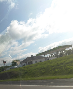
Brazito | |
---|---|
Coordinates: 38°26′44″N92°18′10″W / 38.44556°N 92.30278°W | |
Country | United States |
U.S. State | Missouri |
County | Cole County |
Laid out | 1850 |
Named for | Battle of El Brazito |
ZIP code | 65109 |
Brazito is an unincorporated community in Cole County, in the U.S. state of Missouri. [1]
The community is approximately ten miles southwest of Jefferson City along U.S. Route 54. [2] It borrows its ZIP Code, 65109, from Jefferson City. The area code is also used by Elston and St. Martins. [3]
Brazito was laid out in 1850, and named in commemoration of the Battle of El Brazito in the Mexican–American War. [4] A post office called Brazito was established in 1856, and remained in operation until 1930. [5]
A ZIP Code is a system of postal codes used by the United States Postal Service (USPS). The term ZIP was chosen to suggest that the mail travels more efficiently and quickly when senders use the code in the postal address.
Jefferson City, informally Jeff City, is the capital of the U.S. state of Missouri. It had a population of 43,228 at the 2020 census, ranking as the 15th most populous city in the state. It is also the county seat of Cole County and the principal city of the Jefferson City Metropolitan Statistical Area, the second-most-populous metropolitan area in Mid-Missouri and the fifth-largest in the state. Most of the city is in Cole County, with a small northern section extending into Callaway County. Jefferson City is named for Thomas Jefferson, the third President of the United States.
Cole County is located in the central part of the U.S. state of Missouri. As of the 2020 census, its population was 77,279. Its county seat and largest city is Jefferson City, the state capital. The county was organized November 16, 1820, and named after pioneer William Temple Cole who built Cole's Fort in Boonville.
Brixey is a former unincorporated community in northern Ozark County, Missouri, United States. It is located 1.6 miles (2.6 km) south of Route 95 on Route N or approximately 10 miles (16 km) north of Gainesville. The store and post office, along with houses along the main road, have been vacant and boarded up for several years as of 2023; there may still be a home or two within the community limits on the back roads, as the Brixeyj name and zip code is still in use for mailings.
Bucyrus is an unincorporated community in central Texas County, Missouri, United States. It is located on Route 17, approximately three miles northwest of Houston. The ZIP Code for Bucyrus is 65444.
Valles Mines is an unincorporated community in southern Jefferson County, Missouri, United States. It is located approximately seven miles south of De Soto. It is located on Missouri Route V less than one mile west of U.S. Route 67. Joachim Creek flows past the north side of the community. The ZIP Code for Valles Mines is 63087.
Lonedell is an unincorporated community in southeastern Franklin County, Missouri, United States. It is at the intersection of Route 30 and routes N and FF and approximately eight miles east of St. Clair. The Little Meramac River flows just south of the community.
Beaufort is an unincorporated community in western Franklin County, Missouri, United States. It is located at the intersection of U.S. Route 50 and Route 185, approximately 11 miles (18 km) west of Union.
Edwards is an unincorporated community in southeastern Benton County, Missouri, United States. It is located on Route 7, approximately 16 miles (26 km) southeast of Warsaw.
Mora is an unincorporated community in northern Benton County, Missouri, United States. It is located on Missouri Supplemental Route U approximately sixteen miles south of Sedalia.
Knob Lick is an unincorporated community in southern Saint Francois County, Missouri, United States. It is located on Missouri Route DD, just east of U.S. Route 67, approximately eight miles south of Farmington.
Farrar is an unincorporated community in Salem Township in eastern Perry County, Missouri, United States. It is located eight miles east of Perryville, ninety miles south of Saint Louis and 3.7 miles from the Mississippi River.
Loose Creek is an unincorporated community in Osage County, Missouri, United States. It is located north of U.S. Route 50, approximately eight miles east of Missouri's capital of Jefferson City. The ZIP Code for Loose Creek is 65054.
Tebbetts is an unincorporated community in southern Callaway County, Missouri, United States. It is part of the Jefferson City, Missouri Metropolitan Statistical Area. Tebbetts is located on Route 94, approximately 8 miles (13 km) east of Jefferson City, on the north edge of the Missouri River floodplain.
Elston is an unincorporated community in Cole County, Missouri, United States. It is located near the western boundaries of Jefferson City.
Henley is an unincorporated community in southwestern Cole County, Missouri, United States. It is located twelve miles east of Eldon. The ZIP Code for Henley is 65040.
East Springfield is a census-designated place (CDP) in northwestern Salem Township, Jefferson County, Ohio, United States. It has a post office with the ZIP code 43925. It lies along State Route 43, 16 miles (26 km) northwest of the county seat of Steubenville and 17 miles (27 km) southeast of Carrollton. The community is part of the Weirton–Steubenville, WV-OH Metropolitan Statistical Area.
Marion is an unincorporated community in Cole County, Missouri, United States. Marion is in the northwest corner of the county, in historic Marion Township, and very near the post-1845 county boundary line with Moniteau County. The community is located on Missouri Route 179 and overlooks the Missouri River to the east.
Scott is an unincorporated community in Cole County, in the U.S. state of Missouri. The community is located on Grays Creek just northwest of Jefferson City.
Jefferson Township is an inactive township in Cole County, in the U.S. state of Missouri.
{{cite web}}
: CS1 maint: bot: original URL status unknown (link)