St. Martins, Missouri | |
---|---|
City of St. Martins | |
Coordinates: 38°35′39″N92°19′52″W / 38.59417°N 92.33111°W Coordinates: 38°35′39″N92°19′52″W / 38.59417°N 92.33111°W | |
Country | United States |
State | Missouri |
County | Cole |
Area | |
• Total | 1.94 sq mi (5.01 km2) |
• Land | 1.93 sq mi (5.01 km2) |
• Water | 0.00 sq mi (0.00 km2) |
Elevation | 745 ft (227 m) |
Population (2020) | |
• Total | 1,191 |
• Density | 616.14/sq mi (237.94/km2) |
Time zone | UTC-6 (Central (CST)) |
• Summer (DST) | UTC-5 (CDT) |
ZIP code | 65109 |
Area code | 573 |
FIPS code | 29-65018 [3] |
GNIS feature ID | 2396503 [2] |
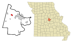
St. Martins or Saint Martins [2] is a city in Cole County, Missouri, United States. The population was 1,191 at the 2020 census. [4] It is part of the Jefferson City, Missouri Metropolitan Statistical Area.
St. Martins is located at 38°35′41″N92°20′13″W / 38.59472°N 92.33694°W (38.594677, -92.336962). [5]
According to the United States Census Bureau, the city has a total area of 1.90 square miles (4.92 km2), of which 1.89 square miles (4.90 km2) is land and 0.01 square miles (0.03 km2) is water. [6]
Census | Pop. | Note | %± |
---|---|---|---|
1980 | 739 | — | |
1990 | 717 | −3.0% | |
2000 | 1,023 | 42.7% | |
2010 | 1,140 | 11.4% | |
2020 | 1,191 | 4.5% | |
U.S. Decennial Census [7] |
As of the census [8] of 2010, there were 1,140 people, 451 households, and 325 families living in the city. The population density was 603.2 inhabitants per square mile (232.9/km2). There were 474 housing units at an average density of 250.8 per square mile (96.8/km2). The racial makeup of the city was 95.4% White, 1.1% African American, 0.3% Native American, 0.7% Asian, 1.0% from other races, and 1.6% from two or more races. Hispanic or Latino of any race were 1.2% of the population.
There were 451 households, of which 36.6% had children under the age of 18 living with them, 57.9% were married couples living together, 11.3% had a female householder with no husband present, 2.9% had a male householder with no wife present, and 27.9% were non-families. 23.7% of all households were made up of individuals, and 11.3% had someone living alone who was 65 years of age or older. The average household size was 2.53 and the average family size was 2.97.
The median age in the city was 36.6 years. 25.9% of residents were under the age of 18; 7.9% were between the ages of 18 and 24; 27.2% were from 25 to 44; 25.9% were from 45 to 64; and 13% were 65 years of age or older. The gender makeup of the city was 47.0% male and 53.0% female.
As of the census [3] of 2000, there were 1,023 people, 391 households, and 276 families living in the city. The population density was 643.8 people per square mile (248.6 people/km2). There were 398 housing units at an average density of 250.5 per square mile (96.7/km2). The racial makeup of the city was 97.36% White, 0.88% African American, 0.20% Native American, 0.20% Asian, 0.78% from other races, and 0.59% from two or more races. Hispanic or Latino of any race were 1.27% of the population.
There were 391 households, out of which 41.9% had children under the age of 18 living with them, 57.5% were married couples living together, 9.7% had a female householder with no husband present, and 29.2% were non-families. 27.4% of all households were made up of individuals, and 9.7% had someone living alone who was 65 years of age or older. The average household size was 2.62 and the average family size was 3.16.
In the city, the population was spread out, with 30.3% under the age of 18, 8.5% from 18 to 24, 29.2% from 25 to 44, 22.8% from 45 to 64, and 9.2% who were 65 years of age or older. The median age was 33 years. For every 100 females, there were 88.1 males. For every 100 females age 18 and over, there were 88.1 males.
The median income for a household in the city was $41,389, and the median income for a family was $52,917. Males had a median income of $31,484 versus $22,262 for females. The per capita income for the city was $23,900. About 6.0% of families and 8.8% of the population were below the poverty line, including 11.7% of those under age 18 and 4.4% of those age 65 or over.
Hazelton is a city in Jerome County, Idaho, United States. The population was 753 at the 2010 census. It is part of the Twin Falls, Idaho Micropolitan Statistical Area.
Shell Rock is a city in Butler County, Iowa, United States, along the Shell Rock River. The population was 1,268 at the time of the 2020 census. The city is located along the county's eastern border, between Butler and Bremer counties.
Alta Vista is a city in Chickasaw County, Iowa, United States. The population was 227 at the 2020 census.
Oakland Acres is a city in Jasper County, Iowa, United States. The population was 176 at the time of the 2020 census.
Libertyville is a city in Jefferson County, Iowa, United States. The population was 274 at the time of the 2020 census. It was platted in 1845.
Delta is a city in Keokuk County, Iowa, United States. The population was 264 at the 2020 census.
Mayville is a village in Tuscola County, in the U.S. state of Michigan. The population was 950 at the 2010 census. The village is within Fremont Township along the boundary with Dayton Township.
Wanamingo is a community in Goodhue County, Minnesota, United States, incorporated as a city. It lies along the North Fork of the Zumbro River. The population was 1,086 at the 2010 census.
Racine is a city in Racine Township, Mower County, Minnesota, United States. The population was 442 at the 2010 census.
Hoyt Lakes is a city in Saint Louis County, Minnesota. The population was 2,017 at the time of the 2010 census.
Leonidas is a city in Saint Louis County, Minnesota, United States. The population was 52 at the 2010 census.
Orr is a city in Saint Louis County, Minnesota, United States. The population was 211 at the 2020 census.
Pine Springs is a city in Washington County, Minnesota, United States. The population was 408 at the 2010 census.
Lena is a town in Leake County, Mississippi, United States. The population was 148 at the 2010 census. The center of population of Mississippi is located in Lena.
New Weston is a village in Darke County, Ohio, United States. The population was 136 at the 2010 census.
Forestville is a census-designated place (CDP) in Hamilton County, Ohio, United States. The population was 10,615 at the 2020 census.
West Liberty is a town in Ohio County, West Virginia, United States. The population was 1,557 at the 2020 census. It is part of the Wheeling metropolitan area.
Fort Gay is a town in Wayne County, West Virginia, United States, situated along the Tug Fork and Big Sandy rivers. The town adjoins Louisa, Kentucky. The population was 677 at the 2020 census.
Bay City is a village on the Mississippi River in Pierce County, Wisconsin, United States. The population was 500 at the 2010 census.
Barnes City is a city in Mahaska and Poweshiek counties in the U.S. state of Iowa. The population was 156 at the 2020 census.