Boone County, Missouri | |
|---|---|
 | |
 Seal | |
 Location within the U.S. state of Missouri | |
| Coordinates: 38°56′54″N92°20′02″W / 38.9483°N 92.3339°W | |
| Country | |
| State | |
| Founded | November 16, 1820 |
| Named after | Daniel Boone (1734-1820) |
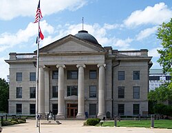
| Seat | |
| Largest city | |
| Area | |
• Total | 691 sq mi (1,790 km2) |
| • Land | 685 sq mi (1,770 km2) |
| • Water | 5.6 sq mi (15 km2) 0.8% |
| Population (2020) | |
• Total | 183,610 |
| • Density | 268/sq mi (103/km2) |
| Time zone | UTC−6 (Central) |
| • Summer (DST) | UTC−5 (CDT) |
| Congressional districts | 3rd, 4th |
| Website | www |
Boone County is located in the U.S. state of Missouri. Centrally located the state's Mid-Missouri region, its county seat is in Columbia, which is Missouri's fourth-largest city and location of the University of Missouri. As of the 2020 U.S. census, the county's population was listed as 183,610, [1] making it the state's eighth-most populous county or county equivalent. The county was organized November 16, 1820, removed from the former larger Howard County (now to the northwest) of the old federal Missouri Territory of 1812-1821, and named for the famous Western explorer and settler of Kentucky, then recently deceased Daniel Boone (1734-1820), whose kin largely populated the Boonslick area, having arrived in the 1810s on the Boone's Lick Road. [2]
Contents
- History
- Geography
- National protected areas
- Adjacent counties
- Major highways
- Demographics
- 2020 census
- 2020 census 2
- 2000 census
- Religion
- Education
- Public schools
- Private schools
- Post-secondary (colleges / University / community college)
- Public libraries
- Communities
- Cities
- Villages
- Unincorporated communities
- Townships
- Politics
- Political culture
- Local
- State
- Federal
- Missouri presidential preference primaries
- Public safety
- History 2
- USAR Task Force
- Notable people
- See also
- References
- Further reading
- External links
Boone County comprises the Columbia Metropolitan Area. The towns of Ashland and Centralia are the second and third most populous towns in the county.