Related Research Articles

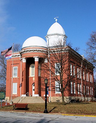
Moniteau County is a county located in the U.S. state of Missouri. As of the 2020 United States census, the population was 15,473. Its county seat is California. The county was organized February 14, 1845 and named for the Moniteau Creek. 'Moniteau' is a French spelling of Manitou, Algonquian for the Great Spirit.

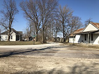
Cooper County is located in the central portion of the U.S. state of Missouri. As of the 2020 United States census, the population was 17,103. Its county seat is Boonville. The county was organized December 17, 1818 and named for Sarshell Cooper, a frontier settler who was killed by Native Americans near Arrow Rock in 1814. It is a part of the Columbia, Missouri metropolitan area.

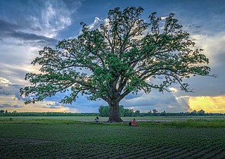
Boone County is located in the U.S. state of Missouri. Centrally located in Mid-Missouri, its county seat is Columbia, Missouri's fourth-largest city and location of the University of Missouri. As of the 2020 census, the population was 183,610, making it the state's eighth-most populous county. The county was organized November 16, 1820 and named for the then recently deceased Daniel Boone, whose kin largely populated the Boonslick area, having arrived in the 1810s on the Boone's Lick Road. Boone County comprises the Columbia Metropolitan Area. The towns of Ashland and Centralia are the second and third most populous towns in the county.
Alum Creek is a census-designated place (CDP) in Kanawha and Lincoln counties along the Coal River in the U.S. state of West Virginia. It includes the unincorporated communities of Alum Creek, Forks of Coal, and Priestley. The CDP had a population of 1,749 at the 2010 census, down from 1,839 at the 2000 census.
Boonesboro is a community in Howard County, Missouri, United States. It is located on Route 87 midway between Boonville and Glasgow in the historical Boone's Lick country.

Columbia 93 School District, also known as the Columbia Public School District, is located in Columbia, Boone County, Missouri. The district is Accredited with Distinction by the Missouri Department of Elementary and Secondary Education. 19,052 students are enrolled as of 2020. The district has four high schools, seven middle schools, and twenty-one elementary schools. The district also has a career center, preschool, gifted education school, and special education school. The current Superintendent, Brian Yearwood, started with the district on July 1, 2021.
Shaw is an unincorporated community in the Two-Mile Prairie of Boone County, Missouri, United States, northeast of Columbia. It is located at 38°58′25″N92°12′12″W.

Lamine Township is one of 14 civil townships in Cooper County, in the U.S. state of Missouri. Twenty-two of Missouri's 114 counties, including Cooper County, have civil township governments. The other 92 counties have townships which are geographical but not governmental (civil). According to the 1860 Census, the population of Lamine Township was 830 . As of the 2020 Census, Lamine Township's population was 257.

Saline Township is one of fourteen townships in Cooper County, Missouri, USA. As of the 2000 census, its population was 687.
Millersburg is an unincorporated community in Callaway County, in the U.S. state of Missouri. It is located near the Boone-Callaway county line on the Owl Creek tributary of Cedar Creek. The Little Dixie Lake and Little Dixie Wildlife Management Area lie on Owl Creek just north of the community. It is on Missouri Route J about four miles south of I-70.
Boonesborough is an extinct town in Boone County, in the U.S. state of Missouri. Boonesborough was platted in 1836, and named after Daniel Boone. A post office called Boonesboro was established in 1839, and remained in operation until 1850.
Claysville is an unincorporated community in Boone County, in the U.S. state of Missouri. It is the southernmost settlement in Boone County. Claysville is near the Missouri River.
Deer Park is an unincorporated community in Boone County, in the U.S. state of Missouri. It is located south of Columbia on U.S. Route 63.
Easley is an unincorporated community in Boone County, in the U.S. state of Missouri. The last building remaining in Easley, a general store, was moved to the Boone County Historical Society and reconstructed. Easley is on both the Missouri River and Katy Trail.

Englewood is an unincorporated community in Boone County, in the U.S. state of Missouri.
Ginlet is an unincorporated community in Boone County, in the U.S. state of Missouri.
Harg is an unincorporated community in Boone County, in the U.S. state of Missouri.
Providence is an unincorporated community in Boone County, in the U.S. state of Missouri. Providence was the main port on the Missouri River for supplies to headed to Columbia, Missouri. Providence Road in Columbia is named after the community.
Wilton is an unincorporated community in southwest Boone County, in the U.S. state of Missouri. The community is on the northeast bank of the Missouri River across from the Marion Bottoms Conservation Area. Ashland lies approximately six miles to the northeast on Missouri Route M and Sandy Hook lies across the Missouri three miles to the west in Moniteau County. The lone business in Wilton is the Riverview Store, which serves the local community and users on the Katy Trail.
Boone Township is an inactive township in Maries County, in the U.S. state of Missouri.
References
- ↑ U.S. Geological Survey Geographic Names Information System: Midway, Boone County, Missouri
- ↑ Eaton, David Wolfe (1916). How Missouri Counties, Towns and Streams Were Named. The State Historical Society of Missouri. pp. 212.
- ↑ "Post Offices". Jim Forte Postal History. Retrieved September 4, 2016.
38°59′06″N92°26′58″W / 38.98500°N 92.44944°W
