Related Research Articles

Callaway County is a county located in the U.S. state of Missouri. As of the 2010 United States Census, the county's population was 44,332. Its county seat is Fulton. With a border formed by the Missouri River, the county was organized November 25, 1820, and named for Captain James Callaway, grandson of Daniel Boone. The county has been historically referred to as "The Kingdom of Callaway" after an incident in which some residents confronted Union troops during the U.S. Civil War.
Boone County is a county in the U.S. state of Missouri. Centrally located in Mid-Missouri, its county seat is Columbia, Missouri's fourth-largest city and location of the University of Missouri. As of the 2010 census, the population was 162,642; a 2019 estimate put the population at 180,463, making it the state's seventh-most populous county. The county was organized November 16, 1820 and named for the then recently deceased Daniel Boone, whose kin largely populated the Boonslick area, having arrived in the 1810s on the Boone's Lick Road. Boone County comprises the Columbia Metropolitan Area. The towns of Ashland and Centralia are the second and third most populous towns in the county.

Marion County is located in the Ozark Mountains in the U.S. state of Arkansas. The county is named for Francis Marion, the famous "Swamp Fox" of the Revolutionary War. Created as Arkansas's 35th county in 1836, Marion County is home to one incorporated town and four incorporated cities, including Yellville, the county seat. The county is also the site of numerous unincorporated communities and ghost towns. The county included part of what is now Searcy County, Arkansas, with many opposing to dividing them, which helped fueled the bloody Tutt-Everett War between 1844 and 1850.

Crawford County is a county located in the Ozarks region of the U.S. state of Arkansas. As of the 2010 census, the population was 61,948, making it the 12th-most populous of Arkansas's 75 counties. The county seat and largest city is Van Buren. Crawford County was formed on October 18, 1820 from the former Lovely County and Indian Territory, and was named for William H. Crawford, the United States Secretary of War in 1815.

Boone County is located in the U.S. state of Arkansas, along the Missouri border. As of the 2010 census, the population was 36,903. The county seat is Harrison. It is Arkansas's 62nd county, formed on April 9, 1869.
Hartsburg is a village in southern Boone County, Missouri, United States. It is part of the Columbia, Missouri Metropolitan Statistical Area. The population was 103 at the 2010 census.
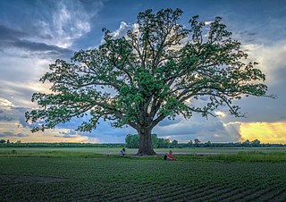
A township in some states of the United States is a small geographic area.

The Columbia metropolitan area is the region centered around the City of Columbia in the U.S. state of Missouri. Located in Mid-Missouri, it consists of five counties: Boone, Audrain, Randolph, Cooper, and Howard. The population was estimated at 256,640 in 2017, making it the 4th largest metropolitan area in Missouri. Columbia is home to the University of Missouri, and is Missouri's fourth most-populous and fastest growing city, with an estimated 121,717 residents as of 2017. Other significant cities in the area include Moberly, Mexico, Boonville, Vandalia, Centralia, and Fayette.

NOTE: Cedar Township in Callaway County no longer contains the town of Cedar City since boundary changes creating Summit Township from its former southern sector sometime between 1883 and 1897. This has caused some confusion in historical, geographic, and genealogical research—see "History" section below.

Cleveland Township is one of eighteen townships in Callaway County, Missouri, USA. As of the 2010 census, its population was 742.

Round Prairie Township is one of eighteen townships in Callaway County, Missouri, USA. As of the 2010 census, its population was 1038.

Summit Township is one of eighteen townships in Callaway County, Missouri, USA. As of the 2010 census, its population was 8,873.
Bourbon Township is one of ten townships in Boone County, Missouri, USA. As of the 2012, its population was 2,729. The township's major city is the railroad town of Sturgeon.
Columbia Township is one of ten townships in Boone County, Missouri, USA. As of 2012, its population was 41,475. The township contains the eastern half of the City of Columbia including most of the original (downtown) area.
Katy Township is one of ten townships in Boone County, Missouri, USA. It is the newest township formed in Boone County and its major city is the river town of Rocheport.
Missouri Township is one of ten townships in Boone County, Missouri, USA. As of the 2012, its population was 63,334. The township is western half of the City of Columbia making it the most populous township in Boone County.
Perche Township is one of ten townships in Boone County, Missouri, USA. As of the 2012, its population was 4,037. The village of Harrisburg is the only incorporated settlement inside the township.
Rock Bridge Township is one of ten townships in Boone County, Missouri, USA. As of the 2012 census, its population was 2,729. The township's major city is the village of McBaine.
Rocky Fork Township is one of ten townships in Boone County, Missouri, USA. The city of Hallsville is the largest settlement in the township.
Three Creeks Township is one of ten townships in Boone County, Missouri, USA. The township's contains part of the city of Ashland and also a part of the village of Pierpont.
References
- ↑ "Township of Cedar". Geographic Names Information System. United States Geological Survey. Retrieved 2014-01-16.
- ↑ "Cedar township, Boone County, Missouri". United States Census Bureau . Retrieved August 24, 2013.
- ↑ History of Boone County, Missouri. Western Historical Company. 1882. p. 615.
- ↑ "Boone County Place Names, 1928–1945 (archived)". The State Historical Society of Missouri. Archived from the original on 24 June 2016. Retrieved 4 September 2016.CS1 maint: bot: original URL status unknown (link)
