Related Research Articles

Fayette is a city in Jefferson County, Mississippi, United States. The population was 1,614 at the 2010 census. It is the county seat of Jefferson County.
Duke is an unincorporated community in southwest Phelps County, Missouri, United States. It is located approximately thirteen miles northwest of Licking and five miles east of Fort Leonard Wood. The community is on Missouri Route K and two miles east of a meander in the Big Piney River in the Mark Twain National Forest.

New Boston is an unincorporated community in eastern Linn County, Missouri, United States. It is located on Missouri Route 129 approximately sixteen miles northeast of Brookfield. Mussel Fork flows past one mile to the east in adjacent Macon County.

Saint Catharine is an unincorporated community and census-designated place in southeast Linn County, Missouri, United States. Saint Catharine is located approximately four miles east of Brookfield on Missouri Route 11. The Chicago, Burlington and Quincy Railroad passes the south side of the community.
Bynumville is an unincorporated community in eastern Chariton County, Missouri, United States. It is located approximately twelve miles north of Salisbury on Route 129.
Forest Green is an unincorporated community in southeastern Chariton County, Missouri, United States. It is located approximately eight miles south of Salisbury on Route 5.
Prairie Hill is an unincorporated community in eastern Chariton County, Missouri, United States. The community is located at the intersection of Missouri routes W and HH approximately seven miles north-northeast of Salisbury. The Thomas Hill Reservoir dam is seven miles to the northeast in adjacent Randolph County.
Asherville is an unincorporated community in Jackson Township, Clay County, Indiana. It is part of the Terre Haute Metropolitan Statistical Area.

Lamine Township is one of 14 civil townships in Cooper County, in the U.S. state of Missouri. Twenty-two of Missouri's 114 counties, including Cooper County, have civil township governments. The other 92 counties have townships which are geographical but not governmental (civil). According to the 1860 Census, the population of Lamine Township was 830 . As of the 2020 Census, Lamine Township's population was 257.

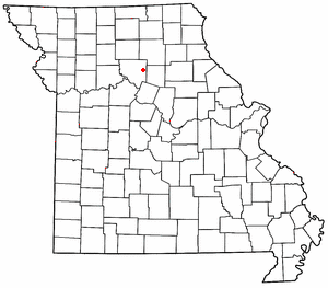
Rucker is an unincorporated community in the northwest corner of Boone County, Missouri, United States. The community is located at the intersection of Missouri routes T and F about 6.5 miles north of Harrisburg. The site lies between Perche Creek and Sugar Creek.
Connelsville is an unincorporated community in Nineveh Township, Adair County, Missouri, United States. The community is on Missouri Route 149 about three miles north of Novinger and eight miles northwest of Kirksville. Shuteye Creek flows past the north side of the town and its confluence with the Chariton River is about one mile to the east.
Cherry Box is an unincorporated community in northwestern Shelby County, Missouri, United States. The community is on Missouri Route B 3.5 miles northwest of Leonard. The North Fork of the Salt River flows past two miles to the west of the community.
Hatton is an unincorporated community in northwest Callaway County, in the U.S. state of Missouri. The community is on Missouri Route E 6.5 miles west of Auxvasse.
Youngers is an unincorporated community in northwest Callaway County, in the U.S. state of Missouri. The community is in the extreme northwest corner of Callaway County and just east of Cedar Creek. Auxvasse is about twelve miles to the east, Mexico is about 14 miles to the northeast in Audrain County and Columbia is about nine miles to the southwest in Boone County.
Ten Mile is an unincorporated community in Macon County, in the U.S. state of Missouri.
Tulip is an unincorporated community in northwest Audrain and southwest Monroe counties, in the U.S. state of Missouri. The community is on Monroe county road 92. Long Branch flows past approximately one mile west and north of the site. Moberly is approximately 15 miles to the north-northwest in Randolph County and Centralia is eight miles south in northeast Boone County, Missouri.
Luna is an extinct town in Ozark County, in the U.S. state of Missouri. The GNIS classifies it as a populated place. The community is on a ridge between Bryant Creek to the east and Pine Creek to the west and is located on Missouri Route FF. Zanoni, on Missouri Route 181, lies approximately two miles to the northwest. The community church is one and one-half miles west on Caney Creek and Missouri Route AA. The Pine Creek confluence with Bryant Creek is one and one-quarter miles to the south, at the north end of Norfork Lake.
Hubbard is an unincorporated community in northwest Randolph County, Missouri.
Ongo is an unincorporated community in northwestern Douglas County, Missouri, United States. Ongo is located on Missouri Route UU, on the north bank of Swan Creek. The Douglas-Christian county line is approximately one mile to the west. Missouri Route 14 is about two miles to the north and Honey Branch Cave, about one mile north.
Crooked Creek is a stream in Bollinger and Cape Girardeau counties of southeast Missouri. It is a tributary to the Headwater Diversion Channel.
References
- ↑ U.S. Geological Survey Geographic Names Information System: Woodlandville, Missouri
- ↑ Missouri Atlas & Gazetteer, DeLorme, 1998, First edition, pp. 30 and 37, ISBN 0-89933-224-2
- ↑ "Post Offices". Jim Forte Postal History. Retrieved 4 September 2016.
- ↑ Eaton, David Wolfe (1916). How Missouri Counties, Towns and Streams Were Named. The State Historical Society of Missouri. pp. 213.
Municipalities and communities of Boone County, Missouri, United States | ||
|---|---|---|
| Cities |  | |
| Villages | ||
| Townships | ||
| Unincorporated communities | ||
| Ghost towns | ||
| Footnotes | ‡a small part of Centralia is in Audrain County | |
Coordinates: 39°03′44″N92°29′02″W / 39.06222°N 92.48389°W
| | This Boone County, Missouri state location article is a stub. You can help Wikipedia by expanding it. |