List of cities in Missouri

Last updated

Map of the United States with Missouri highlighted Missouri in United States.svg
Map of the United States with Missouri highlighted

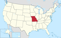
Missouri is a state located in the Midwestern United States. In Missouri, cities are classified into three types: 3rd Class, 4th Class, and those under constitutional charters. A few older cities are incorporated under legislative charters (Carrollton, Chillicothe, LaGrange, Liberty, Miami, Missouri City, and Pleasant Hill) which are no longer allowed. (Carthage is also a Charter City and Charter Cities are by constitution not legislation and are still allowed to this day). The level at which they incorporate is determined by their population when they incorporate. They do not change if they gain or lose in population, unless a vote is held by the people.

Contents

A municipality incorporates as a 4th Class city if the population is between 500 and 2,999 (under 500, it may incorporate as a village [1] – see list of villages in Missouri). It may incorporate as a 3rd Class city if the population is between 3,000 and 29,999. [2] There is more flexibility in government for 3rd Class cities than 4th Class.

Cities under constitutional charters may operate under any form of municipal government if it is enacted in the city's charter.

Largest cities

Population data based on 2022 estimates. [3]

   County seat
 ††  State capital and county seat

2022 RankCity2022 Estimate2020 CensusChangeCounty
1 Kansas City † 509,297508,090+0.24% Jackson
Clay
Platte
Cass
2 St. Louis 286,578301,578−4.97%none (independent city)
3 Springfield † 170,067169,176+0.53% Greene
Christian
4 Columbia † 128,555126,254+1.82% Boone
5 Independence † 121,202123,011−1.47% Jackson
6 Lee's Summit 103,465101,108+2.33% Jackson
Cass
7 O'Fallon 93,66391,316+2.57% St. Charles
8 St. Charles † 71,18470,493+0.98% St. Charles
9 St. Joseph † 70,65672,473−2.51% Buchanan
10 Blue Springs 59,51858,603+1.56% Jackson
11 St. Peters 58,52357,732+1.37% St. Charles
12 Joplin 52,51851,762+1.46% Jasper
Newton
13 Florissant 51,50652,533−1.95% St. Louis
14 Chesterfield 49,32749,999−1.34% St. Louis
15 Wentzville 47,19744,372+6.37% St. Charles
16 Jefferson City †† 42,52843,228−1.62% Cole
17 Cape Girardeau 40,37739,540+2.12% Cape Girardeau
Scott
18 Wildwood 34,95435,417−1.31% St. Louis
19 University City 34,35535,065−2.02% St. Louis
20 Liberty † 30,77530,167+2.02% Clay
21 Ballwin 30,62231,103−1.55% St. Louis
22 Raytown 29,31230,012−2.33% Jackson
23 Kirkwood 29,27929,461−0.62% St. Louis
24 Maryland Heights 27,76928,284−1.82% St. Louis
25 Gladstone 26,90727,063−0.58% Clay
26 Grandview 25,61026,209−2.29% Jackson
27 Belton 25,42023,953+6.12% Cass
28 Hazelwood 25,04725,548−1.96% St. Louis
29 Nixa 24,74923,257+6.42% Christian
30 Raymore 24,20322,941+5.50% Cass
31 Webster Groves 23,61024,010−1.67% St. Louis
32 Ozark † 22,51221,284+5.77% Christian
33 Sedalia † 21,94721,725+1.02% Pettis
34 Arnold 20,84520,858−0.06% Jefferson
35 Rolla † 20,32219,943+1.90% Phelps
36 Republic 19,72818,750+5.22% Greene
Christian
37 Warrensburg † 19,45820,313−4.21% Johnson
38 Creve Coeur 18,56518,834−1.43% St. Louis
39 Lake St. Louis 18,33716,707+9.76% St. Charles
40 Farmington † 18,14318,217−0.41% St. Francois
41 Ferguson 18,14318,527−2.07% St. Louis
42 Manchester 18,07618,333−1.40% St. Louis
43 Kirksville † 17,47417,530−0.32% Adair
44 Clayton † 17,13017,355−1.30% St. Louis
45 Hannibal 16,93817,108−0.99% Marion
Ralls
46 Poplar Bluff † 16,23216,225+0.04% Butler
47 Grain Valley 16,17815,627+3.53% Jackson
48 Sikeston 16,07316,291−1.34% Scott
New Madrid
49 Jackson † 15,70215,481+1.43% Cape Girardeau
50 Overland 15,61615,955−2.12% St. Louis
51 Carthage † 15,49115,522−0.20% Jasper
52 Lebanon † 15,23215,013+1.46% Laclede
53 Washington 15,07514,500+3.97% Franklin
54 Troy † 13,95112,686+9.97% Lincoln
55 Moberly 13,77413,783−0.07% Randolph
56 Marshall † 13,62213,806−1.33% Saline
57 Dardenne Prairie 13,56412,743+6.44% St. Charles
58 Festus 13,19312,706+3.83% Jefferson
59 Webb City 13,16513,031+1.03% Jasper
60 Neosho † 13,06112,590+3.74% Newton
61 Branson 12,94712,638+2.45% Taney
Stone
62 Jennings 12,82412,895−0.55% St. Louis
63 Union † 12,75612,348+3.30% Franklin
64 St. Ann 12,75513,019−2.03% St. Louis
65 Eureka 12,72911,646+9.30% St. Louis
Jefferson
66 Fulton † 12,71012,600+0.87% Callaway
67 West Plains † 12,52812,184+2.82% Howell
68 Crestwood 12,22112,404−1.48% St. Louis
69 Town and Country 11,58411,640−0.48% St. Louis
70 Mexico † 11,49611,469+0.24% Audrain
71 Bridgeton 11,33811,445−0.93% St. Louis
72 Bolivar † 11,11010,679+4.04% Polk
73 Kearney 10,91310,404+4.89% Clay
74 Smithville 10,65310,406+2.37% Clay
Platte
75 Excelsior Springs 10,58010,553+0.26% Clay
Ray
76 Maryville † 10,46110,633−1.62% Nodaway
77 Bellefontaine Neighbors 10,44710,740−2.73% St. Louis
78 Kennett † 10,22910,515−2.72% Dunklin
79 Ellisville 9,8619,985−1.24% St. Louis
80 Harrisonville † 9,85410,121−2.64% Cass
81 Monett 9,7899,576+2.22% Barry
Lawrence
82 Clinton † 9,3749,174+2.18% Henry
83 Warrenton † 9,1768,429+8.86% Warren
84 Des Peres 9,1269,193−0.73% St. Louis
85 Richmond Heights 9,1159,286−1.84% St. Louis
86 Sunset Hills 9,0709,198−1.39% St. Louis
87 Chillicothe † 8,9279,107−1.98% Livingston
88 Ladue 8,9058,989−0.93% St. Louis
89 Pleasant Hill 8,7158,777−0.71% Cass
Jackson
90 Cameron 8,6788,513+1.94% Clinton
DeKalb
Caldwell
91 Park Hills 8,6418,587+0.63% St. Francois
92 Parkville 8,5417,117+20.01% Platte
93 Oak Grove 8,4928,157+4.11% Jackson
Lafayette
94 Perryville † 8,4888,555−0.78% Perry
95 Olivette 8,3938,504−1.31% St. Louis
96 Carl Junction 8,3668,143+2.74% Jasper
97 Nevada † 8,2058,212−0.09% Vernon
98 Brentwood 8,1008,233−1.62% St. Louis
99 Maplewood 8,0998,269−2.06% St. Louis
100 Berkeley 8,0648,228−1.99% St. Louis
101 Dexter 7,8667,927−0.77% Stoddard
102 Marshfield † 7,6867,458+3.06% Webster
103 Boonville † 7,6667,964−3.74% Cooper
104 Pacific 7,4347,414+0.27% Franklin
St. Louis
105 Aurora 7,4127,219+2.67% Lawrence
106 Sullivan 6,8586,906−0.70% Franklin
Crawford
107 Valley Park 6,7686,885−1.70% St. Louis
108 Bonne Terre 6,6676,903−3.42% St. Francois
109 Black Jack 6,5596,634−1.13% St. Louis
110 Willard 6,5116,344+2.63% Greene
111 St. John 6,5096,643−2.02% St. Louis
112 De Soto 6,4516,449+0.03% Jefferson
113 Shrewsbury 6,2866,406−1.87% St. Louis
114 Battlefield 6,2145,990+3.74% Greene
115 Greenwood 6,0886,021+1.11% Jackson
Cass
116 Glendale 6,0776,176−1.60% St. Louis
117 Pevely 6,0276,026+0.02% Jefferson
118 Richmond † 5,9596,013−0.90% Ray
119 Peculiar 5,9585,621+6.00% Cass
120 Cottleville 5,7875,611+3.14% St. Charles
121 Trenton † 5,6265,609+0.30% Grundy
122 Odessa 5,6065,593+0.23% Lafayette
123 Macon † 5,4565,457−0.02% Macon
124 Waynesville † 5,4325,406+0.48% Pulaski
125 St. Robert 5,3865,192+3.74% Pulaski
126 Caruthersville † 5,2955,562−4.80% Pemiscot
127 Weldon Spring 5,2755,326−0.96% St. Charles
128 Wright City 5,2414,881+7.38% Warren
129 Herculaneum 5,1654,672+10.55% Jefferson
130 Savannah † 5,0365,069−0.65% Andrew
131 Ste. Genevieve † 5,0334,999+0.68% Ste. Genevieve

Alphabetical listing

A-C

A

B

C

D-F

D

E

F

G-K

G

H

I

J

K

L-N

L

M

N

O-R

O

P

Q

R

S-W

S

T

U

V

W

See also

Related Research Articles

<span class="mw-page-title-main">St. Louis County, Missouri</span> County in Missouri, United States

St. Louis County is located in the eastern-central portion of Missouri. It is bounded by the City of St. Louis and the Mississippi River to the east, the Missouri River to the north, and the Meramec River to the south. At the 2020 census, the total population was 1,004,125, making it the most populous county in Missouri. Its county seat is Clayton. The county is included in the St. Louis, MO–IL metropolitan statistical area.

<span class="mw-page-title-main">Blue Springs, Missouri</span> City in Missouri, United States

Blue Springs is a city in Jackson County, in the U.S. state of Missouri. Blue Springs is located 19 miles (31 km) east of Kansas City. It is the 8th largest city in the Kansas City metropolitan area and 10th largest city in the state of Missouri. As of the 2020 census, the population was 58,604.

<span class="mw-page-title-main">Kansas City metropolitan area</span> Metropolitan statistical area in the United States

The Kansas City metropolitan area is a bi-state metropolitan area anchored by Kansas City, Missouri. Its 14 counties straddle the border between the U.S. states of Missouri and Kansas. With 8,472 square miles (21,940 km2) and a population of more than 2.2 million people, it is the second-largest metropolitan area centered in Missouri and is the largest metropolitan area in Kansas, though Wichita is the largest metropolitan area centered in Kansas. Alongside Kansas City, Missouri, these are the suburbs with populations above 100,000: Overland Park, Kansas; Kansas City, Kansas; Olathe, Kansas; Independence, Missouri; and Lee's Summit, Missouri.

<span class="mw-page-title-main">Greater St. Louis</span> Metropolitan area in the United States

Greater St. Louis is a bi-state metropolitan statistical area in the United States with its core in both Missouri and Illinois. Its largest principal city is the independent city of St. Louis, and its largest employer is St Louis County, Missouri which lies immediately to the west. The pre-war city core is on the Mississippi Riverfront on the border with Illinois in the geographic center of the metro area. The Mississippi River bisects the metro area geographically between Illinois and Missouri; however, the Missouri portion is much more populous. St. Louis is the focus of the largest metro area in Missouri and the Illinois portion known as Metro East is the second largest metropolitan area in that state. St. Louis County is independent of the City of St. Louis and their two populations are generally tabulated separately.

A borough, in the context of local government in the U.S. state of New Jersey, refers to one of five types and one of eleven forms of municipal government.

The neighborhood planning unit (NPU) is a community-scale governmental structure used in the City of Atlanta, Georgia.

The list of neighborhoods of Kansas City, Missouri has nearly 240 neighborhoods. The list includes only Kansas City, Missouri and not the entire Kansas City metropolitan area, such as Kansas City, Kansas.

References

  1. "2017-2018 Official Manual State of Missouri, Chapter 8 - Cities and Counties" (PDF). Missouri Secretary of State. Retrieved December 11, 2018.
  2. "Classification of Municipalities" (PDF). The Missouri Roster, Missouri Secretary of State. Retrieved September 30, 2020.
  3. "City and Town Population Totals: 2020–2022". United States Census Bureau. Retrieved February 19, 2024.