Ellsinore, Missouri

Last updated

Ellsinore, Missouri
Ellsinore-from-school-mo.jpg
Ellsinore
Carter County Missouri Incorporated and Unincorporated areas Ellsinore Highlighted.svg
Location of Ellsinore, Missouri
Coordinates: 36°55′58″N90°44′52″W / 36.93278°N 90.74778°W / 36.93278; -90.74778
Country United States
State Missouri
County Carter
Area
[1]
  Total0.51 sq mi (1.31 km2)
  Land0.51 sq mi (1.31 km2)
  Water0.00 sq mi (0.00 km2)
Elevation
[2]
732 ft (223 m)
Population
 (2020)
  Total416
  Density822.13/sq mi (317.66/km2)
Time zone UTC-6 (Central (CST))
  Summer (DST) UTC-5 (CDT)
ZIP code
63937
Area code 573
FIPS code 29-21916 [3]
GNIS feature ID2394665 [2]

Ellsinore is a town in Carter County, Missouri, United States. The 2020 U.S. Census showed Ellsinore with a population of 416. [4] [5]

Contents

History

The site of the town of Ellsinore was originally patented on April 15, 1857 by Robert Patterson just two years before Carter County was organized. The land was later sold to a Mr. Cook, who in October 1876 sold the land to Charles Hearin. Charles Hearin cleared the land and raised corn and pumpkins on it. In 1888 Charles Hearin gave the Houck Railroad a right of way across his land, laid out the town, and built a railroad depot on the south side of the creek.

On March 2, 1889, the Current Local printed the following: “Over in the kingdom of Carter, on the land of the Cape Girardeau and Southwestern Railroad (Houck Railroad), at a point eleven miles distant from Williamsville, there is in process of evolution a little town bearing the name of Ellsinore …”

It is not exactly certain how the town came to be called Ellsinore, but the most widely accepted story is that Mr. Brooks, the chief engineer of the Houck Railroad, named the town after Elsinore Castle in Denmark, the setting of William Shakespeare's Hamlet . The post office however added an extra “l” making the spelling “Ellsinore.”

In 1888 John Carr opened the first store in Ellsinore which catered largely to the men who were building the railroad.

In early 1889 the Ellsinore Post Office was established, Silace Pace being its first postmaster.

In 1889 William Crommer and Bob Evans began operating a sawmill at Ellsinore, buying up most of the timber in the area that had not already been bought up by the Missouri Lumber and Mining Company. After passing through a number of hands it finally closed down in 1903 and the equipment moved to Kelley Fork in Wayne County.

In 1891 the first school was organized in Ellsinore. It consisted of a one-room school building and a two-room L-shaped building. Almost all the equipment was home made and the entire library consisted of a single very old copy of Webster's dictionary. The school was located near where the old water tower is located.

In 1895 the Ellsinore Hotel, run by Mamie Seats, was built and began operations.

In 1904 E. P. Queen and S. F. Jackson started up a new sawmill at Ellsinore. It was sold to the Store and Timber Company in 1908, which soon after went bankrupt.

In 1904 W. E. Condray and Clarence Crites began the Carter County Canning Company (4C Brand) in Ellsinore, but the business folded in 1907 largely due to a lack of interest.

In 1907 the Bank of Ellsinore was established. The bank was robbed on August 14, 1918, but no arrests were ever made. The Bank of Ellsinore closed its doors in 1930.

In 1912 the Ellsinore, Crommer Town, Lower Ten Mile, Upper Ten Mile, Hogan Hollow, White's Mill and Freeland school districts consolidated for the purpose of creating a high school.

In 1912 after passing through a number of owners the Ellsinore Hotel burned, and a new structure, the Seats Hotel, was built on the lot in 1913.

In 1913/14 the Ellsinore High School was accredited by the State Department of Education.

In 1918 “The Ellsinore News” began publication. Its name was later changed to “The Carter County News.” The newspaper folded in 1926.

In 1919 a new school building, a two-story brick structure, was built on the south side of town on the site where the school currently stands.

In 1920 the Farmers State Bank was established. Financial difficulty forced it to close its doors in 1924.

In 1937 the Ellsinore School was rebuilt with WPA labor. [6] [7]

In 1938 the Ellsinore Post Office became the first office for Ozark Border Electric Cooperative and its postmaster, P.G. Wingo became the cooperative's first board president.

On April 13, 1939, a ceremonial first pole for Ozark Border Electric Cooperative was raised behind the Ellsinore Post Office. [8]

Geography

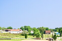
Ellsinore is located on Missouri Route V approximately one mile north of US Route 60. It is approximately 14 miles east-southeast of Van Buren and within the Mark Twain National Forest. [9]

According to the United States Census Bureau, the city has a total area of 0.49 square miles (1.27 km2), all land. [10]

Notable Locations

The Alcorn Corner House - At the North side of town by the Headstart building . Is one of the oldest buildings in the town, built around 1904. The name is derived from Lafayette and Alice Alcorn who farmed the property from about 1906 until retirement in 1943. It was later owned by Virgie Alcorn Evans.

2 Historical bridges - one In town that is part of Main Street and one connecting CR330 to town.

The Pioneer Museum - On Main Street, after the first bridge.

Royal Oak Charcoal - on county road 330 off highway 60

Demographics

Historical population
CensusPop.Note
1930 238
1940 26712.2%
1950 29912.0%
1960 3114.0%
1970 34210.0%
1980 3625.8%
1990 40511.9%
2000 363−10.4%
2010 44622.9%
2020 416−6.7%
U.S. Decennial Census [11]

2010 census

As of the census [12] of 2010, there were 446 people, 190 households, and 112 families residing in the city. The population density was 910.2 inhabitants per square mile (351.4/km2). There were 225 housing units at an average density of 459.2 per square mile (177.3/km2). The racial makeup of the city was 99.10% White, 0.45% Native American, and 0.45% from two or more races. Hispanic or Latino of any race were 1.12% of the population.

There were 190 households, of which 28.4% had children under the age of 18 living with them, 41.6% were married couples living together, 12.6% had a female householder with no husband present, 4.7% had a male householder with no wife present, and 41.1% were non-families. 38.9% of all households were made up of individuals, and 25.2% had someone living alone who was 65 years of age or older. The average household size was 2.35 and the average family size was 3.08.

The median age in the city was 37.3 years. 25.3% of residents were under the age of 18; 9.9% were between the ages of 18 and 24; 21.3% were from 25 to 44; 22.2% were from 45 to 64; and 21.3% were 65 years of age or older. The gender makeup of the city was 42.6% male and 57.4% female.

2000 census

As of the census [3] of 2000, there were 363 people, 162 households, and 99 families residing in the city. The population density was 830.7 inhabitants per square mile (320.7/km2). There were 184 housing units at an average density of 421.1 per square mile (162.6/km2). The racial makeup of the city was 98.07% White, 0.55% Native American, and 1.38% from two or more races. Hispanic or Latino of any race were 0.28% of the population.

There were 162 households, out of which 25.3% had children under the age of 18 living with them, 47.5% were married couples living together, 10.5% had a female householder with no husband present, and 38.3% were non-families. 36.4% of all households were made up of individuals, and 25.3% had someone living alone who was 65 years of age or older. The average household size was 2.20 and the average family size was 2.85.

In the city the population was spread out, with 22.6% under the age of 18, 9.1% from 18 to 24, 21.2% from 25 to 44, 20.4% from 45 to 64, and 26.7% who were 65 years of age or older. The median age was 43 years. For every 100 females, there were 78.8 males. For every 100 females age 18 and over, there were 75.6 males.

The median income for a household in the city was $17,143, and the median income for a family was $27,188. Males had a median income of $26,125 versus $16,250 for females. The per capita income for the city was $11,444. About 10.6% of families and 19.7% of the population were below the poverty line, including 22.8% of those under age 18 and 20.8% of those age 65 or over.

Education

Public education in Ellsinore is administered by East Carter County R-Ii School District, which operates one elementary school, one middle school and East Carter Co. R-II High School. [13]

The town has a lending library, a branch of the Carter County Library. [14]

Notable people

Related Research Articles

<span class="mw-page-title-main">Ozark County, Missouri</span> County in Missouri, United States

Ozark County is a county in the southern portion of the U.S. state of Missouri. As of the 2020 census, the population was 8,553. The largest city and county seat is Gainesville. The county was organized as Ozark County, named after the Ozark Mountains, on January 29, 1841. It was renamed Decatur County, after Commodore Stephen Decatur, from 1843 to 1845, after which the name Ozark County was restored.

<span class="mw-page-title-main">Lead Hill, Arkansas</span> Town in Arkansas, United States

Lead Hill is a town in Boone County, Arkansas, United States. The population was 271 at the 2010 census. It is part of the Harrison Micropolitan Statistical Area.

<span class="mw-page-title-main">St. Joe, Arkansas</span> Town in Arkansas, United States

St. Joe or Saint Joe is a town in Searcy County, Arkansas, United States. The population was 132 at the 2010 census.

<span class="mw-page-title-main">Glen, Mississippi</span> Town in Mississippi, United States

Glen is a town in Alcorn County, Mississippi. The population was 382 at the 2020 census, down from 412 at the 2010 census.

<span class="mw-page-title-main">Exeter, Missouri</span> City in Missouri, United States

Exeter is a city in Exeter Township, Barry County, Missouri, United States. The population was 772 at the 2010 census.

<span class="mw-page-title-main">Ozark, Missouri</span> City in Missouri, United States

Ozark is a city in and the county seat of Christian County, Missouri. Its population was 21,284 as of the 2020 census. Ozark is also the third largest city in the Springfield, Missouri Metropolitan Area, and is centered along a business loop of U.S. Route 65, where it intersects with Missouri Route 14.

<span class="mw-page-title-main">Ava, Missouri</span> City in Missouri, United States

Ava is the only incorporated city in Douglas County, Missouri, United States. The population was 2,894 at the 2020 census. Ava is the county seat of Douglas County. The city was founded in 1871. It was renamed Ava in 1881, the town's original name having been "Militia Springs."

<span class="mw-page-title-main">Annapolis, Missouri</span> City in Missouri, United States

Annapolis is a city located in southern Iron County, Missouri, United States. The population was 250 at the 2020 census.

<span class="mw-page-title-main">Ironton, Missouri</span> City in Missouri, United States

Ironton is a city in Iron County, Missouri, United States. The population was 1,475 at the 2020 census. It is the county seat of Iron County, and is located 12 miles south of Belgrade.

<span class="mw-page-title-main">Pierce City, Missouri</span> City in Missouri, United States

Pierce City, formerly Peirce City, is a city in southwest Lawrence and northwest Barry counties, in southwest Missouri, United States. The population was 1,292 at the 2010 census. In 2010, the town annexed property along Route 97 into Barry County to a point just north of U.S. Route 60. It was estimated to be 1,309 by the City of Pierce City as of July 1, 2019.

<span class="mw-page-title-main">Olean, Missouri</span> Town in Missouri, United States

Olean is a town in northern Miller County, Missouri, United States. The population was 128 at the 2010 census.

<span class="mw-page-title-main">Barnard, Missouri</span> City in Missouri, United States

Barnard is a city in Nodaway County, Missouri, United States. As of the 2010 census, the city population was 221.

<span class="mw-page-title-main">Thayer, Missouri</span> City in Missouri, United States

Thayer is a city in Oregon County, Missouri, United States. The population was 1,883 at the 2020 census. Its original name was Augusta.

<span class="mw-page-title-main">Gainesville, Missouri</span> City in Missouri, United States

Gainesville is a city in Ozark County, Missouri, United States. The population was 745 at the 2020 census. It is the county seat of Ozark County.

<span class="mw-page-title-main">Orrick, Missouri</span> Town in Missouri, United States

Orrick is a town in Ray County, Missouri, and part of the Kansas City metropolitan area within the United States. The population was 753 at the 2020 census.

<span class="mw-page-title-main">Queen City, Missouri</span> City in Missouri, United States

For the place nicknamed "the Queen City of the Ozarks", see Springfield, Missouri.

<span class="mw-page-title-main">Winona, Missouri</span> City in Missouri, United States

Winona is a city in southeast Shannon County, Missouri, United States. The population was 950 at the 2020 census.

<span class="mw-page-title-main">Houston, Missouri</span> City in Missouri, United States

Houston is a city in Texas County, Missouri, United States. The population was 2,079 at the 2020 census. It is the county seat of Texas County.

<span class="mw-page-title-main">Sheldon, Missouri</span> City in Missouri, United States

Sheldon is a city in southern Vernon County, Missouri, United States. The population was 543 at the 2010 census.

<span class="mw-page-title-main">Osage Beach, Missouri</span> City in Missouri, United States

Osage Beach is a city in Camden and Miller counties in the U.S. state of Missouri. Most of the city is in Camden County, while a small eastern sliver is in Miller County. The population was 4,351 at the 2010 census.

References

  1. "ArcGIS REST Services Directory". United States Census Bureau. Retrieved August 28, 2022.
  2. 1 2 U.S. Geological Survey Geographic Names Information System: Ellsinore, Missouri
  3. 1 2 "U.S. Census website". United States Census Bureau . Retrieved January 31, 2008.
  4. Dr. Gene Oakley, "A History of Carter County, Sesquicentennial Edition" 2007, pg. 83
  5. "Explore Census Data". data.census.gov. Retrieved December 16, 2021.
  6. Dr. Gene Oakley, "A History of Carter County, Sesquicentennial Edition" 2007, pg. 83-92
  7. Eunice Pennington, "The History of Carter County" 1959. pg 23
  8. Ozark Border Electric Cooperative minutes, 1938-1939
  9. Missouri Atlas & Gazetteer, DeLorme, 1998, First edition, p. 66, ISBN   0-89933-224-2
  10. "US Gazetteer files 2010". United States Census Bureau. Archived from the original on January 25, 2012. Retrieved July 8, 2012.
  11. "Census of Population and Housing". Census.gov. Retrieved June 4, 2015.
  12. "U.S. Census website". United States Census Bureau . Retrieved July 8, 2012.
  13. "East Carter County R-Ii School District". Great Schools. Retrieved June 1, 2019.
  14. "Find us". Carter County Library. Retrieved June 1, 2019.