Gibbs, Missouri

Last updated

Gibbs, Missouri
Adair County Missouri Incorporated and Unincorporated areas Gibbs Highlighted.svg
Location within Adair County (left) and Missouri (right)
Coordinates: 40°05′56″N92°25′00″W / 40.09889°N 92.41667°W / 40.09889; -92.41667
Country United States
State Missouri
County Adair
Township Wilson
Area
[1]
  Total0.25 sq mi (0.64 km2)
  Land0.25 sq mi (0.64 km2)
  Water0.00 sq mi (0.00 km2)
Elevation
[2]
909 ft (277 m)
Population
 (2020)
  Total70
  Density282.26/sq mi (109.18/km2)
Time zone UTC-6 (Central (CST))
  Summer (DST) UTC-5 (CDT)
ZIP code
63540
Area code 660
FIPS code 29-26920 [3]
GNIS feature ID2398958 [2]

Gibbs is a village in Wilson Township, Adair County, Missouri, United States. The population was 107 at the 2010 census.

Contents

History

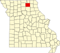
The town of Gibbs was an outgrowth of the Santa Fe Railroad, laid out in 1887 when the rail lines passed through southeastern Adair County. [4] The name Gibbs was chosen in honor of Frank W. Gibbs, who donated land to the Santa Fe Railroad for the construction of a rail depot and stockyard. At the time of Gibbs' incorporation in 1894, it was anticipated that the town might become Adair County's main rail shipping point for the Santa Fe. This hope was bolstered by the fact that the road leading to Gibbs was the first all-weather road in the county. In the late 1800s a considerable amount of cattle and hogs were shipped from the Gibbs depot to packing houses in Chicago, along with seasonal carloads of fresh apples, strawberries, and eggs to points across America. Perrin & Company of Chicago also constructed a grain elevator trackside for the storage and shipping of corn, with lesser amounts of barley, oats, and wheat. [5] The addition of a second Santa Fe trackline next to the existing one in 1908 added to Gibbs residents hopes for a bright future.

Frank W. Gibbs, founder of the town. FW Gibbs.jpg
Frank W. Gibbs, founder of the town.

However, the majority of merchants and businesses of Kirksville, the county's major trading hub, instead chose to use La Plata, on the Macon-Adair County border, as their major shipping and passenger service outlet on the Santa Fe. A US Post Office was established in 1887, and several businesses could be found including a barber shop, several general merchants, and two blacksmiths. The Gibbs business district also had of two hotels, an opera house, a bank, lumberyard, undertaker service, a cement factory, and the aforementioned grain elevator. The Bank Of Gibbs was founded in 1898 and served the citizens of Gibbs, Adair County, and northern Macon county well. It closed in 1933. For a time at the turn-of-the-century Gibbs had its own newspaper, Gibbs Telegraph. Gibbs featured four churches, but a falling population led to the closing of the last one in the early 1980s. The last Gibbs business, a grocery store, closed in 1970. It was also in that year that a rural health clinic, established by a Kirksville hospital in 1949, closed. The Santa Fe rail depot was closed in the 1960s and the two-room school was consolidated into the Brashear (Adair County R-2) school system in 1966. [6] It is now primarily a 'bedroom community' with most residents traveling to cities like Kirksville and Macon for employment. A 2007 rental dispute between the US Postal Service and the buildings owners has led to the closing, at least temporarily, of the Gibbs post office.

Geography

According to the United States Census Bureau, the village has a total area of 0.25 square miles (0.65 km2), all land. [7]

Demographics

Historical population
CensusPop.Note
1900 168
1910 22634.5%
1920 217−4.0%
1930 158−27.2%
1940 152−3.8%
1950 144−5.3%
1960 1589.7%
1970 112−29.1%
1980 107−4.5%
1990 89−16.8%
2000 10012.4%
2010 1077.0%
2020 70−34.6%
U.S. Decennial Census [8]

Gibbs is part of the Kirksville Micropolitan Statistical Area.

2010 census

As of the census [9] of 2010, there were 107 people, 34 households, and 26 families residing in the village. The population density was 428.0 inhabitants per square mile (165.3/km2). There were 42 housing units at an average density of 168.0 per square mile (64.9/km2). The racial makeup of the village was 91.6% White, 1.9% African American, 1.9% Native American, and 4.7% from two or more races. Hispanic or Latino of any race were 0.9% of the population.

There were 34 households, of which 41.2% had children under the age of 18 living with them, 58.8% were married couples living together, 11.8% had a female householder with no husband present, 5.9% had a male householder with no wife present, and 23.5% were non-families. 20.6% of all households were made up of individuals, and 2.9% had someone living alone who was 65 years of age or older. The average household size was 3.15 and the average family size was 3.65.

The median age in the village was 29.8 years. 38.3% of residents were under the age of 18; 6.5% were between the ages of 18 and 24; 24.3% were from 25 to 44; 24.2% were from 45 to 64; and 6.5% were 65 years of age or older. The gender makeup of the village was 52.3% male and 47.7% female.

2000 census

As of the census [3] of 2000, there were 100 people, 34 households, and 28 families residing in the village. The population density was 401.2 inhabitants per square mile (154.9/km2). There were 42 housing units at an average density of 168.5 per square mile (65.1/km2). The racial makeup of the village was 97.00% White, and 3.00% from two or more races.

There were 34 households, out of which 35.3% had children under the age of 18 living with them, 58.8% were married couples living together, 17.6% had a female householder with no husband present, and 17.6% were non-families. 17.6% of all households were made up of individuals, and 2.9% had someone living alone who was 65 years of age or older. The average household size was 2.94 and the average family size was 3.29.

In the village, the population was spread out, with 32.0% under the age of 18, 7.0% from 18 to 24, 30.0% from 25 to 44, 22.0% from 45 to 64, and 9.0% who were 65 years of age or older. The median age was 32 years. For every 100 females, there were 112.8 males. For every 100 females age 18 and over, there were 112.5 males.

The median income for a household in the village was $23,611, and the median income for a family was $23,889. Males had a median income of $21,250 versus $13,750 for females. The per capita income for the village was $9,368. There were 20.0% of families and 37.1% of the population living below the poverty line, including 70.0% of under eighteens and 44.4% of those over 64.

Transportation

Amtrak’s Southwest Chief , which operates between Los Angeles and Chicago, passes through the town on BNSF tracks, but makes no stop. The nearest station is located in La Plata, 13 miles (21 km) to the southwest.

Related Research Articles

<span class="mw-page-title-main">Putnam County, Missouri</span> County in Missouri, United States

Putnam County is in north central Missouri. At the 2020 census, the population was 4,681. Its county seat is Unionville. The county was organized February 28, 1845, and named for Israel Putnam, a hero in the French and Indian War and a general in the American Revolutionary War.

<span class="mw-page-title-main">Adair County, Missouri</span> County in Missouri, United States

Adair County is a county located in the northeastern part of the U.S. state of Missouri. The population census for 2020 was 25,314. As of July 1, 2021, the U.S. Census Bureau's Population Estimates for the county is 25,185, a -0.5% change. Adair county seat is Kirksville. The county was first settled by immigrants from Kentucky and organized on January 29, 1841. Adair County comprises the Kirksville, MO Micropolitan Statistical Area.

<span class="mw-page-title-main">Brashear, Missouri</span> Town in Missouri, United States

Brashear is a city in Salt River Township, Adair County, Missouri, United States. The population was 273 at the 2010 census.

<span class="mw-page-title-main">Kirksville, Missouri</span> City in Missouri, United States

Kirksville is the county seat and most populous city in Adair County, Missouri. Located in Benton Township, its population was 17,530 at the 2020 census. Kirksville is home to two colleges: Truman State University and A.T. Still University.

<span class="mw-page-title-main">Novinger, Missouri</span> Town in Missouri, United States

Novinger is a town in Nineveh Township, Adair County, Missouri, United States. The population was 456 at the 2010 census.

<span class="mw-page-title-main">Rothville, Missouri</span> Village in Missouri, United States

Rothville is a village in northern Chariton County, Missouri, United States. The population was 63 at the 2020 census.

<span class="mw-page-title-main">Waverly, Missouri</span> City in Missouri, United States

Waverly is a city in Lafayette County, Missouri, and part of the Kansas City metropolitan area within the United States. The population was 849 at the 2010 census.

<span class="mw-page-title-main">Callao, Missouri</span> City in Missouri, United States

Callao is a city in Macon County, Missouri, United States. The population was 251 at the 2020 census, down from 292 in 2010.

<span class="mw-page-title-main">Elmer, Missouri</span> City in Missouri, United States

Elmer is a city in Macon County, Missouri, United States. The population was 51 at the 2020 census, down from 80 in 2010.

<span class="mw-page-title-main">Ethel, Missouri</span> Town in Missouri, United States

Ethel is a town in Macon County, Missouri, United States. The population was 41 at the 2020 census, down from 62 in 2010.

<span class="mw-page-title-main">La Plata, Missouri</span> City in Missouri, United States

La Plata is a city in Macon County, Missouri, United States. The population was 1,257 at the 2020 census, down from 1,366 in 2010. La Plata is located next to the Adair County line and is on a mainline of the BNSF Railway. The town is best known for La Plata station, which provides passenger rail service to Chicago and Los Angeles.

<span class="mw-page-title-main">South Gifford, Missouri</span> Village in Missouri, United States

South Gifford is a village in Macon County, Missouri, United States. The population was 22 at the 2020 census, down from 50 in 2010.

<span class="mw-page-title-main">Livonia, Missouri</span> Village in Missouri, United States

Livonia is a village in eastern Putnam County, Missouri, United States. The population was 52 at the 2020 census.

<span class="mw-page-title-main">Grand Pass, Missouri</span> Village in Missouri, United States

Grand Pass is a village in Saline County, Missouri, United States. The population was 66 at the 2010 census.

<span class="mw-page-title-main">Glenwood, Missouri</span> Village in Missouri, United States

Glenwood is a village in Schuyler County, Missouri, United States. As of the 2020 census, its population was 181. It is part of the Kirksville Micropolitan Statistical Area.

<span class="mw-page-title-main">Queen City, Missouri</span> City in Missouri, United States

For the place nicknamed "the Queen City of the Ozarks", see Springfield, Missouri.

<span class="mw-page-title-main">Greencastle, Missouri</span> City in Missouri, United States

Greencastle is a city in eastern Sullivan County, Missouri, United States. The population was 224 at the 2020 census.

<span class="mw-page-title-main">Humphreys, Missouri</span> Village in Missouri, United States

Humphreys is a village in southwest Sullivan County, Missouri, United States. The population was 89 at the 2020 census.

<span class="mw-page-title-main">Millard, Missouri</span> Village in Missouri, United States

Millard is a village in Pettis Township, Adair County, Missouri, United States. The population was 89 at the 2010 census.

<span class="mw-page-title-main">Greentop, Missouri</span> City in Missouri, United States

Greentop is a city in Adair and Schuyler counties, Missouri, United States. As of the 2020 census, its population was 388.

References

  1. "ArcGIS REST Services Directory". United States Census Bureau. Retrieved August 28, 2022.
  2. 1 2 U.S. Geological Survey Geographic Names Information System: Gibbs, Missouri
  3. 1 2 "U.S. Census website". United States Census Bureau . Retrieved January 31, 2008.
  4. Violette, E. M. (1911). History of Adair County. The Denslow History Company. pp.  422.
  5. A Centennial Celebration" by Jonathan Walker, published in The Chariton Collector, Spring 1987
  6. A Book Of Adair County History, published by the Kirksville-Adair County Bicentennial Committee, 1976
  7. "US Gazetteer files 2010". United States Census Bureau. Archived from the original on March 5, 2012. Retrieved July 8, 2012.
  8. "Census of Population and Housing". Census.gov. Retrieved June 4, 2015.
  9. "U.S. Census website". United States Census Bureau . Retrieved July 8, 2012.