Walnut Township, Missouri | |
|---|---|
 | |
| Coordinates: 40°05′02″N092°45′51″W / 40.08389°N 92.76417°W | |
| Country | United States |
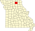
| State | Missouri |
| County | Adair |
| Area | |
• Total | 52.08 sq mi (134.89 km2) |
| • Land | 52.08 sq mi (134.88 km2) |
| • Water | 0.0039 sq mi (0.01 km2) 0.01% |
| Elevation | 950 ft (290 m) |
| Population (2020) | |
• Total | 219 |
| • Density | 4.9/sq mi (1.9/km2) |
| FIPS code | 29-76786 [2] |
| GNIS feature ID | 0766218 |
Walnut Township is one of ten townships in Adair County, Missouri, United States. At the 2020 census, its population was 219. [3] [4] Walnut Township was named from the old-growth forests of walnut it contained at the time of settlement. [5]