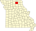
Troy Mills is an unincorporated community in Adair County, in the U.S. state of Missouri. [1]
A post office called Troy Mills was established in 1868, and remained in operation until 1879. [2] The community took its name from a nearby woolen mill. [3]
Adair County is a county located in the northeastern part of the U.S. state of Missouri. The population census for 2020 was 25,314. As of July 1, 2021, the U.S. Census Bureau's Population Estimates for the county is 25,185, a -0.5% change. Adair county seat is Kirksville. The county was first settled by immigrants from Kentucky and organized on January 29, 1841. Adair County comprises the Kirksville, MO Micropolitan Statistical Area.
Yarrow is an unincorporated community in southwestern Adair County, Missouri, United States. It is located on Missouri Supplemental Route N, approximately ten miles southwest of Kirksville. Yarrow's post office has closed and mail now comes from Kirksville.
Adair, Missouri is an unincorporated community in eastern Adair County, Missouri, United States. It is located approximately 12 miles northeast of Kirksville, on Missouri Route 11. Adair is notable as the location of St. Mary's Church, which is on the National Register of Historic Places.
Nineveh is an unincorporated community in Nineveh Township, Adair County, Missouri, United States.
Stahl is an unincorporated community in northwest Adair County, Missouri, United States. The community is on Missouri Route O about six miles northwest of Novinger and 12 miles northwest of Kirksville. The Union Ridge Conservation Area lies to the west about two miles and Spring Creek flows past the community to its confluence with the Chariton River south of Novinger.
Shibleys Point is an unincorporated community in Adair County, Missouri, United States.
Sublette is an unincorporated community in northern Adair County, Missouri, United States. The community is on U.S. Route 63 about six miles north of Kirksville.
Bullion is an unincorporated community in Adair County, in the U.S. state of Missouri.
Clay is an unincorporated community in Adair County, in the U.S. state of Missouri.
Danforth is an unincorporated community in Adair County, in the U.S. state of Missouri.
Fegley is an unincorporated community in Adair County, in the U.S. state of Missouri.
Lindersville is an extinct town in Adair County, in the U.S. state of Missouri.
Nind is an unincorporated community in Adair County, in the U.S. state of Missouri.
Paultown is an unincorporated community in eastern Adair County, in the U.S. state of Missouri. The community was approximately one mile northeast of Brashear and the Paultown Cemetery is about one-half mile to the east above Big Deer Branch.
Ringo Point is an unincorporated community in Adair County, in the U.S. state of Missouri.
Sperry is an unincorporated community in Adair County, in the U.S. state of Missouri.
Willmathsville is an unincorporated community in Adair County, in the U.S. state of Missouri.
Youngstown is an unincorporated community in Adair County, in the U.S. state of Missouri.
Harrison Mills is an unincorporated community in Crawford County, in the U.S. state of Missouri.
Foose is an unincorporated community in western Dallas County, in the U.S. state of Missouri. The community lies on Missouri Route EE, just west of U.S. Route 65, approximately seven miles south-southwest of Buffalo. The Dallas-Polk county line is two miles west along Route EE. The community is at an elevation of 1207 feet and Greasy Creek, a tributary of the Niangua River, drains the area to the east of Route 65.
{{cite web}}
: CS1 maint: bot: original URL status unknown (link)40°08′48″N92°36′02″W / 40.14667°N 92.60056°W