Browning, Missouri

Last updated

Browning, Missouri
City of Browning
Linn County Missouri Incorporated and Unincorporated areas Browning Highlighted.svg
Location of Browning, Missouri
Coordinates: 40°02′05″N93°09′36″W / 40.03472°N 93.16000°W / 40.03472; -93.16000 [1]
Country United States
State Missouri
Counties Linn, Sullivan
Area
[2]
  Total0.53 sq mi (1.36 km2)
  Land0.52 sq mi (1.35 km2)
  Water0.00 sq mi (0.00 km2)
Elevation
[1]
774 ft (236 m)
Population
 (2020)
  Total219
  Density418.74/sq mi (161.67/km2)
Time zone UTC-6 (Central (CST))
  Summer (DST) UTC-5 (CDT)
ZIP code
64630
Area code 660
FIPS code 29-08884 [3]
GNIS feature ID2393438 [1]

Browning is a city in Linn and Sullivan counties in the U.S. state of Missouri. The population was 219 at the 2020 census. [4]

Contents

History

Browning was laid out and platted in 1872. [5] The community was named in honor of the family of J. A. Browning, a railroad employee. [6] A post office called Browning has been in operation since 1873. [7]

Geography

Browning is located on the Linn-Sullivan county line along Missouri Route 5 between Purdin to the south and Milan to the north. Locust Creek flows past the west side of the community. [8] The Chicago, Burlington and Quincy Railroad passes through the community. [9]

According to the United States Census Bureau, the city has a total area of 0.52 square miles (1.35 km2), all land. [10]

Demographics

Historical population
CensusPop.Note
1880 187
1890 527181.8%
1900 72637.8%
1910 629−13.4%
1920 69410.3%
1930 590−15.0%
1940 531−10.0%
1950 492−7.3%
1960 412−16.3%
1970 4120.0%
1980 368−10.7%
1990 331−10.1%
2000 317−4.2%
2010 265−16.4%
2020 219−17.4%
U.S. Decennial Census [11]

2010 census

As of the census [12] of 2010, there were 265 people, 110 households, and 72 families living in the city. The population density was 509.6 inhabitants per square mile (196.8/km2). There were 144 housing units at an average density of 276.9 per square mile (106.9/km2). The racial makeup of the city was 96.2% White, 0.4% African American, 0.4% Native American, 0.4% from other races, and 2.6% from two or more races. Hispanic or Latino of any race were 6.8% of the population.

There were 110 households, of which 31.8% had children under the age of 18 living with them, 40.9% were married couples living together, 14.5% had a female householder with no husband present, 10.0% had a male householder with no wife present, and 34.5% were non-families. 31.8% of all households were made up of individuals, and 10.9% had someone living alone who was 65 years of age or older. The average household size was 2.41 and the average family size was 2.99.

The median age in the city was 38.7 years. 26.4% of residents were under the age of 18; 5.3% were between the ages of 18 and 24; 27.2% were from 25 to 44; 24.9% were from 45 to 64; and 16.2% were 65 years of age or older. The gender makeup of the city was 50.2% male and 49.8% female.

2000 census

As of the census [3] of 2000, there were 317 people, 143 households, and 80 families living in the city. The population density was 604.5 inhabitants per square mile (233.4/km2). There were 177 housing units at an average density of 337.5 per square mile (130.3/km2). The racial makeup of the city was 98.42% White, 0.32% Native American, and 1.26% from two or more races. Hispanic or Latino of any race were 0.95% of the population.

There were 143 households, out of which 20.3% had children under the age of 18 living with them, 44.1% were married couples living together, 9.1% had a female householder with no husband present, and 43.4% were non-families. 35.0% of all households were made up of individuals, and 20.3% had someone living alone who was 65 years of age or older. The average household size was 2.22 and the average family size was 2.77.

In the city, the population was spread out, with 18.6% under the age of 18, 9.1% from 18 to 24, 24.9% from 25 to 44, 21.8% from 45 to 64, and 25.6% who were 65 years of age or older. The median age was 43 years. For every 100 females, there were 83.2 males. For every 100 females age 18 and over, there were 84.3 males.

The median income for a household in the city was $19,167, and the median income for a family was $30,625. Males had a median income of $21,250 versus $17,500 for females. The per capita income for the city was $11,266. About 17.0% of families and 26.9% of the population were below the poverty line, including 50.0% of those under age 18 and 13.0% of those age 65 or over.

Notable person

Related Research Articles

<span class="mw-page-title-main">Linn County, Kansas</span> County in Kansas, United States

Linn County is a county in the U.S. state of Kansas, located in along the eastern edge of Kansas, and is part of the Kansas City metropolitan area. Its county seat is Mound City, and its most populous city is Pleasanton. As of the 2020 census, the county population was 9,591. The county was named for Lewis Linn, a U.S. Senator from Missouri.

<span class="mw-page-title-main">Prairieburg, Iowa</span> City in Iowa, United States

Prairieburg is a city in Linn County, Iowa, United States. The population was 160 at the time of the 2020 census. It is part of the Cedar Rapids Metropolitan Statistical Area.

<span class="mw-page-title-main">Walker, Iowa</span> City in Iowa, United States

Walker is a city in Linn County, Iowa. The population was 688 at the 2020 census. It is part of the Cedar Rapids, Iowa metropolitan area.

<span class="mw-page-title-main">Linn Valley, Kansas</span> City in Kansas, United States

Linn Valley is a city in Linn County, Kansas, United States. As of the 2020 census, the population of the city was 956.

<span class="mw-page-title-main">Linn, Kansas</span> City in Washington County, Kansas

Linn is a city in Washington County, Kansas, United States. As of the 2020 census, the population of the city was 387.

<span class="mw-page-title-main">Linn Creek, Missouri</span> City in Missouri, United States

Linn Creek is a city in Camden County, Missouri, United States. The population was 216 at the 2020 census.

<span class="mw-page-title-main">Brookfield, Missouri</span> City in Missouri, United States

Brookfield is a city in Linn County, Missouri, United States. The population was 4,111 at the 2020 census.

<span class="mw-page-title-main">Bucklin, Missouri</span> City in Missouri, United States

Bucklin is a city in southeast Linn County, Missouri, United States. The population was 413 at the 2020 census.

<span class="mw-page-title-main">Laclede, Missouri</span> City in Missouri, United States

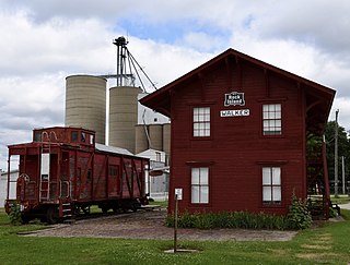
Laclede is a city in Linn County, Missouri. The population was 305 at the 2020 census, down from 345 in 2010.

<span class="mw-page-title-main">Linneus, Missouri</span> City in Missouri, United States

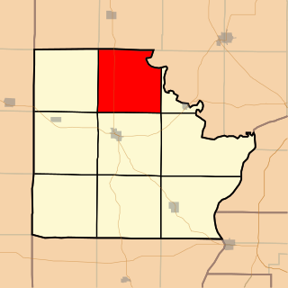
Linneus is a small city in Linn County, Missouri, United States. The population was 281 at the 2020 census. It is the county seat of Linn County.

<span class="mw-page-title-main">Meadville, Missouri</span> City in Missouri, United States

Meadville is a city in southwest Linn County, Missouri, United States. The population was 415 at the 2020 census.

<span class="mw-page-title-main">Purdin, Missouri</span> City in Missouri, United States

Purdin is a city in northwest Linn County, Missouri, United States. The population was 141 at the 2020 census.

<span class="mw-page-title-main">Wheeling, Missouri</span> City in Missouri, United States

Wheeling is a city in eastern Livingston County, Missouri, United States. The population was 220 at the 2020 census.

<span class="mw-page-title-main">Linn, Missouri</span> City in Missouri, United States

Linn is a city in Osage County, Missouri, United States. The population was 1,350 at the 2020 census. It is the county seat of Osage County. Linn is part of the Jefferson City, Missouri Metropolitan Statistical Area.

<span class="mw-page-title-main">Crystal Lake Park, Missouri</span> City in Missouri, United States

Crystal Lake Park is a Missouri Class 4 city in St. Louis County, Missouri, United States. The population was 508 at the 2020 census.

<span class="mw-page-title-main">Velda City, Missouri</span> City in Missouri, United States

Velda City is a city in St. Louis County, Missouri, United States. The population was 1,420 at the 2010 census.

<span class="mw-page-title-main">Braymer, Missouri</span> City in Missouri, United States

Braymer is a city in southeast Caldwell County, Missouri. The population was 737 at the 2020 census.

<span class="mw-page-title-main">Marceline, Missouri</span> City in Missouri, United States

Marceline is a city in Chariton and Linn counties in the U.S. state of Missouri. The population was 2,123 at the 2020 census.

<span class="mw-page-title-main">Idanha, Oregon</span> City in Oregon, United States

Idanha is a city on the Marion County/Linn County line in Oregon, United States, on Oregon Route 22 and the Santiam River. The population was 156 at the 2020 census.

<span class="mw-page-title-main">Missouri Township, Brown County, Illinois</span> Township in Illinois, United States

Missouri Township is one of nine townships in Brown County, Illinois, USA. As of the 2020 census, its population was 156 and it contained 87 housing units.

References

  1. 1 2 3 U.S. Geological Survey Geographic Names Information System: Browning, Missouri
  2. "ArcGIS REST Services Directory". United States Census Bureau. Retrieved August 28, 2022.
  3. 1 2 "U.S. Census website". United States Census Bureau . Retrieved January 31, 2008.
  4. "Explore Census Data". data.census.gov. Retrieved December 20, 2021.
  5. Eaton, David Wolfe (1916). How Missouri Counties, Towns and Streams Were Named. The State Historical Society of Missouri. pp.  188.
  6. "Linn County Place Names, 1928–1945". The State Historical Society of Missouri. Archived from the original on June 24, 2016. Retrieved October 29, 2016.
  7. "Post Offices". Jim Forte Postal History. Retrieved October 29, 2016.
  8. Missouri Atlas & Gazetteer, DeLorme, 1st ed., 1998, p. 22, ISBN   0899332242
  9. Browning, MO, 7.5 Minute Topographic Quadrangle, USGS, 1964
  10. "US Gazetteer files 2010". United States Census Bureau. Archived from the original on July 2, 2012. Retrieved July 8, 2012.
  11. "Census of Population and Housing". Census.gov. Retrieved June 4, 2015.
  12. "U.S. Census website". United States Census Bureau . Retrieved July 8, 2012.