Reger, Missouri

Last updated
MOMap-doton-Reger.png

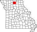
Reger is an unincorporated community in Sullivan County, Missouri, United States. [1] It is located along Missouri Route 6, approximately six miles southwest of Milan. Locust Creek flows past just to the east. [2]

Reger was laid out in 1881. [3] The community has the name of O. M. Reger, an early citizen. [4] A post office called Reger was established in 1881, and remained in operation until 1968. [5]

Henry Cemetery was listed on the National Register of Historic Places in 2005. [6]

Related Research Articles

<span class="mw-page-title-main">Plew, Missouri</span>

Plew is a small unincorporated community in western Lawrence County, Missouri, United States. Plew is located on former U.S. Route 66, now Route 96.

Caplinger Mills is an unincorporated community in northern Cedar County, Missouri, United States. Several homes are located in the community, along with an old mill. It is on the Sac River.

<span class="mw-page-title-main">Quincy, Missouri</span>

Quincy is a small unincorporated community in northwestern Hickory County, Missouri, United States. It is located on Route 83, north of U.S. Route 54. A post office and a few homes are located there.

<span class="mw-page-title-main">Walnut Shade, Missouri</span>

Walnut Shade is an unincorporated community in Taney County, Missouri, United States. It is located approximately six miles northwest of Forsyth on U.S. Route 160. The town sits at the confluence of Bull and Bear Creeks. Walnut Shade is part of the Branson, Missouri Micropolitan Statistical Area. The ZIP Code for Walnut Shade is 65771.

<span class="mw-page-title-main">Mineola, Missouri</span> Unincorporated community in the American state of Missouri

Mineola is an unincorporated community in western Montgomery County, Missouri, United States. The community is located on Missouri Supplemental Route J and is about one mile south from Interstate 70. Montgomery City is approximately six miles north of the community. It is on the east bank of the Loutre River. Graham Cave within Graham Cave State Park is on the north side of I-70 just north of the community and Mount Horeb Baptist Church is approximately 4.5 miles to the southwest.

<span class="mw-page-title-main">Langdon, Missouri</span>

Langdon is an unincorporated community in Atchison County, Missouri, United States. It is located about six miles southwest of Rock Port. Its post office has closed and mail is now delivered through Fairfax.

<span class="mw-page-title-main">Papinville, Missouri</span>

Papinville is an unincorporated community in southern Bates County, Missouri.

Locust Creek is a stream in Wayne County, Iowa and Chariton, Linn, Livingston, Putnam and Sullivan counties in Missouri. It is a tributary of the Grand River.

Lindley is an unincorporated community in Grundy and Sullivan counties, in the U.S. state of Missouri.

Busch is an extinct town in Pike County, in the U.S. state of Missouri. The GNIS classifies it as a populated place.

Harper is an unincorporated community in St. Clair County, in the U.S. state of Missouri.

Bairdston is an unincorporated community in Sullivan County, in the U.S. state of Missouri.

Boynton is an unincorporated community in Sullivan County, in the U.S. state of Missouri.

Cora is an unincorporated community in southern Sullivan County, in the U.S. state of Missouri.

Jacksonville is an unincorporated community in Sullivan County, in the U.S. state of Missouri.

Judson is an unincorporated community in Sullivan County, in the U.S. state of Missouri.

Parsons is an unincorporated community in Sullivan County, in the U.S. state of Missouri.

Paw Paw is a community in south central Sullivan County, in the U.S. state of Missouri, which the GNIS classifies as a populated place.

Wintersville is an unincorporated community in western Sullivan County, in the U.S. state of Missouri.

Bowman Township is a township in Sullivan County, in the U.S. state of Missouri.

References

  1. U.S. Geological Survey Geographic Names Information System: Reger, Missouri
  2. Missouri Atlas & Gazetteer, DeLorme, 1st ed., 1998, p.22 ISBN   0899332242
  3. "Sullivan County Place Names, 1928–1945". The State Historical Society of Missouri. Archived from the original on June 24, 2016. Retrieved December 27, 2016.
  4. Eaton, David Wolfe (1918). How Missouri Counties, Towns and Streams Were Named. The State Historical Society of Missouri. p. 367.
  5. "Post Offices". Jim Forte Postal History. Retrieved 27 November 2016.
  6. "National Register Information System". National Register of Historic Places . National Park Service. July 9, 2010.

40°08′38″N93°11′34″W / 40.14389°N 93.19278°W / 40.14389; -93.19278