References
- ↑ U.S. Geological Survey Geographic Names Information System: Sticklerville, Missouri
- ↑ Mystic, MO, 7.5 Minute Topographic Quadrangle, USGS, 1963 (1985 rev.)
- ↑ "Sullivan County Place Names, 1928–1945". The State Historical Society of Missouri. Archived from the original on June 24, 2016. Retrieved December 27, 2016.
- ↑ "Post Offices". Jim Forte Postal History. Retrieved November 27, 2016.
Municipalities and communities of Sullivan County, Missouri, United States | ||
|---|---|---|
| Cities | 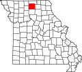 | |
| Villages | ||
| Townships | ||
| CDP | ||
| Unincorporated communities | ||
| Footnotes | ‡This populated place also has portions in an adjacent county or counties | |
40°09′38″N92°53′38″W / 40.16056°N 92.89389°W
| | This Sullivan County, Missouri state location article is a stub. You can help Wikipedia by expanding it. |