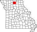
Paw Paw is a community in south central Sullivan County, in the U.S. state of Missouri, which the GNIS classifies as a populated place. [1]
The community is located approximately one third mile north of Paw Paw Creek, approximately 7.5 miles (12.1 km) south-southeast of Milan and six miles (9.7 km) northeast of Browning. [2]
The name was sometimes spelled "Pawpaw". [1] A post office called Pawpaw was established in 1899 and remained in operation until 1905. [3] The community most likely was so named because of the paw paw thickets near the original town site. [4]
Sullivan County is a county located in the northern portion of the U.S. state of Missouri. As of the 2020 census, the population was 5,999. Its county seat is Milan. The county was organized February 14, 1845 and named for Major General John Sullivan of the American Revolutionary War.
Mercer County is a county located in the northwestern portion of the U.S. state of Missouri. As of the 2020 census, the population was 3,538, making it the second-least populous county in Missouri. Its county seat is Princeton. The county was organized February 14, 1845 and named for General John F. Mercer of the Revolutionary War.
Paw Paw is a village in the U.S. state of Michigan. The population was 3,534 at the 2010 census. It is the county seat of Van Buren County.
Reger is an unincorporated community in Sullivan County, Missouri, United States. It is located along Missouri Route 6, approximately six miles southwest of Milan. Locust Creek flows past just to the east.
Owasco is an unincorporated community in Sullivan County, in the U.S. state of Missouri.
Locust Creek is a stream in Wayne County, Iowa and Chariton, Linn, Livingston, Putnam and Sullivan counties in Missouri. It is a tributary of the Grand River.
Olive is an unincorporated community in southeastern Dallas County, in the U.S. state of Missouri.
Cotton Plant is an unincorporated community in Dunklin County, in the U.S. state of Missouri.
Medicine Creek is a stream in Grundy, Livingston, Putnam, and Sullivan counties of the U.S. state of Missouri. It is a tributary to the Grand River.
Enterprise is an unincorporated community in northern Linn County, in the U.S. state of Missouri.
North Salem is an unincorporated community in Linn County, in the U.S. state of Missouri.
Parson Creek is a stream in Sullivan, Linn and Livingston counties of the U.S. state of Missouri. It is a tributary of the Grand River.
Iuka Springs is an extinct town in St. Clair County, in the U.S. state of Missouri. The GNIS classifies it as a populated place.
Carico is an unincorporated community in Stone County, in the U.S. state of Missouri. Carico is located at the junction of Railey Creek and Carico Hollow, approximately 3.5 miles east-southeast of Galena and 6.5 miles northwest of Reeds Spring along the Missouri Pacific Railroad.
Bairdston is an unincorporated community in Sullivan County, in the U.S. state of Missouri.
Boynton is an unincorporated community in Sullivan County, in the U.S. state of Missouri.
Cora is an unincorporated community in southern Sullivan County, in the U.S. state of Missouri.
Jacksonville is an unincorporated community in Sullivan County, in the U.S. state of Missouri.
Pennville is an unincorporated community in northeast Sullivan County, in the U.S. state of Missouri.
Wintersville is an unincorporated community in western Sullivan County, in the U.S. state of Missouri.
40°05′28″N93°05′16″W / 40.09111°N 93.08778°W