Owasco, Missouri

Last updated

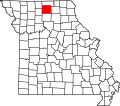
Owasco is an unincorporated community in Sullivan County, in the U.S. state of Missouri. [1]

The community is on Missouri Route V approximately 8.5 miles southeast of Milan. The community of Mystic on Missouri Route 129 is about 2.5 miles to the northeast. The community is on a ridge between East and West Yellow Creeks. [2]

History

A post office called Owasco was established in 1858, and remained in operation until 1919. [3] Owasco is an Indian name for "bridge". [4] Besides the post office, Owasco had a country store. [5]

Related Research Articles

Foil is an unincorporated community in northern Ozark County, Missouri, United States. It is located approximately sixteen miles south of Ava on county roads 953 and 955. Wasola is about four miles northeast on Missouri Route 5 and Thornfield approximately three miles southwest on Missouri Route JJ. The community is on the banks of Little Creek, a tributary of Little North Fork White River.

<span class="mw-page-title-main">Reger, Missouri</span> Unincorporated community in the American state of Missouri

Reger is an unincorporated community in Sullivan County, Missouri, United States. It is located along Missouri Route 6, approximately six miles southwest of Milan. Locust Creek flows past just to the east.

Simmons is a community in Texas County, in the U.S. state of Missouri. The community is located at the intersection of US Route 63 and Missouri Route Z, approximately seven miles south of Houston. The Big Piney River flows past the east side of the community.

Sublette is an unincorporated community in northern Adair County, Missouri, United States. The community is on U.S. Route 63 about six miles north of Kirksville.

Danforth is an unincorporated community in Adair County, in the U.S. state of Missouri.

Fabius is an unincorporated community in Knox County, in the U.S. state of Missouri.

North Salem is an unincorporated community in Linn County, in the U.S. state of Missouri.

Chariton is an unincorporated community in northeast Putnam County, in the U.S. state of Missouri.

Glendale is an unincorporated community in eastern Putnam County, in the U.S. state of Missouri.

Graysville is an unincorporated community in eastern Putnam County, in the U.S. state of Missouri.

Bonne Femme Creek is a stream in Howard and Randolph counties in the U.S. state of Missouri. It is a tributary of the Missouri River.

Hitt is an unincorporated community in northwest Scotland County, in the U.S. state of Missouri.

Bairdston is an unincorporated community in Sullivan County, in the U.S. state of Missouri.

Boynton is an unincorporated community in Sullivan County, in the U.S. state of Missouri.

Cora is an unincorporated community in southern Sullivan County, Missouri, United States. It sits along Missouri Route T approximately six miles south of Milan and consists entirely of private homes. East Locust Creek flows past the west side of the community. The Chicago, Burlington and Quincy Railroad passes near the community.

Paw Paw is a community in south central Sullivan County, in the U.S. state of Missouri, which the GNIS classifies as a populated place.

Pennville is an unincorporated community in northeast Sullivan County, in the U.S. state of Missouri.

Sticklerville is an unincorporated community in Sullivan County, in the U.S. state of Missouri.

Wintersville is an unincorporated community in western Sullivan County, in the U.S. state of Missouri.

Mystic is an unincorporated community in eastern Sullivan County, in the U.S. state of Missouri.

References

  1. U.S. Geological Survey Geographic Names Information System: Owasco, Missouri
  2. Missouri Atlas & Gazetteer, DeLorme, 1st ed., 1998, p. 22 ISBN   0899332242
  3. "Post Offices". Jim Forte Postal History. Retrieved November 27, 2016.
  4. Eaton, David Wolfe (1918). How Missouri Counties, Towns and Streams Were Named. The State Historical Society of Missouri. p. 367.
  5. "Sullivan County Place Names, 1928–1945". The State Historical Society of Missouri. Archived from the original on June 24, 2016. Retrieved December 27, 2016.
40°08′17″N92°58′41″W / 40.13806°N 92.97806°W / 40.13806; -92.97806