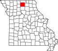
Greencastle, Missouri

Last updated
Greencastle, Missouri
Sullivan County Missouri Incorporated and Unincorporated areas Greencastle Highlighted.svg
Location of Greencastle, Missouri
Coordinates: 40°15′38″N92°52′42″W / 40.26056°N 92.87833°W / 40.26056; -92.87833 Coordinates: 40°15′38″N92°52′42″W / 40.26056°N 92.87833°W / 40.26056; -92.87833
Country United States
State Missouri
County Sullivan
Area
[1]
  Total0.45 sq mi (1.17 km2)
  Land0.45 sq mi (1.16 km2)
  Water0.00 sq mi (0.01 km2)
Elevation
[2]
1,047 ft (319 m)
Population
 (2020)
  Total224
  Density501.12/sq mi (193.52/km2)
Time zone UTC-6 (Central (CST))
  Summer (DST) UTC-5 (CDT)
ZIP code
63544
Area code 660
FIPS code 29-29116 [3]
GNIS feature ID2394981 [2]

Greencastle is a city in eastern Sullivan County, Missouri, United States. The population was 224 at the 2020 census. [4]

Contents

History

Part of the Greencastle business district in the 1890s. GreencastleMO1.jpg
Part of the Greencastle business district in the 1890s.

The plat for Greencastle was surveyed on March 12, 1857 at the behest of Victor Doze, Marion Overstreet, E.E. Prindle, I.E. Wood, and M.P. Wood. It consisted of six full blocks and eight half blocks with each block containing eight lots. The area had been inhabited for some time prior to 1857 however, with the first permanent home built on the present site of Greencastle by Marion Sanders circa 1853. Moreover, the Greencastle Methodist Episcopal Church was organized in 1845 and held services just south of the town's later platted[ sic?] location.

The Greencastle post office was established in 1857 with I.E. Wood as first postmaster, followed a short time later by the opening of the new towns' first general store. Greencastle's first grist mill was built in 1879 and a newspaper, the Greencastle Independence began publication in 1881. It was also in 1881 that Greencastle was finally incorporated on August 8, 1881. A depot for the Quincy, Missouri, and Pacific Railroad was built in 1883. A creamery was established in 1885 and produced an average of 1,500 pounds of butter per week. [5]

Geography

Greencastle is located on Missouri Route 6 approximately 13 miles east-northeast of Milan and 15 miles west of Kirksville. [6]

Mussel Fork flows past approximately one mile to the southwest and the Union Ridge Conservation Area on Spring Creek is two miles north on Missouri Route D. [6]

According to the United States Census Bureau, the city has a total area of 0.45 square miles (1.17 km2), all land. [7]

Demographics

Historical population
CensusPop.Note
1880 191
1890 26739.8%
1900 39046.1%
1910 45416.4%
1920 4877.3%
1930 376−22.8%
1940 342−9.0%
1950 287−16.1%
1960 250−12.9%
1970 235−6.0%
1980 28521.3%
1990 254−10.9%
2000 30821.3%
2010 275−10.7%
2020 224−18.5%
U.S. Decennial Census [8]

2010 census

As of the census [9] of 2010, there were 275 people, 123 households, and 71 families residing in the city. The population density was 611.1 inhabitants per square mile (235.9/km2). There were 147 housing units at an average density of 326.7 per square mile (126.1/km2). The racial makeup of the city was 99.6% White and 0.4% from two or more races. Hispanic or Latino of any race were 1.5% of the population.

There were 123 households, of which 27.6% had children under the age of 18 living with them, 42.3% were married couples living together, 11.4% had a female householder with no husband present, 4.1% had a male householder with no wife present, and 42.3% were non-families. 39.0% of all households were made up of individuals, and 24.4% had someone living alone who was 65 years of age or older. The average household size was 2.24 and the average family size was 3.03.

The median age in the city was 44.1 years. 23.3% of residents were under the age of 18; 8.8% were between the ages of 18 and 24; 19.6% were from 25 to 44; 25.9% were from 45 to 64; and 22.5% were 65 years of age or older. The gender makeup of the city was 48.0% male and 52.0% female.

2000 census

As of the census [3] of 2000, there were 308 people, 133 households, and 75 families residing in the city. The population density was 673.4 inhabitants per square mile (260.0/km2). There were 148 housing units at an average density of 323.6 per square mile (124.9/km2). The racial makeup of the city was 99.68% White and 0.32% Native American.

There were 133 households, out of which 28.6% had children under the age of 18 living with them, 47.4% were married couples living together, 6.0% had a female householder with no husband present, and 42.9% were non-families. 40.6% of all households were made up of individuals, and 18.8% had someone living alone who was 65 years of age or older. The average household size was 2.32 and the average family size was 3.17.

In the city the population was spread out, with 28.9% under the age of 18, 4.9% from 18 to 24, 26.0% from 25 to 44, 24.7% from 45 to 64, and 15.6% who were 65 years of age or older. The median age was 37 years. For every 100 females, there were 85.5 males. For every 100 females age 18 and over, there were 90.4 males.

The median income for a household in the city was $17,500, and the median income for a family was $23,438. Males had a median income of $21,042 versus $18,625 for females. The per capita income for the city was $10,369. About 19.5% of families and 27.1% of the population were below the poverty line, including 22.6% of those under the age of eighteen and 33.3% of those 65 or over.

Related Research Articles

<span class="mw-page-title-main">Amoret, Missouri</span> City in Missouri, United States

Amoret is a city in western Bates County, Missouri, and is part of the Kansas City metropolitan area within the United States. The population was 133 at the 2020 census.

<span class="mw-page-title-main">Bosworth, Missouri</span> City in Missouri, United States

Bosworth is a city in Carroll County, Missouri, United States. The population was 213 at the 2020 U.S. Census.

<span class="mw-page-title-main">Mosby, Missouri</span> City in Missouri, United States

Mosby is a city in Clay County, Missouri, United States, along the Fishing River. The population was 101 at the 2020 census. It is part of the Kansas City metropolitan area.

<span class="mw-page-title-main">Calhoun, Missouri</span> City in Missouri, United States

Calhoun is a city in Henry County, Missouri, United States. The population was 469 at the 2010 census.

<span class="mw-page-title-main">Urich, Missouri</span> City in Missouri, United States

Urich is a city in Henry County, Missouri, United States. The population was 505 at the 2010 census.

<span class="mw-page-title-main">Viburnum, Missouri</span> City in Missouri, United States

Viburnum is a city in Iron County, Missouri, United States. The population was 667 at the 2020 census. The city is located in the New Lead Belt.

<span class="mw-page-title-main">Linneus, Missouri</span> City in Missouri, United States

Linneus is a small city in Linn County, Missouri, United States. The population was 281 at the 2020 census. It is the county seat of Linn County.

<span class="mw-page-title-main">Elmer, Missouri</span> City in Missouri, United States

Elmer is a city in Macon County, Missouri, United States. The population was 51 at the 2020 census.

<span class="mw-page-title-main">Cooter, Missouri</span> City in Missouri, United States

Cooter is a city in Pemiscot County, Missouri, United States. The population was 343 at the 2020 census.

<span class="mw-page-title-main">Hayti Heights, Missouri</span> City in Missouri, United States

Hayti Heights is a city in eastern Pemiscot County in the bootheel of southeast Missouri, United States. The population was 515 at the 2020 census.

<span class="mw-page-title-main">Homestown, Missouri</span> City in Missouri, United States

Homestown is a city in Pemiscot County, Missouri, United States. The population was 73 at the 2020 census.

<span class="mw-page-title-main">Gilliam, Missouri</span> City in Missouri, United States

Gilliam is a city in Saline County, Missouri, United States. The population was 197 at the 2010 census.

<span class="mw-page-title-main">Velda City, Missouri</span> City in Missouri, United States

Velda City is a city in St. Louis County, Missouri, United States. The population was 1,420 at the 2010 census.

<span class="mw-page-title-main">Winchester, Missouri</span> City in Missouri, United States

Winchester is a city in St. Louis County, Missouri, United States. The population was 1,447 at the 2020 census.

<span class="mw-page-title-main">Dudley, Missouri</span> City in Missouri, United States

Dudley is a city in Stoddard County, Missouri, United States. The population was 232 at the 2010 census.

<span class="mw-page-title-main">Bronaugh, Missouri</span> City in Missouri, United States

Bronaugh is a city in southwest Vernon County, Missouri, United States. The population was 249 at the 2010 census.

<span class="mw-page-title-main">Schell City, Missouri</span> City in Missouri, United States

Schell City is a city in northeast Vernon County, Missouri, United States. The population was 249 at the 2010 census.

<span class="mw-page-title-main">Lake Annette, Missouri</span> City in Missouri, United States

Lake Annette is a city in Cass County, Missouri, United States. The population was 100 at the 2010 census. It is part of the Kansas City metropolitan area.

<span class="mw-page-title-main">Clarkson Valley, Missouri</span> City in Missouri, United States

Clarkson Valley is a city in St. Louis County, Missouri, United States. The population was 2,609 at the 2020 census.

<span class="mw-page-title-main">Blackburn, Missouri</span> City in Missouri, United States

Blackburn is a city in Lafayette and Saline counties in the U.S. state of Missouri and is part of the Kansas City metropolitan area. The population was 249 at the 2010 census.

References

  1. "ArcGIS REST Services Directory". United States Census Bureau. Retrieved August 28, 2022.
  2. 1 2 U.S. Geological Survey Geographic Names Information System: Greencastle, Missouri
  3. 1 2 "U.S. Census website". United States Census Bureau . Retrieved 2008-01-31.
  4. "Explore Census Data". data.census.gov. Retrieved 2021-12-20.
  5. "History of Adair, Sullivan, Putnam and Schuyler Counties Missouri". Goodspeed Publishing Company. 1888. Retrieved 2011-07-26.[ page needed ]
  6. 1 2 Missouri Atlas & Gazetteer, DeLorme, 1st ed., 1998, pp. 22-3 ISBN   0899332242
  7. "US Gazetteer files 2010". United States Census Bureau. Archived from the original on 2012-01-25. Retrieved 2012-07-08.
  8. "Census of Population and Housing". Census.gov. Retrieved June 4, 2015.
  9. "U.S. Census website". United States Census Bureau . Retrieved 2012-07-08.