Wintersville, Missouri

Last updated

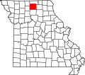
Wintersville is an unincorporated community in western Sullivan County, in the U.S. state of Missouri. [1]

The community is on Missouri Route WW 2.5 miles southeast of Harris and one mile east of Medicine Creek. [2]

History

Wintersville was platted in 1857 by J. N. Winters, and named for him. [3] A post office called Wintersville was established in 1857, and remained in operation until 1904. [4]

Related Research Articles

Sullivan County, Missouri County in Missouri, United States

Sullivan County is located in the northern portion of the U.S. state of Missouri. As of the 2020 census, the population was 5,999. Its county seat is Milan. The county was organized February 14, 1845 and named for Major General John Sullivan of the American Revolutionary War.

Phelps, Missouri

Phelps is an unincorporated community in Lawrence County, Missouri, United States. It lies along former U.S. Route 66, twenty-one miles east of Carthage.

Reger, Missouri

Reger is an unincorporated community in Sullivan County, Missouri, United States. It is located along Missouri Route 6, approximately six miles southwest of Milan. Locust Creek flows past just to the east.

Saverton, Missouri

Saverton was founded in 1819 and is named after the local Saverton family, who were likely prominent in the area. A post office called Saverton has been in operation since 1832.

Owasco is an unincorporated community in Sullivan County, in the U.S. state of Missouri.

Paultown is an unincorporated community in eastern Adair County, in the U.S. state of Missouri. The community was approximately one mile northeast of Brashear and the Paultown Cemetery is about one-half mile to the east above Big Deer Branch.

Lindley is an unincorporated community in Grundy and Sullivan counties, in the U.S. state of Missouri.

Brushy Fork is a stream in Miller County in the U.S. state of Missouri. It is a tributary of Tavern Creek.

Calumet is an unincorporated community in eastern Pike County, in the U.S. state of Missouri. The community is located at the intersection of Missouri routes N and D about six miles southwest of Clarkesville and six miles north of Eolia. Calumet Creek flows past to the south of the community.

Bairdston is an unincorporated community in Sullivan County, in the U.S. state of Missouri.

Boynton is an unincorporated community in Sullivan County, in the U.S. state of Missouri.

Cora is an unincorporated community in southern Sullivan County, in the U.S. state of Missouri.

Jacksonville is an unincorporated community in Sullivan County, in the U.S. state of Missouri.

Judson is an unincorporated community in Sullivan County, in the U.S. state of Missouri.

Parsons is an unincorporated community in Sullivan County, in the U.S. state of Missouri.

Paw Paw is an extinct town in south central Sullivan County, in the U.S. state of Missouri. The GNIS classifies it as a populated place.

Pennville is an unincorporated community in northeast Sullivan County, in the U.S. state of Missouri.

Sticklerville is an unincorporated community in Sullivan County, in the U.S. state of Missouri.

Bowman Township is a township in Sullivan County, in the U.S. state of Missouri.

Burch is an unincorporated community in northeast Wayne County, in the U.S. state of Missouri.

References

  1. U.S. Geological Survey Geographic Names Information System: Wintersville, Missouri
  2. Missouri Atlas & Gazetteer, DeLorme, 1st ed., 1998, p. 22 ISBN   0899332242
  3. "Sullivan County Place Names, 1928–1945". The State Historical Society of Missouri. Archived from the original on June 24, 2016. Retrieved December 27, 2016.
  4. "Post Offices". Jim Forte Postal History. Retrieved 27 November 2016.

Coordinates: 40°16′06″N93°19′37″W / 40.26833°N 93.32694°W / 40.26833; -93.32694