Pennville, Missouri

Last updated

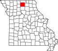
Pennville is an unincorporated community in northeast Sullivan County, in the U.S. state of Missouri. [1]

The community is on Missouri Route 129 approximately 14 miles northeast of Milan and eight miles south-southeast of Unionville in adjacent Putnam County. [2]

History

A post office called Pennville was established in 1856, and remained in operation until 1909. [3] The community most likely was named after Penn Township. [4]

Related Research Articles

Foil is an unincorporated community in northern Ozark County, Missouri, United States. It is located approximately sixteen miles south of Ava on county roads 953 and 955. Wasola is about four miles northeast on Missouri Route 5 and Thornfield approximately three miles southwest on Missouri Route JJ. The community is on the banks of Little Creek, a tributary of Little North Fork White River.

Big Piney is an unincorporated community in Pulaski County, Missouri, United States on the southeastern edge of Fort Leonard Wood and one mile west of a bend in the Big Piney River. The community is on Missouri Route TT four miles northeast of Palace. Licking is seventeen miles to the southeast. Its former K-8 school has closed; students attend the Plato R-V School District.

Owasco is an unincorporated community in Sullivan County, in the U.S. state of Missouri.

Paultown is an unincorporated community in eastern Adair County, in the U.S. state of Missouri. The community was approximately one mile northeast of Brashear and the Paultown Cemetery is about one-half mile to the east above Big Deer Branch.

Mussel Fork is a stream in Adair, Chariton, Linn, Macon and Sullivan counties in the U.S. state of Missouri. It is a tributary to the Chariton River.

North Salem is an unincorporated community in Linn County, in the U.S. state of Missouri.

Bacon is an unincorporated community in northeast Moniteau County, in the U.S. state of Missouri. The community is on Moniteau Creek approximately seven miles northeast of California.

Thuroy is an unincorporated community in Ozark County, Missouri, United States. The village was located on a northward-flowing tributary to Barren Creek, approximately one-half mile from the Missouri-Arkansas border and Missouri State Highway 101. Bakersfield is about four miles to the northeast. Barren Creek flows into Norfork Lake in Arkansas, approximately four miles to the southwest.

Hawkeye is an unincorporated community in the northwest corner of Pulaski County, in the U.S. state of Missouri. The Pulaski-Camden county line is one-half mile to the west and the Pulaski-Miller county line is one mile to the north. Missouri Route U passes through the community. The community is on a ridge at an elevation of 1106 feet at the head of the north flowing Barren Fork, the northeast flowing Clinkingbeard Creek to the east and tributaries of west flowing Deane Creek to the south and west.

Chariton is an unincorporated community in northeast Putnam County, in the U.S. state of Missouri.

Martinstown is an unincorporated community in southeast Putnam County, in the U.S. state of Missouri.

Hazel Run is an unincorporated community in northeastern St. Francois County, in the U.S. state of Missouri. The community is located one-half mile south of Hazel Run creek and approximately five miles east-northeast of Bonne Terre.

Julesburg is an unincorporated community in west central Schuyler County, in the U.S. state of Missouri. It lies two miles west of US-63 and two miles south of US Route 136. Lancaster lies approximately three miles to the northeast.

Bairdston is an unincorporated community in Sullivan County, in the U.S. state of Missouri.

Boynton is an unincorporated community in Sullivan County, in the U.S. state of Missouri.

Paw Paw is a community in south central Sullivan County, in the U.S. state of Missouri, which the GNIS classifies as a populated place.

Sticklerville is an unincorporated community in Sullivan County, in the U.S. state of Missouri.

Wintersville is an unincorporated community in western Sullivan County, in the U.S. state of Missouri.

Spring Creek is a stream in Putnam, Sullivan and Adair counties of northern Missouri. It is a tributary of the Chariton River.

Mystic is an unincorporated community in eastern Sullivan County, in the U.S. state of Missouri.

References

  1. U.S. Geological Survey Geographic Names Information System: Pennville, Missouri
  2. Missouri Atlas & Gazetteer, DeLorme, 1st ed. 1998, p. 16, ISBN   0899332242
  3. "Post Offices". Jim Forte Postal History. Retrieved November 27, 2016.
  4. "Sullivan County Place Names, 1928–1945". The State Historical Society of Missouri. Archived from the original on June 24, 2016. Retrieved December 27, 2016.
40°21′46″N92°56′49″W / 40.36278°N 92.94694°W / 40.36278; -92.94694