Waynesville, Missouri

Last updated

Waynesville, Missouri
City of Waynesville
Pulaski County Missouri Incorporated and Unincorporated areas Waynesville Highlighted.svg
Location of Waynesville, Missouri
Coordinates: 37°49′12″N92°13′13″W / 37.82000°N 92.22028°W / 37.82000; -92.22028 [1]
Country United States
State Missouri
County Pulaski
Area
[2]
  Total7.18 sq mi (18.60 km2)
  Land7.15 sq mi (18.53 km2)
  Water0.03 sq mi (0.07 km2)
Elevation
[1]
873 ft (266 m)
Population
 (2020)
  Total5,406
  Density755.77/sq mi (291.79/km2)
Time zone UTC-6 (Central (CST))
  Summer (DST) UTC-5 (CDT)
ZIP code
65583
Area code 573
FIPS code 29-77992 [3]
GNIS feature ID2397234 [1]
Website waynesvillemo.org

Waynesville is a city in and the county seat of Pulaski County, Missouri, United States. [4] Its population was 5,406 at the 2020 census. Located in the heart of the Missouri Ozarks, it was one of the communities served by historic Route 66.

Contents

History

Waynesville was platted in 1839. [5] The city was named for Anthony Wayne. [6] The post office in Waynesville has been in operation since 1834. [7]

During the American Civil War, units of the 5th Missouri State Militia were sometimes garrisoned at Waynesville. [8]

Geography

Waynesville is located on Roubidoux Creek, approximately 2 miles (3.2 km) south of the Gasconade River. The northern boundary of Fort Leonard Wood is about 2 miles (3.2 km) to the south. [9] The Roubidoux Spring, 15th largest in the state, is located in the city limits. The Roubidoux Spring was also a stop on the infamous Trail of Tears.

According to the United States Census Bureau, the city has a total area of 6.45 square miles (16.71 km2), of which 6.42 square miles (16.63 km2) is land and 0.03 square miles (0.08 km2) is water. [10]

Demographics

Historical population
CensusPop.Note
1910 257
1920 29314.0%
1930 39233.8%
1940 46819.4%
1950 1,010115.8%
1960 2,377135.3%
1970 3,37542.0%
1980 2,879−14.7%
1990 3,20711.4%
2000 3,5079.4%
2010 4,83037.7%
2020 5,40611.9%
U.S. Decennial Census [11]

2010 census

At the 2010 census, [12] there were 4,830 people, 1,894 households, and 1,252 families residing in the city. The population density was 752.3 per square mile (290.5/km2). There were 2,088 housing units at an average density of 325.2 per square mile (125.6/km2). The racial make-up of the city was 73.6% White, 12.4% African American, 1.1% Native American, 3.4% Asian, 0.5% Pacific Islander, 2.5% from other races and 6.5% from two or more races. Hispanic or Latino of any race were 8.1% of the population.

There were 1,894 households, of which 37.8% had children under the age of 18 living with them, 49.3% were married couples living together, 13.3% had a female householder with no husband present, 3.5% had a male householder with no wife present and 33.9% were non-families. 28.9% of all households were made up of individuals, and 8.2% had someone living alone who was 65 years of age or older. The average household size was 2.48 and the average family size was 3.04.

The median age was 32.6 years. 28% of residents were under the age of 18, 8.8% were between the ages of 18 and 24;, 30.6% were from 25 to 44, 21.2% were from 45 to 64 and 11.2% were 65 years of age or older. The gender make-up of the city was 47.1% male and 52.9% female.

2000 census

At the 2000 census, [3] there were 3,507 people, 1,428 households and 922 families residing in the city. The population density was 563.3 per square mile (217.5/km2). There were 1,591 housing units at an average density of 255.6 per square mile (98.7/km2). The racial make-up of the city was 79.70% White, 10.98% African American, 0.94% Native American, 2.88% Asian, 0.11% Pacific Islander, 1.43% from other races and 3.96% from two or more races. Hispanic or Latino of any race were 3.11% of the population.

There were 1,428 households, of which 32.5% had children under the age of 18 living with them, 49.6% were married couples living together, 11.6% had a female householder with no husband present, and 35.4% were non-families. 31.3% of all households were made up of individuals and 10.5% had someone living alone who was 65 years of age or older. The average household size was 2.34 and the average family size was 2.93.

27.3% of the population were under the age of 18, 6.4% from 18 to 24, 29.3% from 25 to 44, 23.4% from 45 to 64, and 13.6% who were 65 years of age or older. The median age was 38 years. For every 100 females, there were 89.4 males. For every 100 females age 18 and over, there were 86.0 males.

The median household income was $41,250 and the median family income was $46,205. Males had a median income of $31,435 and females $23,640. The per capita income was $19,117. About 9.5% of families and 11.3% of the population were below the poverty line, including 16.9% of those under age 18 and 17.5% of those age 65 or over.

Climate

Waynesville experiences a humid subtropical climate (Köppen climate classification Cfa), as does much of southern Missouri.

Climate data for Waynesville 2 W, Missouri (1991–2020 normals, extremes 1941–present)
MonthJanFebMarAprMayJunJulAugSepOctNovDecYear
Record high °F (°C)79
(26)
85
(29)
88
(31)
99
(37)
95
(35)
104
(40)
115
(46)
107
(42)
104
(40)
97
(36)
87
(31)
79
(26)
115
(46)
Average high °F (°C)44.1
(6.7)
49.2
(9.6)
58.9
(14.9)
69.3
(20.7)
76.8
(24.9)
84.5
(29.2)
89.1
(31.7)
88.6
(31.4)
81.3
(27.4)
71.1
(21.7)
58.3
(14.6)
47.7
(8.7)
68.2
(20.1)
Daily mean °F (°C)33.2
(0.7)
37.4
(3.0)
46.6
(8.1)
56.8
(13.8)
65.4
(18.6)
73.7
(23.2)
78.0
(25.6)
76.8
(24.9)
68.8
(20.4)
57.9
(14.4)
46.5
(8.1)
37.1
(2.8)
56.5
(13.6)
Average low °F (°C)22.4
(−5.3)
25.6
(−3.6)
34.3
(1.3)
44.3
(6.8)
53.9
(12.2)
63.0
(17.2)
66.9
(19.4)
65.1
(18.4)
56.4
(13.6)
44.6
(7.0)
34.7
(1.5)
26.6
(−3.0)
44.8
(7.1)
Record low °F (°C)−23
(−31)
−23
(−31)
−14
(−26)
13
(−11)
24
(−4)
35
(2)
42
(6)
36
(2)
24
(−4)
11
(−12)
−3
(−19)
−25
(−32)
−25
(−32)
Average precipitation inches (mm)2.69
(68)
2.72
(69)
4.08
(104)
4.81
(122)
5.18
(132)
4.67
(119)
4.30
(109)
4.61
(117)
4.18
(106)
3.56
(90)
3.76
(96)
2.90
(74)
47.46
(1,205)
Average snowfall inches (cm)4.8
(12)
2.9
(7.4)
0.9
(2.3)
0.0
(0.0)
0.0
(0.0)
0.0
(0.0)
0.0
(0.0)
0.0
(0.0)
0.0
(0.0)
0.0
(0.0)
0.6
(1.5)
1.0
(2.5)
10.2
(26)
Average precipitation days (≥ 0.01 in)6.86.58.79.410.78.87.67.16.57.17.56.393.0
Average snowy days (≥ 0.1 in)1.41.00.30.10.00.00.00.00.00.00.30.73.8
Source: NOAA [13]

Government

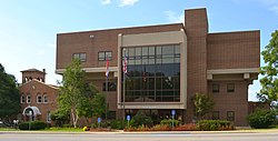
Waynesville is classified a 3rd Class City with an elected mayor and city council.

Sean A. Wilson currently holds the office of Mayor. The current city council members are Rob Rice and Bill Farnham (Ward 1), Cecil V. Davis and Clarence Liberty (Ward 2), Ed Conley and Trudy Dils (Ward 3), and Amanda Koren and Robert Hyatt (Ward 4). John Doyle is the City Administrator, and Michele Brown is the City Clerk. [14]

Education

Almost all of Waynesville is in Waynesville R-VI School District. A small portion is in Laquey R-V School District. [15]

Waynesville Schools include Williams Early Childhood Development Center (Pre-K - Kindergarten), Wood Elementary (K-5), Pick Elementary (K-5), East Elementary (K-5), Freedom Elementary (K-5), Waynesville Sixth Grade Center (6th), Waynesville Middle School (7 & 8), and Waynesville High School (9-12).

Waynesville has a public library, a branch of the Pulaski County Library District. [16]

Registered historic places

Transportation

Waynesville Regional Airport at Forney Field serves the community with air service. Even though it is on Fort Leonard Wood, it is jointly run by the cities of Waynesville and St. Robert and is available for civilian use by private pilots and scheduled commercial passenger service.

The major east–west route is I-44.svg Interstate 44; before that, the main highway was US 66.svg U.S. Route 66 , which still exists as a scenic route through the area and passes through Devil's Elbow, St. Robert, Waynesville, Buckhorn, and Hazelgreen. Names for U.S. Route 66 vary - at different places, it's called Teardrop Road, Highway Z, Old Route 66, Historic Route 66, and Highway 17. State-posted signs mark most of the alignment of the road.

The major north–south routes near Waynesville are:

Major attractions along U.S. Route 66 include the Old Stagecoach Stop in downtown Waynesville, which is now a museum but began as a tavern and boarding house and is the oldest standing structure in the county. It was used as a Civil War hospital for Union troops who were garrisoned above the city in Fort Wayne, which was demolished after the war. The Old Courthouse Museum in downtown Waynesville is near the Old Stagecoach Stop.

The City Of Waynesville does not provide any public transportation (such as buses or shuttles).

Media

KFBD-FM and its AM sister station, KJPW, are the dominant news radio providers in the Pulaski County area, which includes Fort Leonard Wood, Waynesville and St. Robert. These stations compete with the only other station broadcasting from Pulaski County, KFLW Radio, previously owned by the Lebanon Daily Record and working locally from the St. Robert offices of the Pulaski County Mirror weekly newspaper.

The Pulaski County Daily News online newspaper is privately owned by a Waynesville resident.

The Pulaski County Insider is run and maintained by a businessman from St. Robert and hosted by a Potosi resident.

The county's weekly paper, the Dixon Pilot, does not routinely cover Waynesville.

Pulaski County historically had one daily and three weekly print newspapers, as well as an online internet daily newspaper. All but the weekly Dixon Pilot and the online Pulaski County Daily News are now closed. The county also has an internet discussion site, the Pulaski County Insider.

The Daily Guide, commonly known as the Waynesville Daily Guide, but based in St. Robert and serving the entire county, closed in September 2018. It was owned by GateHouse Media and was the central printing plant for three other GateHouse newspapers in nearby counties, the daily Camden Lake Sun Leader and Rolla Daily News as well as the weekly St. James Leader-Journal. The Rolla Daily News and the St. James weekly have since closed as well.

The content of the now-closed weekly Fort Leonard Wood Guidon was previously produced under the auspices of Army Public Affairs at Fort Leonard Wood but printed under contract by the Springfield News-Leader, a Gannett-owned newspaper which produced and sold advertisements in the Fort Leonard Wood Guidon. The military contract to produce the Guidon was held by the Lebanon Daily Record until the end of 2002, and before the Lebanon Daily Record had been held by the Waynesville Daily Guide for many years.

The weekly Pulaski County Mirror closed in February 2017 and had been owned by the Lebanon Daily Record, a family owned newspaper in an adjoining county. The paper is a merger of the Richland Mirror and Pulaski County Democrat in St. Robert, which were separate weekly papers owned by the Lebanon Daily Record until their owner merged them in 2009.

Related Research Articles

<span class="mw-page-title-main">Pierre, South Dakota</span> Capital city of South Dakota, United States

Pierre is the capital city of the U.S. state of South Dakota and the seat of Hughes County. The population was 14,091 at the 2020 census, making it the second-least populous US state capital after Montpelier, Vermont. It is South Dakota's ninth-most populous city. Founded in 1880, it was selected as the state capital when the territory was admitted as a state. Pierre is the principal city of the Pierre Micropolitan Statistical Area, which includes all of Hughes and Stanley counties.

<span class="mw-page-title-main">Warren County, Ohio</span> County in Ohio, United States

Warren County is a county located in the southwestern part of the U.S. state of Ohio. As of the 2020 census, the population was 242,337. Its county seat is Lebanon and largest city is Mason. The county is one of Ohio's most affluent, with the highest median income of the state's 88 counties. The county was established on May 1, 1803, from Hamilton County; it is named for Dr. Joseph Warren, a hero of the Revolution who sent Paul Revere and the overlooked William Dawes on their famous rides and who died at the Battle of Bunker Hill. Warren County is part of the Cincinnati, OH-KY-IN Metropolitan Statistical Area.

<span class="mw-page-title-main">Pulaski County, Missouri</span> County in Missouri, United States

Pulaski County is a county located in the U.S. state of Missouri. As of the 2020 census, the population was 53,955. Its county seat is Waynesville. The county was organized in 1833 and named for Kazimierz Pułaski, a Polish patriot who died fighting in the American Revolution.

<span class="mw-page-title-main">Laclede County, Missouri</span> County in Missouri, United States

Laclede County is a county located in the U.S. state of Missouri. As of the 2020 census, the population was 36,039. Its county seat is Lebanon. The county was organized February 24, 1849, and was named after Pierre Laclède, founder of St. Louis.

<span class="mw-page-title-main">Hawkinsville, Georgia</span> City in Georgia, United States

Hawkinsville is a city in and the county seat of Pulaski County, Georgia, United States. The population was 4,589 at the 2010 census.

<span class="mw-page-title-main">Wood River, Illinois</span> City in Illinois, United States

Wood River is a city in Madison County, Illinois. The population was 10,464 as of the 2020 census.

<span class="mw-page-title-main">St. James, Missouri</span> City in Missouri, United States

St. James is a city in Phelps County, Missouri, United States. The population was 4,216 at the 2010 census.

<span class="mw-page-title-main">Crocker, Missouri</span> City in Missouri, United States

Crocker is a city in Pulaski County, Missouri, United States. The population was 1,110 at the 2010 census.

<span class="mw-page-title-main">Dixon, Missouri</span> City in Missouri, United States

Dixon is a city in northern Pulaski County, Missouri, United States, with a population of 1,549 at the time of the 2010 census.

<span class="mw-page-title-main">St. Robert, Missouri</span> City in Missouri, United States

St. Robert or Saint Robert is a city in Pulaski County, Missouri, United States. The population was 5,192 at the 2020 census. It is a gateway community to the United States Army installation at Fort Leonard Wood.

<span class="mw-page-title-main">Richland, Missouri</span> City in Missouri, United States

Richland is a city in Camden, Laclede, and Pulaski counties in the U.S. state of Missouri. The population was 1,863 at the 2010 census.

<span class="mw-page-title-main">Gasconade River</span> River in central Missouri

The Gasconade River is about 280 miles (450 km) long and is located in central and south-central Missouri.

<span class="mw-page-title-main">Plato, Missouri</span> Village in Missouri, United States

Plato is an incorporated village in northwestern Texas County, Missouri, United States. It is located approximately 20 miles northwest of Houston and 10 miles south of Fort Leonard Wood on Route 32. The population was 82 at the 2020 census.

<span class="mw-page-title-main">Business routes of Interstate 44</span>

Nine business routes of Interstate 44 (I-44) exist, all of them within the state of Missouri.

Roubidoux Creek is a tributary to the Gasconade River in the Ozarks of south central Missouri named after French-Canadian fur trader Joseph Robidoux. It is 57.4 miles (92.4 km) long. Due to its colder water temperatures, it is listed as a trout stream. Roubidoux Spring is a landmark that is nestled just south of downtown Waynesville. The creek cuts north through Fort Leonard Wood before crossing underneath Interstate 44 and into the city limits of Waynesville.

<span class="mw-page-title-main">Interstate 44 in Missouri</span> Highway in Missouri

Interstate 44 (I-44) in the US state of Missouri runs northeast from the Oklahoma state line near Joplin to I-70 in Downtown St. Louis. It runs for about 293 miles (472 km) in the state, and is the longest Interstate Highway in the state.

<span class="mw-page-title-main">KJPW</span> Radio station in Waynesville, Missouri

KJPW is a radio station broadcasting a news talk information format. Licensed to Waynesville, Missouri, United States, the station is currently owned by Alpha Media, through licensee Alpha Media Licensee LLC, and features programming from Fox News Radio.

Fort Leonard Wood is a U.S. Army training installation located in the Missouri Ozarks. The main gate is located on the southern boundary of The City of St. Robert. The post was created in December 1940 and named in honor of General Leonard Wood in January 1941. Originally intended to train infantry troops, in 1941 it became an engineer training post with the creation of the Engineer Replacement Training Center. During World War II Italian and German POWs were interned at the fort. In 1984, as part of the Base Realignment and Closure process, most of the U.S. Army Engineer School's operations were consolidated at Fort Leonard Wood. Before that, officer training was conducted at Fort Belvoir, Virginia.

<span class="mw-page-title-main">KFBD-FM</span> Radio station in Waynesville, Missouri

KFBD-FM is a radio station licensed to Waynesville, Missouri, United States. The station is currently owned by Alpha Media, through licensee Alpha Media Licensee LLC.

Saint Annie was an unincorporated community in northeast Laclede County, Missouri, United States. The community was on Missouri Route U about one mile west of the Laclede-Texas county line approximately five miles north of Lynchburg. The community of Winnipeg is about two miles to the northwest.

References

  1. 1 2 3 U.S. Geological Survey Geographic Names Information System: Waynesville, Missouri
  2. "ArcGIS REST Services Directory". United States Census Bureau. Retrieved August 28, 2022.
  3. 1 2 "U.S. Census website". United States Census Bureau . Retrieved January 31, 2008.
  4. "Find a County". National Association of Counties. Retrieved June 7, 2011.
  5. "Pulaski County Place Names, 1928–1945". The State Historical Society of Missouri. Archived from the original on June 24, 2016. Retrieved November 27, 2016.
  6. Eaton, David Wolfe (1917). How Missouri Counties, Towns and Streams Were Named. The State Historical Society of Missouri. pp.  343.
  7. "Post Offices". Jim Forte Postal History. Retrieved December 10, 2016.
  8. Hewett, J. (1994). Supplement to the Official records of the Union and Confederate Armies. Wilmington, NC: Broadfoot Pub. Co., Volume 35, p. 136
  9. Waynesville, MO, 7.5 Minute Topographic Quadrangle, USGS, 2004
  10. "US Gazetteer files 2010". United States Census Bureau. Archived from the original on January 25, 2012. Retrieved July 8, 2012.
  11. "United States Census Bureau QuickFacts". United States Census Bureau. Retrieved February 26, 2022.
  12. "U.S. Census website". United States Census Bureau . Retrieved July 8, 2012.
  13. "NowData – NOAA Online Weather Data". National Oceanic and Atmospheric Administration. Retrieved August 2, 2021.
    - "Station: Waynesville 2 W, MO". U.S. Climate Normals 2020: U.S. Monthly Climate Normals (1991-2020). National Oceanic and Atmospheric Administration. Retrieved August 2, 2021.
  14. "City of Waynesville Missouri Officials".
  15. "2020 CENSUS - SCHOOL DISTRICT REFERENCE MAP: Pulaski County, MO" (PDF). U.S. Census Bureau . Retrieved October 7, 2022.
  16. "Locations, Hours, and Closings". Pulaski County Library District. March 17, 2016. Retrieved March 25, 2018.