Independence, Missouri

Last updated

Independence, Missouri
Jackson County Courthouse Independence MO-cropped.jpg
Jackson County Courthouse in Independence
Jackson County Missouri Incorporated and Unincorporated areas Independence Highlighted.svg
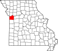
Location of Independence in Missouri
Coordinates: 39°04′42″N94°25′10″W / 39.07833°N 94.41944°W / 39.07833; -94.41944
CountryUnited States
State Missouri
County Jackson
FoundedMarch 29, 1827
Named for The Declaration of Independence
Government
   Mayor Rory Rowland
  City ManagerZachary C. Walker
Area
[1]
  Total78.42 sq mi (203.10 km2)
  Land77.97 sq mi (201.93 km2)
  Water0.45 sq mi (1.17 km2)
Elevation
[2]
863 ft (263 m)
Population
 (2020)
  Total123,011
  Density1,577.75/sq mi (609.17/km2)
Time zone UTC−6 (Central (CST))
  Summer (DST) UTC−5 (CDT)
ZIP Codes
64050–64057
Area code 816
FIPS code 29-35000 [3]
GNIS feature ID2395422 [2]
Website City of Independence

Independence is the 5th most populous city in Missouri and the county seat of Jackson County. [4] Independence is a satellite city of Kansas City, Missouri, and is the largest suburb on the Missouri side of the Kansas City metropolitan area. In 2020, it had a total population of 123,011. [5]

Contents

Independence is known as the "Queen City of the Trails" [6] because it was a point of departure for the California, Oregon, and Santa Fe Trails. It is the hometown of U.S. President Harry S. Truman, with the Truman Presidential Library and Museum, and the gravesites of Truman and First Lady Bess Truman. The city is sacred to the Latter Day Saint movement, as the home of Joseph Smith's 1831 Temple Lot, and the headquarters of several Mormon denominations.

History

Independence was originally inhabited by Missouri and Osage Native Americans, followed by the Spanish and a brief French tenure. It became part of the United States with the Louisiana Purchase in 1803. Lewis and Clark recorded in their journals that they stopped in 1804 to pick plums, raspberries, and wild apples at a site that would later form part of the city. Independence was also a stopping point for the "Donner Party", an ill-fated group of 19th-century wagon train emigrants whose westward journey along the California Trail ended in disaster; spawning one of the most well known and taboo stories of pioneer-era America. [7]

Named after the Declaration of Independence, Independence was founded on March 29, 1827, [8] and quickly became an important frontier town. Independence was the farthest point westward on the Missouri River where the steamboats or other cargo vessels could travel, due to the convergence of the Kansas River with the Missouri River approximately six miles west of town, near the current Kansas-Missouri border. Independence immediately became a jumping-off point for the emerging fur trade, accommodating merchants and adventurers beginning the long trek westward on the Santa Fe Trail.

Engraving of the Courthouse in Independence, 1855 "lndependence-Courthouse-Missouri.", 1855 - NARA - 513335.jpg
Engraving of the Courthouse in Independence, 1855

In 1831, members of the Latter Day Saint movement began moving to the Jackson County, Missouri area. Shortly thereafter, founder Joseph Smith declared a spot west of the Courthouse Square to be the place for his prophesied temple of the New Jerusalem, in expectation of the Second Coming of Christ. Tension grew with local Missourians until the Latter Day Saints were driven from the area in 1833, the beginning of a conflict which culminated in the 1838 Mormon War. Several branches of this movement gradually returned to the city beginning in 1867, with many making their headquarters there. These include the Community of Christ (formerly the Reorganized Church of Jesus Christ of Latter Day Saints), the Church of Christ (Temple Lot), the Church of Jesus Christ (Cutlerite) and the Restoration Branches.

Independence saw great prosperity from the late 1830s through the mid-1840s, while the business of outfitting pioneers boomed. Between 1848 and 1868, it was a hub of the California Trail. On March 8, 1849, the Missouri General Assembly granted a home-rule charter to the town and on July 18, 1849, William McCoy was elected as its first mayor. In the mid-19th century an Act of the United States Congress defined Independence as the start of the Oregon Trail.

A map of the Oregon Trail, marking Independence. Oregontrail 1907.jpg
A map of the Oregon Trail, marking Independence.
Harry S. Truman's Independence home, now part of the Harry S. Truman National Historic Site. Trumanhist.JPG
Harry S. Truman's Independence home, now part of the Harry S. Truman National Historic Site.

Two important Civil War battles occurred at Independence: the first on August 11, 1862, when Confederate soldiers took control of the town, and the second in October 1864, which resulted in a Union victory. The war took its toll on Independence and the town was never able to regain its previous prosperity, although a flurry of building activity took place soon after the war. The rise of nearby Kansas City also contributed to the town's relegation to a place of secondary prominence in Jackson County, though Independence has retained its position as county seat to the present day.

United States President Harry S. Truman grew up in Independence, and in 1922 was elected judge of the Court of Jackson County, Missouri (an administrative, not judicial, post). Although he was defeated for reelection in 1924, he won back the office in 1926 and was reelected in 1930. Truman performed his duties diligently, and won personal acclaim for several popular public works projects, including an extensive series of fine roads for the growing use of automobiles, the building of a new County Court building in Independence, and a series of 12 Madonna of the Trail monuments to pioneer women dedicated across the country in 1928 and 1929. He would later return to the city after two terms as president. His wife, First Lady Bess Truman, was born and raised in Independence, and both are buried there. The Harry S. Truman National Historic Site (Truman's home) and the Harry S. Truman Presidential Library and Museum are both located in Independence, as is one of Truman's boyhood residences.

Geography

Independence is located on the south bank of the Missouri River, near the western edge of the state. According to the United States Census Bureau, the city has a total area of 78.25 square miles (202.67 km2), of which 77.57 square miles (200.91 km2) is land and 0.68 square miles (1.76 km2) is water. [9]

Climate data for Independence, Missouri (1991–2020 normals, extremes 1973–2021)
MonthJanFebMarAprMayJunJulAugSepOctNovDecYear
Record high °F (°C)74
(23)
79
(26)
87
(31)
94
(34)
93
(34)
103
(39)
104
(40)
109
(43)
103
(39)
94
(34)
82
(28)
72
(22)
109
(43)
Mean maximum °F (°C)62.2
(16.8)
67.9
(19.9)
77.6
(25.3)
83.0
(28.3)
87.8
(31.0)
93.4
(34.1)
96.9
(36.1)
97.4
(36.3)
92.3
(33.5)
84.9
(29.4)
72.6
(22.6)
64.8
(18.2)
99.3
(37.4)
Mean daily maximum °F (°C)37.6
(3.1)
43.0
(6.1)
54.5
(12.5)
64.6
(18.1)
73.9
(23.3)
82.9
(28.3)
86.9
(30.5)
86.0
(30.0)
78.4
(25.8)
66.5
(19.2)
53.0
(11.7)
41.8
(5.4)
64.1
(17.8)
Daily mean °F (°C)28.4
(−2.0)
33.1
(0.6)
43.5
(6.4)
53.6
(12.0)
63.8
(17.7)
73.2
(22.9)
77.4
(25.2)
75.8
(24.3)
67.7
(19.8)
55.8
(13.2)
43.3
(6.3)
32.9
(0.5)
54.0
(12.2)
Mean daily minimum °F (°C)19.2
(−7.1)
23.1
(−4.9)
32.6
(0.3)
42.6
(5.9)
53.7
(12.1)
63.5
(17.5)
67.8
(19.9)
65.7
(18.7)
57.0
(13.9)
45.1
(7.3)
33.5
(0.8)
23.9
(−4.5)
44.0
(6.7)
Mean minimum °F (°C)−0.1
(−17.8)
6.3
(−14.3)
15.1
(−9.4)
28.1
(−2.2)
40.7
(4.8)
51.7
(10.9)
58.7
(14.8)
56.7
(13.7)
43.3
(6.3)
29.7
(−1.3)
17.7
(−7.9)
6.2
(−14.3)
−3.3
(−19.6)
Record low °F (°C)−16
(−27)
−13
(−25)
−5
(−21)
14
(−10)
30
(−1)
43
(6)
50
(10)
43
(6)
33
(1)
20
(−7)
1
(−17)
−14
(−26)
−16
(−27)
Average precipitation inches (mm)1.50
(38)
1.86
(47)
2.88
(73)
4.43
(113)
5.99
(152)
5.28
(134)
5.11
(130)
5.06
(129)
4.77
(121)
3.54
(90)
2.40
(61)
1.84
(47)
44.66
(1,134)
Average snowfall inches (cm)3.6
(9.1)
2.6
(6.6)
1.7
(4.3)
0.2
(0.51)
0.0
(0.0)
0.0
(0.0)
0.0
(0.0)
0.0
(0.0)
0.0
(0.0)
0.4
(1.0)
1.2
(3.0)
3.5
(8.9)
13.2
(34)
Average precipitation days (≥ 0.01 in)6.86.29.610.913.39.910.09.28.68.76.86.9106.9
Average snowy days (≥ 0.1 in)3.02.11.10.20.00.00.00.00.00.00.22.810.0
Source: NOAA [10] [11]

Demographics

Historical population
CensusPop.Note
1860 3,164
1870 3,1840.6%
1880 3,146−1.2%
1890 6,380102.8%
1900 6,9749.3%
1910 9,85941.4%
1920 11,68618.5%
1930 15,29630.9%
1940 16,0665.0%
1950 36,963130.1%
1960 62,32868.6%
1970 111,63079.1%
1980 111,8060.2%
1990 112,2950.4%
2000 113,2880.9%
2010 116,8303.1%
2020 123,0115.3%
U.S. Decennial Census [12]
2018 Estimate [13]

2020 census

The 2020 United States census [14] counted 123,011 people, 48,836 households, and 28,955 families in Independence. The population density was 1,577.7 per square mile (609.2/km2). There were 54,120 housing units at an average density of 694.1 per square mile (268.0/km2). The racial makeup was 72.61% (89,323) white, 8.68% (10,678) black or African-American, 0.76% (936) Native American, 1.19% (1,468) Asian, 0.67% (826) Pacific Islander, 5.52% (6,795) from other races, and 10.56% (12,985) from two or more races. Hispanic or Latino of any race was 9.3% (10,948) of the population.

Of the 48,836 households, 24.0% had children under the age of 18; 40.1% were married couples living together; 33.0% had a female householder with no husband present. Of all households, 33.5% consisted of individuals and 14.2% had someone living alone who was 65 years of age or older. The average household size was 2.4 and the average family size was 3.1.

21.5% of the population was under the age of 18, 7.6% from 18 to 24, 24.8% from 25 to 44, 24.0% from 45 to 64, and 17.3% who were 65 years of age or older. The median age was 39.5 years. For every 100 females, the population had 91.4 males. For every 100 females ages 18 and older, there were 89.4 males.

The 2016-2020 5-year American Community Survey [15] estimates show that the median household income was $50,797 (with a margin of error of +/- $1,935) and the median family income was $64,271 (+/- $2,089). Males had a median income of $40,007 (+/- $1,690) versus $26,762 (+/- $1,098) for females. The median income for those above 16 years old was $32,462 (+/- $1,353). Approximately, 11.2% of families and 14.0% of the population were below the poverty line, including 23.3% of those under the age of 18 and 7.1% of those ages 65 or over.

2010 census

As of the census [16] of 2010, there were 116,830 people, 48,742 households, and 30,165 families residing in the city. The population density was 1,506.1 inhabitants per square mile (581.5/km2). There were 53,834 housing units at an average density of 694.0 per square mile (268.0/km2). The racial makeup of the city was

There were 48,742 households, of which 29.3% had children under the age of 18 living with them, 42.5% were married couples living together, 13.9% had a female householder with no husband present, 5.4% had a male householder with no wife present, and 38.1% were non-families. 31.7% of all households were made up of individuals, and 11.5% had someone living alone who was 65 years of age or older. The average household size was 2.37 and the average family size was 2.97.

The median age in the city was 39.4 years. 23% of residents were under the age of 18; 8.6% were between the ages of 18 and 24; 24.9% were from 25 to 44; 27.4% were from 45 to 64; and 16.1% were 65 years of age or older. The gender makeup of the city was 48.0% male and 52.0% female.

2000 census

As of the census [3] of 2000, there were 113,288 people, 47,390 households, and 30,566 families residing in the city. The population density was 1,446.3 inhabitants per square mile (558.4/km2). There were 50,213 housing units at an average density of 641.1 per square mile (247.5/km2). Independence has a population of 111,806 in 1980 and 112,301 in 1990. [19] The racial makeup of the city was 91.87% White, 2.59% African American, 0.70% Asian, 0.64% Native American, 0.46% Pacific Islander, 1.43% from other races, and 2.31% from two or more races. Hispanic or Latino of any race were 3.69% of the population.

There were 47,390 households, out of which 28.1% had children under the age of 18 living with them, 47.9% were married couples living together, 12.3% had a female householder with no husband present, and 35.5% were non-families. 30.1% of all households were made up of individuals, and 11.3% had someone living alone who was 65 years of age or older. The average household size was 2.37 and the average family size was 2.93.

In the city, the population was spread out, with 23.9% under the age of 18, 8.7% from 18 to 24, 28.9% from 25 to 44, 23.0% from 45 to 64, and 15.5% who were 65 years of age or older. The median age was 38 years. For every 100 females, there were 91.6 males. For every 100 females age 18 and over, there were 87.3 males.

The median income for a household in the city was $38,012, and the median income for a family was $45,876. Males had a median income of $34,138 versus $25,948 for females. The per capita income for the city was $19,384. About 6.4% of families and 8.6% of the population were below the poverty line, including 11.8% of those under age 18 and 6.7% of those age 65 or over.

Religion

Independence played an important role in the early history of the Latter Day Saint movement, and is home to the headquarters of several separatist denominations of the Latter Day Saint movement, most notably the Community of Christ (formerly the Reorganized Church of Jesus Christ of Latter Day Saints), whose Temple is located there. Other Latter Day Saint denominations headquartered in the city include the Church of Christ (Temple Lot) and the Church of Jesus Christ (Cutlerite), among others. A number of Restoration Branches are also located in and around Independence, and the Church of Jesus Christ of Latter-day Saints maintains a visitor center in the town.

The Community of Christ has built a temple in Independence, and also maintains a large auditorium and other buildings nearby. The Church of Jesus Christ of Latter-day Saints operates a sizable visitors' center adjacent to the Community of Christ Temple, and across the street from the original Temple Lot designated by Joseph Smith in 1830. The Lot itself is occupied by a small white-frame church building that serves as the headquarters and local meeting house for the Church of Christ (Temple Lot).

There are five Catholic churches and several Episcopal churches in Independence.

One of the oldest churches in Independence is the First Presbyterian Church, founded in 1826. [20] It was here in 1890 that Harry Truman first met Elizabeth (Bess) Wallace. [20] [21] Truman eventually married her after his return from World War I in 1919. [21]

Economy

Top employers

According to the town's 2016 Comprehensive Annual Financial Report, [22] the top employers in the city are:

#EmployerEmployees
1 Independence School District 2,200
2 Northrop Grumman Innovation Systems 1,722
3 Centerpoint Medical Center 1,400
4City of Independence1,097
5 Government Employee Health Association 743
6Rosewood Health Center at the Groves444
7Burd & Fletcher274
8Jackson County Circuit Court274
9Cable Dahmer Automotive271
10 Unilever 260

Government

The Independence City Council is made up of six members. Four are elected to represent one of the city districts, and the other two are elected by the city as a whole. The City Mayor also sits on the City Council and serves as the "Head of Government" for the city, The Mayor can vote on legislation with the council but does not have the right to veto. Members serve a four-year term, beginning on January 1 following the election. The current mayor is Rory Rowland, a Democrat, elected in 2022. [23]

The Independence Municipal Court is currently seated by two members. Judges are appointed by the City Mayor and serve a 4-year term. Judges may be reappointed for multiple terms by the Mayor or the City Council. [24]

Education

Primary and secondary

Van Horn High School after the 2011 renovation. VHHS2011.jpg
Van Horn High School after the 2011 renovation.

Four school districts have areas within the city: Independence, Blue Springs, Fort Osage Schools, and Raytown. [25]

Prior to Fall 2008, parts of western Independence in the Van Horn feeder pattern resided in the Kansas City, Missouri School District, [26] but all of these students are now part of the Independence school district.

Three public high schools are located within the city limits:

Two private high schools within the city limits:

Colleges and universities

Libraries

Midwest Genealogy Center Midwest Genealogy Center 1.jpg
Midwest Genealogy Center

Media

Newspapers

Television

Magazines

Culture

South Main Street in Independence SouthMainStreetIndependenceMO.jpg
South Main Street in Independence

Santa-Cali-Gon Days is an annual Labor Day festival held in Independence intermittently since 1940 and continuously since 1973, celebrating the city's heritage as a starting point of three major frontier trails: the Santa Fe, California and Oregon. Santa-Cali-Gon gathers everyone in the town to vend to the populous and makes for a great time for all ages. Another popular annual festival is the Vaile Strawberry Festival, which is held on the first Saturday of June at the Vaile Mansion, 1500 N. Liberty, five blocks north of the historic Square. The Independence Heritage Festival is a celebration of the diverse culture that exist in Independence. The Independence town square features numerous family-owned shops surrounding the old main courthouse, which was modeled after Philadelphia's Independence Hall. This courthouse houses Harry S. Truman's former courtroom and office.

Museums

Sports

Blue River Community College features a soccer program with a men's team and women's team. The Trailblazers (men) went all the way to the NJCAA Region 16 semifinals before concluding their season. The Lady Trailblazers (women) finished as runners up in the region. The Cable Dahmer Arena is home of the Kansas City Mavericks, a minor-league hockey team in the ECHL. Silverstein Eye Centers Arena is also the home of Kansas City Comets of the Major Arena Soccer League, the top level of professional indoor soccer. Crysler Stadium is the home of the collegiate summer baseball Independence Veterans of the Mid-Plains League.

Local recreational sports teams include:

YMCA and Parks and Recreation have programs for various sports for all people.

Sister city

In 1978, Independence gained sister city status with Higashimurayama, Tokyo, Japan. [32] Higashimurayama Street is south of Truman Rd. between Memorial Dr. and Lynn St., between City Hall and the Independence Square. This twinning is commemorated by a Zen garden, near E Lexington Ave. and Memorial Dr.

Infrastructure

Highways and roads

Hospital

Transportation

Utilities

Independence Power & Light (IPL) is a local electric power plant owned and operated by the city. It was established in 1901 and has undergone many changes and upgrades. One change was moving from the old Dodgion Street plant (where the Roger T. Sermon Center stands now) to the Blue Valley Plant near Truman Rd. and MO-78/Lake City-Buckner Rd. IPL also draws power from other sources: the Missouri City Power Plant, and the Kansas City Power and Light Company (KCP&L), through several 69 and 161 kilovolt transmission interconnections. IPL has an "Out of Sight" power line burial program. After signing an agreement with TradeWind Energy in July 2008, IPL will begin purchasing annually 15 megawatts of renewable energy from the Smoky Hills Wind Farm (a wind turbine facility) in Kansas.

Notable people

See also

Related Research Articles

<span class="mw-page-title-main">Clay County, Missouri</span> County in Missouri, United States

Clay County is located in the U.S. state of Missouri and is part of the Kansas City metropolitan area. As of the 2020 census, the county had a population of 253,335, making it the fifth-most populous county in Missouri. Its county seat is Liberty. The county was organized January 2, 1822, and named in honor of U.S. Representative Henry Clay from Kentucky, later a member of the United States Senate and United States Secretary of State.

<span class="mw-page-title-main">Jackson County, Missouri</span> County in Missouri, United States

Jackson County is located in the western portion of the U.S. state of Missouri, on the border with Kansas. As of the 2020 census, the population was 717,204. making it the second-most populous county in the state.

<span class="mw-page-title-main">Barton County, Missouri</span> County in Missouri, United States

Barton County is a county located in the southwestern part of the U.S. state of Missouri. As of the 2020 census, the population was 11,637. Its county seat is Lamar. The county was organized in 1855 and named after U.S. Senator David Barton from Missouri.

<span class="mw-page-title-main">Montpelier, Idaho</span> City in Idaho, United States

Montpelier is a city in Bear Lake County, Idaho, United States. The population was 2,538 at the 2019 estimation, down from 2,597 in 2010 census. The city is the largest community in the Bear Lake Valley, a farming region north of Bear Lake in southeastern Idaho along the Utah border. It was settled in 1863 by Mormon pioneers on the route of the Oregon Trail. Nearby to the east is the border with Wyoming.

<span class="mw-page-title-main">Lamoni, Iowa</span> City in Iowa, United States

Lamoni is a city in Decatur County, Iowa, United States. The population was 1,969 at the time of the 2020 Census. Lamoni is the home of Graceland University, affiliated with the Community of Christ, a denomination of the Latter Day Saint movement. The city was the church's headquarters from 1880 to 1920, after which it moved to Independence, Missouri.

<span class="mw-page-title-main">Leawood, Kansas</span> City in Kansas, United States

Leawood is a city in Johnson County, Kansas, United States, and is part of the Kansas City metropolitan area. As of the 2020 census, the population of the city was 33,902.

<span class="mw-page-title-main">Galva, Kansas</span> City in McPherson County, Kansas

Galva is a city in McPherson County, Kansas, United States. As of the 2020 census, the population of the city was 834.

<span class="mw-page-title-main">Butler, Missouri</span> City in Missouri, United States

Butler is a city in Bates County, Missouri, United States and is part of the Kansas City metropolitan area. The population was 4,219 at the 2010 census. The county seat of Bates County, the city is named for William Orlando Butler, a noted American military and political figure of the early and mid-19th century. It is located approximately 50 mi (80 km) south of Kansas City, Missouri on U.S. Route 71-Interstate 49.

<span class="mw-page-title-main">Warsaw, Missouri</span> City in Missouri, United States

Warsaw is a city located in Benton County, Missouri, United States. The population was 2,209 at the 2020 census. Warsaw is the county seat of Benton County.

<span class="mw-page-title-main">Fulton, Missouri</span> City in Missouri, United States

Fulton is the largest city in and the county seat of Callaway County, Missouri, United States. Located about 22 miles (35 km) northeast of Jefferson City and the Missouri River and 20 miles (32 km) east of Columbia, the city is part of the Jefferson City, Missouri, Metropolitan Statistical Area. The population was 12,600 at the 2020 census. The city is home to two universities, Westminster College and William Woods University; the Missouri School for the Deaf; the Fulton State Hospital; and the Fulton Reception and Diagnostic Center state prison. Missouri's only nuclear power plant, the Callaway Plant is located 13 miles southeast of Fulton.

<span class="mw-page-title-main">Pleasant Hill, Missouri</span> City in Missouri, United States

Pleasant Hill is a city in Cass and Jackson counties, Missouri, United States. The population was 8,113 at the 2010 census. It is part of the Kansas City metropolitan area.

<span class="mw-page-title-main">Grandview, Missouri</span> City in Missouri, United States

Grandview is a city in Jackson County, Missouri, United States. The population was 24,475 at the 2010 census. It is part of the Kansas City metropolitan area.

<span class="mw-page-title-main">Warrensburg, Missouri</span> City in Missouri

Warrensburg is a city in and the county seat of Johnson County, Missouri, United States. The population was 20,313 at the 2020 census. The Warrensburg Micropolitan Statistical Area consists of Johnson County. The city is a college town as it is home to the University of Central Missouri.

<span class="mw-page-title-main">Lexington, Missouri</span> City in Missouri, United States

Lexington is a city in, and the county seat of, Lafayette County, Missouri. The population was 4,726 at the 2010 census. Located in western Missouri, Lexington lies approximately 40 miles (64 km) east of Kansas City and is part of the Greater Kansas City Metropolitan Area. It is the home of the Battle of Lexington State Historic Site, and of the former Wentworth Military Academy and College, which operated from 1880 to 2017.

<span class="mw-page-title-main">Blue Springs, Missouri</span> City in Missouri, United States

Blue Springs is a city in Jackson County, in the U.S. state of Missouri. Blue Springs is located 19 miles (31 km) east of Kansas City. It is the 8th largest city in the Kansas City metropolitan area and 10th largest city in the state of Missouri. As of the 2020 census, the population was 58,604.

<span class="mw-page-title-main">St. Joseph, Missouri</span> City in Missouri, United States

St. Joseph is a city in Andrew and Buchanan counties and the county seat of Buchanan County, Missouri, United States. Located on the Missouri River, it is the principal city of the St. Joseph Metropolitan Statistical Area, which includes Buchanan, Andrew, and DeKalb counties in Missouri and Doniphan County, Kansas. As of the 2020 census, St. Joseph had a total population of 72,473, making it the 8th most populous city in the state, and the 3rd most populous in Northwest Missouri. St. Joseph is located roughly thirty miles north of the Kansas City, Missouri, city limits and approximately 125 miles (201 km) south of Omaha, Nebraska.

<span class="mw-page-title-main">Lee's Summit, Missouri</span> City in Missouri, United States

Lee's Summit is a city in the U.S. state of Missouri and is a suburb in the Kansas City metropolitan area. It resides in Jackson County (predominantly) as well as Cass County. As of the 2020 census, its population was 101,108, making it the 6th most populous city in both Missouri and the Kansas City metropolitan area.

<span class="mw-page-title-main">Sugar Creek, Missouri</span> City in Missouri, United States

Sugar Creek is a city primarily in Jackson County, Missouri with a very small part of the city limits in Clay County, Missouri, United States. The population was 3,271 at the 2020 census. It is part of the Kansas City metropolitan area.

<span class="mw-page-title-main">Hannibal, Missouri</span> City in Missouri, United States

Hannibal is a city along the Mississippi River in Marion and Ralls counties in the U.S. state of Missouri. According to the 2020 U.S. Census, the population was 17,312, making it the largest city in Marion County. The bulk of the city is in Marion County, with a tiny sliver in the south extending into Ralls County.

<span class="mw-page-title-main">Auditorium (Community of Christ)</span>

The Auditorium is a house of worship and office building located on the greater Temple Lot in Independence, Missouri. The Auditorium is part of the headquarters complex of Community of Christ which also includes the Independence Temple.

References

  1. "ArcGIS REST Services Directory". United States Census Bureau. Retrieved August 28, 2022.
  2. 1 2 U.S. Geological Survey Geographic Names Information System: Independence, Missouri
  3. 1 2 "U.S. Census website". United States Census Bureau . Retrieved January 31, 2008.
  4. "Find a County". National Association of Counties. Archived from the original on May 31, 2011. Retrieved June 7, 2011.
  5. "U.S. Census Bureau QuickFacts". U.S. Census Bureau.
  6. "Independence".
  7. "Donner party | History, Facts, & Survivors". Encyclopedia Britannica. Retrieved July 21, 2020.
  8. Eaton, David Wolfe (1916). How Missouri Counties, Towns and Streams Were Named. The State Historical Society of Missouri. p. 177.
  9. "US Gazetteer files 2010". United States Census Bureau. Archived from the original on January 12, 2012. Retrieved July 8, 2012.
  10. "NOWData – NOAA Online Weather Data". National Oceanic and Atmospheric Administration. Retrieved November 20, 2023.
  11. "Summary of Monthly Normals 1991–2020". National Oceanic and Atmospheric Administration. Retrieved November 20, 2023.
  12. United States Census Bureau. "Census of Population and Housing" . Retrieved November 26, 2014.
  13. "Population Estimates". United States Census Bureau . Retrieved June 8, 2018.
  14. "Explore Census Data". data.census.gov. Retrieved December 17, 2023.
  15. "Explore Census Data". data.census.gov. Retrieved December 17, 2023.
  16. "U.S. Census website". United States Census Bureau . Retrieved July 8, 2012.
  17. "Independence (city), Missouri". State & County QuickFacts. United States Census Bureau. Archived from the original on September 5, 2015.
  18. "Missouri — Race and Hispanic Origin for Selected Cities and Other Places: Earliest Census to 1990". United States Census Bureau. Archived from the original on August 12, 2012.
  19. Encyclopedia of American History
  20. 1 2 "Archived copy" (PDF). Archived from the original (PDF) on September 23, 2015. Retrieved April 14, 2015.{{cite web}}: CS1 maint: archived copy as title (link)
  21. 1 2 "Truman: Bess Truman's Biography".
  22. "Independence 2015 Comprehensive Annual Financial Report" (PDF). Retrieved February 27, 2017.
  23. "Independence City Council". City of Independence. Retrieved January 29, 2021.
  24. "Independence Municipal Court". City of Independence. Retrieved February 9, 2021.
  25. "School Districts." City of Independence. Retrieved on January 5, 2017.
  26. "Apps - Access My Library - Gale".
  27. "Locations". Mid-Continent Public Library. Retrieved March 17, 2018.
  28. "National Frontier Trails Museum". National Park Service. Retrieved January 8, 2024.
  29. "National Frontier Trails Museum". City of Independence, MO. Retrieved January 8, 2024.
  30. "Home". Chicago & Alton Depot. Retrieved January 8, 2024.
  31. "Chicago & Alton Depot is 130 years old". The Topeka Capital-Journal. The Examiner. September 24, 2009. Retrieved January 8, 2024.
  32. "Japanese Sister City Program". Independence. Retrieved May 5, 2014.
  33. "TALKING HISTORY WITH: David McCullough; Immersed in Facts, The Better to Imagine Harry Truman's Life". The New York Times. August 12, 1992.
  34. Wilson, Earl (November 27, 1969). "Small Towns Have Produced Many Big Stars". The Milwaukee Sentinel. pp. A33. Retrieved May 22, 2015.[ permanent dead link ]
  35. Wilson, Topher (February 28, 2016). "Hiram Young: Kansas City's First "Colored Man of Means"". The Telegraph. Retrieved January 21, 2021.