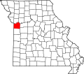
Blue Summit, Missouri

Last updated

Blue Summit, Missouri
Country United States
State Missouri
County Jackson
Area
[1]
  Total0.49 sq mi (1.26 km2)
  Land0.49 sq mi (1.26 km2)
  Water0.00 sq mi (0.00 km2)
Population
 (2020)
  Total658
  Density1,351.13/sq mi (521.30/km2)
ZIP code
64126 [2]
Area code(s) 816 and 975
FIPS code 29-06670

Blue Summit is an unincorporated community and census-designated place (CDP) lodged between Kansas City and Independence in Jackson County, Missouri, United States. [3] It is part of the Kansas City metropolitan area.

It is located in the Independence School District, [4] and is zoned to Korte Elementary, Nowlin Middle School, and Van Horn High School. [5] It was previously in the Kansas City, Missouri School District, where it was zoned to West Rock Creek Elementary School, Nowlin Middle School, and Van Horn High School. [6]

The community is served by Missouri Route 78, Missouri Route 12 & Interstate 435.

Demographics

Historical population
CensusPop.Note
2020 658
U.S. Decennial Census [7]

Related Research Articles

<span class="mw-page-title-main">Clinton County, Missouri</span> County in Missouri, United States

Clinton County is a county located in the U.S. state of Missouri and is part of the Kansas City metropolitan area. As of the 2020 U.S. Census, the county had a population of 21,184. Its county seat is Plattsburg. The county was organized January 2, 1833 and named for Governor DeWitt Clinton of New York. The county seat of Plattsburg derives its name from a town of a similar name that is the county seat of Clinton County, New York, which was also named for the Governor.

<span class="mw-page-title-main">Clay County, Missouri</span> County in Missouri, United States

Clay County is located in the U.S. state of Missouri and is part of the Kansas City metropolitan area. As of the 2020 census, the county had a population of 253,335, making it the fifth-most populous county in Missouri. Its county seat is Liberty. The county was organized January 2, 1822, and named in honor of U.S. Representative Henry Clay from Kentucky, later a member of the United States Senate and United States Secretary of State.

<span class="mw-page-title-main">Platte County, Missouri</span> County in Missouri, United States

Platte County is a county located in the northwestern portion of the U.S. state of Missouri and is part of the Kansas City metropolitan area. As of the 2020 census, the population was 106,718. Its county seat is Platte City. The county was organized December 31, 1838, from the Platte Purchase, named for the Platte River. The Kansas City International Airport is located in the county, approximately one mile west of Interstate 29 between mile markers 12 and 15. The land for the airport was originally in an unincorporated portion of Platte County before being annexed by Platte City, and eventually Kansas City.

<span class="mw-page-title-main">Jackson County, Missouri</span> County in Missouri, United States

Jackson County is located in the western portion of the U.S. state of Missouri, on the border with Kansas. As of the 2020 census, the population was 717,204. making it the second-most populous county in the state.

<span class="mw-page-title-main">North Kansas City, Missouri</span> City in Missouri, United States

North Kansas City is a city in Clay County, Missouri, United States. It is also enclaved in Kansas City. Even though the name is similar to its larger counterpart, Kansas City, it is an independent municipality and part of the Kansas City metropolitan area. The population was 4,467 at the 2020 census. Originally a northern suburb across the Missouri River from Kansas City, it is now almost completely surrounded by Kansas City, which has annexed far to the north of North Kansas City's northern city limits. North Kansas City also adjoins the small municipality of Avondale.

<span class="mw-page-title-main">Grain Valley, Missouri</span> City in Missouri, United States

Grain Valley is a city in Jackson County, Missouri, United States. Grain Valley is located in the Kansas City Metropolitan Area and is a suburb of Kansas City. The population was 12,854 at the 2010 census and an estimated 15,627 in 2020. It is 23 miles (37 km) east of downtown Kansas City.

<span class="mw-page-title-main">Lake Lotawana, Missouri</span> City in Missouri, United States

Lake Lotawana is a city in Jackson County, Missouri, United States and is located 35 miles southeast of downtown Kansas City bordering Blue Springs and Lee’s Summit. The population was 2,310 as of the 2020 census. It is part of the Kansas City metropolitan area.

<span class="mw-page-title-main">Blue Springs, Missouri</span> City in Missouri, United States

Blue Springs is a city located in the U.S. state of Missouri within Jackson County. Blue Springs is located 19 miles (31 km) east of downtown Kansas City. Blue Springs is the 8th largest city in the Kansas City Metropolitan Area and 10th largest city in the state of Missouri. As of the 2020 census, the population was 58,604.

<span class="mw-page-title-main">Arcola, Texas</span> City in Texas, United States

Arcola is a city in Fort Bend County, Texas, United States, within the Houston–Sugar Land–Baytown metropolitan area. The population was 2,034 as of the 2020 census, up from 1,642 at the 2010 census, up from 1,048 at the 2000 census.

<span class="mw-page-title-main">Lee's Summit, Missouri</span> City in Missouri, United States

Lee's Summit is a city in the U.S. state of Missouri and is a suburb in the Kansas City metropolitan area. It resides in Jackson County (predominantly) as well as Cass County. As of the 2020 census, its population was 101,108, making it the 6th most populous city in both Missouri and the Kansas City metropolitan area.

<span class="mw-page-title-main">Independence, Missouri</span> City in Missouri, United States

Independence is the 5th most populous city in Missouri and the county seat of Jackson County. Independence is a satellite city of Kansas City, Missouri, and is the largest suburb on the Missouri side of the Kansas City metropolitan area. In 2020, it had a total population of 123,011.

<span class="mw-page-title-main">Sugar Creek, Missouri</span> City in Missouri, United States

Sugar Creek is a city primarily in Jackson County, Missouri with a very small part of the city limits in Clay County, Missouri, United States. The population was 3,271 at the 2020 census. It is part of the Kansas City metropolitan area.

<span class="mw-page-title-main">Kansas City metropolitan area</span> Metropolitan statistical area in the United States

The Kansas City metropolitan area is a bi-state metropolitan area containing Kansas City, Missouri although Johnson County, Kansas is its largest employer and most densely populated county. Its 14 counties straddle the border between the U.S. states of Missouri and Kansas having its core in both states. With 8,472 square miles (21,940 km2) and a population of more than 2.2 million people, it is the second-largest metropolitan area with its 1950s dominant historic core city in Missouri and is the largest metropolitan area in Kansas, though Wichita is the largest metropolitan area with its 1950s dominant historic core city in Kansas. Alongside Kansas City, Missouri, these are the suburbs with populations above 100,000: Overland Park, Kansas; Kansas City, Kansas; Olathe, Kansas; Independence, Missouri; and Lee's Summit, Missouri.

<span class="mw-page-title-main">Interstate 470 (Missouri)</span> Highway in Missouri

Interstate 470 (I-470) is a 16.72-mile (26.91 km) loop of the Interstate Highway System that serves to link southeast Kansas City to Independence via Lee's Summit in Jackson County, Missouri. The western terminus of the freeway is at the Grandview Triangle interchange with I-49, I-435, U.S. Route 50 (US 50), and US 71 while the northern terminus is a cloverleaf interchange with I-70. The freeway travels west to east through southern Kansas City, curving toward the north at the Lee's Summit Municipal Airport and becoming concurrent with Route 291 as the highway travels north toward Independence.

<span class="mw-page-title-main">Van Horn High School (Missouri)</span> Public school in Independence, Missouri, USA

Van Horn High School is a public high school located at 1109 S. Arlington Ave. in Independence, Missouri, United States, in the Kansas City metropolitan area. As of 2008, it is part of the Independence School District. It previously was part of the Kansas City, Missouri School District when it opened in 1955.

<span class="mw-page-title-main">Independence Public School District</span> School district headquartered in Independence, Missouri

Independence Public School District is a school district headquartered in Independence, Missouri, United States. The district serves most of Independence and Sugar Creek, as well as Blue Summit.

Missouri's 5th congressional district has been represented in the United States House of Representatives by Democrat Emanuel Cleaver, the former Mayor of Kansas City, since 2005.

Truman Road, Truman, or 15th Street is a major east/west road in Jackson County, Missouri. It serves Kansas City, Missouri, Independence, and eastern unincorporated Jackson County.

The Fort Osage R-1 School District is a public school district located in Jackson County, Missouri, in the Kansas City metropolitan area. The district headquarters is in an unincorporated area adjacent to the City of Independence. The district serves a section of northern Independence, the City of Buckner, the City of Levasy, and the City of Sibley.

References

  1. "ArcGIS REST Services Directory". United States Census Bureau. Retrieved September 5, 2022.
  2. "Blue Summit MO ZIP Code". zipdatamaps.com. 2023. Retrieved June 16, 2023.
  3. "Sparks fly at Blue Summit's volunteer fire department". Kansas City Pitch. Archived from the original on October 14, 2016. Retrieved October 13, 2016.
  4. "2020 CENSUS - SCHOOL DISTRICT REFERENCE MAP: Jackson County, MO" (PDF). U.S. Census Bureau . Retrieved November 14, 2023. - 2010 map
  5. "Boundary Maps" (Archive). Independence School District. Retrieved on January 3, 2016.
  6. "2007-2008 Boundaries." Kansas City, Missouri School District. Retrieved on December 30, 2008.
  7. "Census of Population and Housing". Census.gov. Retrieved June 4, 2016.

39°05′13″N94°28′52″W / 39.087°N 94.481°W / 39.087; -94.481