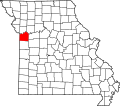
Buckner, Missouri | |
---|---|
Nickname: "The Little Village in the Valley" | |
Coordinates: 39°8′5″N94°11′54″W / 39.13472°N 94.19833°W | |
Country | United States |
State | Missouri |
County | Jackson |
Area | |
• Total | 1.79 sq mi (4.63 km2) |
• Land | 1.79 sq mi (4.62 km2) |
• Water | 0.00 sq mi (0.01 km2) |
Elevation | 751 ft (229 m) |
Population (2020) | |
• Total | 2,945 |
• Density | 1,648.94/sq mi (636.81/km2) |
Time zone | UTC-6 (Central (CST)) |
• Summer (DST) | UTC-5 (CDT) |
ZIP code | 64016 |
Area code | 816 |
FIPS code | 29-09424 [2] |
GNIS feature ID | 0735540 [3] |
Buckner is a city in Jackson County, Missouri, United States. The population was 2,945 at the 2020 census. For decades it was best known for TV and radio commercials promoting local automobile dealership Lasater Ford, run by the Lasater brothers, Wilson and Milton and later Halverson Ford. It is part of the Kansas City metropolitan area. [4]
Buckner is located at 39°8′5″N94°11′54″W / 39.13472°N 94.19833°W (39.134806, -94.198223). [5] According to the United States Census Bureau, the city has a total area of 1.79 square miles (4.64 km2), all land. [6]
Census | Pop. | Note | %± |
---|---|---|---|
1880 | 88 | — | |
1890 | 164 | 86.4% | |
1900 | 234 | 42.7% | |
1910 | 410 | 75.2% | |
1920 | 439 | 7.1% | |
1930 | 529 | 20.5% | |
1940 | 571 | 7.9% | |
1950 | 639 | 11.9% | |
1960 | 1,198 | 87.5% | |
1970 | 1,695 | 41.5% | |
1980 | 2,848 | 68.0% | |
1990 | 2,873 | 0.9% | |
2000 | 2,725 | −5.2% | |
2010 | 3,076 | 12.9% | |
2020 | 2,945 | −4.3% | |
U.S. Decennial Census [7] |
As of the census [8] of 2010, there were 3,076 people, 1,141 households, and 808 families residing in the city. The population density was 1,718.4 inhabitants per square mile (663.5/km2). There were 1,243 housing units at an average density of 694.4 per square mile (268.1/km2). The racial makeup of the city was 95.6% White, 0.4% African American, 0.4% Native American, 0.1% Asian, 0.2% Pacific Islander, 1.2% from other races, and 2.2% from two or more races. Hispanic or Latino of any race were 3.4% of the population.
There were 1,141 households, of which 41.0% had children under the age of 18 living with them, 50.7% were married couples living together, 13.1% had a female householder with no husband present, 6.9% had a male householder with no wife present, and 29.2% were non-families. 24.2% of all households were made up of individuals, and 10.2% had someone living alone who was 65 years of age or older. The average household size was 2.70 and the average family size was 3.19.
The median age in the city was 33.6 years. 29.5% of residents were under the age of 18; 8% were between the ages of 18 and 24; 28.1% were from 25 to 44; 24.1% were from 45 to 64; and 10.4% were 65 years of age or older. The gender makeup of the city was 50.3% male and 49.7% female.
As of the census [2] of 2000, there were 2,725 people, 1,019 households, and 747 families residing in the city. The population density was 1,595.3 inhabitants per square mile (615.9/km2). There were 1,065 housing units at an average density of 623.5 per square mile (240.7/km2). The racial makeup of the city was 95.93% White, 0.11% African American, 0.44% Native American, 0.26% Pacific Islander, 0.84% from other races, and 2.42% from two or more races. Hispanic or Latino of any race were 1.98% of the population.
There were 1,019 households, out of which 39.1% had children under the age of 18 living with them, 54.0% were married couples living together, 13.7% had a female householder with no husband present, and 26.6% were non-families. 22.2% of all households were made up of individuals, and 10.4% had someone living alone who was 65 years of age or older. The average household size was 2.67 and the average family size was 3.14.
In the city the population was spread out, with 30.3% under the age of 18, 9.1% from 18 to 24, 29.6% from 25 to 44, 21.0% from 45 to 64, and 10.1% who were 65 years of age or older. The median age was 33 years. For every 100 females, there were 96.9 males. For every 100 females age 18 and over, there were 91.5 males.
The median income for a household in the city was $40,577, and the median income for a family was $45,313. Males had a median income of $36,010 versus $22,372 for females. The per capita income for the city was $16,748. About 7.3% of families and 8.4% of the population were below the poverty line, including 10.4% of those under age 18 and 10.4% of those age 65 or over.
Buckner was established in 1875. In its inception Buckner was a railroad depot town for the Missouri Pacific Railroad. Where Buckner derives its name from is a point of contention; the town is either named from former US Senator Alexander Buckner (1830-1833) who served on the States Constitutional Convention in 1820, or named after Real Estate operator Simon Buckner. [9] [10] Yet another claim as namesake is Thomas W. Buckner, an original owner of the site. [11]
The WGN America series Outlaw Country was set in Buckner. [12]
Buckner is part of the Fort Osage School District. The only school within the city limits is Buckner Elementary, for middle school children attend Fire Prairie Middle School, and move onto Fort Osage High School to complete their secondary education.
Buckner has a public library, a branch of the Mid-Continent Public Library. [13]
The Gazette Weekly serves Buckner, Levasy, Sibley, and Eastern Independence on a weekly basis.
South Taft is a census-designated place (CDP) in Kern County, California, United States. South Taft is located 0.5 miles (0.8 km) south of Taft, at an elevation of 1,017 feet (310 m). The population was 2,169 at the 2010 census, up from 1,898 at the time of the 2000 census.
Fredericksburg is a city in Chickasaw County, Iowa, United States. The population was 987 at the time of the 2020 census.
Benton City is a village in Audrain County, Missouri, United States. The population was 104 at the 2010 census.
Rocheport is a city in Boone County, Missouri, United States. It is part of the Columbia, Missouri Metropolitan Statistical Area. The population was 239 at the 2010 census. Rocheport includes the Rocheport Historic District, an area with buildings dating from 1830 and which is listed on the National Register of Historic Places.
Randolph is a city in Clay County, Missouri, United States. The population was 57 at the 2020 census. It is completely surrounded by Kansas City and is a part of the Kansas City metropolitan area.
Everton is a city in southeast Dade County, Missouri, United States. The population was 273 at the 2020 census.
Neck City is a city in Jasper County, Missouri, United States. The population was 228 at the 2020 census.
Bates City is a city in western Lafayette County, Missouri, and is part of the Kansas City metropolitan area. The population was 219 at the 2020 census, which is neither a gain nor a loss in population since 2010.
Hawk Point is a city in Lincoln County, Missouri, United States. The population was 669 at the 2010 census.
Bevier is a city in Macon County, Missouri, United States. The population was 636 at the 2020 census.
Laurie is a city in southern Morgan and northern Camden counties, Missouri, United States. The population was 945 at the 2010 census.
Alton is a city and the county seat of Oregon County, Missouri, United States. The population was 707 at the 2020 census.
Homestown is a city in Pemiscot County, Missouri, United States. The population was 73 at the 2020 census.
Ferrelview is a village in Platte County, Missouri in the United States. It is within the Kansas City metropolitan area. The population was 451 at the 2010 census.
Malta Bend is a city in Saline County, Missouri, United States. The population was 250 at the 2010 census.
Greendale is a city in St. Louis County, Missouri, United States. The population was 651 at the 2010 census.
Mackenzie is an unincorporated community in St. Louis County, Missouri, United States. The population was 134 at the 2010 census.
Norwood Court is a village in St. Louis County, Missouri, United States. The population was 959 at the 2010 census.
Harris is a city in Sullivan County, Missouri, United States. The population was 61 at the 2010 census, at which time it was a town.
Western is a village in Saline County, Nebraska, United States. The population was 224 at the 2020 census.
{{cite web}}
: CS1 maint: bot: original URL status unknown (link)