Gardner, Kansas

Last updated

Gardner, Kansas
Gardner, KS.jpg
Main & Elm Street (2022)
Flag of Gardner, Kansas.svg
Johnson County Kansas Incorporated and Unincorporated areas Gardner Highlighted.svg
Location within Johnson County and Kansas
Map of Johnson County, Kansas, U.S..png
Coordinates: 38°48′41″N94°55′41″W / 38.81139°N 94.92806°W / 38.81139; -94.92806 [1]
Country United States
State Kansas
County Johnson
Founded1857
Incorporated 1887
Named for Henry Gardner
Government
  Type Mayor–Council
   Mayor Todd Winters [2]
  City AdministratorJim Pruetting
Area
[3]
  Total10.31 sq mi (26.72 km2)
  Land10.28 sq mi (26.61 km2)
  Water0.04 sq mi (0.10 km2)
Elevation
[1]
1,063 ft (324 m)
Population
 (2020) [4] [5]
  Total23,287
  Estimate 
(2021) [6]
23,942
  Density2,300/sq mi (870/km2)
Time zone UTC-6 (CST)
  Summer (DST) UTC-5 (CDT)
ZIP codes
66030-66031 [7]
Area code 913
FIPS code 20-25425
GNIS ID 485580 [1]
Website gardnerkansas.gov

Gardner is a city in Johnson County, Kansas, United States. [1] As of the 2020 census, the population of the city was 23,287. [4] [5] It is located within the Kansas City metropolitan area.

Contents

History

Gardner was founded where the Santa Fe Trail and the Oregon/California Trails divided. The Santa Fe Trail sent travelers southwest through Santa Fe and Albuquerque toward Los Angeles and San Diego. The Oregon/California Trails bore west for a few miles before turning north toward the Kansas River valley, followed the Big Blue River into present-day Nebraska, followed the Platte River west, and ultimately split in present-day Wyoming, Idaho or Utah. [8]

Gardner was founded as a Free-Stater settlement in 1857. Settled primarily by emigrants from Massachusetts, it was named for Henry Gardner, [9] then governor of Massachusetts. Four years after its establishment, it became the first community in Johnson County—and perhaps the first in the state—to experience an attack by Confederate forces. [10]

The first post office in Gardner was established in 1858. [11]

Geography

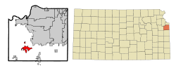
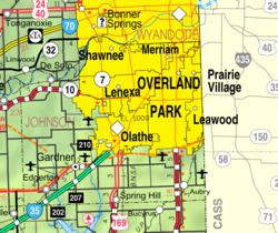
According to the United States Census Bureau, the city has a total area of 10.21 square miles (26.44 km2), of which 10.16 square miles (26.31 km2) is land and 0.05 square miles (0.13 km2) is water. [12] The most notable body of water in Gardner is Gardner Lake on the north side of town off of S Gardner Road and 151st Street. Gardner is also the genesis point of Kill Creek which runs north joining with the Kansas River in De Soto.

Climate

The climate in this area is characterized by hot, humid summers and generally mild to cool winters. According to the Köppen Climate Classification system, Gardner has a humid subtropical climate, abbreviated "Cfa" on climate maps. [13]

Climate data for Gardner, Kansas (New Century AirCenter) (1991–2020 normals, extremes 1945–1970, 1997–present)
MonthJanFebMarAprMayJunJulAugSepOctNovDecYear
Record high °F (°C)74
(23)
81
(27)
87
(31)
92
(33)
95
(35)
104
(40)
114
(46)
111
(44)
107
(42)
96
(36)
81
(27)
74
(23)
114
(46)
Mean maximum °F (°C)64.0
(17.8)
67.9
(19.9)
77.7
(25.4)
84.3
(29.1)
89.1
(31.7)
94.7
(34.8)
99.7
(37.6)
99.8
(37.7)
93.8
(34.3)
86.0
(30.0)
73.7
(23.2)
65.1
(18.4)
101.7
(38.7)
Mean daily maximum °F (°C)39.4
(4.1)
44.1
(6.7)
56.0
(13.3)
66.0
(18.9)
75.4
(24.1)
84.7
(29.3)
89.4
(31.9)
88.2
(31.2)
79.7
(26.5)
67.5
(19.7)
54.0
(12.2)
43.0
(6.1)
65.6
(18.7)
Daily mean °F (°C)29.8
(−1.2)
34.1
(1.2)
44.9
(7.2)
54.8
(12.7)
64.9
(18.3)
74.5
(23.6)
78.8
(26.0)
77.4
(25.2)
68.6
(20.3)
56.5
(13.6)
43.8
(6.6)
33.6
(0.9)
55.1
(12.8)
Mean daily minimum °F (°C)20.1
(−6.6)
24.1
(−4.4)
33.8
(1.0)
43.6
(6.4)
54.4
(12.4)
64.3
(17.9)
68.2
(20.1)
66.5
(19.2)
57.5
(14.2)
45.5
(7.5)
33.6
(0.9)
24.2
(−4.3)
44.7
(7.1)
Mean minimum °F (°C)0.0
(−17.8)
5.0
(−15.0)
14.1
(−9.9)
26.9
(−2.8)
39.9
(4.4)
51.5
(10.8)
58.5
(14.7)
55.9
(13.3)
43.5
(6.4)
28.2
(−2.1)
17.0
(−8.3)
5.2
(−14.9)
−3.6
(−19.8)
Record low °F (°C)−12
(−24)
−15
(−26)
−7
(−22)
18
(−8)
31
(−1)
43
(6)
49
(9)
47
(8)
36
(2)
23
(−5)
4
(−16)
−11
(−24)
−15
(−26)
Average precipitation inches (mm)1.05
(27)
1.50
(38)
2.31
(59)
3.76
(96)
5.08
(129)
5.26
(134)
4.21
(107)
3.95
(100)
3.74
(95)
3.27
(83)
1.91
(49)
1.50
(38)
37.54
(954)
Average precipitation days (≥ 0.01 in)5.56.49.411.013.411.19.39.49.08.96.15.7105.2
Source: NOAA [14] [15]

Demographics

Historical population
CensusPop.Note
1880 203
1890 515153.7%
1900 475−7.8%
1910 5148.2%
1920 5140.0%
1930 493−4.1%
1940 5103.4%
1950 67632.5%
1960 1,619139.5%
1970 1,83913.6%
1980 2,39230.1%
1990 3,19133.4%
2000 9,396194.5%
2010 19,123103.5%
2020 23,28721.8%
2021 (est.)23,942 [6] 2.8%
U.S. Decennial Census
2010-2020 [5]

2020 census

The 2020 United States census counted 23,287 people, 8,005 households, and 5,938 families in Gardner. [16] [17] The population density was 1,996.8 per square mile (771.0/km2). There were 8,294 housing units at an average density of 711.2 per square mile (274.6/km2). [17] [18] The racial makeup was 79.22% (18,449) white or European American (76.52% non-Hispanic white), 3.89% (907) black or African-American, 0.56% (130) Native American or Alaska Native, 1.78% (415) Asian, 0.14% (32) Pacific Islander or Native Hawaiian, 3.58% (834) from other races, and 10.82% (2,520) from two or more races. [19] Hispanic or Latino of any race was 10.21% (2,378) of the population. [20]

Of the 8,005 households, 47.7% had children under the age of 18; 56.1% were married couples living together; 21.6% had a female householder with no spouse or partner present. 20.4% of households consisted of individuals and 6.9% had someone living alone who was 65 years of age or older. [17] The average household size was 3.0 and the average family size was 3.3. [21] The percent of those with a bachelor's degree or higher was estimated to be 20.9% of the population. [22]

32.1% of the population was under the age of 18, 7.6% from 18 to 24, 31.5% from 25 to 44, 20.3% from 45 to 64, and 8.5% who were 65 years of age or older. The median age was 32.6 years. For every 100 females, there were 101.9 males. [17] For every 100 females ages 18 and older, there were 104.9 males. [17]

The 2016-2020 5-year American Community Survey estimates show that the median household income was $78,193 (with a margin of error of +/- $4,899) and the median family income was $86,859 (+/- $4,392). [23] Males had a median income of $49,402 (+/- $4,503) versus $30,995 (+/- $3,086) for females. The median income for those above 16 years old was $39,662 (+/- $2,267). [24] Approximately, 4.3% of families and 6.0% of the population were below the poverty line, including 9.6% of those under the age of 18 and 6.9% of those ages 65 or over. [25] [26]

2010 census

As of the census [27] of 2010, there were 19,123 people, 6,644 households, and 4,938 families living in the city. [28] The population density was 1,889.6 inhabitants per square mile (729.6/km2). There were 7,300 housing units at an average density of 721.3 per square mile (278.5/km2). The racial makeup of the city was 89.7% White, 3.0% African American, 0.5% Native American, 1.9% Asian, 1.8% from other races, and 3.0% from two or more races. Hispanic or Latino of any race were 6.2% of the population.

There were 6,644 households, of which 49.7% had children under the age of 18 living with them, 58.9% were married couples living together, 10.3% had a female householder with no husband present, 5.1% had a male householder with no wife present, and 25.7% were non-families. 20.1% of all households were made up of individuals, and 5% had someone living alone who was 65 years of age or older. The average household size was 2.85 and the average family size was 3.31.

The median age in the city was 30 years. 33.2% of residents were under the age of 18; 6.6% were between the ages of 18 and 24; 37.7% were from 25 to 44; 17.1% were from 45 to 64; and 5.3% were 65 years of age or older. The gender makeup of the city was 49.9% male and 50.1% female.

2000 census

As of the census [29] of 2000, there were 9,396 people, 3,307 households, and 2,460 families living in the city. The population density was 1,898.5 inhabitants per square mile (733.0/km2). There were 3,533 housing units at an average density of 713.8 per square mile (275.6/km2). The racial makeup of the city was 94.13% White, 1.21% African American, 0.49% Native American, 1.05% Asian, 0.01% Pacific Islander, 1.26% from other races, and 1.85% from two or more races. Hispanic or Latino of any race were 2.99% of the population. 26.8% were of German, 18.2% American, 11.5% Irish and 5.6% English ancestry according to Census 2000.

There were 3,307 households, out of which 47.8% had children under the age of 18 living with them, 58.5% were married couples living together, 11.1% had a female householder with no husband present, and 25.6% were non-families. 19.5% of all households were made up of individuals, and 5.6% had someone living alone who was 65 years of age or older. The average household size was 2.80 and the average family size was 3.23.

In the city, the population was spread out, with 33.1% under the age of 18, 8.4% from 18 to 24, 38.4% from 25 to 44, 13.7% from 45 to 64, and 6.4% who were 65 years of age or older. The median age was 29 years. For every 100 females, there were 96.9 males. For every 100 females age 18 and over, there were 93.7 males.

As of 2000 the median income for a household in the city was $50,807, and the median income for a family was $54,554. Males had a median income of $37,438 versus $27,553 for females. The per capita income for the city was $20,434. About 5.3% of families and 6.0% of the population were below the poverty line, including 6.1% of those under age 18 and 9.2% of those age 65 or over.

Economy

BNSF Railway built a refueling plant and office in Edgerton which is 3 miles from western Gardner. It opened in May 2013 and employs about 200.[ citation needed ]

Largest employers

According to the city's 2015 Comprehensive Annual Financial Report, [30] the largest employers in the city are:

#Employer# of Employees
1 Unified School District No. 231 800
2 Walmart 250
3Meadowbrook Rehabilitation Hospital174
4Epic Landscape Productions172
5 Coleman 167
6City of Gardner135
7TradeNet Publishing130
8 Price Chopper 130
9Medical Lodge of Gardner102
10D.O.T. Label, Inc (ITW)87

Government

The mayor of Gardner is Todd Winters, who was sworn in on December 6, 2021. The city council is made up of five (5) at-large members, each of whom serve rotating 4-year terms. [2]

Education

Gardner is part of the USD 231 school district. Located in Gardner are six out of the seven elementary schools (Edgerton Elementary is the only school in the district not located in Gardner). These include Gardner Elementary, Sunflower Elementary, Madison Elementary, Nike Elementary, Grand Star Elementary, and Moonlight Elementary. The district also has three middle schools, Wheatridge, Trail Ridge, and Pioneer Ridge, and one high school (Gardner-Edgerton High School) all located in Gardner.

Library

The Johnson County Library maintains a branch in Gardner. [31]

Notable people

Notable individuals who were born in and/or have lived in Gardner include:

See also

Related Research Articles

<span class="mw-page-title-main">Colony, Kansas</span> City in Anderson County, Kansas

Colony is a city in Anderson County, Kansas, United States. As of the 2020 census, the population of the city was 381.

<span class="mw-page-title-main">Garnett, Kansas</span> City in Anderson County, Kansas

Garnett is a city in and the county seat of Anderson County, Kansas, United States. As of the 2020 census, the population of the city was 3,242.

<span class="mw-page-title-main">Benton, Kansas</span> City in Butler County, Kansas

Benton is a city in Butler County, Kansas, United States. As of the 2020 census, the population of the city was 943.

<span class="mw-page-title-main">Baldwin City, Kansas</span> City in Kansas, United States

Baldwin City is a city in Douglas County, Kansas, United States, about 12 miles (19 km) south of Lawrence. As of the 2020 census, the population of the city was 4,826. The city is home to Baker University, the state's oldest four-year university.

<span class="mw-page-title-main">Kinsley, Kansas</span> City in Edwards County, Kansas

Kinsley is a city in and the county seat of Edwards County, Kansas, United States. As of the 2020 census, the population of the city was 1,456. It is located along Highway 50.

<span class="mw-page-title-main">Holcomb, Kansas</span> City in Finney County, Kansas

Holcomb is a city in Finney County, Kansas, United States. As of the 2020 census, the population of the city was 2,245. It is located south of Highway 50.

<span class="mw-page-title-main">Montezuma, Kansas</span> City in Gray County, Kansas

Montezuma is a city in Gray County, Kansas, United States. As of the 2020 census, the population of the city was 975.

<span class="mw-page-title-main">Fall River, Kansas</span> City in Greenwood County, Kansas

Fall River is a city in Greenwood County, Kansas, United States. As of the 2020 census, the population of the city was 131.

<span class="mw-page-title-main">Coolidge, Kansas</span> City in Hamilton County, Kansas

Coolidge is a city in Hamilton County, Kansas, United States. As of the 2020 census, the population of the city was 80. It is located along Highway 50 about 1 miles east of the Colorado-Kansas border.

<span class="mw-page-title-main">Admire, Kansas</span> City in Lyon County, Kansas

Admire is a city in Lyon County, Kansas, United States. As of the 2020 census, the population of the city was 130.

<span class="mw-page-title-main">Marysville, Kansas</span> City in Marshall County, Kansas

Marysville is a city in and the county seat of Marshall County, Kansas, United States. As of the 2020 census, the population of the city was 3,447.

<span class="mw-page-title-main">Council Grove, Kansas</span> City in Morris County, Kansas

Council Grove is a city and county seat in Morris County, Kansas, United States. As of the 2020 census, the population of the city was 2,140. It was named after an agreement between American settlers and the Osage Nation allowing settlers' wagon trains to pass westward through the area on the Santa Fe Trail. Pioneers gathered at a grove of trees so that wagons could band together for their trip west.

<span class="mw-page-title-main">Overbrook, Kansas</span> City in Osage County, Kansas

Overbrook is a city in Osage County, Kansas, United States. As of the 2020 census, the population of the city was 1,005.

<span class="mw-page-title-main">Larned, Kansas</span> City in Pawnee County, Kansas

Larned is a city in and the county seat of Pawnee County, Kansas, United States. As of the 2020 census, the population of the city was 3,769.

<span class="mw-page-title-main">Louisville, Kansas</span> City in Pottawatomie County, Kansas

Louisville is a city in Pottawatomie County, Kansas, United States. As of the 2020 census, the population of the city was 131.

<span class="mw-page-title-main">Atwood, Kansas</span> City in Rawlins County, Kansas

Atwood is a city in and the county seat of Rawlins County, Kansas, United States. As of the 2020 census, the population of the city was 1,290.

<span class="mw-page-title-main">Andale, Kansas</span> City in Sedgwick County, Kansas

Andale is a city in Sedgwick County, Kansas, United States. As of the 2020 census, the population of the city was 941.

<span class="mw-page-title-main">Haysville, Kansas</span> City in Sedgwick County, Kansas

Haysville is a city in Sedgwick County, Kansas, United States, and a suburb of Wichita. As of the 2020 census, the population of the city was 11,262. Haysville is known as the "Peach Capital of Kansas".

<span class="mw-page-title-main">Caldwell, Kansas</span> City in Sumner County, Kansas

Caldwell is a city in Sumner County, Kansas, United States. As of the 2020 census, the population of the city was 1,025.

<span class="mw-page-title-main">Oakley, Kansas</span> City in Gove / Logan / Thomas Counties of Kansas

Oakley is a city in Gove, Logan, and Thomas counties in the U.S. state of Kansas. It is the county seat of Logan County. As of the 2020 census, the population of the city was 2,046.

References

  1. 1 2 3 4 U.S. Geological Survey Geographic Names Information System: Gardner, Kansas
  2. 1 2 "Governing Body". City of Gardner Kansas. Archived from the original on February 3, 2022.
  3. "2019 U.S. Gazetteer Files". United States Census Bureau. Retrieved July 24, 2020.
  4. 1 2 "Profile of Gardner, Kansas in 2020". United States Census Bureau. Archived from the original on November 23, 2022. Retrieved November 22, 2022.
  5. 1 2 3 "QuickFacts; Gardner, Kansas; Population, Census, 2020 & 2010". United States Census Bureau. Archived from the original on August 24, 2021. Retrieved August 24, 2021.
  6. 1 2 "City and Town Population Totals: 2020-2021". United States Census Bureau. May 16, 2022. Retrieved June 3, 2022.
  7. United States Postal Service (2012). "USPS - Look Up a ZIP Code" . Retrieved February 15, 2012.
  8. Crease, Craig. "History of Gardner". City of Gardner. Archived from the original on April 15, 2014.
  9. Gannett, Henry (1905). The Origin of Certain Place Names in the United States. Govt. Print. Off. pp.  134.
  10. Gardner History, Gardner Historical Museum. Accessed 2018-08-21.
  11. "Kansas Post Offices, 1828-1961 (archived)". Kansas Historical Society. Archived from the original on October 9, 2013. Retrieved June 11, 2014.
  12. "US Gazetteer files 2010". United States Census Bureau. Archived from the original on July 2, 2012. Retrieved July 6, 2012.
  13. Climate Summary for Gardner, Kansas
  14. "NOWData – NOAA Online Weather Data". National Oceanic and Atmospheric Administration. Retrieved November 20, 2023.
  15. "Summary of Monthly Normals 1991–2020". National Oceanic and Atmospheric Administration. Retrieved November 20, 2023.
  16. "US Census Bureau, Table P16: HOUSEHOLD TYPE". data.census.gov. Retrieved January 3, 2024.
  17. 1 2 3 4 5 "US Census Bureau, Table DP1: PROFILE OF GENERAL POPULATION AND HOUSING CHARACTERISTICS". data.census.gov. Retrieved January 3, 2024.
  18. "Gazetteer Files". Census.gov. Retrieved December 30, 2023.
  19. "US Census Bureau, Table P1: RACE". data.census.gov. Retrieved January 3, 2024.
  20. "US Census Bureau, Table P2: HISPANIC OR LATINO, AND NOT HISPANIC OR LATINO BY RACE". data.census.gov. Retrieved January 3, 2024.
  21. "US Census Bureau, Table S1101: HOUSEHOLDS AND FAMILIES". data.census.gov. Retrieved January 3, 2024.
  22. "US Census Bureau, Table S1501: EDUCATIONAL ATTAINMENT". data.census.gov. Retrieved January 3, 2024.
  23. "US Census Bureau, Table S1903: MEDIAN INCOME IN THE PAST 12 MONTHS (IN 2020 INFLATION-ADJUSTED DOLLARS)". data.census.gov. Retrieved January 3, 2024.
  24. "US Census Bureau, Table S2001: EARNINGS IN THE PAST 12 MONTHS (IN 2020 INFLATION-ADJUSTED DOLLARS)". data.census.gov. Retrieved January 3, 2024.
  25. "US Census Bureau, Table S1701: POVERTY STATUS IN THE PAST 12 MONTHS". data.census.gov. Retrieved January 3, 2024.
  26. "US Census Bureau, Table S1702: POVERTY STATUS IN THE PAST 12 MONTHS OF FAMILIES". data.census.gov. Retrieved January 3, 2024.
  27. "U.S. Census website". United States Census Bureau . Retrieved July 6, 2012.
  28. "2010 City Population and Housing Occupancy Status". U.S. Census Bureau. Retrieved March 6, 2011.[ dead link ]
  29. "U.S. Census website". United States Census Bureau . Retrieved January 31, 2008.
  30. "City of Gardner, Kansas 2015 Comprehensive Annual Financial Report For the fiscal year ended December 31, 2015" (PDF). Retrieved March 2, 2017.
  31. Johnson County Library
  32. Thompson, D. (March 12, 2011). "Gardner Scientist Honored by State Project". The Gardner News. Retrieved April 1, 2016.[ permanent dead link ]
  33. "Bubba Starling". Baseball-Reference.com. Retrieved April 1, 2016.

Further reading