
McClain County is a county located in south central Oklahoma. As of the 2010 census, the population was 34,506. Its county seat is Purcell. The county was named for Charles M. McClain, an Oklahoma constitutional convention attendee.

Johnson County abbreviated as ’’JoCo’’ is the most populated county and largest employment center in Kansas. Johnson County is a suburb of Kansas City (MO). Its county seat is Olathe and its most populous city is Overland Park. Bordering Kansas City (MO) and Kansas City (KS), it has become the most densely populated county within the Kansas City Metropolitan Area. As of the 2010 census, the county population was 544,179 with a 2018 estimate of 597,555 making it the most populous county in Kansas. It is home to the headquarters of Garmin, Sprint Telecomunications, and AMC Theatres, with total employment in 2017 being 333,751.
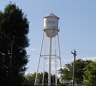
De Soto is a city in Johnson and Leavenworth counties in the U.S. state of Kansas, and part of the Kansas City Metropolitan Area. As of the 2010 census, the city population was 5,720, and in 2018 the estimated population was 6,443. De Soto was incorporated as a city on October 1, 1897.
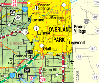
Edgerton is a city in Johnson County, Kansas, United States and part of the Kansas City metropolitan area. As of the 2010 census, the population was 1,671. It is home to the large BNSF intermodal train facility named Logistics Park Kansas City.

Gardner is a city in Johnson County, Kansas, United States. As of the 2010 census, the city population was 19,123. It is located in the Kansas City metropolitan area.

The Kansas City metropolitan area is a bi-state 14-county metropolitan area straddling the border between the U.S. states of Missouri and Kansas, anchored by Jackson County, Missouri, and Johnson County, Kansas. Its most-populous municipality is Kansas City, Missouri (KCMO). With a population of 2,487,053, it ranks as the second-largest metropolitan area in Missouri and the largest metropolitan area in Kansas. Alongside KCMO, the area includes a number of other cities and suburbs, the largest being Overland Park, Kansas; Kansas City, Kansas; Olathe, Kansas; and Independence, Missouri; each over 100,000 in population. The Mid-America Regional Council (MARC) serves as the Council of Governments and the Metropolitan Planning Organization for the area.

U.S. Route 36 (US 36) is an east–west United States highway that travels approximately 1,414 miles (2,276 km) from Rocky Mountain National Park, Colorado to Uhrichsville, Ohio. The highway's western terminus is at Deer Ridge Junction, an intersection in Rocky Mountain National Park, Colorado, where it meets US 34. Its eastern terminus is at US 250 in Uhrichsville, Ohio.
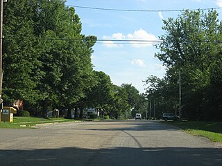
Tecumseh is an unincorporated community in Shawnee County, Kansas, United States. It is situated along the Kansas River. The community and township are both named for the famous Shawnee chief.
K-99 is a state highway in the U.S. state of Kansas. The highway runs 234.473 miles (377.348 km) from Oklahoma State Highway 99 (SH-99) at the Oklahoma state line near Chautauqua north to Nebraska Highway 99 (N-99) at the Nebraska state line in Summerfield. K-99 connects Emporia with several smaller county seats to the south and north, including Sedan, Howard, Eureka, Alma, and Westmoreland while passing through the Flint Hills of eastern Kansas. When K-99 was first designated it was K-11, but was renumbered to match SH-99 in Oklahoma.
The 18th Street Expressway is a freeway in Kansas City, Kansas that runs from Interstate 35 north to Interstate 70/U.S. Route 24/U.S. Route 40. It carries the U.S. Route 69 designation its entire length.
Interstate 25 (I-25) is a part of the Interstate Highway System that runs from Las Cruces, New Mexico, to Buffalo, Wyoming. In Wyoming, the Interstate Highway runs 300.530 miles (483.656 km) from the Colorado state line near Cheyenne north to its national terminus at I-90 near Buffalo. I-25 connects Wyoming's largest city and capital, Cheyenne, with its second largest city, Casper, and the smaller communities of Wheatland, Douglas, and Buffalo. The highway also connects those cities with Denver and Billings via I-90. I-25 runs concurrently with U.S. Route 87 for almost its entire course in Wyoming. The highway also has extensive concurrencies with US 20 and US 26 along its east–west segment through the North Platte River valley. The Interstate has business loops through Cheyenne, Chugwater, Wheatland, Douglas, Glenrock, Casper, and Buffalo.
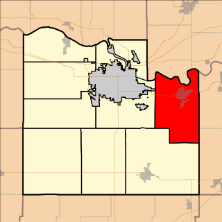
Eudora Township is a township in Douglas County, Kansas, USA. As of the 2010 census, its population was 6,724.

Lecompton Township is a township in Douglas County, Kansas, USA. As of the 2000 census, its population was 1,761.

Palmyra Township is a township in Douglas County, Kansas, USA. As of the 2000 census, its population was 5,760. It was named after a small trail stop on the Santa Fe Trail that was later absorbed into Baldwin City. When it was first established in 1855, it was called Calhoun, until 1858.

Wakarusa Township is a township in Douglas County, Kansas, USA. As of the 2010 census, its population was 2,318. It was named for the Wakarusa River which flows through Douglas County from Wabaunsee County to the Kansas River near Eudora.

Peoria Township is a township in Franklin County, Kansas, USA. As of the 2000 census, its population was 626. Peoria Township has two unincorporated towns: Peoria and Imes.
K-33 is a 10.405-mile-long (16.745 km) north–south state highway in the U.S. state of Kansas. It is a two-lane expressway, linking K-68 in rural Franklin County to U.S. Route 56 (US-56) in Douglas County, just north of Wellsville. It provides an important link between US-56 and K-68 to Interstate 35 (I-35) in Wellsville.
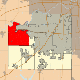
Lexington Township is one of seven townships in Johnson County, Kansas, United States. As of the 2010 census, its population was 1,312.

Gardner Township is one of seven townships in Johnson County, Kansas, USA. As of the 2010 census, its population was 2,143.

Olathe Township is one of seven townships in Johnson County, Kansas, USA. As of the 2010 census, its population was 137,324. It contains the city of Olathe, Kansas and 0.53 Square Miles of De Soto, Kansas & Lexington Township, Kansas


