Clearview City, Kansas

Last updated
Clearview City, Kansas
Unincorporated community
Map of Johnson Co, Ks, USA.png
KDOT map of Johnson County (legend)
USA Kansas location map.svg
Red pog.svg
Clearview City
Location within the state of Kansas
Coordinates: 38°56′44″N94°59′55″W / 38.94556°N 94.99861°W / 38.94556; -94.99861 Coordinates: 38°56′44″N94°59′55″W / 38.94556°N 94.99861°W / 38.94556; -94.99861 [1]
Country United States
State Kansas
County Johnson
Township Lexington
Housing Complex 1941
Annexed 1998 (with De Soto)
Area
  Total 44.17 sq mi (114.4 km2)
  Land 44.06 sq mi (114.1 km2)
  Water 0.11 sq mi (0.3 km2)
Elevation [1] 915 ft (279 m)
Population (2010)
  Total 339
  Estimate (2017) 339
  Density 7.7/sq mi (3.0/km2)
Time zone CST (UTC-6)
  Summer (DST) CDT (UTC-5)
ZIP codes 66018, 66019
Area code 913
FIPS code 20-13900 [1]
GNIS ID 479182 [1]

Clearview City was an unincorporated community in Johnson County, Kansas, Kansas, United States, [1] but is now a part of the city of De Soto. Clearview Village is currently registered in the Kansas Historical Registry.

Johnson County, Kansas County in the United States

Johnson County is a county located in the U.S. state of Kansas. Largely suburban, its proximity to Kansas City, Missouri has led to population growth within the Kansas City Metropolitan Area. As of the 2010 census, the county population was 544,179, making it the most populous county in Kansas. Its county seat is Olathe, and its most populous city is Overland Park.

Kansas State of the United States of America

Kansas is a U.S. state in the Midwestern United States. Its capital is Topeka and its largest city is Wichita, with its most populated county being Johnson County. Kansas is bordered by Nebraska on the north; Missouri on the east; Oklahoma on the south; and Colorado on the west. Kansas is named after the Kansa Native American tribe, which inhabited the area. The tribe's name is often said to mean "people of the (south) wind" although this was probably not the term's original meaning. For thousands of years, what is now Kansas was home to numerous and diverse Native American tribes. Tribes in the eastern part of the state generally lived in villages along the river valleys. Tribes in the western part of the state were semi-nomadic and hunted large herds of bison.

De Soto, Kansas City in Kansas, United States

De Soto is a city in Johnson and Leavenworth counties in the U.S. state of Kansas, and part of the Kansas City Metropolitan Area. The vast majority of the city, 11.13 square miles (28.8 km2), lies within Johnson County. As of the 2010 census, the city population was 5,720, and in 2017 the estimated population was 6,107. The area code is 913, and the two ZIP codes are 66018 and 66019.

Contents

History

Clearview City was the home of the now defunct Sunflower Army Ammunition Plant. The town was initially used as a housing complex built for workers at the ammunition plant, as well had a drug store, post office and a hardware store. The housing is now fixed up and used as apartments, the businesses have disbanded and sit empty. Clearview City was annexed by the city of De Soto in 1998

Sunflower Army Ammunition Plant

The Sunflower Army Ammunition Plant was a smokeless powder and propellant manufacturing facility in northwest Johnson County, Kansas, south of De Soto, owned by the United States Government and operated under contract, primarily by Hercules Aerospace Company.

In 1987, six acres (2.4 ha) of houses in the eastern part of Clearview City were demolished due to damage and age. The church within the Clearview Village is no longer used and a newer church, the Clearview Baptist Church now sits slightly on the outside of the Clearview Village borders.

Clearview Village

Clearview Village was earlier known as Sunflower Village and was built for employees of the Sunflower Ordnance Works. the west side "Old Village" had 853 dwellings in 1943, and the east side "New Village" had 580 pre-fab units that was completed by 1945. Housing, a school and traffic were filled and overflowing. Highway 10, the main street which is now currently 83rd Street. As people came in, it was getting harder to find room and places to room, bored and to dwell in, to a point that people were living in the chicken house and sleeping under quilts on the ground where the current Scout House is sitting on Wea Street. It was so unbearable that rooms that were rented out "by the shift" that other people were bring in trailers and tents. DeSoto's declined with the start of World War II.

In 1955, the housing units transferred to Sunflower Ordnance Worker (SOW) than sold to private buyers. Middle of 1961 Sunflower was sold to Quick Way Homes and is currently known as Clearview City. Around 1999, the area was considered for demolition to make way for the Oz theme park based on the movie and stories of the "Wizard of Oz" by Frank Baum, but the park never materialized. [2]

<i>The Wonderful Wizard of Oz</i> 1900 childrens novel by L. Frank Baum

The Wonderful Wizard of Oz is an American children's novel written by author L. Frank Baum and illustrated by W. W. Denslow, originally published by the George M. Hill Company in Chicago on May 17, 1900. It has since seen several reprints, most often under the title The Wizard of Oz, which is the title of the popular 1902 Broadway musical adaptation as well as the iconic 1939 musical film adaptation.

L. Frank Baum Childrens writer

Lyman Frank Baum was an American author chiefly famous for his children's books, particularly The Wonderful Wizard of Oz and its sequels. He wrote 14 novels in the Oz series, plus 41 other novels, 83 short stories, over 200 poems, and at least 42 scripts. He made numerous attempts to bring his works to the stage and the nascent medium of film; the 1939 adaptation of the first Oz book would become a landmark of 20th-century cinema. His works anticipated such century-later commonplaces as television, augmented reality, laptop computers, wireless telephones, women in high-risk and action-heavy occupations, and the ubiquity of advertising on clothing.

Geography

Clearview City is located approximately 36 miles west of Kansas City, Kansas and is two miles (3 km) south of De Soto. It is located in Lexington Township.

Lexington Township, Johnson County, Kansas Township in Kansas, United States

Lexington Township is one of seven townships in Johnson County, Kansas, United States. As of the 2010 census, its population was 1,312.

Related Research Articles

Childersburg, Alabama City in Alabama, United States

Childersburg is a city in Talladega County in the U.S. state of Alabama. It was incorporated in 1889. At the 2010 census the population was 5,175. It claims a history dating back before 1540, when it was noted as a village of the Coosa Nation visited by the Spanish explorer Hernando de Soto. The Alabama Army Ammunition Plant, important during World War II, was located 4 miles (6 km) north of Childersburg.

Parsons, Kansas City in Kansas, United States

Parsons is a city in Labette County, Kansas, United States. As of the 2010 census, the city population was 10,500. It is the most populous city of Labette County, and after Pittsburg, is the second-most populous city in the southeastern region of Kansas.

Emporia, Kansas City and County seat in Kansas, United States

Emporia is a city in and the county seat of Lyon County, Kansas, United States. As of the 2010 census, the city population was 24,916. Emporia lies between Topeka and Wichita at the intersection of U.S. Route 50 with Interstates 335 and 35 on the Kansas Turnpike. Emporia is also a college town, home to Emporia State University and Flint Hills Technical College.

De Soto, Missouri City in Missouri, United States

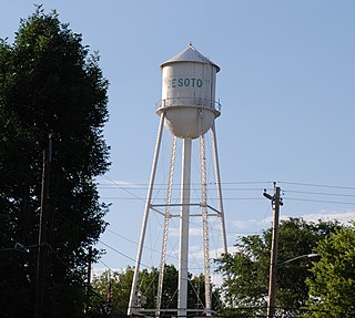
De Soto is a city in Jefferson County, Missouri, United States. The population was 6,400 at the 2010 census and the city is part of the St. Louis metropolitan area. The Van Metre family were first to settle in 1803. The town was organized in 1857 and is named for the explorer Hernando De Soto, who claimed the Louisiana Territory for Spain. De Soto was the city closest to the mean center of U.S. population in 1980. The city celebrated its Bicentennial in 2003. The city made national news on and after May 6, 2003, when straightline winds and a tornado struck.

Kansas City metropolitan area Metropolitan area in the United States

The Kansas City metropolitan area is a 14 county metropolitan area anchored by Kansas City, Missouri, and straddling the border between the U.S. states of Missouri and Kansas. With a population of 2,104,509, it ranks as the second largest metropolitan area centered in Missouri. Alongside Kansas City, the area includes a number of other cities and suburbs, the largest being Overland Park, Kansas; Kansas City, Kansas; Olathe, Kansas; and Independence, Missouri; each over 100,000 in population. The Mid-America Regional Council (MARC) serves as the Council of Governments and the Metropolitan Planning Organization for the area.

Spennymoor town and civil parish in County Durham, England

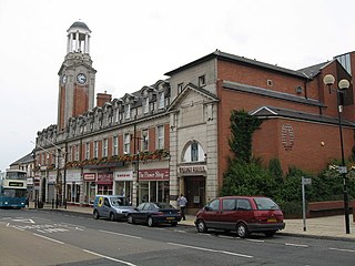
Spennymoor is a town in County Durham, England. It stands above the Wear Valley approximately 7 mi (11 km) south of Durham. The town was founded over 160 years ago. The Town Council area, which includes the villages of Kirk Merrington, Middlestone Moor, Byers Green and Tudhoe, has a population of approximately 20,000.

Hawthorne Army Depot

Hawthorne Army Depot (HWAD) is a U.S. Army ammunition storage depot located near the town of Hawthorne in western Nevada in the United States. It is directly south of Walker Lake. The depot covers 147,000 acres (59,000 ha) or 226 sq. mi. and has 600,000 square feet (56,000 m2) storage space in 2,427 bunkers. HWAD is the "World's Largest Depot" and is divided into three ammunition storage and production areas, plus an industrial area housing command headquarters, facilities engineering shops, etc.

Kansass 3rd congressional district Congressional district in Kansas, USA

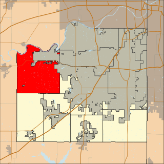
Kansas's 3rd congressional district is a congressional district in the U.S. state of Kansas. Located in eastern Kansas, the district encompasses all of Wyandotte and Johnson counties and parts of Miami county. The district includes the heart of the Kansas side of the Kansas City metropolitan area, including Kansas City, Overland Park, Lenexa, Shawnee, Spring Hill, DeSoto and Olathe.

Exbury village in the United Kingdom

Exbury is a village in Hampshire, England. It is in the civil parish of Exbury and Lepe. It lies just in the New Forest, near the Beaulieu River and about a mile from the Solent coast. It is best known as the location of Exbury House, built by the Rothschild family, and the famous Exbury Gardens. The Rothschild family still have significant land ownings in the area.

Sunflower (Helianthus) is a genus of annual flowering plants native to North America.

Clearview, Washington CDP in Washington, United States

Clearview is a small unincorporated community and census-designated place (CDP) in Snohomish County, Washington, United States. The population was 3,324 at the 2010 census. Clearview is located on both sides of State Route 9, where it intersects 180th Street SE in Snohomish County, Washington, United States. It is located between Snohomish and Woodinville and the top of the Clearview Hill.

Moulton, Cheshire a village located in Cheshire West and Chester, United Kingdom

Moulton is a civil parish and village in the unitary authority of Cheshire West and Chester and near the centre of the ceremonial county of Cheshire, England, situated 3 miles (4.8 km) south of Northwich and 3 miles (4.8 km) north of Winsford.

Eastriggs village in the United Kingdom

Eastriggs is a village in the south of Dumfries and Galloway. It has a small number of shops, a restaurant, post office, public house, working men's club and a church. Eastriggs Primary School feeds to Annan Academy.

McCamish Township, Johnson County, Kansas Township in Kansas, United States

McCamish Township is one of seven townships in Johnson County, Kansas, USA. As of the 2010 census, its population was 878.

Sunflower Village Historic District

Sunflower Village, also known as Clearview City, was a historic complex used to house the workers of the now defunct Sunflower Army Ammunition Plant in DeSoto, Johnson County, Kansas, United States.

References