Westwood Hills, Kansas

Last updated

Westwood Hills, Kansas
Johnson County Kansas Incorporated and Unincorporated areas Westwood Hills Highlighted.svg
Location within Johnson County and Kansas
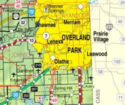
Map of Johnson County, Kansas, U.S..png
Coordinates: 39°02′20″N94°36′35″W / 39.03889°N 94.60972°W / 39.03889; -94.60972 [1]
Country United States
State Kansas
County Johnson
Founded1922
Incorporated 1949
Area
[2]
  Total0.06 sq mi (0.17 km2)
  Land0.06 sq mi (0.17 km2)
  Water0.00 sq mi (0.00 km2)
Elevation
[1]
902 ft (275 m)
Population
 (2020) [3]
  Total400
  Density6,700/sq mi (2,400/km2)
Time zone UTC-6 (CST)
  Summer (DST) UTC-5 (CDT)
ZIP code
66205
Area code 913
FIPS code 20-77525 [1]
GNIS ID 485661 [1]
Website westwoodhillsks.gov

Westwood Hills is a city in Johnson County, Kansas, United States. [1] As of the 2020 census, the population of the city was 400. [3] It is the most densely populated city in the Kansas City Metropolitan Area at 6,240 people per square mile. [4] It borders Kansas City, Missouri.

Contents

History

Westwood Hills had its start in the year 1922 when developer J.C. Nichols platted the subdivision and began building. [5]

Geography

According to the United States Census Bureau, the city has a total area of 0.07 square miles (0.18 km2), all of it land. [6]

Demographics

Historical population
CensusPop.Note
1950 431
1960 49514.8%
1970 414−16.4%
1980 4375.6%
1990 383−12.4%
2000 378−1.3%
2010 359−5.0%
2020 40011.4%
U.S. Decennial Census

2010 census

As of the census [7] of 2010, there were 359 people, 167 households, and 105 families living in the city. The population density was 5,128.6 inhabitants per square mile (1,980.2/km2). There were 177 housing units at an average density of 2,528.6 per square mile (976.3/km2). The racial makeup of the city was 94.4% White, 1.7% African American, 1.9% Asian, and 1.9% from two or more races. Hispanic or Latino of any race were 3.1% of the population.

There were 167 households, of which 25.7% had children under the age of 18 living with them, 54.5% were married couples living together, 6.6% had a female householder with no husband present, 1.8% had a male householder with no wife present, and 37.1% were non-families. 29.3% of all households were made up of individuals, and 10.2% had someone living alone who was 65 years of age or older. The average household size was 2.15 and the average family size was 2.65.

The median age in the city was 47.1 years. 17.8% of residents were under the age of 18; 4.2% were between the ages of 18 and 24; 26.2% were from 25 to 44; 34.3% were from 45 to 64; and 17.5% were 65 years of age or older. The gender makeup of the city was 50.1% male and 49.9% female.

2000 census

As of the census [8] of 2000, there were 378 people, 170 households, and 116 families living in the city. The population density was 5,512.0 inhabitants per square mile (2,128.2/km2). There were 173 housing units at an average density of 2,522.7 per square mile (974.0/km2). The racial makeup of the city was 93.92% White, 1.59% African American, 0.26% Native American, 3.17% Asian, and 1.06% from two or more races. Hispanic or Latino of any race were 1.06% of the population.

There were 170 households, out of which 28.2% had children under the age of 18 living with them, 59.4% were married couples living together, 7.6% had a female householder with no husband present, and 31.2% were non-families. 25.9% of all households were made up of individuals, and 4.1% had someone living alone who was 65 years of age or older. The average household size was 2.22 and the average family size was 2.70.

In the city, the population was spread out, with 21.7% under the age of 18, 3.2% from 18 to 24, 33.1% from 25 to 44, 31.7% from 45 to 64, and 10.3% who were 65 years of age or older. The median age was 41 years. For every 100 females, there were 98.9 males. For every 100 females age 18 and over, there were 93.5 males.

The median income for a household in the city was $81,812, and the median income for a family was $108,732. Males had a median income of $76,250 versus $52,188 for females. The per capita income for the city was $48,256. About 1.8% of families and 2.4% of the population were below the poverty line, including none of those under the age of eighteen or sixty-five or over.

Transportation

Major highways

Related Research Articles

<span class="mw-page-title-main">Westwood, Iowa</span> City in Iowa, United States

Westwood is a city in Henry County, Iowa, United States. The population was 101 at the time of the 2020 census.

<span class="mw-page-title-main">Rose Hill, Kansas</span> City in Butler County, Kansas

Rose Hill is a city in Butler County, Kansas, United States. As of the 2020 census, the population of the city was 4,185.

<span class="mw-page-title-main">Oak Hill, Kansas</span> City in Clay County, Kansas

Oak Hill is a city in Clay County, Kansas, United States. As of the 2020 census, the population of the city was 24.

<span class="mw-page-title-main">Hill City, Kansas</span> City in Graham County, Kansas

Hill City is a city and county seat of Graham County, Kansas, United States. As of the 2020 census, the population of the city was 1,403.

<span class="mw-page-title-main">Burr Oak, Kansas</span> City in Jewell County, Kansas

Burr Oak is a city in Jewell County, Kansas, United States. As of the 2020 census, the population of the city was 140.

<span class="mw-page-title-main">Formoso, Kansas</span> City in Jewell County, Kansas

Formoso is a city in Jewell County, Kansas, United States. As of the 2020 census, the population of the city was 94.

<span class="mw-page-title-main">Mankato, Kansas</span> City in Jewell County, Kansas

Mankato is a city in and the county seat of Jewell County, Kansas, United States. As of the 2020 census, the population of the city was 836.

<span class="mw-page-title-main">Webber, Kansas</span> City in Jewell County, Kansas

Webber is a city in Jewell County, Kansas, United States. As of the 2020 census, the population of the city was 30.

<span class="mw-page-title-main">Mission Woods, Kansas</span> City in Kansas, United States

Mission Woods is a city in Johnson County, Kansas, United States, and part of the Kansas City Metropolitan Area. As of the 2020 census, the population of the city was 203.

<span class="mw-page-title-main">Westwood, Kansas</span> City in Kansas, United States

Westwood is a city in northeast Johnson County, Kansas, United States. As of the 2020 census, the population of the city was 1,750. It is the second most densely populated city in the Kansas City Metropolitan Area.

<span class="mw-page-title-main">Mound Valley, Kansas</span> City in Labette County, Kansas

Mound Valley is a city in Labette County, Kansas, United States. As of the 2020 census, the population of the city was 348.

<span class="mw-page-title-main">Mound City, Kansas</span> City and County seat in Kansas, United States

Mound City is a city in and the county seat of Linn County, Kansas, United States. As of the 2020 census, the population of the city was 647.

<span class="mw-page-title-main">Andale, Kansas</span> City in Sedgwick County, Kansas

Andale is a city in Sedgwick County, Kansas, United States. As of the 2020 census, the population of the city was 941.

<span class="mw-page-title-main">Viola, Kansas</span> City in Sedgwick County, Kansas

Viola is a city in Sedgwick County, Kansas, United States. As of the 2020 census, the population of the city was 115.

<span class="mw-page-title-main">Alma, Kansas</span> City in Wabaunsee County, Kansas

Alma is a city in and the county seat of Wabaunsee County, Kansas, United States. As of the 2020 census, the population of the city was 802.

<span class="mw-page-title-main">Maple Hill, Kansas</span> City in Wabaunsee County, Kansas

Maple Hill is a city in Wabaunsee County, Kansas, United States. As of the 2020 census, the population of the city was 631.

Westwood is a census-designated place in Boyd County, Kentucky, United States. The population was 4,387at the 2020 census. A suburb of Ashland, the two cities are closely affiliated, sharing a ZIP code and bus system. Westwood is located on a flat to hilly elevation just west of the Ohio River. The flat hilltop is unusual to eastern Kentucky and was created by the preglacial Teays River which existed in ancient times and flowed in the opposite direction of the Ohio River. Westwood is part of the Huntington–Ashland metropolitan area.

<span class="mw-page-title-main">Langdon Place, Kentucky</span> City in Kentucky, United States

Langdon Place is a home rule-class city in Jefferson County, Kentucky, United States. The population was 936 as of the 2010 census.

<span class="mw-page-title-main">Rolling Hills, Kentucky</span> City in Kentucky, United States

Rolling Hills is a home rule-class city in Jefferson County, Kentucky. The population was 959 at the time of the 2010 census.

<span class="mw-page-title-main">Westwood, Jefferson County, Kentucky</span> City in Kentucky, United States

Westwood is a home rule-class city in Jefferson County, Kentucky, United States. The population was 634 at the 2010 census.

References

  1. 1 2 3 4 5 U.S. Geological Survey Geographic Names Information System: Westwood Hills, Kansas
  2. "2019 U.S. Gazetteer Files". United States Census Bureau. Retrieved July 24, 2020.
  3. 1 2 "Profile of Westwood Hills, Kansas in 2020". United States Census Bureau. Archived from the original on November 23, 2022. Retrieved November 22, 2022.
  4. "The Demographic Statistical Atlas of the United States - Statistical Atlas".
  5. "Westwood & Westwood Hills, Kansas". JoCoHistory. Johnson County Museum. Retrieved June 12, 2014.
  6. "US Gazetteer files 2010". United States Census Bureau . Retrieved July 6, 2012.
  7. "U.S. Census website". United States Census Bureau . Retrieved July 6, 2012.
  8. "U.S. Census website". United States Census Bureau . Retrieved January 31, 2008.

Further reading