Raytown, Missouri

Last updated

Raytown, Missouri
City of Raytown
Aerial view of Raytown, Missouri 8-31-2013.JPG
Aerial view of Raytown
Jackson County Missouri Incorporated and Unincorporated areas Raytown Highlighted.svg
Location of Raytown in Jackson County and Missouri
Coordinates: 38°59′42″N94°27′56″W / 38.99500°N 94.46556°W / 38.99500; -94.46556
CountryUnited States
State Missouri
County Jackson
Area
[1]
  Total9.97 sq mi (25.83 km2)
  Land9.93 sq mi (25.72 km2)
  Water0.04 sq mi (0.11 km2)
Elevation
1,014 ft (309 m)
Population
 (2020)
  Total30,012
  Density3,022.36/sq mi (1,166.99/km2)
Time zone UTC−6 (Central (CST))
  Summer (DST) UTC−5 (CDT)
ZIP codes
64129, 64133, 64138
Area code 816
FIPS code 29-60788 [2]
GNIS feature ID0735817 [3]
Website The City of Raytown web site

Raytown is a city in Jackson County, Missouri, United States, and is a suburb of Kansas City. The population was at 30,012 in 2020 census. The current mayor of Raytown is Michael McDonough. It is part of the Kansas City metropolitan area.

Contents

History

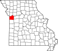
The area where Raytown now lies was developed throughout the 19th century and early 20th century as pioneers moved westward along the Three Trails in search of available fertile lands and water. It was added to the state of Missouri at a cost of $800 by a treaty signed in 1826. Jackson County, named after President Andrew Jackson, was formed in 1827.

A large section of the county, Township 49, was accidentally not offered for sale when the other townships were, and so was called "The Lost Township". People moved into the township and squatted until the township was surveyed and the land sold in 1843.

The pioneers and travelers moving westward down the Three Trails discovered an area of high, wooded ridges, in the Raytown area, that reminded them of their former homes in the Blue Ridge Mountains. The land was named Blue Ridge, with the bordering bodies of waters called the Big Blue and the Little Blue rivers.

The Rice-Tremonti Home, which still stands in Raytown today, was built on the Santa Fe Trail in 1844 by Archibald Rice and his family. [4]

William Ray established a blacksmith shop on the Santa Fe Trail in Jackson County in about 1848. The settlement around the blacksmith shop was known first as "Ray's Town" and later as "Raytown" in 1854. [5] [6] (Now Fox's Drugs)

There is now a historical marker in Raytown at the corner of 63rd Street and Raytown Road showing the location of William Ray's shop.

In 1860, residents of Jackson County petitioned the county for a better road to connect southern Jackson County with Independence in northern Jackson County. The result was Raytown Road, which led north from High Grove Road, crossed the Little Blue River at the "rockford" (now inundated by Longview Lake) and joined the Santa Fe Trail at William Ray's blacksmith shop. Many portions of the original Raytown Road still are used today.
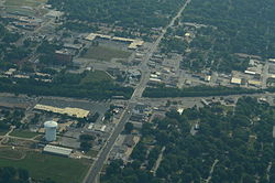
Raytown was incorporated July 17th 1950.

Geography

According to the United States Census Bureau, the city has a total area of 9.97 square miles (25.82 km2), of which 9.93 square miles (25.72 km2) is land and 0.04 square miles (0.10 km2) is water. [7]

Demographics

Historical population
CensusPop.Note
1960 17,083
1970 33,63296.9%
1980 31,831−5.4%
1990 30,601−3.9%
2000 30,388−0.7%
2010 29,526−2.8%
2020 30,0121.6%
U.S. Decennial Census

2020 census

The 2020 United States census [8] counted 30,012 people, 12,720 households, and 7,019 families in Raytown. The population density was 3,022.4 per square mile (1,166.9/km2). There were 13,640 housing units at an average density of 1,373.6 per square mile (530.3/km2). The racial makeup was 53.34% (16,007) white, 32.68% (9,807) black or African-American, 0.52% (155) Native American, 1.11% (333) Asian, 0.21% (63) Pacific Islander, 2.98% (894) from other races, and 9.17% (2,753) from two or more races. Hispanic or Latino of any race was 6.6% (1,924) of the population.

Of the 12,720 households, 22.4% had children under the age of 18; 34.8% were married couples living together; 36.4% had a female householder with no husband present. Of all households, 37.3% consisted of individuals and 9.6% had someone living alone who was 65 years of age or older. The average household size was 2.3 and the average family size was 3.0.

19.8% of the population was under the age of 18, 8.3% from 18 to 24, 24.6% from 25 to 44, 27.8% from 45 to 64, and 16.7% who were 65 years of age or older. The median age was 41.1 years. For every 100 females, the population had 89.4 males. For every 100 females ages 18 and older, there were 93.0 males.

The 2016-2020 5-year American Community Survey [9] estimates show that the median household income was $55,940 (with a margin of error of +/- $4,100) and the median family income was $71,461 (+/- $3,629). Males had a median income of $38,259 (+/- $4,989) versus $32,413 (+/- $1,439) for females. The median income for those above 16 years old was $34,618 (+/- $2,306). Approximately, 6.9% of families and 9.7% of the population were below the poverty line, including 18.0% of those under the age of 18 and 5.3% of those ages 65 or over.

2010 census

Raytown street map with annex dates RaytownStreetMap.jpg
Raytown street map with annex dates

As of the census [10] of 2010, there were 29,526 people, 12,104 households, and 7,701 families living in the city. The population density was 2,973.4 inhabitants per square mile (1,148.0/km2). There were 13,276 housing units at an average density of 1,337.0 per square mile (516.2/km2). The racial makeup of the city was 67.7% White, 25.1% African American, 0.5% Native American, 1.0% Asian, 0.2% Pacific Islander, 1.9% from other races, and 3.5% from two or more races. Hispanic or Latino of any race were 5.1% of the population.

There were 12,104 households, of which 30.3% had children under the age of 18 living with them, 41.4% were married couples living together, 16.9% had a female householder with no husband present, 5.3% had a male householder with no wife present, and 36.4% were non-families. 30.7% of all households were made up of individuals, and 12.3% had someone living alone who was 65 years of age or older. The average household size was 2.39 and the average family size was 2.97.

The median age in the city was 40.3 years. 23.1% of residents were under the age of 18; 8% were between the ages of 18 and 24; 24.9% were from 25 to 44; 27.8% were from 45 to 64; and 16.2% were 65 years of age or older. The gender makeup of the city was 47.3% male and 52.7% female.

2000 census

As of the census [2] of 2000, there were 30,388 people, 12,855 households, and 8,304 families living in the city. The population density was 3,065.9 inhabitants per square mile (1,183.8/km2). There were 13,309 housing units at an average density of 1,342.8 per square mile (518.5/km2). The racial makeup of the city was 84.2% White, 11.7% African American, 0.4% Native American, 0.8% Asian, 0.2% Pacific Islander, 0.9% from other races, and 1.9% from two or more races. Hispanic or Latino of any race were 2.3% of the population.

There were 12,855 households, out of which 27.1% had children under the age of 18 living with them, 48.6% were married couples living together, 12.6% had a female householder with no husband present, and 35.4% were non-families. 30.3% of all households were made up of individuals, and 13.3% had someone living alone who was 65 years of age or older. The average household size was 2.32 and the average family size was 2.88.

In the city, the population was spread out, with 22.6% under the age of 18, 7.8% from 18 to 24, 27.9% from 25 to 44, 22.5% from 45 to 64, and 19.3% who were 65 years of age or older. The median age was 40 years. For every 100 females, there were 88.7 males. For every 100 females age 18 and over, there were 83.6 males.

The median income for a household in the city was $41,949, and the median income for a family was $50,952. Males had a median income of $33,828 versus $26,745 for females. The per capita income for the city was $21,634. About 3.1% of families and 5.0% of the population were below the poverty line, including 6.0% of those under age 18 and 2.6% of those age 65 or over.

Economy

Top employers

According to the town's 2014 Chamber of Commerce report, [11] the top employers in the city are:

#Employer# of Employees
1Raytown Quality Schools1,300
2 Wal-Mart 400
3 Hy-Vee Food & Drug Store 350
4USA 800309
5 KCP&L 300
6Stratford Development Corporation235
7 KC Chiefs Football Club 192
8Southeast Enterprises, Inc.190
9City of Raytown153
10 Kansas City Zoo 151
11H & H Color Lab150
12 Cosentino's Food Stores 150
13Blue Ridge Bank and Trust Co.150
14 Two Rivers Behavioral Health System 149
15Shamrock Cabinet & Fixtures Corp100

Education

The Raytown C-2 School District serves the vast majority of Raytown; But the very slim portion of the southern part of Raytown goes to the Hickman Mills C-1 School District.

The Raytown C-2 School District operates public schools, including Raytown High School and Raytown South High School. [12]

Raytown has a public library, a branch of the Mid-Continent Public Library. [13]

The 1980s television series Mama's Family took place in the fictional location of Raytown, although the U.S. state where Raytown is located is never mentioned. Based on the accents, it was set in the South or Midwest. [14]

Related Research Articles

<span class="mw-page-title-main">Jackson, Alabama</span> City in Alabama, United States

Jackson is a city in Clarke County, Alabama, United States. The population was 5,557 at the 2020 census. It was one of three wet settlements in an otherwise-dry county.

<span class="mw-page-title-main">Florala, Alabama</span> Town in Alabama, United States

Florala is a town in Covington County, Alabama, United States. At the 2020 census, the population was 1,923.

<span class="mw-page-title-main">Monmouth, Iowa</span> City in Iowa, United States

Monmouth is a city in Jackson County, Iowa, United States. The population was 129 at the time of the 2020 census.

<span class="mw-page-title-main">Springbrook, Iowa</span> City in Iowa, United States

Springbrook is a small city in central Jackson County, Iowa, United States. The population was 143 at the time of the 2020 census.

<span class="mw-page-title-main">Jackson Junction, Iowa</span> City in Iowa, United States

Jackson Junction is a city in Winneshiek County, Iowa, United States. The population was 37 at the time of the 2020 census.

<span class="mw-page-title-main">Lakefield, Minnesota</span> City in Minnesota, United States

Lakefield is a city in Jackson County, Minnesota, United States. The population was 1,694 at the 2010 census.

Jackson Township is a township in Scott County, Minnesota, United States. Organized in 1858, Jackson Township's population was 1,361 at the 2000 census. While the origin of its name is not recorded, it is most likely named after President Andrew Jackson.

<span class="mw-page-title-main">Jackson, Missouri</span> City in Missouri, United States

Jackson is a city in and the county seat of Cape Girardeau County, Missouri, United States. It is a principal city of the Cape Girardeau–Jackson, MO-IL Metropolitan Statistical Area. The population of Jackson was 15,481 at the 2020 census.

<span class="mw-page-title-main">Belton, Missouri</span> City in Missouri, United States

Belton is a city in northwestern Cass County, Missouri, United States. The population was 23,116 at the 2010 census.

<span class="mw-page-title-main">Grain Valley, Missouri</span> City in Missouri, United States

Grain Valley is a city in Jackson County, Missouri, United States. Grain Valley is located in the Kansas City Metropolitan Area and is a suburb of Kansas City. The population was 12,854 at the 2010 census and an estimated 15,627 in 2020. It is 23 miles (37 km) east of downtown Kansas City.

<span class="mw-page-title-main">Grandview, Missouri</span> City in Missouri, United States

Grandview is a city in Jackson County, Missouri, United States. The population was 24,475 at the 2010 census. It is part of the Kansas City metropolitan area.

<span class="mw-page-title-main">Lake Tapawingo, Missouri</span> City in Missouri, United States

Lake Tapawingo is a city in Jackson County, Missouri, United States. The population was 730 at the 2010 census.

<span class="mw-page-title-main">Levasy, Missouri</span> City in Missouri, United States

Levasy is a city in Jackson County, Missouri, United States. The population was 83 at the 2010 census. It is part of the Kansas City metropolitan area.

<span class="mw-page-title-main">River Bend, Missouri</span> Village in Missouri, United States

River Bend is a village in Jackson County, Missouri, United States. The population was 3 at the 2020 census. It is the only part of Jackson County that lies north of the Missouri River. In 1951, the Missouri River was relocated to a new channel, creating River Bend,. The county line still follows the original riverbed. It is part of the Kansas City metropolitan area. The mayor is Alex Dockler.

<span class="mw-page-title-main">Butte Falls, Oregon</span> City in Oregon, United States

Butte Falls is a city in Jackson County, Oregon, United States. The population was 423 at the 2010 census. As of July 1, 2018, the city's population was estimated to be 450.

<span class="mw-page-title-main">Banks Township, Indiana County, Pennsylvania</span> Township in Pennsylvania, United States

Banks Township is a township in Indiana County, Pennsylvania, United States. The population was 914 at the 2020 census. It was named after William Banks, a well-known Indiana attorney. It contains the communities of Flora, Horton, Johnsonburg, Keal Run, Lochvale, Madeline, Raytown, Smithville, and Urey.

<span class="mw-page-title-main">Jackson Township, York County, Pennsylvania</span> Township in Pennsylvania, United States

Jackson Township is a township in York County, Pennsylvania, United States. The population was 8,737 at the 2020 census. It was founded in 1853 from parts of Paradise Township. Jackson Township education is served by the Spring Grove Area School District. Police coverage is provided by Northern York County Regional Police Department, and EMS is provided by Spring Grove Area Ambulance. The township is home to York Airport.

<span class="mw-page-title-main">Kadoka, South Dakota</span> City in South Dakota, United States

Kadoka is a city in, and the county seat of, Jackson County, South Dakota, United States. The population was 543 at the 2020 census. The town occupies about 2.3 square miles.

<span class="mw-page-title-main">Zwingle, Iowa</span> City in Iowa, United States

Zwingle is a city in Dubuque and Jackson counties in the U.S. state of Iowa. The population was 84 at the time of the 2020 census, down from 100 in 2000.

<span class="mw-page-title-main">Summit Township, Jackson County, Michigan</span> Civil township in Michigan, United States

Summit Township is a civil township of Jackson County in the U.S. state of Michigan. The population was 22,508 at the 2010 census.

References

  1. "ArcGIS REST Services Directory". United States Census Bureau. Retrieved August 28, 2022.
  2. 1 2 "U.S. Census website". United States Census Bureau . Retrieved January 31, 2008.
  3. "US Board on Geographic Names". United States Geological Survey. October 25, 2007. Retrieved January 31, 2008.
  4. Rice-Tremonti Home
  5. History of Raytown
  6. Raytown Chamber of Commerce – History
  7. "US Gazetteer files 2010". United States Census Bureau. Archived from the original on January 25, 2012. Retrieved July 8, 2012.
  8. "Explore Census Data". data.census.gov. Retrieved December 17, 2023.
  9. "Explore Census Data". data.census.gov. Retrieved December 17, 2023.
  10. "U.S. Census website". United States Census Bureau . Retrieved July 8, 2012.
  11. "Major Area Employers" (PDF). Retrieved February 27, 2017.
  12. "Raytown C-2 School District". Great Schools. Retrieved March 18, 2018.
  13. "Locations". Mid-Continent Public Library. Retrieved March 17, 2018.
  14. Wenzel, John (2013). "Why So Serious, Vicki Lawrence? The Denver Post Newspaper, Oct 2, 2013". Denver, CO: Digital First Media, MediaNews Group, Journal Register Company.