River Bend, Missouri

Last updated

River Bend, Missouri
Jackson County Missouri Incorporated and Unincorporated areas River Bend Highlighted.svg
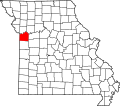
Location of River Bend, Missouri
Coordinates: 39°10′44″N94°23′42″W / 39.17889°N 94.39500°W / 39.17889; -94.39500 [1]
Country United States
State Missouri
County Jackson
Government
   Mayor Alex Dockler
Area
[2]
  Total1.75 sq mi (4.52 km2)
  Land1.52 sq mi (3.94 km2)
  Water0.23 sq mi (0.58 km2)
Elevation
[1]
735 ft (224 m)
Population
 (2020)
  Total3
  Density1.97/sq mi (0.76/km2)
Time zone UTC-6 (Central (CST))
  Summer (DST) UTC-5 (CDT)
FIPS code 29-62056 [3]
GNIS feature ID1699794 [1]

River Bend is a village in Jackson County, Missouri, United States. The population was 3 at the 2020 census. It is the only part of Jackson County that lies north of the Missouri River. In 1951, the Missouri River was relocated to a new channel, creating River Bend, (also known as Liberty Bend). The county line still follows the original riverbed. It is part of the Kansas City metropolitan area. The mayor is Alex Dockler.

Contents

Geography

According to the United States Census Bureau, the village has a total area of 1.75 square miles (4.53 km2), of which 1.52 square miles (3.94 km2) is land and 0.23 square miles (0.60 km2) is water. [4]

Demographics

Historical population
CensusPop.Note
2000 10
2010 100.0%
2020 3−70.0%
U.S. Decennial Census [5]

2010 census

As of the census [6] of 2010, there were 10 people, 5 households, and 3 families living in the village. The population density was 6.6 inhabitants per square mile (2.5/km2). There were 5 housing units at an average density of 3.3 per square mile (1.3/km2). The racial makeup of the village was 100.0% White.

There were 5 households, of which 60.0% were married couples living together and 40.0% were non-families. 20.0% of all households were made up of individuals. The average household size was 2.00 and the average family size was 2.33.

The median age in the village was 52.5 years. 0.0% of residents were under the age of 18; 0.0% were between the ages of 18 and 24; 20% were from 25 to 44; 70% were from 45 to 64; and 10% were 65 years of age or older. The gender makeup of the village was 40.0% male and 60.0% female.

2000 census

As of the census [3] of 2000, there were 10 people, 5 households, and 4 families living in the village. The population density was 7.6 people per square mile (2.9/km2). There were 5 housing units at an average density of 3.8 per square mile (1.5/km2). The racial makeup of the village was 100.00% White.

There were 5 households, out of which none had children under the age of 18 living with them, 80.0% were married couples living together, and 20.0% were non-families. 20.0% of all households were made up of individuals, and none had someone living alone who was 65 years of age or older. The average household size was 2.00 and the average family size was 2.25.

In the village, the population was spread out, with 10.0% from 18 to 24, 30.0% from 25 to 44, 40.0% from 45 to 64, and 20.0% who were 65 years of age or older. The median age was 45 years. For every 100 females, there were 66.7 males. For every 100 females age 18 and over, there were 66.7 males.

The median income for a household in the village was $70,000, and the median income for a family was $70,000. Males had a median income of $46,667 versus $41,250 for females. The per capita income for the village was $27,820. None of the population and none of the families were below the poverty line.

Related Research Articles

<span class="mw-page-title-main">Chain-O-Lakes, Missouri</span> Village in Missouri, United States

Chain-O-Lakes is a village in Roaring River Township of southeast Barry County, Missouri, United States. The population was 126 at the 2010 census.

<span class="mw-page-title-main">McBaine, Missouri</span> Town in Missouri, United States

McBaine is a village in Boone County, Missouri, United States. It is part of the Columbia, Missouri Metropolitan Statistical Area. The population was 10 at the 2010 census. McBaine is located just north of Eagle Bluffs Conservation Area and within sight of The Big Tree.

<span class="mw-page-title-main">Parkway, Missouri</span> Village in Missouri, United States

Parkway is a village in Franklin County, Missouri, United States. The population was 439 at the 2010 census.

<span class="mw-page-title-main">Gentry, Missouri</span> Village in Missouri, United States

Gentry is a village in Gentry County, Missouri, United States. The population was 56 at the 2020 census.

<span class="mw-page-title-main">Evergreen, Missouri</span> Village in Missouri, United States

Evergreen is a village in Laclede County, Missouri, United States. The population was 28 at the 2010 census. It was named Twin Bridges at the 2000 census.

<span class="mw-page-title-main">Cave, Missouri</span> City in Missouri, United States

Cave is a City in Lincoln County, Missouri, United States. The population was 5 at the 2010 census. However, As of the 2020 census, the population is 0, making it the smallest incorporated community in the U.S state of Missouri. It is the 939th largest city in Missouri and the 19481st largest city in the United States. Cave is currently declining at a rate of 0.00% annually and its population has decreased by 0.00% since the most recent census, which recorded a population of 5 in 2010.

<span class="mw-page-title-main">Shoal Creek Estates, Missouri</span> Village in Missouri, United States

Shoal Creek Estates is a village in Newton County, Missouri, United States. The population was 76 at the 2010 census. It is part of the Joplin, Missouri Metropolitan Statistical Area.

<span class="mw-page-title-main">Biehle, Missouri</span> Census-designated place in Missouri, United States

Biehle was a village in Perry County, Missouri, United States. The population was 47 at the 2020 census. The community was founded in 1876 and named after the Biehle family.

<span class="mw-page-title-main">Aldrich, Missouri</span> Village in Missouri, United States

Aldrich is a village in southwestern Polk County, Missouri, United States. The population was 80 at the 2010 census. It is part of the Springfield, Missouri Metropolitan Statistical Area.

<span class="mw-page-title-main">Malta Bend, Missouri</span> City in Missouri, United States

Malta Bend is a city in Saline County, Missouri, United States. The population was 250 at the 2010 census.

<span class="mw-page-title-main">Arbela, Missouri</span> Village in Missouri, United States

Arbela is a village in Scotland County, Missouri, United States. As of the 2020 census, its population was 24.

<span class="mw-page-title-main">Country Life Acres, Missouri</span> Village in Missouri, United States

Country Life Acres is a village in St. Louis County, Missouri, United States. The population was 74 at the 2010 census.

<span class="mw-page-title-main">Glen Echo Park, Missouri</span> Village in Missouri, United States

Glen Echo Park is a village in St. Louis County, Missouri, United States. The population was 160 at the 2010 census. The community took its name from the Glen Echo Country Club. Glen Echo Park is set to consolidate with the neighboring city of Normandy on February 8, 2024.

<span class="mw-page-title-main">Westwood, Missouri</span> Village in Missouri, United States

Westwood is a village in west St. Louis County, Missouri, United States. The population was 316 at the 2020 census.

<span class="mw-page-title-main">McCord Bend, Missouri</span> Village in Missouri, United States

McCord Bend is a village in Stone County, Missouri, United States. The population was 212 at the 2020 census. It is part of the Branson, Missouri Micropolitan Statistical Area.

<span class="mw-page-title-main">Stotesbury, Missouri</span> Village in Missouri, United States

Stotesbury is a village in northwest Vernon County, Missouri, United States. The population was 18 at the 2010 census.

<span class="mw-page-title-main">South Bend, Nebraska</span> Village in Nebraska, United States

South Bend is a village in Cass County, Nebraska, United States. The population was 92 at the 2020 census. The main landmark is a pedestrian bridge across the Platte River which leads to Schramm Park State Recreation Area. It was built in 2004 on the pillars of the abandoned Rock Island Railroad bridge. Thirty-five trains a day—most of them coal trains—still pass through the area on the BNSF Railway main.

<span class="mw-page-title-main">Champ, Missouri</span> Village in Missouri, United States

Champ is a village in St. Louis County, Missouri, United States. The population was 10 at the 2020 census.

<span class="mw-page-title-main">Indian Point, Missouri</span> Village in Missouri, United States

Indian Point is a village in Stone County, Missouri, United States. The population was 550 at the 2020 census. It is part of the Branson, Missouri Micropolitan Statistical Area.

<span class="mw-page-title-main">Argyle, Missouri</span> Town in Missouri, United States

Argyle is a town in Maries and Osage counties in the U.S. state of Missouri. The population was 144 at the 2020 census.

References

  1. 1 2 3 U.S. Geological Survey Geographic Names Information System: River Bend, Missouri
  2. "ArcGIS REST Services Directory". United States Census Bureau. Retrieved August 28, 2022.
  3. 1 2 "U.S. Census website". United States Census Bureau . Retrieved January 31, 2008.
  4. "US Gazetteer files 2010". United States Census Bureau. Archived from the original on January 25, 2012. Retrieved July 8, 2012.
  5. "Census of Population and Housing". Census.gov. Retrieved June 4, 2015.
  6. "U.S. Census website". United States Census Bureau . Retrieved July 8, 2012.