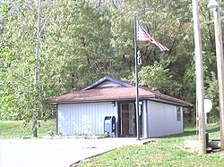
Missouri City, Missouri | |
---|---|
Coordinates: 39°14′18″N94°18′10″W / 39.23833°N 94.30278°W Coordinates: 39°14′18″N94°18′10″W / 39.23833°N 94.30278°W | |
Country | United States |
State | Missouri |
County | Clay |
Area | |
• Total | 1.10 sq mi (2.84 km2) |
• Land | 1.10 sq mi (2.84 km2) |
• Water | 0.00 sq mi (0.00 km2) |
Elevation | 892 ft (272 m) |
Population (2020) | |
• Total | 217 |
• Density | 197.99/sq mi (76.41/km2) |
Time zone | UTC-6 (Central (CST)) |
• Summer (DST) | UTC-5 (CDT) |
ZIP code | 64072 |
Area code | 816 |
FIPS code | 29-48980 [3] |
GNIS feature ID | 2395355 [2] |
Missouri City is a city in Clay County, Missouri, United States. The population was 217 at the 2020 census. [4] It is part of the Kansas City metropolitan area.
Missouri City was originally named Atchison. [5] The earliest known use of the name was on a deed to a building from 1820. The land was possessed by French fur traders Antoine Laffond and Bernard Laffond as early as January 24, 1807. The name had changed to Missouri City by December 5, 1857. [6]
A special charter town of about 600 inhabitants on the Missouri River, in Clay County, six miles from Liberty. The Wabash Railroad runs through it. The beginning of the place was in Williams' Landing, and a ferry established by a man named Shrewsbury Williams, at the mouth of Rose's branch, about the year 1834. About 1846 there were a dozen houses in the place and it was called Richfield. Some time later a bar formed opposite the landing and a stock company laid off a town below which they called St. Bernard. Later still another town was laid off and called New Richfield, and not long after another town was laid off and called Atchison. In 1859 St. Bernard, Richfield and Atchison were incorporated as Missouri City. There was at one time a tobacco factory in the place, and a large quantity of hemp was shipped from there. During the Civil War it was the prey of bushwhackers and jayhawkers, and its business was almost entirely destroyed, but since the building of the Wabash Railroad a considerable business has been attracted to it.
— Howard Louis Conard, Encyclopedia of the History of Missouri (1901) [7]
The Missouri City Savings Bank Building and Meeting Hall was listed on the National Register of Historic Places in 2010. [8]
According to the United States Census Bureau, the city has a total area of 1.14 square miles (2.95 km2), of which 1.01 square miles (2.62 km2) is land and 0.13 square miles (0.34 km2) is water. [9]
Census | Pop. | Note | %± |
---|---|---|---|
1860 | 480 | — | |
1870 | 572 | 19.2% | |
1880 | 581 | 1.6% | |
1890 | 422 | −27.4% | |
1900 | 398 | −5.7% | |
1910 | 559 | 40.5% | |
1920 | 292 | −47.8% | |
1930 | 376 | 28.8% | |
1940 | 323 | −14.1% | |
1950 | 314 | −2.8% | |
1960 | 404 | 28.7% | |
1970 | 375 | −7.2% | |
1980 | 343 | −8.5% | |
1990 | 348 | 1.5% | |
2000 | 295 | −15.2% | |
2010 | 267 | −9.5% | |
2020 | 217 | −18.7% | |
U.S. Decennial Census [10] |
As of the census [11] of 2010, there were 267 people, 116 households, and 68 families residing in the city. The population density was 264.4 inhabitants per square mile (102.1/km2). There were 133 housing units at an average density of 131.7 per square mile (50.8/km2). The racial makeup of the city was 89.9% White, 4.1% African American, 0.7% Native American, 0.4% Asian, and 4.9% from two or more races. Hispanic or Latino of any race were 2.2% of the population.
There were 116 households, of which 25.9% had children under the age of 18 living with them, 44.0% were married couples living together, 5.2% had a female householder with no husband present, 9.5% had a male householder with no wife present, and 41.4% were non-families. 31.0% of all households were made up of individuals, and 9.5% had someone living alone who was 65 years of age or older. The average household size was 2.30 and the average family size was 2.79.
The median age in the city was 46.2 years. 17.6% of residents were under the age of 18; 8.6% were between the ages of 18 and 24; 21.7% were from 25 to 44; 38.9% were from 45 to 64; and 13.1% were 65 years of age or older. The gender makeup of the city was 54.3% male and 45.7% female.
As of the census [3] of 2000, there were 295 people, 110 households, and 75 families residing in the city. The population density was 290.5 inhabitants per square mile (112.2/km2). There were 120 housing units at an average density of 118.2 per square mile (45.6/km2). The racial makeup of the city was 93.56% White, 2.71% African American, and 3.73% from two or more races.
There were 110 households, out of which 29.1% had children under the age of 18 living with them, 52.7% were married couples living together, 8.2% had a female householder with no husband present, and 31.8% were non-families. 23.6% of all households were made up of individuals, and 7.3% had someone living alone who was 65 years of age or older. The average household size was 2.68 and the average family size was 3.23.
In the city the population was spread out, with 26.1% under the age of 18, 8.1% from 18 to 24, 29.8% from 25 to 44, 26.8% from 45 to 64, and 9.2% who were 65 years of age or older. The median age was 37 years. For every 100 females, there were 121.8 males. For every 100 females age 18 and over, there were 107.6 males.
The median income for a household in the city was $41,875, and the median income for a family was $45,000. Males had a median income of $30,357 versus $24,554 for females. The per capita income for the city was $17,693. About 4.2% of families and 7.6% of the population were below the poverty line, including 9.1% of those under the age of eighteen and none of those 65 or over.
Richfield is a city in Morton County, Kansas, United States. As of the 2020 census, the population of the city was 30.
Fairfax is a city in Clark Township, Atchison County, Missouri, United States. The population was 648 at the 2020 census.
Rock Port is a city in, and the county seat of, Atchison County, Missouri, United States. The population was 1,278 at the 2020 census.
Watson is a village in Nishnabotna Township, Atchison County, Missouri, United States. The population was 61 at the 2020 census. It is the westernmost settlement in the state of Missouri, about 120 miles northwest of Kansas City.
Westboro is a city in Lincoln Township, Atchison County, Missouri, United States. The population was 116 at the 2020 census.
Cleveland is a city in Cass County, Missouri, United States. The population was 661 at the 2010 census. It is part of the Kansas City metropolitan area.
Mosby is a city in Clay County, Missouri, United States, along the Fishing River. The population was 101 at the 2020 census. It is part of the Kansas City metropolitan area.
Calhoun is a city in Henry County, Missouri, United States. The population was 469 at the 2010 census.
Arcadia is a city in Iron County, Missouri, United States. The population was 618 at the 2020 census.
Pilot Knob is a city in northeast Iron County, Missouri, United States. The population was 671 at the 2020 census. It lies eighteen miles south-east of Belgrade and twenty-seven miles north-east of Centerville.
Baring is a city in northern Knox County, Missouri, United States. As of the 2020 census, its population is 125.
Bucklin is a city in southeast Linn County, Missouri, United States. The population was 413 at the 2020 census.
Centerville is a city in Reynolds County, Missouri, United States, situated along the West Fork of the Black River. The population was 167 at the 2020 census. It is the county seat of Reynolds County.
Winona is a city in southeast Shannon County, Missouri, United States. The population was 950 at the 2020 census.
West Alton is a city in St. Charles County, Missouri, United States. The population was 359 at the 2020 census. It is located at the tip of the peninsula formed by the confluence of the Missouri and Mississippi Rivers and is directly across Alton, Illinois.
Iron Mountain Lake is a city in St. Francois County, Missouri, United States. The population was 737 at the 2010 census.
Northwoods is a city in St. Louis County, Missouri, United States. The population was 4,227 at the 2010 census.
Velda City is a city in St. Louis County, Missouri, United States. The population was 1,420 at the 2010 census.
Stoutland is a village in Camden and Laclede counties in the U.S. state of Missouri. The population was 192 at the 2010 census.
Blackburn is a city in Lafayette and Saline counties in the U.S. state of Missouri and is part of the Kansas City metropolitan area. The population was 249 at the 2010 census.
{{cite web}}
: CS1 maint: bot: original URL status unknown (link)