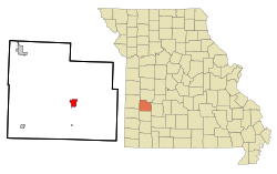
Stockton, Missouri | |
---|---|
Coordinates: 37°41′49″N93°47′46″W / 37.69694°N 93.79611°W [1] | |
Country | United States |
State | Missouri |
County | Cedar |
Area | |
• Total | 2.16 sq mi (5.58 km2) |
• Land | 2.12 sq mi (5.48 km2) |
• Water | 0.04 sq mi (0.10 km2) |
Elevation | 974 ft (297 m) |
Population (2020) | |
• Total | 1,683 |
• Density | 794.99/sq mi (306.98/km2) |
Time zone | UTC-6 (Central (CST)) |
• Summer (DST) | UTC-5 (CDT) |
ZIP code | 65785 |
Area code | 417 |
GNIS feature ID | 2395973 [1] |
Stockton is a city in Cedar County, Missouri, United States. The population was 1,683 at the 2020 census. [3] It is the county seat of Cedar County. [4]
Stockton was platted in 1846. [5] It was originally named Lancaster, but was renamed Fremont in 1847 in honor of John C. Frémont. [6] In 1857 it was renamed again, in honor of Robert F. Stockton. [7]
The Stockton Community Building is listed on the National Register of Historic Places. [8]
According to the United States Census Bureau, the city has a total area of 2.14 square miles (5.54 km2), of which 2.10 square miles (5.44 km2) is land and 0.04 square miles (0.10 km2) is water. [9]
The town lies just west of the Stockton Lake dam, [10] approximately 40 miles (64 km) northwest of Springfield. [11]
Climate data for Stockton, Missouri (Stockton Dam) (1991–2020 normals, extremes 1970–present) | |||||||||||||
---|---|---|---|---|---|---|---|---|---|---|---|---|---|
Month | Jan | Feb | Mar | Apr | May | Jun | Jul | Aug | Sep | Oct | Nov | Dec | Year |
Record high °F (°C) | 74 (23) | 80 (27) | 87 (31) | 96 (36) | 93 (34) | 104 (40) | 108 (42) | 109 (43) | 106 (41) | 92 (33) | 83 (28) | 78 (26) | 109 (43) |
Mean maximum °F (°C) | 65.2 (18.4) | 69.8 (21.0) | 77.5 (25.3) | 82.6 (28.1) | 87.8 (31.0) | 93.5 (34.2) | 98.0 (36.7) | 99.2 (37.3) | 93.5 (34.2) | 85.4 (29.7) | 74.8 (23.8) | 66.1 (18.9) | 100.4 (38.0) |
Mean daily maximum °F (°C) | 43.0 (6.1) | 48.4 (9.1) | 57.9 (14.4) | 67.9 (19.9) | 76.3 (24.6) | 85.1 (29.5) | 90.0 (32.2) | 89.8 (32.1) | 81.9 (27.7) | 70.6 (21.4) | 58.0 (14.4) | 47.3 (8.5) | 68.0 (20.0) |
Daily mean °F (°C) | 33.1 (0.6) | 37.5 (3.1) | 46.7 (8.2) | 56.5 (13.6) | 66.2 (19.0) | 75.5 (24.2) | 80.1 (26.7) | 79.0 (26.1) | 70.8 (21.6) | 59.2 (15.1) | 47.7 (8.7) | 37.8 (3.2) | 57.5 (14.2) |
Mean daily minimum °F (°C) | 23.3 (−4.8) | 26.6 (−3.0) | 35.4 (1.9) | 45.1 (7.3) | 56.2 (13.4) | 66.0 (18.9) | 70.1 (21.2) | 68.2 (20.1) | 59.7 (15.4) | 47.9 (8.8) | 37.4 (3.0) | 28.3 (−2.1) | 47.0 (8.3) |
Mean minimum °F (°C) | 3.0 (−16.1) | 9.4 (−12.6) | 18.0 (−7.8) | 29.9 (−1.2) | 40.2 (4.6) | 53.6 (12.0) | 59.7 (15.4) | 57.0 (13.9) | 43.8 (6.6) | 30.4 (−0.9) | 20.6 (−6.3) | 9.5 (−12.5) | −1.6 (−18.7) |
Record low °F (°C) | −16 (−27) | −15 (−26) | −2 (−19) | 19 (−7) | 30 (−1) | 42 (6) | 47 (8) | 47 (8) | 29 (−2) | 19 (−7) | 5 (−15) | −18 (−28) | −18 (−28) |
Average precipitation inches (mm) | 1.95 (50) | 2.15 (55) | 3.06 (78) | 4.82 (122) | 5.90 (150) | 5.14 (131) | 4.32 (110) | 3.63 (92) | 4.13 (105) | 3.88 (99) | 3.38 (86) | 2.52 (64) | 44.88 (1,140) |
Average snowfall inches (cm) | 3.9 (9.9) | 1.0 (2.5) | 1.4 (3.6) | 0.0 (0.0) | 0.0 (0.0) | 0.0 (0.0) | 0.0 (0.0) | 0.0 (0.0) | 0.0 (0.0) | 0.0 (0.0) | 0.2 (0.51) | 0.4 (1.0) | 6.9 (18) |
Average precipitation days (≥ 0.01 in) | 7.0 | 6.7 | 9.4 | 10.5 | 11.7 | 10.8 | 8.6 | 7.4 | 7.2 | 9.2 | 8.3 | 6.1 | 102.9 |
Average snowy days (≥ 0.1 in) | 1.4 | 0.8 | 0.3 | 0.0 | 0.0 | 0.0 | 0.0 | 0.0 | 0.0 | 0.0 | 0.2 | 1.0 | 3.7 |
Source: NOAA [12] [13] |
Census | Pop. | Note | %± |
---|---|---|---|
1880 | 407 | — | |
1890 | 508 | 24.8% | |
1900 | 555 | 9.3% | |
1910 | 590 | 6.3% | |
1920 | 696 | 18.0% | |
1930 | 647 | −7.0% | |
1940 | 801 | 23.8% | |
1950 | 811 | 1.2% | |
1960 | 838 | 3.3% | |
1970 | 1,063 | 26.8% | |
1980 | 1,432 | 34.7% | |
1990 | 1,579 | 10.3% | |
2000 | 1,960 | 24.1% | |
2010 | 1,819 | −7.2% | |
2020 | 1,683 | −7.5% | |
U.S. Decennial Census [14] |
As of the census [15] of 2010, there were 1,819 people, 774 households, and 470 families living in the city. The population density was 866.2 inhabitants per square mile (334.4/km2). There were 949 housing units at an average density of 451.9 per square mile (174.5/km2). The racial makeup of the city was 97.0% White, 0.1% African American, 0.8% Native American, 0.4% Asian, 0.1% Pacific Islander, 0.1% from other races, and 1.6% from two or more races. Hispanic or Latino of any race were 1.4% of the population.
There were 774 households, of which 30.5% had children under the age of 18 living with them, 43.9% were married couples living together, 12.0% had a female householder with no husband present, 4.8% had a male householder with no wife present, and 39.3% were non-families. 35.3% of all households were made up of individuals, and 22% had someone living alone who was 65 years of age or older. The average household size was 2.26 and the average family size was 2.92.
The median age in the city was 43.7 years. 24.5% of residents were under the age of 18; 6.9% were between the ages of 18 and 24; 20% were from 25 to 44; 22.9% were from 45 to 64; and 25.9% were 65 years of age or older. The gender makeup of the city was 46.4% male and 53.6% female.
As of the census of 2000, there were 1,960 people, 814 households, and 473 families living in the city. The population density was 921.7 inhabitants per square mile (355.9/km2). There were 968 housing units at an average density of 455.2 per square mile (175.8/km2). The racial makeup of the city was 95.66% White, 0.41% African American, 0.51% Native American, 1.12% Asian, 0.51% from other races, and 1.79% from two or more races. Hispanic or Latino of any race were 1.94% of the population.
There were 814 households, out of which 25.4% had children under the age of 18 living with them, 46.8% were married couples living together, 8.6% had a female householder with no husband present, and 41.8% were non-families. 38.9% of all households were made up of individuals, and 23.7% had someone living alone who was 65 years of age or older. The average household size was 2.14 and the average family size was 2.85.
In the city, the population was spread out, with 27.5% under the age of 18, 6.7% from 18 to 24, 20.7% from 25 to 44, 18.7% from 45 to 64, and 26.4% who were 65 years of age or older. The median age was 41 years. For every 100 females, there were 93.1 males. For every 100 females age 18 and over, there were 77.4 males.
The median income for a household in the city was $25,353, and the median income for a family was $34,427. Males had a median income of $22,574 versus $19,688 for females. The per capita income for the city was $14,540. About 7.0% of families and 14.8% of the population were below the poverty line, including 21.0% of those under age 18 and 10.5% of those age 65 or over.
Stockton R-I School District operates one elementary school, one middle school and Stockton High School. [16]
The town has a lending library, a branch of the Cedar County Library District. [17]
El Dorado Springs is the largest city in Cedar County, Missouri, United States. The population was 3,493 at the 2020 census.
Jerico Springs is a village in Cedar County, Missouri, United States. The population was 160 at the 2020 census.
Everton is a city in southeast Dade County, Missouri, United States. The population was 273 at the 2020 census.
Battlefield is a city in Greene County, Missouri, United States. As of the 2020 census, the city's population was 5,990. It is part of the Springfield, Missouri Metropolitan Statistical Area. The town has no post office and shares the ZIP code (65619) with Brookline.
Cedar Hill Lakes is a village in Jefferson County, Missouri, United States. The population was 203 at the 2020 census.
Hillsboro is a city in Jefferson County, Missouri, United States. The population was 3,473 at the 2020 census, up from 2,821 in 2010. Hillsboro is the county seat of Jefferson County.
New Cambria is a city in Macon County, Missouri, United States. The population was 153 at the 2020 census.
Palmyra is a city in and the county seat of Marion County, Missouri, United States. The population was 3,595 at the 2010 census. It is part of the Hannibal Micropolitan Statistical Area.
Anderson is a city in McDonald County, Missouri, United States. The population was 1,961 at the 2010 census.
Hayti Heights is a city in eastern Pemiscot County in the bootheel of southeast Missouri, United States. The population was 515 at the 2020 census.
Bowling Green is a city and the county seat of in Pike County, Missouri, United States. The population was 5,334 at the 2010 census.
Tracy is a city in Platte County, Missouri within the United States, located along the Platte River. The population was 269 at the 2020 census. The city is part of the Kansas City metropolitan area.
Fair Play is a city in western Polk County, Missouri, United States. The population was 475 at the 2010 census. It is part of the Springfield, Missouri Metropolitan Statistical Area.
Humansville is a city in Polk County, Missouri, United States. As of the 2020 census, the city population was 965. It is part of the Springfield, Missouri Metropolitan Statistical Area. Carl Long is the current mayor, sworn in on October 7, 2019.
Miami is a city in Saline County, Missouri, United States. The population was 175 at the 2010 census.
Crystal Lake Park is a Missouri Class 4 city in St. Louis County, Missouri, United States. The population was 508 at the 2020 census.
Glendale is a city in St. Louis County, Missouri, United States. The population was 5,925 at the 2010 census.
Cabool is a city in Texas County, Missouri, United States. The population was 1,946 at the 2020 census.
Clarkson Valley is a city in St. Louis County, Missouri, United States. The population was 2,609 at the 2020 census.
Dardenne Prairie is a city in St. Charles County, Missouri, United States. The population was 12,743 at the 2020 census.
{{cite web}}
: CS1 maint: bot: original URL status unknown (link)