Centerville, Missouri

Last updated

Centerville, Missouri
Galena-253975.jpg
Galena from the West Fork Mine, near Centerville
Reynolds County Missouri Incorporated and Unincorporated areas Centerville Highlighted.svg
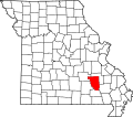
Location of Centerville, Missouri
Coordinates: 37°26′12″N90°57′37″W / 37.43667°N 90.96028°W / 37.43667; -90.96028
Country United States
State Missouri
County Reynolds
Area
[1]
  Total0.32 sq mi (0.84 km2)
  Land0.32 sq mi (0.83 km2)
  Water0.00 sq mi (0.01 km2)
Elevation
[2]
738 ft (225 m)
Population
 (2020)
  Total167
  Density523.51/sq mi (202.16/km2)
Time zone UTC-6 (Central (CST))
  Summer (DST) UTC-5 (CDT)
ZIP code
63633
Area code 573
FIPS code 29-12718 [3]
GNIS feature ID2393785 [2]

Centerville is a city in Reynolds County, Missouri, United States, situated along the West Fork of the Black River. The population was 167 at the 2020 census. [4] It is the county seat of Reynolds County. [5]

Contents

History

A post office called Centreville was established in 1846, and the name was changed to Centerville in 1892. [6] Centerville was named from its central location in the county. [7]

Geography

According to the United States Census Bureau, the city has a total area of 0.30 square miles (0.78 km2), all land. [8]

West Fork Lead Mine

The West Fork Mine is a lead-zinc-silver-copper mine located near Centerville. Initially developed by ASARCO, it reached full production of 3,400 tons/day of ore in August 1988. It is currently owned and operated by the Doe Run Company, which acquired the Missouri Lead Division operation of ASARCO in 1998. [9] The mine produces about 46,000 tons of lead, 6,800 tons zinc, and 3,900 kg of silver per year. [10]

Demographics

Historical population
CensusPop.Note
1960 163
1970 20928.2%
1980 24115.3%
1990 89−63.1%
2000 17192.1%
2010 19111.7%
2020 167−12.6%
U.S. Decennial Census [11]

2010 census

As of the census [12] of 2010, there were 191 people, 78 households, and 50 families living in the city. The population density was 636.7 inhabitants per square mile (245.8/km2). There were 99 housing units at an average density of 330.0 per square mile (127.4/km2). The racial makeup of the city was 95.29% White, 2.09% Black or African American, 0.52% Native American, and 2.09% from two or more races.

There were 78 households, of which 23.1% had children under the age of 18 living with them, 43.6% were married couples living together, 12.8% had a female householder with no husband present, 7.7% had a male householder with no wife present, and 35.9% were non-families. 30.8% of all households were made up of individuals, and 18% had someone living alone who was 65 years of age or older. The average household size was 2.31 and the average family size was 2.84.

The median age in the city was 44.5 years. 20.4% of residents were under the age of 18; 6.9% were between the ages of 18 and 24; 23% were from 25 to 44; 26.7% were from 45 to 64; and 23% were 65 years of age or older. The gender makeup of the city was 52.9% male and 47.1% female.

2000 census

As of the census [3] of 2000, there were 171 people, 70 households, and 46 families living in the city. The population density was 534.3 inhabitants per square mile (206.3/km2). There were 102 housing units at an average density of 318.7 per square mile (123.1/km2). The racial makeup of the city was 94.15% White, 3.51% Native American, and 2.34% from two or more races.

There were 70 households, out of which 20.0% had children under the age of 18 living with them, 54.3% were married couples living together, 10.0% had a female householder with no husband present, and 32.9% were non-families. 31.4% of all households were made up of individuals, and 7.1% had someone living alone who was 65 years of age or older. The average household size was 2.30 and the average family size was 2.85.

In the city, the population was spread out, with 17.5% under the age of 18, 15.2% from 18 to 24, 18.1% from 25 to 44, 31.6% from 45 to 64, and 17.5% who were 65 years of age or older. The median age was 44 years. For every 100 females, there were 111.1 males. For every 100 females age 18 and over, there were 107.4 males.

The median income for a household in the city was $23,864, and the median income for a family was $29,750. Males had a median income of $30,250 versus $30,000 for females. The per capita income for the city was $13,207. About 9.8% of families and 21.1% of the population were below the poverty line, including 56.0% of those under the age of eighteen and none of those 65 or over.

Education

Centerville R-I School District operates Centerville Elementary School. [13]

Centerville has a public library, a branch of the Reynolds County Library District. [14]

Related Research Articles

<span class="mw-page-title-main">Reynolds County, Missouri</span> County in Missouri, United States

Reynolds County is a county located in the Ozark Foothills Region in the Lead Belt of Missouri. As of the 2020 census, the population was 6,096. Its county seat is Centerville. The county was officially organized on February 25, 1845, and was named in honor of former Governor of Missouri Thomas Reynolds.

<span class="mw-page-title-main">Cincinnati, Iowa</span> City in Iowa, USA

Cincinnati is a city in Appanoose County, Iowa, United States. The population was 290 in the 2020 census, a decline from 428 in 2000.

<span class="mw-page-title-main">Exline, Iowa</span> City in Iowa, USA

Exline is a city in Appanoose County, Iowa, United States. The population was 160 in the 2020 census, a decline from 191 in 2000.

<span class="mw-page-title-main">Mystic, Iowa</span> City in Iowa, USA

Mystic is a city in Appanoose County, Iowa, United States. The population was 322 at the time of the 2020 census.

<span class="mw-page-title-main">Numa, Iowa</span> City in Iowa, USA

Numa is a city in Appanoose County, Iowa, United States. The population was 68 in the 2020 census, a decline from 109 in 2000.

<span class="mw-page-title-main">Rathbun, Iowa</span> City in Iowa, USA

Rathbun is a city in Appanoose County, Iowa, United States. The population was 43 at the time of the 2020 census.

<span class="mw-page-title-main">Kearney, Missouri</span> City in Missouri, United States

Kearney is a city in Clay County, Missouri, United States. The population per the 2020 U.S. Census was 10,404. The city was the birthplace of Jesse James, and there is an annual festival in the third weekend of September to recognize the outlaw. It is part of the Kansas City metropolitan area.

<span class="mw-page-title-main">Pilot Knob, Missouri</span> City in Missouri, United States

Pilot Knob is a city in northeast Iron County, Missouri, United States. The population was 671 at the 2020 census. It lies eighteen miles south-east of Belgrade and twenty-seven miles north-east of Centerville.

<span class="mw-page-title-main">Alba, Missouri</span> City in Missouri, United States

Alba is a city in Jasper County, Missouri, United States. The population was 544 at the 2020 census.

<span class="mw-page-title-main">Purcell, Missouri</span> City in Missouri, United States

Purcell is a city in Jasper County, Missouri, United States. As of the 2020 census, the city population was 318.

<span class="mw-page-title-main">Edina, Missouri</span> City in Missouri, United States

Edina is a city in Knox County, Missouri, United States, between the North and South Forks of the South Fabius River. As of the 2020 census, its population was 1,012. It is the county seat of Knox County.

<span class="mw-page-title-main">Crystal Lakes, Missouri</span> City in Missouri, United States

Crystal Lakes is a city in western Ray County, Missouri, and part of the Kansas City metropolitan area within the United States. The population was 390 at the 2020 census.

<span class="mw-page-title-main">Ellington, Missouri</span> City in Missouri, United States

Ellington is a city in Reynolds County, Missouri, United States. The population was 790 at the 2020 census. In 1925, the infamous Tri-State Tornado began just northwest of Ellington.

<span class="mw-page-title-main">Bloomsdale, Missouri</span> City in Missouri, United States

Bloomsdale is a city in Ste. Genevieve County, Missouri, United States. The population was 639 at the 2020 census.

<span class="mw-page-title-main">Grant City, Missouri</span> City in Missouri, United States

Grant City is a city in, and the county seat of, Worth County, Missouri, United States. The population was 859 at the 2010 census.

<span class="mw-page-title-main">Centerville, Minnesota</span> City in Minnesota, United States

Centerville is a city in Anoka County, Minnesota, United States. The population was 3,792 at the 2010 census.

<span class="mw-page-title-main">Centerville, Ohio</span> City in Ohio, United States

Centerville is a city in Montgomery County, Ohio, United States. A core suburb of Metro Dayton, its population was 24,240 as of the 2020 census.

<span class="mw-page-title-main">Centerville, South Dakota</span> City in South Dakota, United States

Centerville is a city in Turner County, South Dakota, United States. The population was 918 at the 2020 census. Centerville is part of the Sioux Falls, South Dakota metropolitan area.

<span class="mw-page-title-main">Bunker, Missouri</span> City in Missouri, United States

Bunker is a town in Dent and Reynolds counties in the U.S. state of Missouri. The population was 295 at the 2020 census.

<span class="mw-page-title-main">Reynolds, North Dakota</span> City in North Dakota, United States

Reynolds is a city in Grand Forks and Traill counties in the State of North Dakota. It is part of the Grand Forks, ND-MN Metropolitan Statistical Area or "Greater Grand Forks". The population was 277 at the 2020 census. Reynolds, named for pioneer settler Dr. Henry Reynolds, was founded in 1881.

References

  1. "ArcGIS REST Services Directory". United States Census Bureau. Retrieved August 28, 2022.
  2. 1 2 U.S. Geological Survey Geographic Names Information System: Centerville, Missouri
  3. 1 2 "U.S. Census website". United States Census Bureau . Retrieved January 31, 2008.
  4. "Explore Census Data". data.census.gov. Retrieved December 20, 2021.
  5. "Find a County". National Association of Counties. Archived from the original on May 31, 2011. Retrieved June 7, 2011.
  6. "Post Offices". Jim Forte Postal History. Retrieved December 13, 2016.
  7. Eaton, David Wolfe (1917). How Missouri Counties, Towns and Streams Were Named. The State Historical Society of Missouri. pp.  347.
  8. "US Gazetteer files 2010". United States Census Bureau. Archived from the original on January 25, 2012. Retrieved July 8, 2012.
  9. "Company Information". Doe Run Company. 2004. Archived from the original on October 3, 2011. Retrieved September 21, 2011.
  10. West Fork Mine at Mindat.org
  11. "Census of Population and Housing". Census.gov. Retrieved June 4, 2015.
  12. "U.S. Census website". United States Census Bureau . Retrieved July 8, 2012.
  13. "Centerville R-I School District". Great Schools. Retrieved March 17, 2018.
  14. "Contact Information". Reynolds County Library District. Archived from the original on March 17, 2018. Retrieved March 17, 2018.

See also