Roby, Missouri

Last updated
MOMap-doton-Roby.png
Roby Fire Station 110414 Roby Fire Station 001 EDITED.jpg
Roby Fire Station

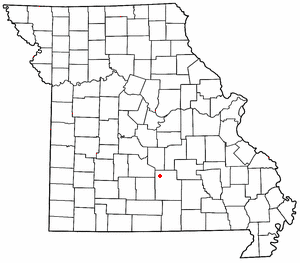
Roby is an unincorporated community in northwestern Texas County, Missouri, United States. [1] It is located approximately sixteen miles northwest of Houston and ten miles south of Fort Leonard Wood at the northern junction of Routes 17 and 32. Roby is home to the "Mark Twain National Forest" campgrounds.

A post office called Roby has been in operation since 1883. [2] The community has the name of Cyrus H. Roby, who kept a store in the area. [3]

Related Research Articles

Bendavis is an unincorporated community in western Texas County, Missouri, United States. It is located approximately thirteen miles west of Houston on Route 38.

Ellis Prairie is an unincorporated community in Texas County, Missouri, United States. It is located on Missouri Route AA, 7.5 miles northwest of Houston and 2.5 miles east of Mitchells Corner and Missouri Route 17.

Bucyrus is an unincorporated community in central Texas County, Missouri, United States. It is located on Route 17, approximately three miles northwest of Houston. The ZIP Code for Bucyrus is 65444.

<span class="mw-page-title-main">Upton, Missouri</span> Unincorporated community in the American state of Missouri

Upton is an unincorporated community in western Texas County, Missouri, United States. The community is located on a ridge top approximately one mile east of the West Fork Roubidoux Creek. It is located about ten miles west of Houston on Missouri Route FF.

Clara is an unincorporated community in central Texas County, Missouri, United States. The community is located on a hilltop, approximately one-half mile northwest of the Big Piney River. It is about three miles southwest of Houston on Missouri Route Z.

Simmons is a community in Texas County, in the U.S. state of Missouri. The community is located at the intersection of US Route 63 and Missouri Route Z, approximately seven miles south of Houston. The Big Piney River flows past the east side of the community.

Harold is an unincorporated community in northwest Greene County, in the U.S. state of Missouri. Harold is located on Missouri Route 123, southeast of Walnut Grove and 1.5 miles east of Phenix.

Galesburg is an unincorporated community in northwest Jasper County in southwest Missouri, United States. The community is located on the south bank of the Spring River, approximately twelve miles north of Joplin.

Alice is an unincorporated community in southwest Texas County, in the U.S. state of Missouri.

Bado is an unincorporated community in southwest Texas County, in the U.S. state of Missouri. Bado is located on Missouri Route M, along the banks of Little Piney Creek. The community is approximately nine miles west-southwest of Houston and nine miles north of Cabool. The store, post office, a rock house and White House are still standing.

Dunn is an unincorporated community in southwest Texas County, in the U.S. state of Missouri. The community is located just south of U.S. Route 60, approximately four miles west of Cabool.

Dykes is an unincorporated community in southwest Texas County, in the U.S. state of Missouri. Dykes is located on Missouri Route 38, seven miles west of Houston.

Ellsworth is an unincorporated community in the Township Of Lynch in Texas County, in the U.S. state of Missouri.

Evening Shade is an unincorporated community in northwest Texas County, in the U.S. state of Missouri.

Fowler is an unincorporated community in southwest Texas County, in the U.S. state of Missouri.

Ladd is an unincorporated community in northwestern Texas County, in the U.S. state of Missouri.

Pleasant Ridge is an unincorporated community in Texas County, in the U.S. state of Missouri. The community is located on Pleasant Ridge Road, approximately three-quarters of a mile southwest of Upton and about ten miles west of Houston.

Plum Valley is an extinct town in west central Texas County, in the U.S. state of Missouri. The GNIS classifies it as a populated place. The community lies near the East Fork of Roubidoux Creek, approximately one mile west of Missouri Route 17 and 3.5 miles west of Bucyrus.

Sargent is an unincorporated community in southern Texas County, in the U.S. state of Missouri. The community is adjacent to the Burlington Northern Railroad, approximately four miles southeast of Cabool. The Texas County-Howell county line is about two miles south of the location. Potter Creek flows past the east side of the community.

Vada is an unincorporated community in northern Texas County, in the U.S. state of Missouri. The community is located on Missouri Route 32, approximately three miles northeast of Success.

References

  1. U.S. Geological Survey Geographic Names Information System: Roby, Missouri
  2. "Post Offices". Jim Forte Postal History. Retrieved 28 December 2016.
  3. "Texas County Place Names, 1928–1945". The State Historical Society of Missouri. Archived from the original on June 24, 2016. Retrieved December 28, 2016.

37°30′56″N92°08′21″W / 37.51556°N 92.13917°W / 37.51556; -92.13917