Maples is an unincorporated community in northeastern Texas County, Missouri, United States. It is located approximately seven miles northeast of Licking on Missouri Route C.

Solo is an unincorporated community in Texas County, Missouri, United States. It is located approximately six miles south of Houston. Solo is reached via Missouri Route UU from U.S. Route 63 and is on the west side of Hog Creek.

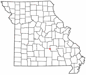
Sherrill is an unincorporated community in northern Texas County, Missouri, United States. It is located approximately six miles north of Licking and is located just west of U.S. Route 63. Sherrill Creek flows past the north side of the community. The community of Beulah lies about 2.5 miles northwest on Sherrill Creek in Phelps County.
Eunice is an unincorporated community in southeastern Texas County, Missouri, United States. It is located approximately ten miles southeast of Houston on Route 17 midway between the communities of Yukon and Midvale.

Kimble is an unincorporated community in northeastern Texas County, Missouri, United States. It is located just east of U.S. Route 63, approximately six miles north of Licking.
Tyrone is an unincorporated community in southern Texas County, Missouri, United States. The community is located on Missouri Route H, approximately 1.5 miles west of Missouri Route 137. It consists of several houses.
Arroll is an unincorporated community in southeast Texas County, in the U.S. state of Missouri. The community is located on Missouri Route W, two miles north of the Jacks Fork River.
Big Creek is an unincorporated community in Texas County, in the U.S. state of Missouri. The community was located along Big Creek, approximately 2.5 miles south of Yukon and one-half mile east of Missouri Route 137. The Big Creek school was south of the creek and the Big Creek church was about one-half mile north along a county road.
Clear Springs is an unincorporated community in southern Texas County, in the U.S. state of Missouri. The community is located on Missouri Route Y, one mile east of Missouri Route 137. The spring is on the South Prong Jacks Fork, 1.5 miles south of the community site.
Grogan is an extinct town in southern Texas County, in the U.S. state of Missouri. The GNIS classifies it as a populated place.
Guild is an unincorporated community in southeast Texas County, in the U.S. state of Missouri. The community was located on a ridge just west of Stillhouse Branch and approximately 1⁄2 mile south of the South Prong Jacks Fork. The community of Hattie was about 1+1⁄2 miles (2.4 km) to the northeast on the South Prong. Access is via Missouri Route NN from Howell County and Mt. Olive Road. The former Mt. Olive School was located to the east across Stillhouse Branch.
Kinderpost is an unincorporated community in northern Texas County, in the U.S. state of Missouri. The community is located on Missouri Route AT approximately 6.5 miles northwest of Licking. Spring Creek flows past to the east of the community.
Mahan is an unincorporated community in Texas County, in the U.S. state of Missouri. The community was located on Missouri Route 137 and Missouri Route V, approximately one mile south of Oscar and four miles north of Raymondville. It is at an elevation of 1,309 ft (399 m). The Mahan Cemetery lies about one mile east on Route V.
Nile is an unincorporated community in eastern Texas County, in the U.S. state of Missouri. The community is situated on the floodplain of Big Creek, approximately one mile west of the Texas-Shannon county line. The old Nile Schoolhouse was about one mile east (upstream) and on the opposite side of the river across a stream ford.
Prescott is an unincorporated community in northern Texas County, in the U.S. state of Missouri. The community lies approximately 4.5 miles southwest of Licking and the Big Piney River flows about 1.5 miles to the west of the location. The Prescott Church and cemetery lie one-half mile south.
Samoa is an unincorporated community in Texas County, in the U.S. state of Missouri.
Stultz is an unincorporated community in southern Texas County, in the U.S. state of Missouri. The community is located on a tributary of Elk Creek, approximately 2.3 miles east-southeast of the community of Elk Creek.
Varvol is an unincorporated community in southern Texas County, in the U.S. state of Missouri. The community is on the South Prong of Jacks Fork at the intersection of Missouri Route HH and Varvel Road. The community of Sargent is approximately 3.5 miles to the west on Varvel Road and Willow Springs in adjacent Howell County is about seven miles south on route HH and Missouri Route 137. Varvel School was about three miles east along the north bank of the river.
Venable is an unincorporated community in northwest Texas County, in the U.S. state of Missouri.

Teddy Joseph Von Nukem was an American white nationalist and far-right extremist, and drug smuggler, noted for his role at the 2017 Unite the Right rally in Charlottesville, Virginia.

