Related Research Articles
Arlington is an unincorporated community in western Phelps County, Missouri, United States. The community is located just northeast of the confluence of Little Piney Creek and the Gasconade River. I-44 passes just to the east and the Burlington Northern Railroad passes the south edge of the community. The community of Jerome lies approximately three-quarters of a mile to the northwest across the Gasconade.
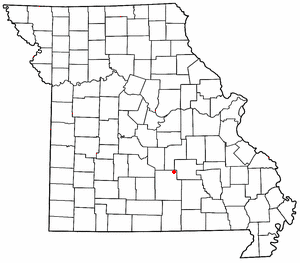
Maples is an unincorporated community in northeastern Texas County, Missouri, United States. It is located approximately seven miles northeast of Licking on Missouri Route C.

Solo is an unincorporated community in Texas County, Missouri, United States. It is located approximately six miles south of Houston. Solo is reached via Missouri Route UU from U.S. Route 63 and is on the west side of Hog Creek.

Sherrill is an unincorporated community in northern Texas County, Missouri, United States. It is located approximately six miles north of Licking and is located just west of U.S. Route 63. Sherrill Creek flows past the north side of the community. The community of Beulah lies about 2.5 miles northwest on Sherrill Creek in Phelps County.

Hartshorn is an unincorporated community in eastern Texas County, Missouri, United States. The community is located on Missouri Route KK, approximately six miles north of Summersville and fifteen miles east of Houston.
Eunice is an unincorporated community in southeastern Texas County, Missouri, United States. It is located approximately ten miles southeast of Houston on Route 17 midway between the communities of Yukon and Midvale.
Vida is an unincorporated community in Phelps County, Missouri, United States. Vida is approximately six miles south of Rolla, near the junction of US Highway 63 and Missouri Route W. Vida is located at an elevation of 1033 feet above sea level. Vida can be found on Phelps County plat maps in Section 10, Township 36 N, Range 9 W.
On February 26, 2015, a gunman shot and killed seven people in several locations across the town of Tyrone, Missouri, an unincorporated community approximately 95 miles east of Springfield. The gunman, identified as 36-year-old Joseph Jesse Aldridge, was found dead of a self-inflicted gunshot wound the next day. It was the worst mass murder in the history of Texas County, which previously had experienced an average of one homicide per year.
Elk Prairie is an unincorporated community in Phelps County, in the U.S. state of Missouri. The community was located on Missouri Route 72 approximately seven miles south-southeast of Rolla.
Oakside is an unincorporated community in western Shannon County, in the U.S. state of Missouri.
Rector is an extinct town in northwest Shannon County, in the U.S. state of Missouri. The GNIS classifies it as a populated place. The community is located in Rector Hollow, which is a tributary to Gladden Creek approximately one mile to the west. It is on Missouri Route J two miles west of Missouri Route 19.
Arroll is an unincorporated community in southeast Texas County, in the U.S. state of Missouri. The community is located on Missouri Route W, two miles north of the Jacks Fork River.
Clear Springs is an unincorporated community in southern Texas County, in the U.S. state of Missouri. The community is located on Missouri Route Y, one mile east of Missouri Route 137. The spring is on the South Prong Jacks Fork, 1.5 miles south of the community site.
Hattie is an extinct town in southeast Texas County, in the U.S. state of Missouri. The GNIS classifies it as a populated place. The community is on the South Prong Jacks Fork, south of Missouri Route Y, and two miles north of the county line.
Mahan is an unincorporated community in Texas County, in the U.S. state of Missouri. The community was located on Missouri Route 137 and Missouri Route V, approximately one mile south of Oscar and four miles north of Raymondville. It is at an elevation of 1,309 ft (399 m). The Mahan Cemetery lies about one mile east on Route V.
Nagle or Nogle is an extinct town in southeast Texas County, in the U.S. state of Missouri. The GNIS classifies it as a populated place. The community was located just east of Missouri Route 137 and north of the North Prong of Jacks Fork Creek. The local road, Nagle Drive, serves the area just east of Route 137.
Raftville is an extinct town in Texas County, in the U.S. state of Missouri. The community was located on the west side of the Big Piney River, south of Boiling Spring.
Varvol is an unincorporated community in southern Texas County, in the U.S. state of Missouri. The community is on the South Prong of Jacks Fork at the intersection of Missouri Route HH and Varvel Road. The community of Sargent is approximately 3.5 miles to the west on Varvel Road and Willow Springs in adjacent Howell County is about seven miles south on route HH and Missouri Route 137. Varvel School was about three miles east along the north bank of the river.
Venable is an unincorporated community in northwest Texas County, in the U.S. state of Missouri.
Kochs Creek is a stream in Warren County in the U.S. state of Missouri.
References
- ↑ U.S. Geological Survey Geographic Names Information System: Tyrone, Missouri
- ↑ Eunice, Missouri and Elk Creek, Missouri, 7.5 Minute Topographic Quadrangles, USGS, 1987
- ↑ Bauer, Laura, Donald Bradley, and Glenn E. Rice. "In tiny Tyrone, Mo., ‘half of the town got killed last night’." The Kansas City Star . February 27, 2015. Retrieved on April 28, 2016.
- ↑ "Post Offices". Jim Forte Postal History. Retrieved December 28, 2016.
- ↑ "Texas County Place Names, 1928–1945". The State Historical Society of Missouri. Archived from the original on June 24, 2016. Retrieved December 28, 2016.
- ↑ The New York Times. "Gunman Kills 7 in Tyrone, Mo., and Tiny Town Is Reeling" . Retrieved February 27, 2015.
Municipalities and communities of Texas County, Missouri, United States | ||
|---|---|---|
| Cities |  | |
| Villages | ||
| Townships | ||
| Unincorporated communities |
| |
| Ghost towns | ||
| Footnotes | ‡This populated place also has portions in an adjacent county or counties | |
37°12′12″N91°52′36″W / 37.20333°N 91.87667°W
| | This Texas County, Missouri state location article is a stub. You can help Wikipedia by expanding it. |