
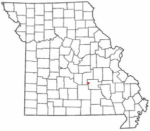
Maples is an unincorporated community in northeastern Texas County, Missouri, United States. [1] It is located approximately seven miles northeast of Licking on Missouri Route C. [2]
Maples is an unincorporated community in northeastern Texas County, Missouri, United States. [1] It is located approximately seven miles northeast of Licking on Missouri Route C. [2]
A post office called Maples was established in 1891, and remained in operation until 1967. [3] J. J. Maples, an early postmaster, gave the community his last name. [4] [5]
Lenox is an unincorporated community in western Dent County, Missouri, United States. The community is located approximately twelve miles west of Salem at the intersection of routes H and C. Edgar Springs is approximately four miles to the northwest in adjacent Phelps County and the community of Maples is 4.5 miles to the south in Texas County.

Hartshorn is an unincorporated community in eastern Texas County, Missouri, United States. The community is located on Missouri Route KK, approximately six miles north of Summersville and fifteen miles east of Houston.

Kimble is an unincorporated community in northeastern Texas County, Missouri, United States. It is located just east of U.S. Route 63, approximately six miles north of Licking.
Arroll is an unincorporated community in southeast Texas County, in the U.S. state of Missouri. The community is located on Missouri Route W, two miles north of the Jacks Fork River.
Big Creek is an unincorporated community in Texas County, in the U.S. state of Missouri. The community was located along Big Creek, approximately 2.5 miles south of Yukon and one-half mile east of Missouri Route 137. The Big Creek school was south of the creek and the Big Creek church was about one-half mile north along a county road.
Clear Springs is an unincorporated community in southern Texas County, in the U.S. state of Missouri. The community is located on Missouri Route Y, one mile east of Missouri Route 137. The spring is on the South Prong Jacks Fork, 1.5 miles south of the community site.
Dent is an unincorporated community in Texas County, in the U.S. state of Missouri.
Grogan is an extinct town in southern Texas County, in the U.S. state of Missouri. The GNIS classifies it as a populated place.
Guild is an unincorporated community in southeast Texas County, in the U.S. state of Missouri. The community was located on a ridge just west of Stillhouse Branch and approximately 1⁄2 mile south of the South Prong Jacks Fork. The community of Hattie was about 1+1⁄2 miles (2.4 km) to the northeast on the South Prong. Access is via Missouri Route NN from Howell County and Mt. Olive Road. The former Mt. Olive School was located to the east across Stillhouse Branch.
Hattie is an extinct town in southeast Texas County, in the U.S. state of Missouri. The GNIS classifies it as a populated place. The community is on the South Prong Jacks Fork, south of Missouri Route Y, and two miles north of the county line.
Kinderpost is an unincorporated community in northern Texas County, in the U.S. state of Missouri. The community is located on Missouri Route AT approximately 6.5 miles northwest of Licking. Spring Creek flows past to the east of the community.
Louisa is an extinct town in southern Texas County, in the U.S. state of Missouri. The community was located along the South Prong of Jacks Fork Creek, southeast of Grogan.
Mahan is an unincorporated community in Texas County, in the U.S. state of Missouri. The community was located on Missouri Route 137 and Missouri Route V, approximately one mile south of Oscar and four miles north of Raymondville. It is at an elevation of 1,309 ft (399 m). The Mahan Cemetery lies about one mile east on Route V.
Nagle or Nogle is an extinct town in southeast Texas County, in the U.S. state of Missouri. The GNIS classifies it as a populated place. The community was located just east of Missouri Route 137 and north of the North Prong of Jacks Fork Creek. The local road, Nagle Drive, serves the area just east of Route 137.
Nile is an unincorporated community in eastern Texas County, in the U.S. state of Missouri. The community is situated on the floodplain of Big Creek, approximately one mile west of the Texas-Shannon county line. The old Nile Schoolhouse was about one mile east (upstream) and on the opposite side of the river across a stream ford.
Raftville is an extinct town in Texas County, in the U.S. state of Missouri. The community was located on the west side of the Big Piney River, south of Boiling Spring.
Samoa is an unincorporated community in Texas County, in the U.S. state of Missouri.
Stultz is an unincorporated community in southern Texas County, in the U.S. state of Missouri. The community is located on a tributary of Elk Creek, approximately 2.3 miles east-southeast of the community of Elk Creek.
Varvol is an unincorporated community in southern Texas County, in the U.S. state of Missouri. The community is on the South Prong of Jacks Fork at the intersection of Missouri Route HH and Varvel Road. The community of Sargent is approximately 3.5 miles to the west on Varvel Road and Willow Springs in adjacent Howell County is about seven miles south on route HH and Missouri Route 137. Varvel School was about three miles east along the north bank of the river.
Venable is an unincorporated community in northwest Texas County, in the U.S. state of Missouri.
Municipalities and communities of Texas County, Missouri, United States | ||
|---|---|---|
| Cities |  | |
| Villages | ||
| Townships | ||
| Unincorporated communities |
| |
| Ghost towns | ||
| Footnotes | ‡This populated place also has portions in an adjacent county or counties | |
37°35′03″N91°47′01″W / 37.58417°N 91.78361°W
| | This Texas County, Missouri state location article is a stub. You can help Wikipedia by expanding it. |