Stanberry, Missouri | |
---|---|
Coordinates: 40°13′00″N94°32′17″W / 40.21667°N 94.53806°W | |
Country | United States |
State | Missouri |
County | Gentry |
Area | |
• Total | 1.40 sq mi (3.63 km2) |
• Land | 1.40 sq mi (3.63 km2) |
• Water | 0.00 sq mi (0.00 km2) |
Elevation | 948 ft (289 m) |
Population (2020) | |
• Total | 1,129 |
• Density | 804.70/sq mi (310.71/km2) |
Time zone | UTC-6 (Central (CST)) |
• Summer (DST) | UTC-5 (CDT) |
ZIP code | 64489 |
Area code | 660 |
FIPS code | 29-70270 [3] |
GNIS feature ID | 2395949 [2] |
Stanberry is a city in Gentry County, Missouri, United States. The population was 1,129 at the 2020 census. [4]
Stanberry was platted in 1879 when the railroad was extended to that point. [5] The community was named for J. J. Stanberry, original owner of the town site. [6] A post office called Stanberry has been in operation since 1879. [7]
Stanberry is located in western Gentry County at the intersection of US Routes 136 and 169. Albany is approximately eleven miles to the east and King City is about eleven miles to the south. Wildcat Creek flows past the south side of the community. [8]
According to the United States Census Bureau, the city has a total area of 1.40 square miles (3.63 km2), all land [9] or 896 acres. [10]
Census | Pop. | Note | %± |
---|---|---|---|
1880 | 1,207 | — | |
1890 | 2,035 | 68.6% | |
1900 | 2,654 | 30.4% | |
1910 | 2,121 | −20.1% | |
1920 | 1,864 | −12.1% | |
1930 | 2,029 | 8.9% | |
1940 | 1,893 | −6.7% | |
1950 | 1,651 | −12.8% | |
1960 | 1,409 | −14.7% | |
1970 | 1,479 | 5.0% | |
1980 | 1,387 | −6.2% | |
1990 | 1,310 | −5.6% | |
2000 | 1,243 | −5.1% | |
2010 | 1,185 | −4.7% | |
2020 | 1,129 | −4.7% | |
U.S. Decennial Census [11] |
As of the census [12] of 2010, there were 1,185 people, 477 households, and 304 families living in the city. The population density was 846.4 inhabitants per square mile (326.8/km2). There were 573 housing units at an average density of 409.3 per square mile (158.0/km2). The racial makeup of the city was 99.1% White, 0.2% African American, 0.2% Native American, 0.2% from other races, and 0.4% from two or more races. Hispanic or Latino of any race were 0.9% of the population.
There were 477 households, of which 28.7% had children under the age of 18 living with them, 52.2% were married couples living together, 9.4% had a female householder with no husband present, 2.1% had a male householder with no wife present, and 36.3% were non-families. 32.3% of all households were made up of individuals, and 19.1% had someone living alone who was 65 years of age or older. The average household size was 2.35 and the average family size was 2.98.
The median age in the city was 42.7 years. 24.2% of residents were under the age of 18; 8.1% were between the ages of 18 and 24; 20.5% were from 25 to 44; 22.4% were from 45 to 64; and 24.8% were 65 years of age or older. The gender makeup of the city was 47.2% male and 52.8% female.
As of the census [3] of 2000, there were 1,243 people, 508 households, and 342 families living in the city. The population density was 942.5 inhabitants per square mile (363.9/km2). There were 589 housing units at an average density of 446.6 per square mile (172.4/km2). The racial makeup of the city was 98.47% White, 0.08% African American, 0.56% Native American, 0.08% Asian, 0.40% from other races, and 0.40% from two or more races. Hispanic or Latino of any race were 0.16% of the population.
There were 508 households, out of which 28.5% had children under the age of 18 living with them, 55.9% were married couples living together, 9.1% had a female householder with no husband present, and 32.5% were non-families. 31.3% of all households were made up of individuals, and 21.3% had someone living alone who was 65 years of age or older. The average household size was 2.32 and the average family size was 2.91.
In the city the population was spread out, with 22.8% under the age of 18, 7.9% from 18 to 24, 21.5% from 25 to 44, 20.8% from 45 to 64, and 27.1% who were 65 years of age or older. The median age was 43 years. For every 100 females, there were 87.5 males. For every 100 females age 18 and over, there were 78.8 males.
The median income for a household in the city was $30,417, and the median income for a family was $38,684. Males had a median income of $25,774 versus $18,750 for females. The per capita income for the city was $13,736. About 6.3% of families and 8.8% of the population were below the poverty line, including 8.1% of those under age 18 and 11.3% of those age 65 or over.
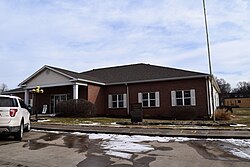
Public education in Stanberry is administered by Stanberry R-II School District. [13]
Stanberry has a public library, the Gentry County Library. [14]
Worth County is a county located in the northwestern portion of the U.S. state of Missouri. As of the 2020 census, the population was 1,973. It is the smallest county in the state in population and, excluding the independent city of St. Louis, the smallest in total area. Its county seat is Grant City. The county was organized February 8, 1861, and named for General William J. Worth, who served in the Mexican–American War. Worth County is also the youngest county in the state.
Gentry County is a county located in the northwestern portion of the U.S. state of Missouri. As of the 2020 census, the population was 6,162. Its county seat is Albany. The county was organized February 14, 1841 and named for Colonel Richard Gentry of Boone County, who fell in the Seminole War in 1837.
Wheaton is a city in Wheaton Township, Barry County, Missouri, United States. The population was 696 at the 2010 census.
Belton is a city in northwestern Cass County, Missouri, United States. The population was 23,953 at the 2020 census. It is a part of the Kansas City Metropolitan Area.
Smithville is a city in Clay and Platte counties in the U.S. state of Missouri and is part of the Kansas City metropolitan area, along the Little Platte River. The population was 10,406 at the 2020 United States Census.
Albany is a city and county seat of Gentry County, Missouri, United States. With an annual growth rate of -0.30%. The population was 1,679 at the 2020 census.
Darlington is a village in central Gentry County, Missouri, United States. The population was 66 at the 2020 census.
King City is a city in southwest Gentry County, Missouri, United States. The population was 799 at the 2020 census.
McFall is a rural village, incorporated and thus called a city in Missouri law, located in southeast Gentry County, Missouri, United States. It is also located within the Gentry County administrative subdivision of Miller Township. The population of McFall was 119 at the 2020 census. There is a post office at McFall, also a city hall and fire department, and a small apartment complex.
Carl Junction is a city in Jasper County, Missouri, United States. The population was 8,143 at the 2020 census.
Bridgeton is a second-ring suburb of Greater St. Louis in northwestern St. Louis County, Missouri, United States. Bridgeton is located at the intersection of the St. Louis outer belt and I-70. Bridgeton serves as the primary transport hub within Greater St. Louis. The population at the 2020 census was 11,445. Portions of St. Louis Lambert International Airport are within Bridgeton. The town is featured in the documentary Atomic Homefront, which covers the effects of radioactive waste stored in the nearby West Lake Landfill site.
Crystal Lake Park is a Missouri Class 4 city in St. Louis County, Missouri, United States. The population was 508 at the 2020 census.
Flordell Hills is a city in St. Louis County, Missouri, United States. The population was 822 at the 2010 census.
Hazelwood is a city in St. Louis County, Missouri, within Greater St. Louis. It is a second-ring northern suburb of St. Louis. Based on the 2020 United States census, the city had a total population of 25,485. It is located north of St. Louis-Lambert International Airport and is situated on Interstates 270 and 170, as well as the much-traveled Lindbergh Boulevard and Highway 370.
Manchester is a city in St. Louis County, Missouri, United States. The population was 18,333 at the 2020 census.
Wildwood is a city in St. Louis County, Missouri, United States. It is located in the far western portion of the county. As of the 2020 census, the population was 35,417. Wildwood is the home of the Al Foster Trail, and numerous other trails, parks, and reserves such as Rockwoods Reservation and Babler State Park.
Moscow Mills is a city in Lincoln County, Missouri, United States. The population was 2,509 at the 2010 census.
Clarkson Valley is a city in St. Louis County, Missouri, United States. The population was 2,609 at the 2020 census.
Moline Acres is a city in St. Louis County, Missouri, United States. The population was 2,442 at the 2010 census.
Stinnett is a town in Washburn County, Wisconsin, United States. The population was 263 at the 2000 census. The unincorporated community of Stanberry is located in the town, situated 7 miles (11 km) west of Hayward on County Highway M. The ghost town of Harmon was located in the town.