Ginger Blue, Missouri

Last updated

Ginger Blue, Missouri
USA Missouri location map.svg
Red pog.svg
Ginger Blue
Usa edcp location map.svg
Red pog.svg
Ginger Blue
Coordinates: 36°35′24″N94°27′35″W / 36.59000°N 94.45972°W / 36.59000; -94.45972
Country United States
State Missouri
County McDonald
IncorporationJanuary 21, 1965 [1]
Area
[2]
  Total0.26 sq mi (0.68 km2)
  Land0.26 sq mi (0.68 km2)
  Water0.00 sq mi (0.00 km2)
Elevation
[3]
843 ft (257 m)
Population
 (2020) [4]
  Total37
  Density141.76/sq mi (54.78/km2)
Time zone UTC-6 (Central (CST))
  Summer (DST) UTC-5 (CDT)
ZIP code
64854 (Noel)
Area code 417
FIPS code 29-27100 [5]
GNIS feature ID2398965 [3]

Ginger Blue is an incorporated village [6] in McDonald County, Missouri, United States. The population was 37 at the 2020 census, [4] down from 61 in 2010.

Contents

Geography

Ginger Blue is in southwestern McDonald County on Missouri Route 59, which leads 2 miles (3 km) north to Lanagan and 4 miles (6 km) south to Noel. It is on the northwest side of a sharp meander in the Elk River. [7]

According to the U.S. Census Bureau, the village has a total area of 0.26 square miles (0.67 km2), [2] including the Elk River where it curves through the southern part of the village. Via the Elk River, the village is within the Neosho River watershed, a tributary of the Arkansas River.

Demographics

Historical population
CensusPop.Note
2010 61
2020 37−39.3%
U.S. Decennial Census [8]

2010 census

As of the census [5] of 2010, there were 61 people, 28 households, and 17 families residing in the village. The population density was 234.6 inhabitants per square mile (90.6/km2). There were 40 housing units at an average density of 153.8 per square mile (59.4/km2). The racial makeup of the village was 88.5% White, 1.6% African American, 1.6% Pacific Islander, 6.6% from other races, and 1.6% from two or more races. Hispanic or Latino of any race were 6.6% of the population.

There were 28 households, of which 28.6% had children under the age of 18 living with them, 39.3% were married couples living together, 17.9% had a female householder with no husband present, 3.6% had a male householder with no wife present, and 39.3% were non-families. 35.7% of all households were made up of individuals, and 7.2% had someone living alone who was 65 years of age or older. The average household size was 2.18 and the average family size was 2.71.

The median age in the village was 40.6 years. 16.4% of residents were under the age of 18; 13.1% were between the ages of 18 and 24; 29.4% were from 25 to 44; 36% were from 45 to 64; and 4.9% were 65 years of age or older. The gender makeup of the village was 49.2% male and 50.8% female.

Related Research Articles

<span class="mw-page-title-main">Elk Falls, Kansas</span> City in Elk County, Kansas

Elk Falls is a city in Elk County, Kansas, United States, along the Elk River. As of the 2020 census, the population of the city was 113.

<span class="mw-page-title-main">Elk Rapids, Michigan</span> Village in Michigan, United States

Elk Rapids is a village in the U.S. state of Michigan. The village is the largest incorporated community in Antrim County, with a population of 1,529 at the 2020 census. The village is located within Elk Rapids Township, in the southwest of Antrim County, and is on the shore of Grand Traverse Bay, a bay of Lake Michigan. Elk Rapids is located about 12 miles (19 km) southwest of Bellaire, the county seat, and about 13 miles (21 km) northeast of Traverse City, the largest city in Northern Michigan.

<span class="mw-page-title-main">Emerald Beach, Missouri</span> Village in Missouri, United States

Emerald Beach is a village in White River Township, Barry County, Missouri, United States. The community is located on a bend in the White River now Table Rock Lake. Cassville is approximately 13 miles to the northwest and Rogers, Arkansas is 32 mile to the southwest.

<span class="mw-page-title-main">Hartsburg, Missouri</span> Village in Missouri, United States

Hartsburg is a village in southern Boone County, Missouri, United States. It is part of the Columbia, Missouri Metropolitan Statistical Area. The population was 133 per the 2020 census.

<span class="mw-page-title-main">Ozark, Missouri</span> City in Missouri, United States

Ozark is a city in and the county seat of Christian County, Missouri. Its population was 21,284 as of the 2020 census. Ozark is also the third largest city in the Springfield, Missouri Metropolitan Area, and is centered along a business loop of U.S. Route 65, where it intersects with Missouri Route 14.

<span class="mw-page-title-main">Parkway, Missouri</span> Village in Missouri, United States

Parkway is a village in Franklin County, Missouri, United States. The population was 439 at the 2010 census.

<span class="mw-page-title-main">Big Lake, Missouri</span> Village in Missouri, United States

Big Lake is a village in Holt County, Missouri, United States. The population was 65 at the 2020 census.

<span class="mw-page-title-main">South Gifford, Missouri</span> Village in Missouri, United States

South Gifford is a village in Macon County, Missouri, United States. The population was 22 at the 2020 census, down from 50 in 2010.

<span class="mw-page-title-main">Anderson, Missouri</span> City in Missouri, United States

Anderson is a city in McDonald County, Missouri, United States. The population was 1,981 at the 2020 census.

<span class="mw-page-title-main">Goodman, Missouri</span> City in Missouri, United States

Goodman is a city in McDonald County, Missouri, United States. The population was 1,202 at the 2020 census.

<span class="mw-page-title-main">Lanagan, Missouri</span> City in Missouri, United States

Lanagan is a city in McDonald County, Missouri, United States. It is near Truitt's Cave. The population was 373 at the 2020 census, down from 419 in 2010.

<span class="mw-page-title-main">Noel, Missouri</span> City in Missouri, United States

Noel is a city in McDonald County, Missouri, United States, along the Elk River. The population was 2,124 as of the 2020 census, up from 1,832 in 2010. The city is in the southwest corner of Missouri, just north of the Arkansas border.

<span class="mw-page-title-main">Pineville, Missouri</span> City in Missouri, United States

Pineville is a city in and the county seat of McDonald County, Missouri, United States. The population was 802 at the 2020 census.

<span class="mw-page-title-main">Southwest City, Missouri</span> City in Missouri, United States

Southwest City is a city in McDonald County, Missouri, United States. The population was 922 at the 2020 census. It is located in the southwestern corner of the state of Missouri.
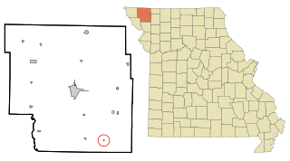
<span class="mw-page-title-main">Guilford, Missouri</span> Village in Missouri, United States

Guilford is a village in Nodaway County, Missouri, United States, near the Platte River. The population was 85 at the 2010 census.

<span class="mw-page-title-main">Blue Eye, Missouri</span> Town in Missouri, United States

Blue Eye is a town in Stone County, Missouri, United States. The population was 289 at the 2020 census. The population estimate is 389 as of 2022. It is part of the Branson Micropolitan Statistical Area. Blue Eye, Missouri is adjacent to Blue Eye, Arkansas.
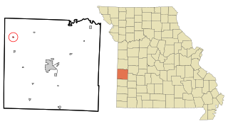
<span class="mw-page-title-main">Stotesbury, Missouri</span> Village in Missouri, United States

Stotesbury is a village in northwest Vernon County, Missouri, United States. The population was 18 at the 2010 census.

<span class="mw-page-title-main">McDonald, Ohio</span> Village in Ohio, United States

McDonald is a village in southern Trumbull County, Ohio, United States, along the Mahoning River. The population was 3,172 at the 2020 census. It is a suburb of the Youngstown–Warren metropolitan area.
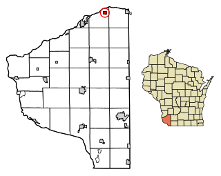
<span class="mw-page-title-main">Blue River, Wisconsin</span> Village in Wisconsin, United States

Blue River is a village in Grant County, Wisconsin, United States. The population was 434 at the 2010 census.

<span class="mw-page-title-main">Argyle, Missouri</span> Town in Missouri, United States

Argyle is a town in Osage and Maries counties in the U.S. state of Missouri. The population was 144 at the 2020 census.

References

  1. "2010 Entity Changes" (TXT). 2.census.gov. Retrieved July 26, 2018.
  2. 1 2 "2023 U.S. Gazetteer Files: Missouri". United States Census Bureau. Retrieved March 29, 2024.
  3. 1 2 U.S. Geological Survey Geographic Names Information System: Ginger Blue, Missouri
  4. 1 2 "P1. Race – Ginger Blue village, Missouri: 2020 DEC Redistricting Data (PL 94-171)". U.S. Census Bureau. Retrieved March 29, 2024.
  5. 1 2 "U.S. Census website". United States Census Bureau . Retrieved July 26, 2017.
  6. "Boundary Changes". Geographic Change Notes: Missouri. Population Division, United States Census Bureau. May 19, 2006. Archived from the original on August 6, 2010. Retrieved July 13, 2008.
  7. Missouri Atlas & Gazetteer, DeLorme, 1998, First edition, p. 60, ISBN   0-89933-224-2
  8. "Census of Population and Housing". Census.gov. Retrieved June 4, 2015.