
Interstate 29 (I-29) is an Interstate Highway in the Midwestern United States. I-29 runs from Kansas City, Missouri, at a junction with I-35 and I-70, to the Canada–US border near Pembina, North Dakota, where it connects with Manitoba Provincial Trunk Highway 75 (PTH 75), which continues on to Winnipeg. The road follows the course of three major rivers, all of which form the borders of US states. The southern portion of I-29 closely parallels the Missouri River from Kansas City northward to Sioux City, Iowa, where it crosses and then parallels the Big Sioux River. For the northern third of the highway, it closely follows the Red River of the North. The major cities that I-29 connects to includes Council Bluffs, Iowa; Sioux City, Iowa; Sioux Falls, South Dakota; Fargo, North Dakota; and Grand Forks, North Dakota. I-29 also serves as a road connection between the four largest public universities in the Dakotas: the University of North Dakota, North Dakota State University, the University of South Dakota, and South Dakota State University.
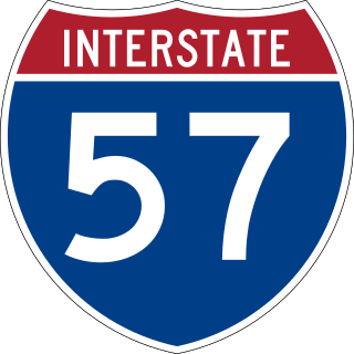
Interstate 57 (I-57) is a north–south Interstate Highway that currently exists in two segments. It runs through Arkansas, Missouri, and Illinois. I-57 parallels the old Illinois Central Railroad for much of its route north of I-55. The Interstate begins at I-40 in North Little Rock, Arkansas, traveling northward concurrently with U.S. Highway 67 (US 67) until it reaches Walnut Ridge, Arkansas, where the Interstate ends for now. I-57 will run northward to meet up with the existing segment in southeastern Missouri. I-57 resumes its run from Sikeston, Missouri, at I-55 to Chicago, Illinois, at I-94. I-57 essentially serves as a shortcut route for travelers headed between the Southern United States and Chicago, bypassing St. Louis, Missouri, and Springfield, Illinois. Between the junction of I-55 and I-57 in Sikeston and the junction of I-55 and I-90/I-94 in Chicago, I-55 travels for 436 miles (702 km), while the combination of I-57 and I-94 is only 396 miles (637 km) long between the same two points. In fact, both the control cities on the overhead signs and the destination mileage signs reference Memphis along southbound I-57, even as far north as its northern origin at I-94 in Chicago. Likewise, at its southern end in Missouri, Chicago is the control city listed for I-57 on signs on northbound I-55 south of Sikeston, even though I-55 also goes to Chicago.

Interstate 44 (I-44) is an Interstate Highway in the central United States. Although it is nominally an east–west road as it is even-numbered, it follows a more southwest–northeast alignment. Its western terminus is in Wichita Falls, Texas, at a concurrency with U.S. Route 277 (US 277), US 281, and US 287; its eastern terminus is at I-70 in St. Louis, Missouri. I-44 is one of five Interstates built to bypass US 66; this highway covers the section between Oklahoma City and St. Louis. Virtually the entire length of I-44 east of Springfield, Missouri, was once US 66, which was upgraded from two to four lanes from 1949 to 1955. The section of I-44 west of Springfield was built farther south than US 66 in order to connect Missouri's section with the already completed Will Rogers Turnpike, which Oklahoma wished to carry their part of I-44.

Interstate 49 (I-49) is a north–south Interstate Highway with multiple segments. The original portion is entirely within Louisiana with an additional signed portion extending from I-220 in Shreveport to the Arkansas state line, three newer sections are in Arkansas, and one section in Missouri. Its southern terminus is in Lafayette, Louisiana, at I-10 while its northern terminus is in Kansas City, Missouri, at I-435 and I-470. Future plans include portions of the remaining roadway in Louisiana, Arkansas, and Texas, to link Kansas City, Missouri with New Orleans.

U.S. Route 412 is an east–west United States highway, first commissioned in 1982. U.S. 412 overlaps expressway-grade Cimarron Turnpike from Tulsa west to Interstate 35 and the Cherokee Turnpike from 5 miles (8.0 km) east of Chouteau, Oklahoma, to 8 miles (13 km) west of the Arkansas state line. It runs the entire length of the Oklahoma Panhandle and traverses the Missouri Bootheel.

U.S. Route 67 is a major north–south U.S. highway which extends for 1,560 miles (2,511 km) in the Central United States. The southern terminus of the route is at the United States-Mexico border in Presidio, Texas, where it continues south as Mexican Federal Highway 16 upon crossing the Rio Grande. The northern terminus is at U.S. Route 52 in Sabula, Iowa. US 67 crosses the Mississippi River twice along its routing. The first crossing is at West Alton, Missouri, where US 67 uses the Clark Bridge to reach Alton, Illinois. About 240 miles (390 km) to the north, US 67 crosses the river again at the Rock Island Centennial Bridge between Rock Island, Illinois, and Davenport, Iowa. Additionally, the route crosses the Missouri River via the Lewis Bridge a few miles southwest of the Clark Bridge.

U.S. Route 271 is a north–south United States highway. Never a long highway, it went from bi-state route to a tri-state route. Its southern terminus is in Tyler, Texas, at an intersection with State Highway 31 and SH 155. The highway's northern terminus is in Fort Smith, Arkansas, at an intersection with Business U.S. Route 71 and Highway 255. It enters Arkansas from Oklahoma as a controlled-access highway, but the highway continues as Interstate 540 when US 271 exits toward downtown after one-half mile (800 m) in Arkansas.

U.S. Route 79 is a United States highway in the Southern United States. The route is officially considered and labeled as a north–south highway, but its path is actually more of a diagonal northeast–southwest highway. The highway's northern/eastern terminus is in Russellville, Kentucky, at a junction with U.S 68. Its southern/western terminus is in Round Rock, Texas, at an interchange with Interstate 35, ten miles (16 km) north of Austin. US 79, US 68, and Interstate 24/US 62 are the primary east–west access points for the Land Between the Lakes recreation area straddling the Kentucky/Tennessee border.

U.S. Route 59 is a north–south United States highway. A latecomer to the U.S. numbered route system, US 59 is now a border-to-border route, part of the NAFTA Corridor Highway System. It parallels U.S. Route 75 for nearly its entire route, never much more than 100 miles (160 km) away, until it veers southwest in Houston, Texas. Its number is out of place since US 59 is either concurrent with or entirely west of U.S. Route 71. The highway's northern terminus is 9 mi (14 km) north of Lancaster, Minnesota, at the Lancaster–Tolstoi Border Crossing on the Canada–US border, where it continues as Manitoba Highway 59. Its southern terminus is at the Mexico–US border in Laredo, Texas, where it continues as Mexican Federal Highway 85D.

U.S. Route 71 or U.S. Highway 71 is a major north–south United States highway that extends for over 1500 miles (2500 km) in the central United States. This original 1926 route has remained largely unchanged by encroaching Interstate highways. Currently, the highway's northern terminus is in International Falls, Minnesota at the Canada–US border, at the southern end of the Fort Frances-International Falls International Bridge to Fort Frances, Ontario. U.S. Route 53 also ends here. On the other side of the bridge, Trans-Canada Highway is an east–west route while Ontario Highway 71 is a north–south route. US 71's southern terminus is between Port Barre and Krotz Springs, Louisiana at an intersection with U.S. Route 190. For the entirety south of Kansas City, Missouri, US 71 runs parallel and concurrent with the existing and future Interstate 49. North of Kansas City, US 71 runs halfway between Interstate 29 and Interstate 35, which they split in the city at an interchange with Interstate 70.

U.S. Route 65 is a north–south United States highway in the southern and midwestern United States. The southern terminus of the route is at U.S. Route 425 in Clayton, Louisiana. The northern terminus is at Interstate 35 just south of Interstate 90 in Albert Lea, Minnesota. Parts of its modern route in Iowa and historic route in Minnesota follow the old Jefferson Highway.

U.S. Route 63 (US 63) is a 1,286-mile (2,070 km), north–south United States Highway primarily in the Midwestern and Southern United States. The southern terminus of the route is at Interstate 20 (I-20) in Ruston, Louisiana; the northern terminus is at US 2 eight miles (13 km) west of Ashland, Wisconsin.

Route 13 is a highway in Missouri which runs almost the entire north–south length of the state. Its northern terminus is at U.S. Route 69/136 in Bethany. Its southern terminus is at the Arkansas state line in downtown Blue Eye, Missouri–Arkansas where it continues as Highway 21. It is one of the original state highways of Missouri.

Route 86 is a highway in southwest Missouri. The eastern terminus is at U.S. Route 65 just north of Ridgedale. From there, the road crosses the Long Creek arm of Table Rock Lake and continues to Blue Eye west between the Arkansas state line on the south and Table Rock Lake on the north. This section is also in the Mark Twain National Forest, and is recommended as a scenic drive by the Missouri Department of Transportation. From Eagle Rock the road turns north to join with Route 76 at Bates Corner with which it is runs concurrent through Cassville to just east of Rocky Comfort. The road continues north and west towards Neosho, then goes further west before turning north towards Joplin where the road ends at the interchange of Interstate 44 and Route 43. Except for a short section in Neosho, the road is a two-lane highway for its entire length.
A total of ten special routes of U.S. Route 71 exist, and another ten previously existed.
U.S. Route 65 is a north–south U.S. highway that runs from Clayton, Louisiana to Albert Lea, Minnesota. In Missouri, the highway enters the state from Arkansas, just south of Branson. The highway exits the state into Iowa near South Lineville.
U.S. Route 71 (US 71) is a major north–south U.S. Highway that runs from Louisiana to Canada. US 71 enters Missouri from Arkansas in the town of Jane. US 71 serves the cities of Joplin, Kansas City and St. Joseph. At noon on December 12, 2012, the section of US 71 between Pineville, Missouri and I-435 in south Kansas City was also designated as a northern extension of Interstate 49 (I-49).
U.S. Route 65 (US 65) runs north–south through southeastern and north central Arkansas for 309.52 miles (498.12 km). US 65 enters the state from Louisiana south of Eudora, running concurrently with the Great River Road. The route exits into Missouri northwest of Omaha. US 65 runs through the major cities of Pine Bluff and Little Rock.
U.S. Route 71 is a U.S. route that runs from Krotz Springs, LA to the Fort Frances–International Falls International Bridge at the Canadian border. In Arkansas, the highway runs from the Louisiana state line near Doddridge to the Missouri state line near Bella Vista. In Texarkana, the highway runs along State Line Avenue with US 59 and partially runs in Texas. Other areas served by the highway include Fort Smith and Northwest Arkansas.

U.S. Route 60 (US 60) is a part of the United States Numbered Highway System that runs from Brenda, Arizona, east to Virginia Beach, Virginia. In the state of Missouri, US 60 is a main east–west highway that runs through the southern part of the state, from the Oklahoma border to the Illinois border.

