List of U.S. Routes in Missouri

Last updated

Contents

United States Numbered Highways of the Missouri Highway System
US 61.svg US 160.svg
Highway markers for U.S. Route 61 and U.S. Route 160
System information
Maintained by MDOT
FormedNovember 11, 1926 (1926-11-11) [1] [2]
Highway names
US Highways U.S. Route nn (US nn)
System links

List

NumberLength (mi) [3] Length (km)Southern or western terminusNorthern or eastern terminusFormedRemovedNotes
US 24.svg US 24 215.560346.910 US 24 at Kansas City US 24 at West Quincy
US 36.svg US 36 192.660310.056 US 36 at St. Joseph I-72/US 36/IL 110 (CKC) at Hannibal 01926-11-111926 [2] current
US 40.svg US 40 255.838411.731 US 40 at Kansas City I-55/I-64/US 40 at St. Louis 01926-11-111926 [2] current
US 50.svg US 50 261.946421.561 US 50 at Kansas City I-255/US 50 at St. Louis 01926-11-111926 [2] current
US 54.svg US 54 271.494436.927 US 54 west of Nevada US 54 at Louisiana
US 55 (1948).svg US 55 3.0964.983Proposed number for what would become US 56. [4]
US 56.svg US 56 3.0964.983 US 56 at Kansas City US 71 in Kansas City01956-06-271956 [5] current
US 59.svg US 59 106.256171.002 US 59 east of Atchison, KS US 59 north of Rock Port
US 60 (1926).svg US 60 32051001926-01-011926Proposed number for what would become US 66.
US 60.svg US 60 341.232549.160 US 60 at Seneca US 60 east of Charleston 01926-11-111926 [2] current
US 61.svg US 61 392.847632.226 US 61 south of Steele US 61 west of Keokuk, IA 01926-11-111926 [2] current
US 62 (1926).svg US 62 341.232549.16001926-01-011926Proposed number for what would become US 60.
US 62.svg US 62 86.705139.538 US 62 west of Campbell US 62 east of Charleston
US 63.svg US 63 337.750543.556 US 63 at Thayer US 63 north of Lancaster
US 65.svg US 65 313.114503.908 US 65 south of Branson US 65 north of Princeton 01926-11-111926 [2] current
US 66 (1961).svg US 66 320510 US 66 west of Joplin US 66 at St. Louis 01926-11-111926 [2] 01985-06-261985 [6]
US 67.svg US 67 197.582317.977 US 67 south of Poplar Bluff US 67 east of West Alton 01926-11-111926 [2] current
US 69.svg US 69 121.704195.864 US 69 at Northmoor US 69 north of Bethany 01926-11-111926 [2] current
US 71.svg US 71 316.722509.715 US 71 south of Pineville US 71 north of Maryville
US 73 (1961).svg US 73 1.652.6601926-01-01192602007-01-012007Decommissioned in Missouri. [7]
US 78 (1948).svg US 78 Former proposal highway in Missouri.
US 80 (1948).svg US 80 Former proposal highway in Missouri.
US 136.svg US 136 257.457414.337 US 136 west of Rock Port US 136 west of Keokuk, IA
US 159.svg US 159 17.64828.402 US 159 east of Rulo, NE US 59 north of St. Joseph
US 160.svg US 160 323.417520.489 US 160 west of Lamar US 67/Route 158 near Poplar Bluff 01930-01-011930current
US 166.svg US 166 0.9361.506 US 166 west of Joplin I-44 west of Joplin01926-11-111926 [2] current
US 169.svg US 169 126.908204.239 US 169 at Kansas City US 169 north of Grant City
US 271 (1961).svg US 271 01960-01-011960Former proposal highway in Missouri; now US 59. [8]
US 275.svg US 275 15.10624.311 US 136 in Rock Port US 275 south of Hamburg, IA
US 400.svg US 400 0.9361.506 US 400 west of Joplin I-44 west of Joplin01994-01-011994current
US 412.svg US 412 50.76781.702 US 412 south of Senath I-155/US 412 east of Caruthersville
US 460 (1961).svg US 460 11.6 St. Louis US 460 at St. Louis01933-01-01193301976-01-011976
  •       Former

Special routes

NumberLength (mi)Length (km)Southern or western terminusNorthern or eastern terminusServesFormedRemovedNotes
Optional plate 1961.svg
US 24 (1961).svg US 24 Opt.
Kansas City to Independence
Alternate plate 1961.svg
US 24 (1961).svg US 24 Alt.
1.973.17 Lexington
Business plate.svg
US 24.svg US 24 Bus.
Napoleon to Lexington
Business plate.svg
US 24.svg US 24 Bus.
2.483.99 Carrollton
City plate 1961.svg
US 24 (1961).svg US 24 City
Kirksville
Business plate.svg
US 24.svg US 24 Bus.
3.505.63 Paris
Business plate 1961.svg
US 36 (1961).svg US 36 Bus.
St. Joseph
Business plate.svg
US 36.svg US 36 Bus.
1.502.41 Cameron
Business plate.svg
US 36.svg US 36 Bus.
2.824.54 Hamilton
Business plate 1961.svg
US 36 (1961).svg US 36 Bus.
Mooresville
Business plate.svg
US 36.svg US 36 Bus.
1.051.69 Chillicothe
Business plate.svg
US 36.svg US 36 Bus.
2.654.26 Brookfield
Business plate.svg
US 36.svg US 36 Bus.
3.034.88 Macon
Spur plate 1961.svg
US 36 (1961).svg US 36 Spur
11.6 Macon
Business plate.svg
US 36.svg US 36 Bus.
1.282.06 Clarence
Business plate.svg
US 36.svg US 36 Bus.
1.772.85 Shelbina
Business plate.svg
US 36.svg US 36 Bus.
2.473.98 Monroe City
Business plate.svg
US 36.svg US 36 Bus.
3.766.05 Hannibal
Alternate plate 1948.svg
US 36 (1948).svg US 36 Alt.
3.655.87 US 36 in Hannibal US 36/Route 79 in Hannibal Hannibal Replaced by US 61 and Route 79
City plate 1948.svg
US 36 (1948).svg US 36 City
3.766.05 Hannibal
Optional plate 1961.svg
US 40 (1961).svg US 40 Opt.
Kansas City
US 40 City 1926.svg US 40 City Kansas City
Alternate plate 1961.svg
US 40 (1961).svg US 40 Alt.
Kansas City to Independence
Optional plate 1961.svg
US 40 (1961).svg US 40 Opt.
Kansas City to Leeds
Optional plate 1961.svg
US 40 (1961).svg US 40 Opt.
Independence to Kansas City
Business plate 1961.svg
US 40 (1961).svg US 40 Bus.
Columbia
By-pass plate 1961.svg
US 40 (1961).svg US 40 Byp.
Wentzville, Missouri to Troy, Illinois
City plate 1961.svg
US 40 (1961).svg US 40 City
Pattonville to St. Louis
Truck plate 1961.svg
US 40 (1961).svg US 40 Truck
Frontenac, Missouri to East St. Louis, Illinois
Alternate plate 1961.svg
US 40 (1961).svg US 40 Alt.
Bridgeton to St. Louis
Business plate 1961.svg
US 40 (1961).svg US 40 Bus.
St. Louis
Spur plate.svg
US 40.svg US 40 Spur
St. Louis
Optional plate 1961.svg
US 50 (1961).svg US 50 Opt.
Olathe, Kansas to Lone Jack, Missouri
Business plate.svg
US 50.svg US 50 Bus.
2.534.07 Warrensburg
Business plate.svg
US 50.svg US 50 Bus.
1.111.79 Knob Noster
Temporary plate 1926.svg
US 50 (1926).svg US 50 Temp.
Sedalia 01931-01-011931Served Sedalia
Spur plate.svg
US 50.svg US 50 Spur
1.211.95 Smithton
Business plate.svg
US 50.svg US 50 Bus.
5.268.47 California
Business plate.svg
US 50.svg US 50 Bus.
4.086.57 St. Martins to Apache Flats
Business plate.svg
US 50.svg US 50 Bus.
Jefferson City
Business plate.svg
US 50.svg US 50 Bus.
2.974.78 Jefferson City
Business plate.svg
US 50.svg US 50 Bus.
Brentwood to St. Louis
City plate.svg
US 50.svg City US 50
Brentwood to St. Louis
By-pass plate.svg
US 50.svg US 50 Byp.
Mehlville, Missouri to Fairview Heights, Illinois
Truck plate.svg
US 50.svg US 50 Truck
St. Louis
Business plate.svg
US 54.svg US 54 Bus.
5.158.29 Lake Ozark
Business plate.svg
US 54.svg US 54 Bus.
5.578.96 Eldon
Alternate plate 1961.svg
US 54 (1961).svg US 54 Alt.
Jefferson City
Business plate.svg
US 54.svg US 54 Bus.
5.719.19 Fulton
Business plate.svg
US 54.svg US 54 Bus.
6.119.83 Mexico
Business plate.svg
US 54.svg US 54 Bus.
2.9674.775 Bowling Green
Business plate.svg
US 54.svg US 54 Bus.
3.3755.432 Louisiana
Business plate.svg
US 59.svg US 59 Bus.
Industrial City to St. Joseph
City plate.svg
US 59.svg City US 59
Industrial City to St. Joseph
Spur plate.svg
US 59.svg US 59 Spur
St. Joseph Now Missouri Route 759
Business plate.svg
US 60.svg US 60 Bus.
1.362.19 West Seneca, Oklahoma to Seneca, Missouri
Business plate.svg
US 60.svg US 60 Bus.
7.1411.49 Neosho
Business plate.svg
US 60.svg US 60 Bus.
5.919.51 Monett
Business plate.svg
US 60.svg US 60 Bus.
8.0112.89 Verona to Aurora
Business plate.svg
US 60.svg US 60 Bus.
Springfield
City plate 1948.svg
US 60 (1948).svg US 60 City
Springfield
Business plate.svg
US 60.svg US 60 Bus.
3.385.44 Rogersville
Business plate.svg
US 60.svg US 60 Bus.
2.223.57 Mansfield
Business plate.svg
US 60.svg US 60 Bus.
6.5110.48 Mountain Grove
Business plate.svg
US 60.svg US 60 Bus.
4.326.95 Cabool
Business plate.svg
US 60.svg US 60 Bus.
5.869.43 Willow Springs
Business plate.svg
US 60.svg US 60 Bus.
2.083.35 Van Buren
Business plate.svg
US 60.svg US 60 Bus.
7.7912.54 Poplar Bluff
Business plate.svg
US 60.svg US 60 Bus.
4.286.89 Dexter
Business plate.svg
US 60.svg US 60 Bus.
17.227.7 Sikeston to Charleston
Business plate.svg
US 61.svg US 61 Bus.
Holland to Steele
Spur plate.svg
US 61.svg US 61 Spur
0.4950.797 New Madrid
Business plate.svg
US 61.svg US 61 Bus.
2.574.14 Sikeston
Business plate.svg
US 61.svg US 61 Bus.
Cape Girardeau
City plate.svg
US 61.svg City US 61
Cape Girardeau
Alternate plate 1926.svg
US 61 (1926).svg US 61 Alt.
St. Louis
Business plate.svg
US 61.svg US 61 Bus.
4.467.18 Bowling Green
Spur plate.svg
US 61.svg US 61 Spur
0.4600.740 Bowling Green
Business plate.svg
US 61.svg US 61 Bus.
1.923.09 New London
Business plate.svg
US 61.svg US 61 Bus.
6.3410.20 Hannibal
City plate 1948.svg
US 61 (1948).svg US 61 City
6.3410.20 Hannibal
Business plate.svg
US 61.svg US 61 Bus.
3.435.52 Palmyra
Business plate.svg
US 61.svg US 61 Bus.
4.687.53 La Grange
Business plate.svg
US 61.svg US 61 Bus.
4.947.95 Canton
City plate.svg
US 62.svg City US 62
Sikeston
Business plate.svg
US 63.svg US 63 Bus.
2.133.43 Thayer
Business plate.svg
US 63.svg US 63 Bus.
4.016.45 West Plains
Business plate.svg
US 63.svg US 63 Bus.
4.417.10 Willow Springs
Business plate.svg
US 63.svg US 63 Bus.
4.326.95 Cabool
Business plate.svg
US 63.svg US 63 Bus.
Columbia
Connector plate.svg
US 63.svg US 63 Conn.
1.2512.013 Columbia
Spur plate.svg
US 63.svg US 63 Spur
Columbia
Business plate.svg
US 63.svg US 63 Bus.
9.5815.42 Renick to Moberly
Business plate.svg
US 63.svg US 63 Bus.
7.1311.47 Kirksville
City plate.svg
US 63.svg City US 63
Kirksville
Spur plate.svg
US 65.svg US 65 Spur
2.033.27 Tina
Business plate.svg
US 65.svg US 65 Bus.
4.517.26 Point Lookout to Branson
Business plate.svg
US 65.svg US 65 Bus.
4.036.49 Ozark
Business plate.svg
US 65.svg US 65 Bus.
9.2014.81 Springfield
By-pass plate.svg
US 65.svg US 65 Byp.
Springfield
Spur plate.svg
US 65.svg US 65 Spur
1.752.82 Warsaw
Business plate.svg
US 65.svg US 65 Bus.
5.028.08 Marshall
Business plate.svg
US 65.svg US 65 Bus.
2.473.98 Carrollton
Business plate.svg
US 65.svg US 65 Bus.
2.934.72 Trenton
City plate.svg
US 65.svg City US 65
Trenton
Alternate plate.svg
US 66.svg US 66 Alt.
Joplin
Business plate.svg
US 66.svg US 66 Bus.
Joplin
By-pass plate.svg
US 66.svg US 66 Byp.
Joplin
Alternate plate.svg
US 66.svg US 66 Alt.
Joplin to Webb City
Business plate.svg
US 66.svg US 66 Bus.
Webb City to Carterville
Alternate plate.svg
US 66.svg US 66 Alt.
Carthage to Kendricktown
Business plate.svg
US 66.svg US 66 Bus.
Carthage
Alternate business plate.svg
US 66.svg US 66 Bus. Alt.
Springfield
Business plate.svg
US 66.svg US 66 Bus.
Springfield
By-pass plate.svg
US 66.svg US 66 Byp.
Springfield
City plate.svg
US 66.svg City US 66
Springfield
Business plate.svg
US 66.svg US 66 Bus.
Lebanon
Business plate.svg
US 66.svg US 66 Bus.
Waynesville
Spur plate.svg
US 66.svg US 66 Spur
Fort Leonard Wood
Business plate.svg
US 66.svg US 66 Bus.
Rolla
City plate.svg
US 66.svg City US 66
Rolla
Business plate.svg
US 66.svg US 66 Bus.
Pacific
Business plate.svg
US 66.svg US 66 Bus.
St. Louis to Sunset Hills
By-pass plate.svg
US 66.svg US 66 Byp.
St. Louis to Sunset Hills
Optional plate.svg
US 66.svg US 66 Opt.
St. Louis, Missouri to Venice, Illinois
City plate.svg
US 66.svg City US 66
St. Louis, Missouri to Mitchell, Illinois
City plate.svg
US 66.svg City US 66
Kirkwood to Bellefontaine Neighbors
Business plate.svg
US 67.svg US 67 Bus.
7.3411.81 Poplar Bluff
Business plate.svg
US 67.svg US 67 Bus.
2.333.75 Greenville
Business plate.svg
US 67.svg US 67 Bus.
7.9712.83 Fredericktown to Cherokee Pass
Business plate.svg
US 67.svg US 67 Bus.
5.278.48 Leadington to Park Hills
Alternate plate 1961.svg
US 67 (1961).svg US 67 Alt.
Mehlville, Missouri to Alton, Illinois
By-pass plate 1961.svg
US 67 (1961).svg US 67 Byp.
Mehlville, Missouri to Alton, Illinois
Alternate plate.svg
US 69.svg US 69 Alt.
Kansas City, Missouri to Olathe, Kansas
Business plate.svg
US 69.svg US 69 Bus.
Excelsior Springs
Spur plate.svg
US 69.svg US 69 Spur
0.841.35 Bethany
Temporary plate.svg
US 71.svg Temp. US 71
Bentonville, Arkansas to Lanagan, Missouri
By-pass plate.svg
US 71.svg US 71 Byp.
18.930.4 Douglas County, Missouri to Bella Vista, Arkansas
Business plate.svg
US 71.svg US 71 Bus.
12.720.4 Pineville to Anderson Known as an alternate alignment to US 71 in 2019
Business plate.svg
US 71.svg US 71 Bus.
Neosho
Alternate plate.svg
US 71.svg US 71 Alt.
Neosho to Carthage
Optional plate.svg
US 71.svg US 71 Opt.
Neosho to Carthage
US 71B.svg US 71B Saginaw to Webb City via Joplin
Spur plate.svg
US 71.svg US 71 Spur
1.151.85 Milo
Business plate.svg
US 71.svg US 71 Bus.
Nevada
Business plate.svg
US 71.svg US 71 Bus.
Butler to Passaic
Business plate.svg
US 71.svg US 71 Bus.
Kansas City
City plate.svg
US 71.svg City US 71
Kansas City
By-pass plate.svg
US 71.svg US 71 Byp.
Harrisonville to Ferrelview via Kansas City
By-pass plate.svg
US 71.svg US 71 Byp.
Tracy
By-pass plate.svg
US 71.svg US 71 Byp.
Platte City
City plate.svg
US 71.svg City US 71
Faucett to St. Joseph
Business plate.svg
US 71.svg US 71 Bus.
8.9414.39 St. Joseph to Savannah
Spur plate.svg
US 71.svg US 71 Spur
St. Joseph
Business plate.svg
US 71.svg US 71 Bus.
5.128.24 Maryville
No image.svgBusiness plate.svgNo image.svg
US 136.svg US 136 Bus.
1.732.78 Albany
No image.svgBusiness plate.svgNo image.svg
US 136.svg US 136 Bus.
0.971.56 Memphis
No image.svgSpur plate.svgNo image.svg
US 136.svg US 136 Spur
0.711.14 Arbela
No image.svgBusiness plate.svgNo image.svg
US 136.svg US 136 Bus.
3.595.78 Kahoka
No image.svgSpur plate.svgNo image.svg
US 136.svg US 136 Spur
1.101.77 Wayland
No image.svgBusiness plate.svgNo image.svg
US 160.svg US 160 Bus.
1.903.06 Willard
No image.svgCity plate.svgNo image.svg
US 160.svg City US 160
Springfield
No image.svgBusiness plate.svgNo image.svg
US 166.svg US 166 Bus.
Joplin
No image.svgBusiness plate.svgNo image.svg
US 166.svg US 166 Bus.
Springfield
No image.svgCity plate.svgNo image.svg
US 166.svg City US 166
Springfield
No image.svgTruck plate.svgNo image.svg
US 166.svg US 166 Truck
Springfield
No image.svgAlternate plate.svgNo image.svg
US 169.svg US 169 Alt.
Kansas City, Kansas to Northmoor
No image.svgSpur plate.svgNo image.svg
US 169.svg US 169 Spur
0.480.77 Smithville
No image.svgAlternate plate.svgNo image.svg
US 412.svg US 412 Alt.
1.873.01 Kennett A temporary alternate route assigned to parts of Highways W and VV. [9] [10]
Spur plate 1961.svg
US 460 (1961).svg US 460 Spur
45.3372.95 St. Louis
  •       Former

See also

Related Research Articles

United States Numbered Highway System Highway system of the United States of America

The United States Numbered Highway System is an integrated network of roads and highways numbered within a nationwide grid in the contiguous United States. As the designation and numbering of these highways were coordinated among the states, they are sometimes called Federal Highways, but the roadways were built and have always been maintained by state or local governments since their initial designation in 1926.

U.S. Route 412 Highway in the United States

U.S. Route 412 is an east–west United States highway, first commissioned in 1982. U.S. 412 overlaps expressway-grade Cimarron Turnpike from Tulsa west to Interstate 35 and the Cherokee Turnpike from 5 miles (8.0 km) east of Chouteau, Oklahoma, to 8 miles (13 km) west of the Arkansas state line. It runs the entire length of the Oklahoma Panhandle and traverses the Missouri Bootheel.

U.S. Highway 55 was a north–south United States highway. Though it was part of the original 1926 numbering plan, it was deleted within 10 years.

U.S. Route 56 is an east–west United States highway that runs for approximately 640 miles (1,030 km) in the Midwestern United States. US 56's western terminus is at Interstate 25 Business, US 412 and New Mexico State Road 21 in Springer, New Mexico and the highway's eastern terminus is at US 71 in Kansas City, Missouri. Much of it follows the Santa Fe Trail.

K-156 is a 175.663-mile-long (282.702 km) west–east state highway in the U.S. state of Kansas. K-156's western terminus is at U.S. Route 50 Business and US-83 Bus. in Garden City and the eastern terminus is at Interstate 70 (I-70) and U.S. Route 40 (US-40) northeast of Ellsworth. Along the way, it intersects several major highways including US-50, US-83 and US-400 in Garden City; US-283 in Jetmore; and US-183 near Rozel, and it overlaps its implied parent, US-56, from Larned to east of Great Bend.

U.S. Route 730 (US 730) is an east–west United States Highway, of which all but 6.08 miles of its 41.78 miles are within the state of Oregon. The highway starts in rural Morrow County in Eastern Oregon at an interchange with Interstate 84 (I-84) and US 30, located east of the city of Boardman. US 730 travels east along the Columbia River as a continuation of Columbia River Highway No. 2 into Umatilla County, intersecting I-82 and US 395 in the city of Umatilla. US 730 and US 395 form a short concurrency within the city before the highways part, with US 730 continuing northeast into Washington. The highway travels through rural Walla Walla County and ends at an intersection with US 12 south of Wallula.

Arkansas Highway 25

Arkansas Highway 25 is a northeast–southwouthwest state highway in north central Arkansas. The route runs 85.66 miles (137.86 km) from US 64 in Conway to US 63/412 in Black Rock through Greers Ferry, Batesville, and the foothills of The Ozarks.

U.S. Route 60 (US 60) is a major U.S. Highway in the American state of Kentucky. In the early days of the U.S. Highway System, US 60 was originally to be numbered as US 62. Following extensive lobbying and complaints filed by Kentucky governor William J. Fields to the American Association of State Highway Officials, the route was re-designated as US 60 before the system was finalized. In Kentucky, US 60 parallels the Ohio River. US 60 enters Kentucky from Cairo, Illinois, traveling northeast to Louisville, then takes a direct eastward route to rejoin the Ohio River in downtown Ashland, Kentucky. Both US 60 and US 23 run concurrently from Ashland to Catlettsburg where US 60 turns east and enters Kenova, West Virginia.

U.S. Route 50 (US-50) is a major east–west route of the U.S. Highway system, stretching just over 3,000 miles (4,800 km) from Interstate 80 (I-80) in West Sacramento, California, to Maryland Route 528 in Ocean City, Maryland, on the Atlantic Ocean. In the U.S. state of Kansas, US-50 is a main east–west highway serving the southwest, central and northeastern parts of the state. Kansas City is the only metropolitan area US-50 serves in the state but the highway does serve several other larger towns in Kansas such as Garden City, Dodge City, Hutchinson, Newton and Emporia.

K-150 is a 16.645-mile (26.788 km) east–west state highway in the U.S. state of Kansas. The route begins at a roundabout with U.S. Route 56 (US-56) and US-77 northeast of Marion and runs east to a junction with US-50 southwest of Elmdale. It runs through the Flint Hills region of Kansas, and is a two-lane road its entire length. There are no cities or towns along the road, but it provides a direct link for traffic from Marion, Hillsboro, McPherson and points west to Emporia and the Kansas Turnpike.

U.S. Route 36 in the state of Missouri is an expressway with many freeway sections, connecting Kansas to Illinois. From Cameron to the Illinois state line, it forms part of the principal route between Kansas City and Chicago, known as the Chicago–Kansas City Expressway.

K-33 is an approximately 10.4-mile-long (16.7 km) north–south state highway in the U.S. state of Kansas. K-33's southern terminus is at K-68 in rural Franklin County east of Ottawa and the northern terminus is at U.S. Route 56 (US-56) in Douglas County, east of Baldwin City and southwest of Kansas City. K-33 provides an important link between US-56 and K-68 to Interstate 35 (I-35) and US-50 in Wellsville. K-33 is a two-lane rural highway for most of its length except for the section within Wellsville.

U.S. Route 60 (US-60) is a transcontinental U.S. highway extending from near Brenda, Arizona to Virginia Beach, Virginia on the Atlantic Ocean. Along the way, 352.39 miles (567.12 km) of the route lies within the state of Oklahoma. The highway crosses into the state from Texas west of Arnett and serves many towns and cities in the northern part of the state, including Arnett, Seiling, Fairview, Enid, Ponca City, Pawhuska, Bartlesville, and Vinita. US-60 exits Oklahoma near Seneca, Missouri. In Oklahoma, US-60 has three business routes, serving Tonkawa, Ponca City, and Seneca. The first 60.2 miles (96.9 km) of the route, from the Texas line to Seiling, is also designated as State Highway 51 (SH-51).

U.S. Route 412 in Arkansas US Highway section within the state of Arkansas

U.S. Highway 412 (US 412) runs east-to-west through northern Arkansas for about 290 miles (470 km). The route begins at the Oklahoma state line near Siloam Springs, and ends at the Missouri state line east of Paragould.

U.S. Route 412 (US 412) enters the state of Missouri from Arkansas near Cardwell. The highway leaves the state into Tennessee concurrent with I-155 near Caruthersville.

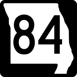
Route 84 is a state highway in the Missouri bootheel. The route starts at Arkansas Highway 90 over the St. Francis River on the Arkansas–Missouri state line. The road travels eastward to Kennett, where it becomes concurrent with U.S. Route 412. East of Kennett, the concurrent routes travel eastward on a divided highway to Hayti Heights, where the concurrency ends. Route 84 travels through Hayti Heights and Hayti, and it crosses Interstate 55 (I-55) and US 61. The route then travels southeastwards to Caruthersville, and bypasses the central area of the city. In the southern part of Caruthersville, Route 84 ends at an interchange with I-155 and US 412.

Six special routes of U.S. Route 412 exist.

K-51 is an approximately 79-mile-long (127 km) east–west state highway in the southwestern part of the U.S. state of Kansas. K-51 begins at the Colorado state line as a continuation of County Road M and travels eastward through portions of Morton, Stevens, and Seward counties before ending at U.S. Route 83 (US-83) north of Liberal. Along the way, it runs concurrently with US-56 from Rolla to Hugoton. Although K-51 travels through mostly rural farmlands, it does pass through the cities of Richfield, Rolla and Hugoton. The highway is also a two-lane road most of its length with the exception of short sections within Rolla and Hugoton, where it is four lanes.

K-190 is a 24.172-mile-long (38.901 km) east–west state highway in the U.S. state of Kansas. K-190's western terminus is at U.S. Route 160 (US-160) east of the community of Hickok, and the eastern terminus is at US-83 and US-160 south of the city of Sublette. K-190 travels mostly through flat rural farmland, however it does run through the city of Satanta where it is co-designated as US-56.

K-145 was a 1.527-mile-long (2.457 km) state highway in the U.S. state of Kansas. K-145's western terminus was at U.S. Route 83 (US-83) and US-160 west of the city of Sublette and the eastern terminus was at US-56 in Sublette.

References

  1. McNichol, Dan (2006). The Roads that Built America. New York: Sterling. p. 74. ISBN   1-4027-3468-9.
  2. 1 2 3 4 5 6 7 8 9 10 11 Bureau of Public Roads & American Association of State Highway Officials (November 11, 1926). United States System of Highways Adopted for Uniform Marking by the American Association of State Highway Officials (Map). 1:7,000,000. Washington, DC: United States Geological Survey. OCLC   32889555 . Retrieved November 7, 2013 via Wikimedia Commons.
  3. Missouri Department of Transportation (August 30, 2015). MoDOT HPMAPS (Map). Missouri Department of Transportation. Retrieved August 30, 2015.
  4. Oklahoma Department of Transportation, Chronological History Documentation: US 56 (correspondence between ODOT, AASHO, and other DOTs)
  5. Oklahoma Department of Transportation. "Chronological History Documentation: US 56" (PDF). (correspondence between ODOT, AASHO, and other DOTs)
  6. Special Committee on U.S. Route Numbering (June 26, 1985). "Route Numbering Committee Agenda" (Report). Washington, DC: American Association of State Highway and Transportation Officials. p. 5 via Wikisource.
  7. AASHTO October 2008 meeting
  8. "Minutes of the Meeting" (PDF). Arkansas State Highway Commission. November 9, 1960. p. 1399. Retrieved January 28, 2013.
  9. Missouri Department of Transportation (July 2019). Alternate US 412 (Road sign). Kennett, Missouri: Missouri Department of Transportation. Retrieved August 30, 2021 via Google Street View.
  10. "MoDOT Holds Public Meeting to Discuss Improvements to Route 412 in Kennett". Missouri Department of Transportation. Retrieved September 1, 2021.