Lock Springs, Missouri | |
---|---|
Coordinates: 39°50′56″N93°46′34″W / 39.84889°N 93.77611°W | |
Country | United States |
State | Missouri |
County | Daviess |
Area | |
• Total | 0.12 sq mi (0.32 km2) |
• Land | 0.12 sq mi (0.32 km2) |
• Water | 0.00 sq mi (0.00 km2) |
Elevation | 735 ft (224 m) |
Population (2020) | |
• Total | 40 |
• Density | 322.58/sq mi (124.86/km2) |
Time zone | UTC-6 (Central (CST)) |
• Summer (DST) | UTC-5 (CDT) |
ZIP code | 64654 |
Area code | 660 |
FIPS code | 29-43472 [3] |
GNIS feature ID | 2398461 [2] |
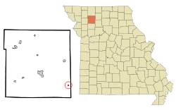
Lock Springs is a village in southeast Daviess County, Missouri, United States. The population was 40 at the 2020 census. [4]
Lock Springs is located on Missouri Route 190 approximately eight miles south of Jamesport. Chillicothe in adjacent Livingston County is approximately twelve miles to the east-southeast on Route 190. The Grand River flows past one mile to the southwest. [5]
According to the United States Census Bureau, the village has a total area of 0.12 square miles (0.31 km2), all land. [6]
Census | Pop. | Note | %± |
---|---|---|---|
1890 | 212 | — | |
1900 | 246 | 16.0% | |
1910 | 255 | 3.7% | |
1920 | 288 | 12.9% | |
1930 | 209 | −27.4% | |
1940 | 191 | −8.6% | |
1950 | 137 | −28.3% | |
1960 | 117 | −14.6% | |
1970 | 85 | −27.4% | |
1980 | 85 | 0.0% | |
1990 | 57 | −32.9% | |
2000 | 69 | 21.1% | |
2010 | 57 | −17.4% | |
2020 | 40 | −29.8% | |
U.S. Decennial Census [7] |
As of the census [8] of 2010, there were 57 people, 20 households, and 16 families living in the village. The population density was 475.0 inhabitants per square mile (183.4/km2). There were 30 housing units at an average density of 250.0 per square mile (96.5/km2). The racial makeup of the village was 100.0% White.
There were 20 households, of which 30.0% had children under the age of 18 living with them, 65.0% were married couples living together, 5.0% had a female householder with no husband present, 10.0% had a male householder with no wife present, and 20.0% were non-families. 15.0% of all households were made up of individuals, and 10% had someone living alone who was 65 years of age or older. The average household size was 2.85 and the average family size was 3.00.
The median age in the village was 34.3 years. 21.1% of residents were under the age of 18; 7.1% were between the ages of 18 and 24; 33.4% were from 25 to 44; 29.8% were from 45 to 64; and 8.8% were 65 years of age or older. The gender makeup of the village was 45.6% male and 54.4% female.
As of the census [3] of 2000, there were 69 people, 25 households, and 17 families living in the village. The population density was 564.5 inhabitants per square mile (218.0/km2). There were 31 housing units at an average density of 253.6 per square mile (97.9/km2). The racial makeup of the village was 97.10% White, and 2.90% from two or more races.
There were 25 households, out of which 28.0% had children under the age of 18 living with them, 60.0% were married couples living together, 4.0% had a female householder with no husband present, and 32.0% were non-families. 24.0% of all households were made up of individuals, and 12.0% had someone living alone who was 65 years of age or older. The average household size was 2.76 and the average family size was 3.41.
In the village, the population was spread out, with 27.5% under the age of 18, 7.2% from 18 to 24, 29.0% from 25 to 44, 23.2% from 45 to 64, and 13.0% who were 65 years of age or older. The median age was 40 years. For every 100 females, there were 86.5 males. For every 100 females age 18 and over, there were 85.2 males.
The median income for a household in the village was $21,500, and the median income for a family was $21,500. Males had a median income of $34,583 versus $16,250 for females. The per capita income for the village was $10,816. There were 38.9% of families and 37.0% of the population living below the poverty line, including 48.1% of under eighteens and 21.4% of those over 64.
Muir is a village in Lyons Township, Ionia County in the U.S. state of Michigan. The population was 604 at the 2010 census.
Trommald is a city in Crow Wing County, Minnesota, United States. The population was 99 at the 2020 census. It is part of the Brainerd Micropolitan Statistical Area.
Blairstown is a village in Henry County, Missouri, United States. The population was 97 at the 2010 census. A post office, and a firearms store are located there.
Cedar Hill Lakes is a village in Jefferson County, Missouri, United States. The population was 203 at the 2020 census.
Corder is a city in Lafayette County, Missouri, and is part of the Kansas City metropolitan area within the United States. The population was 418 at the 2020 census.
Bakersfield is a village in southeastern Ozark County in the Ozarks of southern Missouri, United States. The population was 186 at the 2020 census.
Country Life Acres is a village in St. Louis County, Missouri, United States. The population was 72 at the 2020 census.
Glen Echo Park was a village in St. Louis County, Missouri, United States. The population was 122 at the 2020 census. The community took its name from the nearby Glen Echo Country Club.
Grantwood Village is a town in St. Louis County, Missouri, United States. The population was 863 at the 2010 census.
Hillsdale is a village in St. Louis County, Missouri, United States. Greenwood Cemetery is located in Hillsdale. The population was 1,478 at the 2010 census.
Mackenzie is an unincorporated community in St. Louis County, Missouri, United States. The population was 134 at the 2010 census.
Marlborough is a village in St. Louis County, Missouri, United States. The population was 2,179 at the 2010 census.
Pasadena Park is a village in St. Louis County, Missouri, United States. The population was 470 at the 2010 census. It is part of the Normandy School District, and is distinct from the city of Pasadena Hills.
Velda Village Hills is a city in northeastern St. Louis County, Missouri, United States. The population was 1,055 at the 2010 census.
Westwood is a village in west St. Louis County, Missouri, United States. The population was 316 at the 2020 census.
Hanley Hills is a village in St. Louis County, Missouri, United States. The population was 2,101 at the 2010 census.
New Bloomington is a village in Marion County, Ohio, United States. The population was 413 at the 2020 census. New Bloomington is served by Elgin Local School District.
Hubbardston is a village in the U.S. state of Michigan. It is mostly in North Plains Township in Ionia County, and partially in Lebanon Township in Clinton County. Its population was 395 at the 2010 census.
Ionia is a village in northern Benton and southern Pettis counties in the U.S. state of Missouri. The population was 88 at the 2010 census.
Hancock is a village in Waushara County, Wisconsin, United States. The population was 417 at the 2010 census. The village is located within the Town of Hancock.