Jameson, Missouri

Last updated
Jameson, Missouri
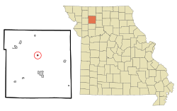
Daviess County Missouri Incorporated and Unincorporated areas Jameson Highlighted.svg
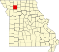
Location of Jameson, Missouri
Coordinates: 40°00′21″N93°59′16″W / 40.00583°N 93.98778°W / 40.00583; -93.98778 Coordinates: 40°00′21″N93°59′16″W / 40.00583°N 93.98778°W / 40.00583; -93.98778
Country United States
State Missouri
County Daviess
Area
[1]
  Total0.22 sq mi (0.58 km2)
  Land0.22 sq mi (0.58 km2)
  Water0.00 sq mi (0.00 km2)
Elevation
[2]
833 ft (254 m)
Population
 (2020)
  Total73
  Density325.89/sq mi (125.77/km2)
Time zone UTC-6 (Central (CST))
  Summer (DST) UTC-5 (CDT)
ZIP code
64647
Area code 660
FIPS code 29-36314 [3]
GNIS feature ID2397009 [2]

Jameson is a village in Daviess County, Missouri, United States. The population was 73 at the 2020 census. [4]

Contents

History

Jameson was originally named Feurt Summit, and under the latter name was laid out in 1871. [5] A post office called Jameson has been in operation since 1871. [6]

Geography

Jameson is located at 40°0′19″N93°59′12″W / 40.00528°N 93.98667°W / 40.00528; -93.98667 (40.005372, -93.986538). [7]

According to the United States Census Bureau, the village has a total area of 0.22 square miles (0.57 km2), all land. [8]

Demographics

Historical population
CensusPop.Note
1880 405
1890 4295.9%
1900 335−21.9%
1910 3586.9%
1920 329−8.1%
1930 260−21.0%
1940 223−14.2%
1950 185−17.0%
1960 177−4.3%
1970 172−2.8%
1980 1720.0%
1990 149−13.4%
2000 120−19.5%
2010 13310.8%
2020 73−45.1%
U.S. Decennial Census [9]

2010 census

As of the census [10] of 2010, there were 133 people, 50 households, and 32 families living in the village. The population density was 604.5 inhabitants per square mile (233.4/km2). There were 63 housing units at an average density of 286.4 per square mile (110.6/km2). The racial makeup of the village was 88.0% White, 2.3% Native American, 0.8% from other races, and 9.0% from two or more races. Hispanic or Latino of any race were 3.0% of the population.

There were 50 households, of which 36.0% had children under the age of 18 living with them, 38.0% were married couples living together, 12.0% had a female householder with no husband present, 14.0% had a male householder with no wife present, and 36.0% were non-families. 34.0% of all households were made up of individuals, and 12% had someone living alone who was 65 years of age or older. The average household size was 2.66 and the average family size was 3.19.

The median age in the village was 35.5 years. 34.6% of residents were under the age of 18; 3.1% were between the ages of 18 and 24; 24.9% were from 25 to 44; 26.4% were from 45 to 64; and 11.3% were 65 years of age or older. The gender makeup of the village was 46.6% male and 53.4% female.

2000 census

As of the census [3] of 2000, there were 125 people, 56 households, and 37 families living in the town. The population density was 541.7 inhabitants per square mile (209.2/km2). There were 70 housing units at an average density of 316.0 per square mile (122.0/km2). The racial makeup of the town was 99.17% White, and 0.83% from two or more races.

There were 56 households, out of which 28.6% had children under the age of 18 living with them, 44.6% were married couples living together, 14.3% had a female householder with no husband present, and 33.9% were non-families. 32.1% of all households were made up of individuals, and 12.5% had someone living alone who was 65 years of age or older. The average household size was 2.14 and the average family size was 2.54.

In the town the population was spread out, with 20.0% under the age of 18, 20.0% from 18 to 24, 21.7% from 25 to 44, 22.5% from 45 to 64, and 15.8% who were 65 years of age or older. The median age was 38 years. For every 100 females, there were 71.4 males. For every 100 females age 18 and over, there were 71.4 males.

The median income for a household in the town was $21,750, and the median income for a family was $26,250. Males had a median income of $22,189 versus $14,688 for females. The per capita income for the town was $10,351. There were 14.7% of families and 17.9% of the population living below the poverty line, including 8.0% of under eighteens and 50.0% of those over 64.
Related Research Articles

<span class="mw-page-title-main">Stevens Village, Alaska</span> CDP in Alaska, United States

Stevens Village is a census-designated place (CDP) in Yukon-Koyukuk Census Area, Alaska, United States. The population was 78 at the 2010 census, down from 87 in 2000.

<span class="mw-page-title-main">Philo, Illinois</span> Village in Illinois, United States

Philo is a village about nine miles south of Urbana in Champaign County, Illinois, United States. The population was 1,392 at the 2020 census.

<span class="mw-page-title-main">Apple River, Illinois</span> Village in Illinois, United States

Apple River is a village in Jo Daviess County, Illinois, United States. The population was 366 at the 2010 census, down from 379 in 2000.

<span class="mw-page-title-main">Warren, Illinois</span> Village in Illinois, United States

Warren is a village in Jo Daviess County, Illinois, United States. The population was 1,323 at the 2020 census, down from 1,428 at the 2010 census.

<span class="mw-page-title-main">Alfordsville, Indiana</span> Town in Indiana, United States

Alfordsville is a town in Reeve Township, Daviess County, Indiana, United States. The population was 101 at the 2010 census.

<span class="mw-page-title-main">Elnora, Indiana</span> Town in Indiana, United States

Elnora is a town in Elmore Township, Daviess County, Indiana, United States. The population was 640 at the 2010 census.

<span class="mw-page-title-main">Odon, Indiana</span> Town in Indiana, United States

Odon is a town in Madison Township, Daviess County, Indiana, United States. The population was 1,354 at the 2010 census.

<span class="mw-page-title-main">Sulphur Springs, Indiana</span> Town in Indiana, United States

Sulphur Springs is a town in Jefferson Township, Henry County, Indiana, United States. As of the 2010 census, the town's population was 399.

Robinson Township is a civil township of Ottawa County in the U.S. state of Michigan. The population was 5,588 at the 2000 census.

<span class="mw-page-title-main">Altamont, Missouri</span> A village in Missouri, United States

Altamont is a village in southwest Daviess County, Missouri, United States. The population was 171 at the 2020 census.

<span class="mw-page-title-main">Coffey, Missouri</span> City in Missouri, United States

Coffey is a city in northern Daviess County, Missouri, United States. The population was 151 at the 2020 census.

<span class="mw-page-title-main">Winston, Missouri</span> Village in Missouri, United States

Winston is a village in southwestern Daviess County, Missouri, United States. The population was 229 at the 2020 census.

<span class="mw-page-title-main">Velda Village Hills, Missouri</span> Village in Missouri, United States

Velda Village Hills is a village in northeastern St. Louis County, Missouri, United States. The population was 1,055 at the 2010 census.

<span class="mw-page-title-main">Lock Springs, Missouri</span> Village in Missouri, United States

Lock Springs is a village in southeast Daviess County, Missouri, United States. The population was 40 at the 2020 census.

<span class="mw-page-title-main">Pitsburg, Ohio</span> Village in Ohio, United States

Pitsburg is a village in Monroe Township, Darke County, Ohio, United States. The population was 388 at the 2010 census.

<span class="mw-page-title-main">Mount Oliver, Pennsylvania</span> Borough in Pennsylvania, United States

Mount Oliver is a borough in Allegheny County, Pennsylvania, United States. It is a largely residential area situated atop a crest about 3 miles (5 km) west of the Monongahela River. The borough is surrounded entirely by the city of Pittsburgh, having resisted annexations by the city, as it prefers to manage its own local needs and finances.

<span class="mw-page-title-main">Clearview, West Virginia</span> Village in West Virginia, United States

Clearview is a village in Ohio County, West Virginia, United States. It is part of the Wheeling, West Virginia Metropolitan Statistical Area. The population was 565 at the 2010 census.

<span class="mw-page-title-main">Mattoon, Wisconsin</span> Village in Wisconsin, United States

Mattoon is a village in Shawano County, Wisconsin, United States. The population was 438 at the 2010 census.

Gratiot is a town in Lafayette County, Wisconsin, United States. The population was 550 at the 2010 census, down from 653 at the 2000 census. The village of Gratiot is located within the town. The unincorporated community of Riverside and part of the unincorporated community of Dunbarton are also in the town.

<span class="mw-page-title-main">Fairchild (town), Wisconsin</span>

Fairchild is a town in Eau Claire County, Wisconsin, United States. The population was 351 at the 2000 census. The Village of Fairchild is located within the town.

References

  1. "ArcGIS REST Services Directory". United States Census Bureau. Retrieved August 28, 2022.
  2. 1 2 U.S. Geological Survey Geographic Names Information System: Jameson, Missouri
  3. 1 2 "U.S. Census website". United States Census Bureau . Retrieved 2008-01-31.
  4. "Explore Census Data". data.census.gov. Retrieved 2021-12-23.
  5. "Daviess County Place Names, 1928–1945 (archived)". The State Historical Society of Missouri. Archived from the original on 24 June 2016. Retrieved 26 September 2016.{{cite web}}: CS1 maint: bot: original URL status unknown (link)
  6. "Post Offices". Jim Forte Postal History. Retrieved 26 September 2016.
  7. "US Gazetteer files: 2010, 2000, and 1990". United States Census Bureau. 2011-02-12. Retrieved 2011-04-23.
  8. "US Gazetteer files 2010". United States Census Bureau. Archived from the original on 2012-07-02. Retrieved 2012-07-08.
  9. "Census of Population and Housing". Census.gov. Retrieved June 4, 2015.
  10. "U.S. Census website". United States Census Bureau . Retrieved 2012-07-08.