Winston, Missouri

Last updated

Winston, Missouri
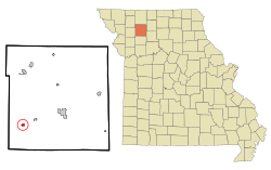
Daviess County Missouri Incorporated and Unincorporated areas Winston Highlighted.svg
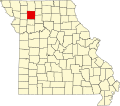
Location of Winston, Missouri
Coordinates: 39°52′12″N94°08′30″W / 39.87000°N 94.14167°W / 39.87000; -94.14167
Country United States
State Missouri
County Daviess
Area
[1]
  Total0.31 sq mi (0.80 km2)
  Land0.31 sq mi (0.80 km2)
  Water0.00 sq mi (0.00 km2)
Elevation
[2]
1,053 ft (321 m)
Population
 (2020)
  Total229
  Density743.51/sq mi (286.85/km2)
Time zone UTC-6 (Central (CST))
  Summer (DST) UTC-5 (CDT)
ZIP code
64689
Area code 660
FIPS code 29-80548 [3]
GNIS feature ID2399723 [2]

Winston is a village in southwestern Daviess County, Missouri, United States. The population was 229 at the 2020 census. [4]

Contents

History

Rock Island Railroad depot that was allegedly robbed by the James-Younger Gang in which a clerk was killed. Frank James stood trial for the robbery and was acquitted in a highly publicized trial in nearby Gallatin. Winston-depot.jpg
Rock Island Railroad depot that was allegedly robbed by the James-Younger Gang in which a clerk was killed. Frank James stood trial for the robbery and was acquitted in a highly publicized trial in nearby Gallatin.

Winston was originally called Crofton's Depot, and under the latter name was laid out in 1871 when the railroad was extended to that point. [5] Other early variant names were "Winstonville" and "Emporia". [6] The present name is after F. K. Winston, a railroad official. [5] A post office called Winstonville was established in 1872, the name was changed to Emporia in 1879, and changed once more to Winston in 1885. [7]

Geography

Winston is located in southwest Daviess County on US Route 69. Gallatin is approximately ten miles to the east along Route 69 and Cameron is ten miles to the southwest in the northeastern corner of Clinton County. [8]

According to the United States Census Bureau, the village has a total area of 0.31 square miles (0.80 km2), all land. [9]

Climate

Winston has a humid continental climate with very cold, snowy winters, and warm-to-hot, wet and humid summers in which much of the seasonal precipitation falls as thunderstorms. The hottest recorded temperature is 106 °F on August 19, 2003, while the record low temperature is −23 °F on December 23, 1989. Temperatures drop below freezing (32 °F) on an average of 100 days a year. Sub-zero Fahrenheit temperatures occur on average 7 days per year. Temperatures reach 90 °F or higher on an average of 24 days a year, and temperatures over 100 °F four days a year.[ citation needed ]

Climate data for Winston, Missouri
MonthJanFebMarAprMayJunJulAugSepOctNovDecYear
Record high °F (°C)71
(22)
76
(24)
86
(30)
91
(33)
92
(33)
97
(36)
105
(41)
106
(41)
98
(37)
94
(34)
81
(27)
71
(22)
106
(41)
Mean daily maximum °F (°C)34.9
(1.6)
40.2
(4.6)
52.1
(11.2)
63.3
(17.4)
72.8
(22.7)
82.0
(27.8)
86.4
(30.2)
85.4
(29.7)
77.2
(25.1)
65.4
(18.6)
51.2
(10.7)
37.6
(3.1)
62.4
(16.9)
Mean daily minimum °F (°C)15.9
(−8.9)
19.7
(−6.8)
30.2
(−1.0)
40.8
(4.9)
51.6
(10.9)
61.3
(16.3)
66.0
(18.9)
63.9
(17.7)
54.2
(12.3)
42.2
(5.7)
31.0
(−0.6)
19.1
(−7.2)
41.3
(5.2)
Record low °F (°C)−16
(−27)
−18
(−28)
−12
(−24)
17
(−8)
30
(−1)
42
(6)
51
(11)
44
(7)
32
(0)
21
(−6)
−4
(−20)
−23
(−31)
−23
(−31)
Average precipitation inches (mm)1.11
(28)
1.16
(29)
2.61
(66)
3.49
(89)
4.82
(122)
4.22
(107)
4.25
(108)
3.78
(96)
4.42
(112)
3.14
(80)
2.42
(61)
1.59
(40)
37.01
(940)
Average snowfall inches (cm)3.7
(9.4)
4.9
(12)
1.6
(4.1)
0.1
(0.25)
0
(0)
0
(0)
0
(0)
0
(0)
0
(0)
0
(0)
0.7
(1.8)
4.6
(12)
15.6
(40)
Source 1: [10]
Source 2: [11]

Demographics

Historical population
CensusPop.Note
1880 304
1890 47054.6%
1900 457−2.8%
1910 257−43.8%
1920 33931.9%
1930 314−7.4%
1940 38121.3%
1950 278−27.0%
1960 236−15.1%
1970 189−19.9%
1980 24630.2%
1990 2512.0%
2000 247−1.6%
2010 2594.9%
2020 229−11.6%
U.S. Decennial Census [12]

2010 census

As of the census [13] of 2010, there were 259 people, 95 households, and 69 families living in the village. The population density was 835.5 inhabitants per square mile (322.6/km2). There were 111 housing units at an average density of 358.1 per square mile (138.3/km2). The racial makeup of the village was 97.3% White, 1.2% African American, 0.4% Native American, 0.8% from other races, and 0.4% from two or more races. Hispanic or Latino of any race were 0.8% of the population.

There were 95 households, of which 40.0% had children under the age of 18 living with them, 49.5% were married couples living together, 11.6% had a female householder with no husband present, 11.6% had a male householder with no wife present, and 27.4% were non-families. 24.2% of all households were made up of individuals, and 5.3% had someone living alone who was 65 years of age or older. The average household size was 2.73 and the average family size was 3.04.

The median age in the village was 35.5 years. 30.9% of residents were under the age of 18; 5.3% were between the ages of 18 and 24; 24.7% were from 25 to 44; 27.4% were from 45 to 64; and 11.6% were 65 years of age or older. The gender makeup of the village was 50.6% male and 49.4% female.

2000 census

As of the census [3] of 2000, there were 247 people, 97 households, and 67 families living in the village. The population density was 798.8 inhabitants per square mile (308.4/km2). There were 111 housing units at an average density of 359.0 per square mile (138.6/km2). The racial makeup of the village was 97.98% White and 2.02% Native American. Hispanic or Latino of any race were 1.62% of the population.

There were 97 households, out of which 32.0% had children under the age of 18 living with them, 53.6% were married couples living together, 14.4% had a female householder with no husband present, and 30.9% were non-families. 27.8% of all households were made up of individuals, and 13.4% had someone living alone who was 65 years of age or older. The average household size was 2.55 and the average family size was 3.06.

In the village, the population was spread out, with 27.5% under the age of 18, 11.3% from 18 to 24, 23.5% from 25 to 44, 25.5% from 45 to 64, and 12.1% who were 65 years of age or older. The median age was 37 years. For every 100 females, there were 79.0 males. For every 100 females age 18 and over, there were 79.0 males.

The median income for a household in the village was $30,125, and the median income for a family was $32,917. Males had a median income of $28,125 versus $19,375 for females. The per capita income for the village was $13,283. About 7.7% of families and 8.9% of the population were below the poverty line, including 8.5% of those under the age of eighteen and 7.1% of those 65 or over.
Related Research Articles

<span class="mw-page-title-main">Alfordsville, Indiana</span> Town in Indiana, United States

Alfordsville is a town in Reeve Township, Daviess County, Indiana, United States. The population was 101 at the 2010 census.

<span class="mw-page-title-main">Odon, Indiana</span> Town in Indiana, United States

Odon is a town in Madison Township, Daviess County, Indiana, United States. The population was 1,354 at the 2010 census.

<span class="mw-page-title-main">Warsaw, Missouri</span> City in Missouri, United States

Warsaw is a city located in Benton County, Missouri, United States. The population was 2,209 at the 2020 census. Warsaw is the county seat of Benton County.

<span class="mw-page-title-main">Smithville, Missouri</span> City in Missouri, United States

Smithville is a city in Clay and Platte counties in the U.S. state of Missouri and is part of the Kansas City metropolitan area, along the Little Platte River. The population was 10,406 at the 2020 United States Census.

<span class="mw-page-title-main">Altamont, Missouri</span> A village in Missouri, United States

Altamont is a village in southwest Daviess County, Missouri, United States. The population was 171 at the 2020 census.

<span class="mw-page-title-main">Coffey, Missouri</span> City in Missouri, United States

Coffey is a city in northern Daviess County, Missouri, United States. The population was 151 at the 2020 census.

<span class="mw-page-title-main">Gallatin, Missouri</span> City in Missouri, United States

Gallatin is a city in Daviess County, Missouri, United States. The population was 1,821 at the 2020 census. It is the county seat of Daviess County.

<span class="mw-page-title-main">Jameson, Missouri</span> Village in Missouri, United States

Jameson is a village in Daviess County, Missouri, United States. The population was 73 at the 2020 census.

<span class="mw-page-title-main">Jamesport, Missouri</span> City in Missouri, United States

Jamesport is a city in eastern Daviess County, Missouri, United States. The population was 559 at the 2020 census.

<span class="mw-page-title-main">Pattonsburg, Missouri</span> City in Missouri, United States

Pattonsburg is a city in northwest Daviess County, Missouri, United States. The population was 314 at the 2020 census.

<span class="mw-page-title-main">Weatherby, Missouri</span> Village in Missouri, United States

Weatherby is a village in eastern DeKalb County, Missouri, United States. The population was 80 at the 2020 census. It is part of the St. Joseph, MO–KS Metropolitan Statistical Area.

<span class="mw-page-title-main">Rosebud, Missouri</span> City in Missouri, United States

Rosebud is a city in Gasconade County, Missouri, United States. The population was 390 at the 2020 census.

<span class="mw-page-title-main">McFall, Missouri</span> City in Missouri, United States

McFall is a rural village, incorporated and thus called a city in Missouri law, located in southeast Gentry County, Missouri, United States. It is also located within the Gentry County administrative subdivision of Miller Township. The population of McFall was 119 at the 2020 census. There is a post office at McFall, also a city hall and fire department, and a small apartment complex.

<span class="mw-page-title-main">Evergreen, Missouri</span> Village in Missouri, United States

Evergreen is a village in Laclede County, Missouri, United States. The population was 28 at the 2010 census. It was named Twin Bridges at the 2000 census.

<span class="mw-page-title-main">Laurie, Missouri</span> City in Missouri, US

Laurie is a city in southern Morgan and northern Camden counties, Missouri, United States. The population was 939 at the 2020 census.

<span class="mw-page-title-main">Orrick, Missouri</span> Town in Missouri, United States

Orrick is a town in Ray County, Missouri, and part of the Kansas City metropolitan area within the United States. The population was 753 at the 2020 census.

<span class="mw-page-title-main">Bull Creek, Missouri</span> Village in Missouri, United States

Bull Creek is a village in northwest Taney County, Missouri, United States. The population was 426 at the 2020 census. It is part of the Branson, Missouri Micropolitan Statistical Area.

<span class="mw-page-title-main">Lock Springs, Missouri</span> Village in Missouri, United States

Lock Springs is a village in southeast Daviess County, Missouri, United States. The population was 40 at the 2020 census.

<span class="mw-page-title-main">Champ, Missouri</span> Village in Missouri, United States

Champ is a village in St. Louis County, Missouri, United States. The population was 10 at the 2020 census.

<span class="mw-page-title-main">Hanley Hills, Missouri</span> Village in Missouri, United States

Hanley Hills is a village in St. Louis County, Missouri, United States. The population was 2,101 at the 2010 census.

References

  1. "ArcGIS REST Services Directory". United States Census Bureau. Retrieved August 28, 2022.
  2. 1 2 U.S. Geological Survey Geographic Names Information System: Winston, Missouri
  3. 1 2 "U.S. Census website". United States Census Bureau . Retrieved January 31, 2008.
  4. "Explore Census Data". data.census.gov. Retrieved December 23, 2021.
  5. 1 2 Earngey, Bill (1995). Missouri Roadsides: The Traveler's Companion. University of Missouri Press. p. 99.
  6. "Daviess County Place Names, 1928–1945 (archived)". The State Historical Society of Missouri. Archived from the original on June 24, 2016. Retrieved September 26, 2016.
  7. "Post Offices". Jim Forte Postal History. Retrieved September 26, 2016.
  8. Missouri Atlas & Gazetteer DeLorme, 1st ed., 1998, p. 20, ISBN   0899332242
  9. "US Gazetteer files 2010". United States Census Bureau . Retrieved July 8, 2012.
  10. "Zipcode 64689". www.plantmaps.com. Retrieved March 6, 2022.
  11. "Winston, Missouri Climate". www.bestplaces.net. Retrieved March 6, 2022.
  12. "Census of Population and Housing". Census.gov. Retrieved June 4, 2015.
  13. "U.S. Census website". United States Census Bureau . Retrieved July 8, 2012.