References
- ↑ U.S. Geological Survey Geographic Names Information System: Alta Vista, Missouri
- ↑ Weatherby, MO, 7.5 Minute Topographic Quadrangle, USGS, 1983
- ↑ "Daviess County Place Names, 1928–1945 (archived)". The State Historical Society of Missouri. Archived from the original on June 24, 2016. Retrieved September 26, 2016.
{{cite web}}: CS1 maint: bot: original URL status unknown (link) - ↑ "Post Offices". Jim Forte Postal History. Retrieved September 26, 2016.
Municipalities and communities of Daviess County, Missouri, United States | ||
|---|---|---|
| Cities | 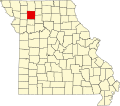 | |
| Villages | ||
| Townships | ||
| CDP | ||
| Unincorporated communities | ||
| Footnotes | ‡This populated place also has portions in an adjacent county or counties | |
Municipalities and communities of DeKalb County, Missouri, United States | ||
|---|---|---|
| Cities | 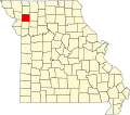 | |
| Villages | ||
| Townships | ||
| Unincorporated communities | ||
| Extinct Places | ||
| Footnotes | ‡This populated place also has portions in an adjacent county or counties | |
39°54′33″N94°12′19″W / 39.90917°N 94.20528°W
| | This Daviess County, Missouri state location article is a stub. You can help Wikipedia by expanding it. |
| | This DeKalb County, Missouri state location article is a stub. You can help Wikipedia by expanding it. |