
Washington Township is a township in DeKalb County, in the U.S. state of Missouri. [1] Its population was 1,844 as of the 2010 census.
Washington Township is a township in DeKalb County, in the U.S. state of Missouri. [1] Its population was 1,844 as of the 2010 census.
Municipalities and communities of DeKalb County, Missouri, United States | ||
|---|---|---|
| Cities | 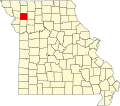 | |
| Villages | ||
| Townships | ||
| Unincorporated communities | ||
| Extinct Places | ||
| Footnotes | ‡This populated place also has portions in an adjacent county or counties | |
39°47′40″N94°31′35″W / 39.79444°N 94.52639°W
| | This DeKalb County, Missouri state location article is a stub. You can help Wikipedia by adding missing information. |