Harrison Township | |
|---|---|
 | |
| Coordinates: 39°49′01″N93°49′45″W / 39.816824°N 93.8291514°W | |
| Country | |
| State | |
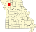
| County | Daviess |
| Area | |
• Total | 21.77 sq mi (56.4 km2) |
| • Land | 21.57 sq mi (55.9 km2) |
| • Water | 0.2 sq mi (0.52 km2) 0.92% |
| Elevation | 787 ft (240 m) |
| Population | |
• Total | 143 |
| • Density | 6.6/sq mi (2.5/km2) |
| FIPS code | 29-06130502 [1] |
| GNIS feature ID | 766579 [2] |
Harrison Township is a township in Daviess County, Missouri, United States. [2] At the 2020 census, its population was 143. [3]
Harrison Township has the name of William Henry Harrison, 9th President of the United States. [4]