Jamesport, Missouri | |
---|---|
Coordinates: 39°58′30″N93°48′11″W / 39.97500°N 93.80306°W Coordinates: 39°58′30″N93°48′11″W / 39.97500°N 93.80306°W | |
Country | United States |
State | Missouri |
County | Daviess |
Area | |
• Total | 0.56 sq mi (1.46 km2) |
• Land | 0.56 sq mi (1.45 km2) |
• Water | 0.00 sq mi (0.00 km2) |
Elevation | 984 ft (300 m) |
Population (2020) | |
• Total | 559 |
• Density | 996.43/sq mi (384.39/km2) |
Time zone | UTC-6 (Central (CST)) |
• Summer (DST) | UTC-5 (CDT) |
ZIP code | 64648 |
Area code | 660 Exchsnge: 684 |
FIPS code | 29-36332 [3] |
GNIS feature ID | 2395453 [2] |
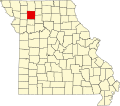
Jamesport is a city in eastern Daviess County, Missouri, United States. The population was 559 at the 2020 census. [4]
A post office called Jamesport has been in operation since 1857. [5] The community's name honors two first settlers with the given name James, namely James Gillilan and James Allen. [6]
Jamesport has the largest Amish community in the state of Missouri. [7]
Jamesport is located in eastern Daviess County on Missouri Route 190 just south of Missouri Route 6. Gallatin is approximately nine miles to the southwest and Trenton is approximately 12 miles to the northeast in adjacent Grundy County. [8]
According to the United States Census Bureau, the city has a total area of 0.56 square miles (1.45 km2), all land. [9]
Census | Pop. | Note | %± |
---|---|---|---|
1860 | 59 | — | |
1880 | 608 | — | |
1890 | 790 | 29.9% | |
1900 | 728 | −7.8% | |
1910 | 611 | −16.1% | |
1920 | 884 | 44.7% | |
1930 | 839 | −5.1% | |
1940 | 761 | −9.3% | |
1950 | 720 | −5.4% | |
1960 | 622 | −13.6% | |
1970 | 614 | −1.3% | |
1980 | 651 | 6.0% | |
1990 | 570 | −12.4% | |
2000 | 505 | −11.4% | |
2010 | 524 | 3.8% | |
2020 | 559 | 6.7% | |
U.S. Decennial Census [10] |
As of the census [11] of 2010, there were 524 people, 230 households, and 145 families living in the city. The population density was 935.7 inhabitants per square mile (361.3/km2). There were 308 housing units at an average density of 550.0 per square mile (212.4/km2). The racial makeup of the city was 96.0% White, 0.2% Native American, 0.4% Asian, and 3.4% from two or more races. Hispanic or Latino of any race were 0.6% of the population.
There were 230 households, of which 31.7% had children under the age of 18 living with them, 40.0% were married couples living together, 16.5% had a female householder with no husband present, 6.5% had a male householder with no wife present, and 37.0% were non-families. 32.2% of all households were made up of individuals, and 14.4% had someone living alone who was 65 years of age or older. The average household size was 2.28 and the average family size was 2.87.
The median age in the city was 38.4 years. 27.5% of residents were under the age of 18; 8.7% were between the ages of 18 and 24; 21% were from 25 to 44; 25.8% were from 45 to 64; and 17% were 65 years of age or older. The gender makeup of the city was 47.5% male and 52.5% female.
As of the Census [3] of 2000, there were 505 people, 211 households, and 140 families living in the city. The population density was 895.0 inhabitants per square mile (345.6/km2). There were 258 housing units at an average density of 457.2 per square mile (176.5/km2). The racial makeup of the city was 99.01% White, 0.59% Native American, and 0.40% from two or more races. Hispanic or Latino of any race were 1.78% of the population.
There were 211 households, out of which 25.1% had children under the age of 18 living with them, 52.1% were married couples living together, 10.9% had a female householder with no husband present, and 33.6% were non-families. 29.9% of all households were made up of individuals, and 15.2% had someone living alone who was 65 years of age or older. The average household size was 2.39 and the average family size was 2.94.
In the city the population was spread out, with 23.6% under the age of 18, 10.1% from 18 to 24, 21.2% from 25 to 44, 25.3% from 45 to 64, and 19.8% who were 65 years of age or older. The median age was 41 years. For every 100 females, there were 92.0 males. For every 100 females age 18 and over, there were 84.7 males.
The median income for a household in the city was $29,265, and the median income for a family was $30,556. Males had a median income of $38,438 versus $28,167 for females. The per capita income for the city was $12,447. About 22.2% of families and 27.1% of the population were below the poverty line, including 29.1% of those under age 18 and 40.2% of those age 65 or over.
Public education from kindergarten through 12th grade is provided by the Tri-County R-VII School District. K-6 is located at Tri-County Elementary School, and 7-12 is located at Tri-County High School. There are also five private schools in the area. The Jamesport Mennonite School provides education for 1st through 8th grades. The seven Amish schools in the area include Spring Hill, Country View, Hickory Hill (1-8), Meadow View (1-7), Oak Grove (1-8), and Walnut Creek (1-8), and Special Education School. There is also a New Order Amish School, Faith View School.
Jamesport has a lending library, a branch of the Daviess County Library. [12]
Jamesport is served by a weekly newspaper, the Tri-County Weekly, which has been in circulation since 1944.
Daviess County is a county located in the U.S. state of Missouri. As of the 2020 census, the population was 8,430. Its county seat is Gallatin. The county was organized December 29, 1836, from Ray County and named for Major Joseph Hamilton Daveiss, a soldier from Kentucky who was killed in 1811 at the Battle of Tippecanoe.
Daviess County is a county in the U.S. state of Indiana. As of the 2010 United States Census, the population was 31,648. The county seat is Washington. About 15% of the county's population is Amish of Swiss origin, as of 2017.
Alfordsville is a town in Reeve Township, Daviess County, Indiana, United States. The population was 101 at the 2010 census.
Montgomery is a town in Barr Township, Daviess County, Indiana, United States. The population was 343 at the 2010 census.
Jesup is a city in Buchanan County and partly in Black Hawk County in the U.S. state of Iowa. The population was 2,508 at the time of the 2020 census. It was named for Morris Ketchum Jesup, president of the Dubuque and Sioux City Railroad.
Kalona is a city in Washington County, Iowa. It is part of the Iowa City metropolitan area. The population was 2,630 at the time of the 2020 census. Kalona is the second-largest city in Washington County.
Slayton is a city in and the county seat of Murray County, Minnesota, United States. The population was 2,153 at the 2010 census.
Fairfax is a city in Clark Township, Atchison County, Missouri, United States. The population was 648 at the 2020 census.
Sturgeon is a city in Boone County, Missouri, United States. It is part of the Columbia, Missouri Metropolitan Statistical Area. The population was 872 at the 2010 census.
Kingston is a city in Caldwell County, Missouri, and is part of the Kansas City metropolitan area with the United States. The population was 290 at the 2020 census. It is the county seat of Caldwell County.
Coffey is a city in northern Daviess County, Missouri, United States. The population was 151 at the 2020 census.
Gallatin is a city in Daviess County, Missouri, United States. The population was 1,821 at the 2020 census. It is the county seat of Daviess County.
McFall is a city in southeast Gentry County, Missouri, United States. The population was 119 at the 2020 census.
Ironton is a city in Iron County, Missouri, United States. The population was 1,475 at the 2020 census. It is the county seat of Iron County, and is located 12 miles south of Belgrade.
Licking is a city located in Texas County, Missouri, United States. The population was 3,124 at the 2010 census, making it the most populous city in Texas County.
Seymour is a city in southeastern Webster County, Missouri, United States. The population was 1,921 at the 2010 census. It is part of the Springfield, Missouri Metropolitan Statistical Area.
Grant City is a city in, and the county seat of, Worth County, Missouri, United States. The population was 859 at the 2010 census.
Lock Springs is a village in southeast Daviess County, Missouri, United States. The population was 40 at the 2020 census.
Mount Vernon is a city in and the county seat of Lawrence County, Missouri, United States. The population was 4,575 as of the 2010 census. It was estimated to be 4,960 by the City of Mount Vernon on July 1, 2020.
Brady Township is a township in Clearfield County, Pennsylvania, United States. The population was 1,942 at the 2020 census.
{{cite web}}
: CS1 maint: bot: original URL status unknown (link)