Salem Township | |
|---|---|
 | |
| Coordinates: 40°05′43″N94°02′21″W / 40.0952366°N 94.0391561°W | |
| Country | |
| State | |
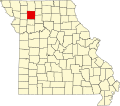
| County | Daviess |
| Area | |
• Total | 36.39 sq mi (94.2 km2) |
| • Land | 36.14 sq mi (93.6 km2) |
| • Water | 0.25 sq mi (0.65 km2) 0.69% |
| Elevation | 860 ft (260 m) |
| Population | |
• Total | 440 |
| • Density | 12.2/sq mi (4.7/km2) |
| FIPS code | 29-06165198 [1] |
| GNIS feature ID | 766587 [2] |
Salem Township is a township in Daviess County, Missouri, United States. [2] At the 2020 census, its population was 440. [3]
Salem Township was established in 1859. [4] The town of Coffey was originally settled in 1856 and called Salem. [5]